Items Similar to Antique Map of the Mediterranean and the Persian Gulf by Danckerts, c.1718

Want more images or videos?
Request additional images or videos from the seller
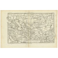
Antique Map of the Mediterranean and the Persian Gulf by Danckerts, c.1718
About the Item
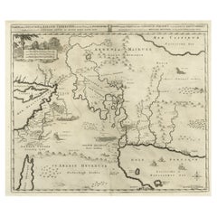
Antique map titled 'De Gelegentheyt Van't Paradys en 't Landt Canaan.' Dutch Bible map covering the region between the Mediterranean and the Persian Gulf, featuring the Garden of Eden, which is located near "Babel". The map includes tiny engravings of Eve offering Adam the apple and the expulsion from the garden. Abraham's journey from Ur is noted, as are the wanderings of the Children of Isreal, and a vignette of Jonas and the whale.
Artsists and Engravers: Engraved by A. Schut. Published by C. Danckerts II. The Danckerts were a well known family containing several engravers, cartographers and print-sellers that started with the founder Cornelis Danckerts I (1536-1595) who was the city Carpenter.
Condition: Fair, few tiny tears and several repairs. Dutch text on verso, faded. Please study image carefully.
Date: c.1718
Overall size: 54 x 41.5 cm.
Image size: 50.5 x 34.5 cm.
We sell original antique maps to collectors, historians, educators and interior decorators all over the world. Our collection includes a wide range of authentic antique maps from the 16th to the 20th centuries. Buying and collecting antique maps is a tradition that goes back hundreds of years. Antique maps have proved a richly rewarding investment over the past decade, thanks to a growing appreciation of their unique historical appeal. Today the decorative qualities of antique maps are widely recognized by interior designers who appreciate their beauty and design flexibility. Depending on the individual map, presentation, and context, a rare or antique map can be modern, traditional, abstract, figurative, serious or whimsical. We offer a wide range of authentic antique maps for any budget.
- Dimensions:Height: 16.34 in (41.5 cm)Width: 21.26 in (54 cm)Depth: 0 in (0.01 mm)
- Materials and Techniques:
- Period:
- Date of Manufacture:circa 1718
- Condition:
- Seller Location:Langweer, NL
- Reference Number:
About the Seller
5.0
Platinum Seller
These expertly vetted sellers are 1stDibs' most experienced sellers and are rated highest by our customers.
Established in 2009
1stDibs seller since 2017
1,950 sales on 1stDibs
Typical response time: <1 hour
- ShippingRetrieving quote...Ships From: Langweer, Netherlands
- Return PolicyA return for this item may be initiated within 14 days of delivery.
More From This SellerView All
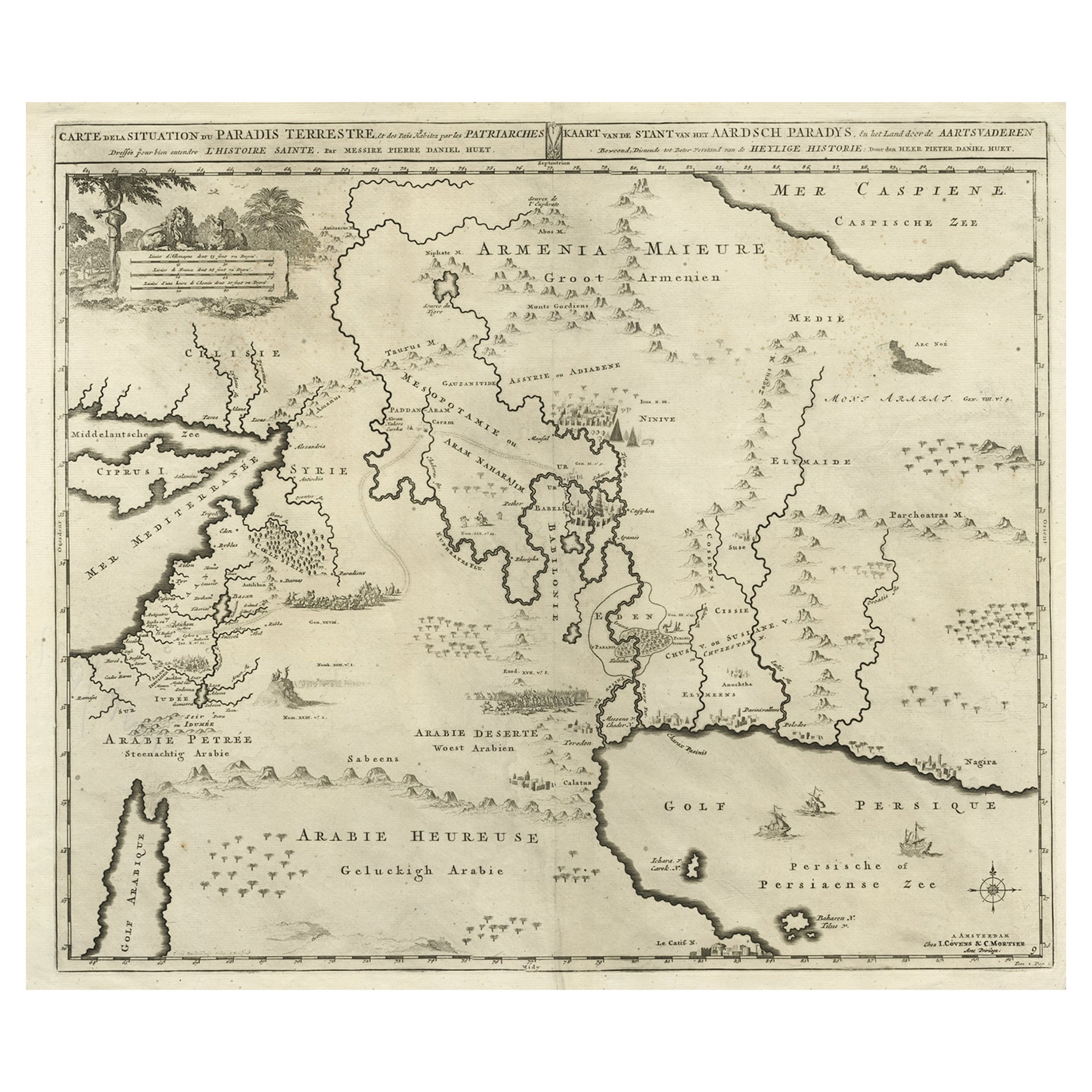
- Biblical Map of the Region from the Mediterranean through the Persian Gulf, 1720Located in Langweer, NLAntique map titled 'Carte de la Situation du Paradis Terrestre, Et des Pais Habitez par les Patriarches Dressee pour bien entendre l'Histoire Sainte, Par Messire Pierre Daniel Huet.' This interesting map covers the region from the Mediterranean through the Persian Gulf. Detail is omitted in favor of Biblical depictions including the Sermon on the Mount...Category
Antique 1720s Maps
MaterialsPaper
- Antique Map of the Holy Land by Danckerts, c.1710Located in Langweer, NLAntique map titled 'Afbeeldinge van de Veertich-Iaarige Reyse der Kinderen Israëls uyt Egypten door de Roode Zee en de Woestyne tot in 't Beloofde Landt Canaan'. Map of the Holy Land...Category
Antique 18th Century Maps
MaterialsPaper
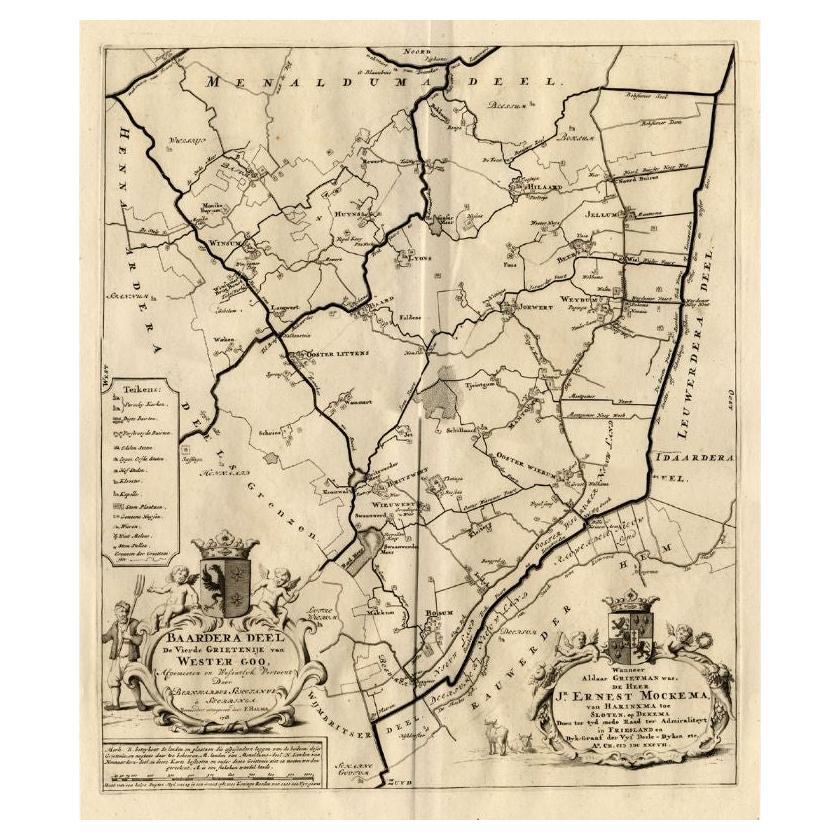
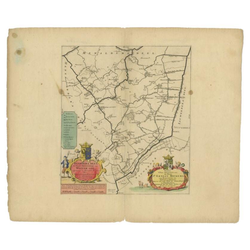
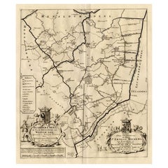
- Antique Map of the Baarderadeel Township, 1718Located in Langweer, NLAntique map Friesland titled 'Baardera Deel de Vierde Grietenije van Wester Goo (..)'. Old map of Friesland, the Netherlands. This map depicts the region of B...Category
Antique 18th Century Maps
MaterialsPaper
- Antique Map of the Baarderadeel Township, 1718Located in Langweer, NLAntique map Friesland titled 'Baardera Deel de Vierde Grietenije van Wester Goo (..)'. Old map of Friesland, the Netherlands. This map depicts the region of B...Category
Antique 18th Century Maps
MaterialsPaper
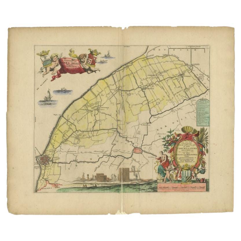
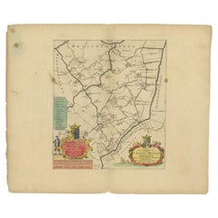
- Antique Map of the Barradeel Township, 1718Located in Langweer, NLAntique map Friesland titled 'De Grietenije van Barra Deel (..)'. Old map of Friesland, the Netherlands. This map depicts the region of Barradeel and includes cities and villages lik...Category
Antique 18th Century Maps
MaterialsPaper
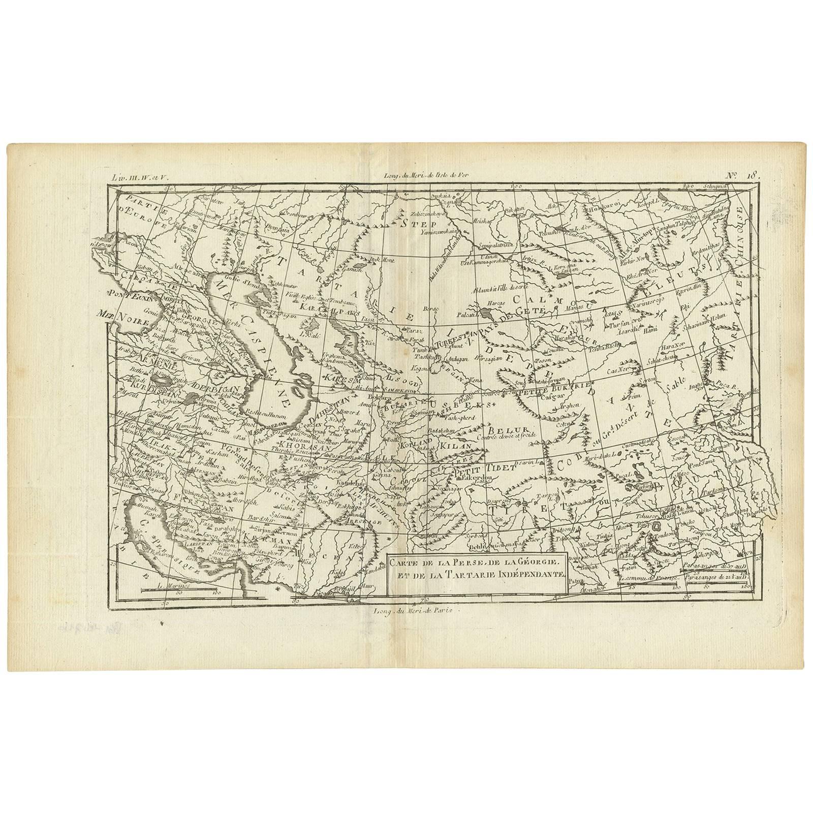
- Antique Map of the Persian Gulf and Caspian Sea Region by R. Bonne, 1780Located in Langweer, NLAntique print titled 'Carte de la Perse, de la Georgie, et de la Tartarie Independante'. Shows the region from the Persian Gulf and Caspian Sea in the wes...Category
Antique Late 18th Century Maps
MaterialsPaper


You May Also Like
- Large Framed Map of the MediterraneanLocated in New York, NYLarge map/chart chart of The Mediterranean and the Grecian Archipelago showing Italy, Sardinia, Corsica, part of France, etc. in a black frame.Category
20th Century French Mid-Century Modern Maps
- Original Antique Map of Ancient Greece, Phocis, Gulf of Corinth, 1787Located in St Annes, LancashireGreat map of Ancient Greece. Showing the region of Phocis, including the Gulf of Corinth Drawn by J.D. Barbie Du Bocage Copper plate engraving by P.F Tardieu Original hand c...Category
Antique 1780s French Other Maps
MaterialsPaper
- Framed 1838 Mexico & Gulf of Mexico MapLocated in Stamford, CTFramed 1838 Mexico & Gulf of Mexico map. Printed by Fisher, Son & Co. of London in 1838. As found framed condition. Map has not been examined outside of th...Category
Antique 1830s English American Classical Maps
MaterialsGlass, Wood, Paper
- Vintage Exploration: Realms of the Persian Gulf, 1970, USSR, 1J141Located in Bordeaux, FREmbark on a journey of exploration with this vintage book titled "Княжества Персидского залива" (Realms of the Persian Gulf). Originating from Moscow in the USSR and dating back to 1...Category
Vintage 1970s Books
MaterialsPaper
- 1861 Topographical Map of the District of Columbia, by Boschke, Antique MapLocated in Colorado Springs, COPresented is an original map of Albert Boschke's extremely sought-after "Topographical Map of the District of Columbia Surveyed in the Years 1856 ...Category
Antique 1860s American Historical Memorabilia
MaterialsPaper
- Original Antique Map of The World by Thomas Clerk, 1817Located in St Annes, LancashireGreat map of The Eastern and Western Hemispheres On 2 sheets Copper-plate engraving Drawn and engraved by Thomas Clerk, Edinburgh. Published by Mackenzie And Dent, 1817 ...Category
Antique 1810s English Maps
MaterialsPaper


Recently Viewed
View AllMore Ways To Browse
Mediterranean Antique
Antique Mediterranean Furniture
Mediterranean Garden
Antique Carpenters
Mediterranean Garden Furniture
By Jonas Furniture
18th Century Bible
Rare Bible
Antique Persian Prints
Maps Of Mediterranean
Rare Antique Bibles
Apple Ii
Rare And Antique Bibles
Antique Map Mediterranean
Persian Gulf
Eve Apple
Antique Family Bible
Van Apple