Items Similar to Antique Map of the Netherlands in 1859 by Mees, 1861
Want more images or videos?
Request additional images or videos from the seller
1 of 5
Antique Map of the Netherlands in 1859 by Mees, 1861
About the Item
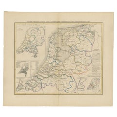
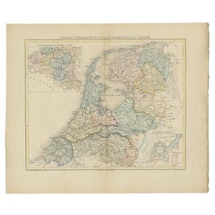
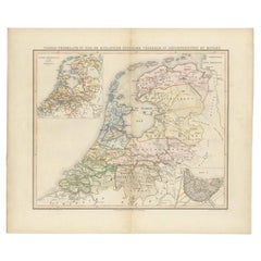
Antique map titled 'Noord-Nederland in 1859. De Straat- en Spoorwegen met de jaartallen der vervaardiging'. Map of the Netherlands in 1859. This map originates from 'Historische Atlas van Noord-Nederland'.
Artists and Engravers: Author: G. Mees. Published by Van der Meer & Verbruggen.
Condition: Good, general age-related toning. Original folding line. Minor wear, blank verso. Includes descriptive text in green wrapper.
Date: 1861
Overall size: 55.5 x 47 cm.
Image size: 43 x 36 cm.
We sell original antique maps to collectors, historians, educators and interior decorators all over the world. Our collection includes a wide range of authentic antique maps from the 16th to the 20th centuries. Buying and collecting antique maps is a tradition that goes back hundreds of years. Antique maps have proved a richly rewarding investment over the past decade, thanks to a growing appreciation of their unique historical appeal. Today the decorative qualities of antique maps are widely recognized by interior designers who appreciate their beauty and design flexibility. Depending on the individual map, presentation, and context, a rare or antique map can be modern, traditional, abstract, figurative, serious or whimsical. We offer a wide range of authentic antique maps for any budget.
- Dimensions:Height: 18.51 in (47 cm)Width: 21.86 in (55.5 cm)Depth: 0 in (0.01 mm)
- Materials and Techniques:
- Period:
- Date of Manufacture:1861
- Condition:
- Seller Location:Langweer, NL
- Reference Number:
About the Seller
5.0
Platinum Seller
These expertly vetted sellers are 1stDibs' most experienced sellers and are rated highest by our customers.
Established in 2009
1stDibs seller since 2017
1,957 sales on 1stDibs
Typical response time: <1 hour
- ShippingRetrieving quote...Ships From: Langweer, Netherlands
- Return PolicyA return for this item may be initiated within 14 days of delivery.
More From This SellerView All
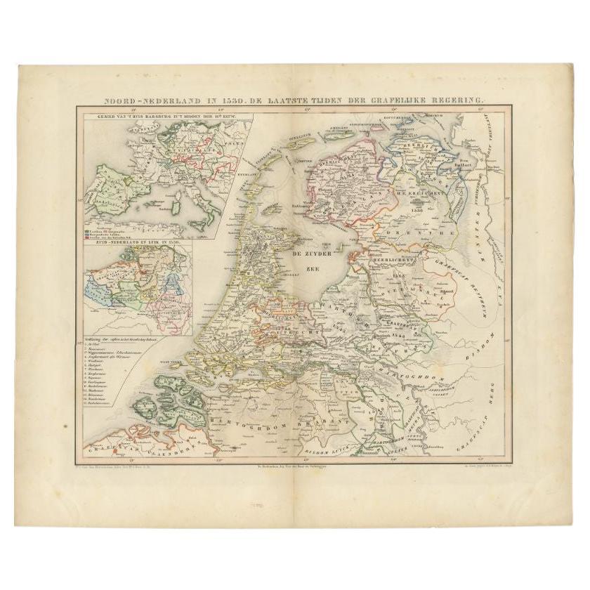
- Antique Map of the Netherlands in 1530 by Mees, 1852Located in Langweer, NLAntique map titled 'Noord-Nederland in 1530. De laatste tijden der Grafelijke Regering'. Map of the Netherlands in 1530. This map originates from 'Historische Atlas van Noord-Nederla...Category
Antique 19th Century Maps
MaterialsPaper
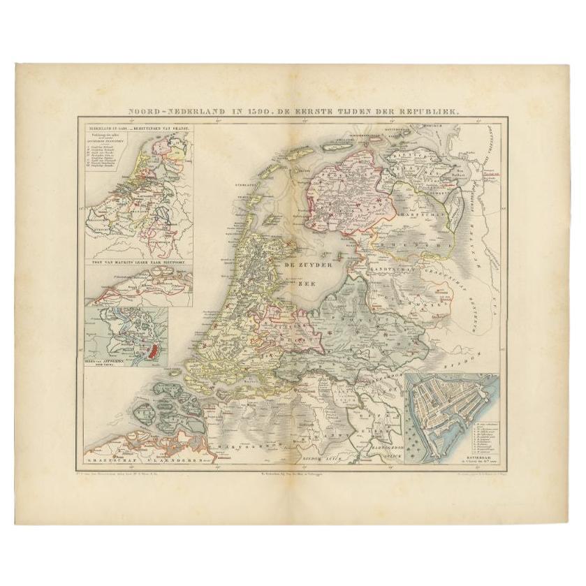
- Antique Map of the Netherlands in 1590 by Mees, 1854Located in Langweer, NLAntique map titled 'Noord-Nederland in 1590. De eerste tijden der Republiek'. Map of the Netherlands in 1590. This map originates from 'Historische Atlas van Noord-Nederland'. Ar...Category
Antique 19th Century Maps
MaterialsPaper
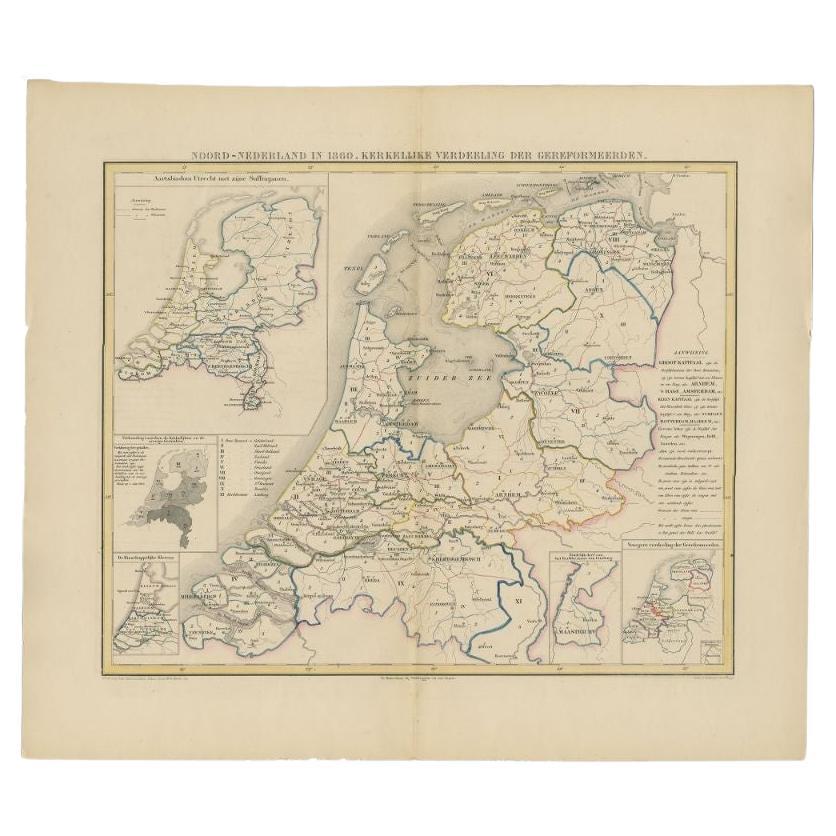
- Antique Map of the Netherlands in 1860 by Mees, 1862Located in Langweer, NLAntique map titled 'Noord-Nederland in 1860. Kerkelijke verdeeling der Gereformeerden'. Map of the Netherlands in 1860. This map originates from 'Historische Atlas van Noord-Nederlan...Category
Antique 19th Century Maps
MaterialsPaper
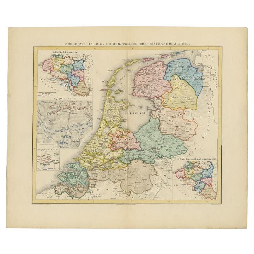
- Antique Map of the Netherlands in 1814 by Mees, 1858Located in Langweer, NLAntique map titled 'Noord-Nederland in 1814. De herstelling der onafhankelijkheid'. Map of the Netherlands in 1814. This map originates from 'Historische Atlas van Noord-Nederland'. ...Category
Antique 19th Century Maps
MaterialsPaper
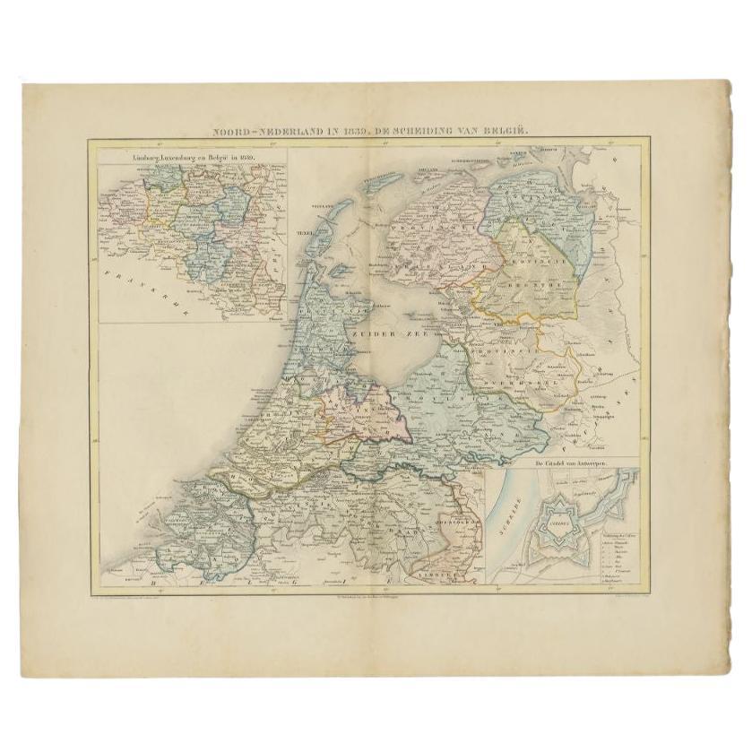
- Antique Map of the Netherlands in 1839 by Mees, 1860Located in Langweer, NLAntique map titled 'Noord-Nederland in 1839. De scheiding van België'. Map of the Netherlands in 1839. This map originates from 'Historische Atlas van Noord-Nederland'. Artists a...Category
Antique 19th Century Maps
MaterialsPaper
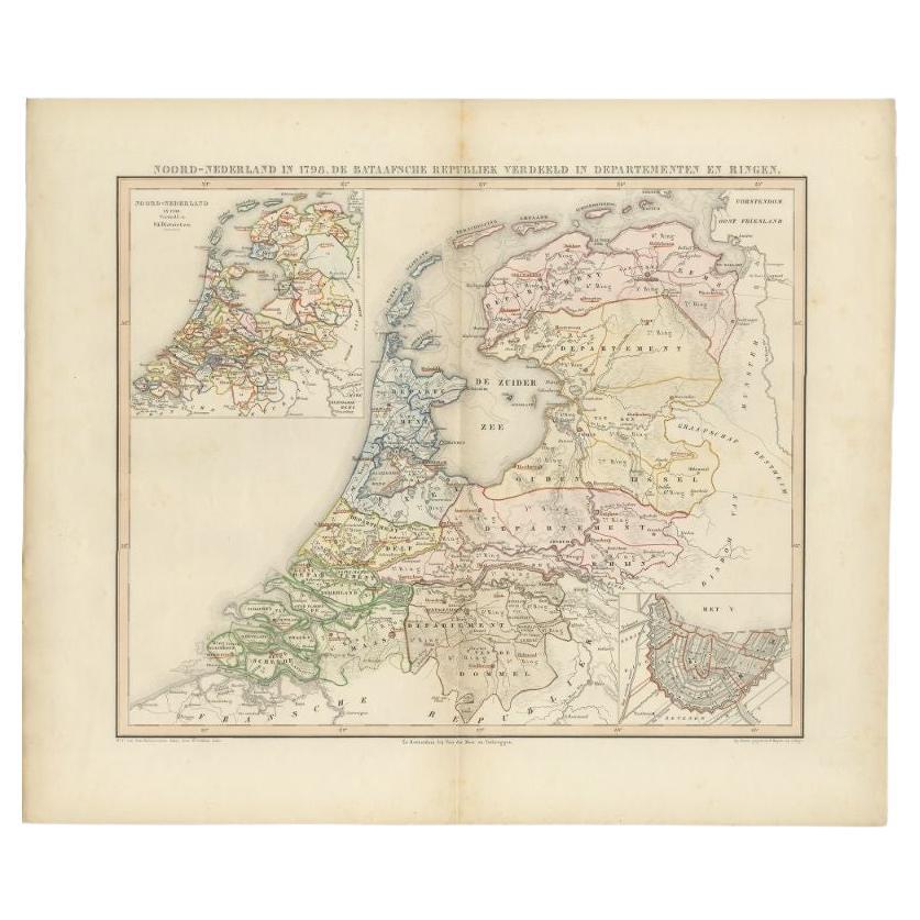
- Antique Map of the Netherlands in 1798 by Mees, 1851Located in Langweer, NLAntique map titled 'Noord-Nederland in 1798. De Bataafsche Republiek verdeeld in departementen en ringen'. Map of the Netherlands in 1798. This map originates from 'Historische Atlas...Category
Antique 19th Century Maps
MaterialsPaper

You May Also Like
- 1861 Topographical Map of the District of Columbia, by Boschke, Antique MapLocated in Colorado Springs, COPresented is an original map of Albert Boschke's extremely sought-after "Topographical Map of the District of Columbia Surveyed in the Years 1856 ...Category
Antique 1860s American Historical Memorabilia
MaterialsPaper
- Original Antique Map of Indonesia, 1861Located in St Annes, LancashireGreat map of Indonesia Drawn and engraved by Edward Weller Original color Published in The Weekly Dispatch Atlas, 1861 Repairs to minor e...Category
Antique 1860s English Victorian Maps
MaterialsPaper

- Large Antique 1859 Map of North AmericaLocated in Sag Harbor, NYThis Map was made by Augustus Mitchell in 1859 It is in amazing condition for being 163 years old. This price is for the rolled up easy to ship version of this piece. I will be Frami...Category
Antique Mid-19th Century American Maps
MaterialsCanvas, Paper

- 1859 "Map of the United States of America..." by J. H. ColtonBy J.H. ColtonLocated in Colorado Springs, COPresented is an 1859 “Map of the United States of America, the British Provinces, Mexico, the West Indies and Central America with Part of...Category
Antique 1850s American Maps
MaterialsPaper
- Original Antique Map of The Netherlands, Engraved by Barlow, Dated 1807Located in St Annes, LancashireGreat map of Netherlands Copper-plate engraving by Barlow Published by Brightly & Kinnersly, Bungay, Suffolk. Dated 1807 Unframed.Category
Antique Early 1800s English Maps
MaterialsPaper
- 1859 "Colton's New Map of the State of Texas..." by Johnson & BrowningLocated in Colorado Springs, COPresented is "Colton's New Map of the State of Texas Compiled from De Cordova's Large Map", published in Alivin J. Johnson’s “New Illustrated Family Atlas.” The map was published in ...Category
Antique 1850s American Maps
MaterialsPaper


Recently Viewed
View AllMore Ways To Browse
Antique Green Abstract
Antique Architecture Plan
Seven Fold
Antique Map Series
Antique Street Maps
Scottish Fold
Antique Doctors Office Furniture
Antique Prints Of A Cross
Atlas Furniture Company
Antique Map Set
Balinese Wood
Portuguese 16th
Atlas Book
Set Of Antique Maps
Pirate Furniture
Antique In Philippines
Victorian Book Ends
Railroad Collectibles