Items Similar to Antique Map of the North Pole by Fullarton, 1856


Want more images or videos?
Request additional images or videos from the seller
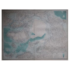
Antique Map of the North Pole by Fullarton, 1856
About the Item
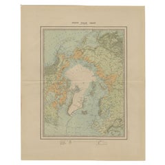
Antique map titled 'The Arctic Regions showing the North-West Passage of Captain R. McClure'. Old map of the North Pole, displaying the Northwest Passage discovered by Captain Robert McClure. The map was apparently originally issued for the Royal Geographical Society to illustrate Dr. Kane's expeditions.
Artists and Engravers: Engraved by A. Fullarton & Co.
Condition: Good, some toning and a small split on the folding line. Please study image carefully.
Date: 1856
Overall size: 26 x 28.5 cm.
Image size: 25 x 24.5 cm.
We sell original antique maps to collectors, historians, educators and interior decorators all over the world. Our collection includes a wide range of authentic antique maps from the 16th to the 20th centuries. Buying and collecting antique maps is a tradition that goes back hundreds of years. Antique maps have proved a richly rewarding investment over the past decade, thanks to a growing appreciation of their unique historical appeal. Today the decorative qualities of antique maps are widely recognized by interior designers who appreciate their beauty and design flexibility. Depending on the individual map, presentation, and context, a rare or antique map can be modern, traditional, abstract, figurative, serious or whimsical. We offer a wide range of authentic antique maps for any budget.
- Dimensions:Height: 11.23 in (28.5 cm)Width: 10.24 in (26 cm)Depth: 0 in (0.01 mm)
- Materials and Techniques:
- Period:
- Date of Manufacture:1856
- Condition:
- Seller Location:Langweer, NL
- Reference Number:
About the Seller
5.0
Platinum Seller
These expertly vetted sellers are 1stDibs' most experienced sellers and are rated highest by our customers.
Established in 2009
1stDibs seller since 2017
1,949 sales on 1stDibs
Typical response time: <1 hour
- ShippingRetrieving quote...Ships From: Langweer, Netherlands
- Return PolicyA return for this item may be initiated within 14 days of delivery.
More From This SellerView All
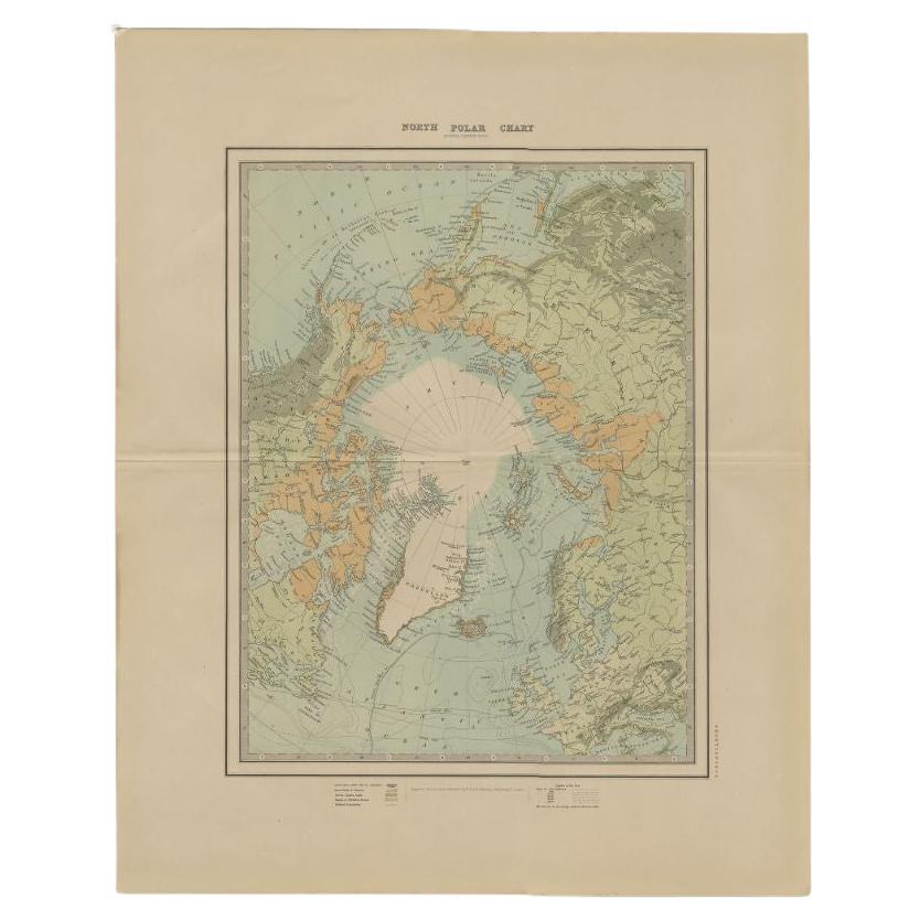
- Antique Map of the North Pole by Johnston, 1882Located in Langweer, NLAntique map titled 'North Pole Chart'. Old map of the North Pole showing the various regions and political boundaries. This map originates from 'The Royal A...Category
Antique 19th Century Maps
MaterialsPaper
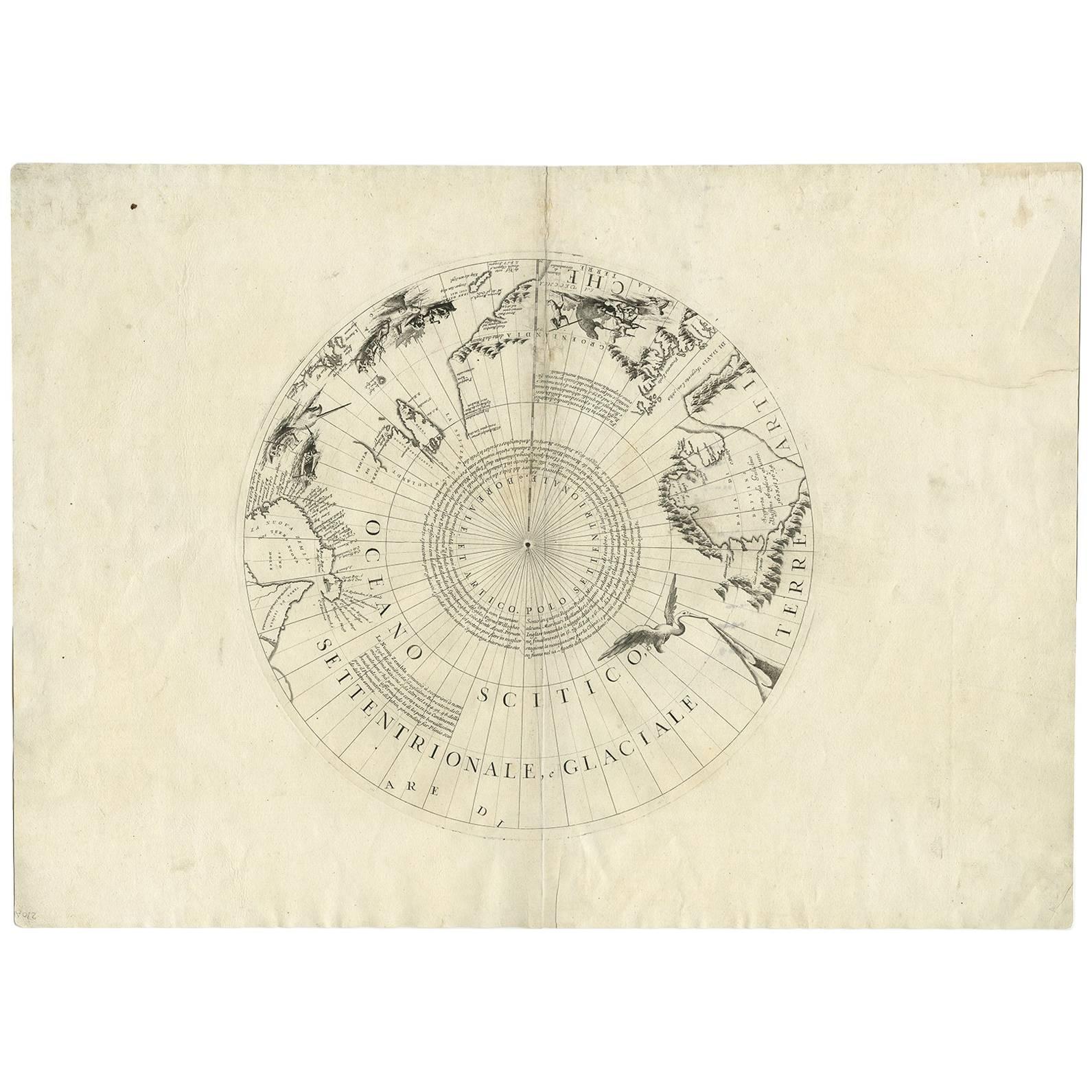
- Antique Map of the North Pole by V.M. Coronelli, circa 1692By Vincenzo CoronelliLocated in Langweer, NLGlobe gore by Vincenzo Maria Coronelli shows the North Pole with the coasts of Canada, Greenland, Scandinavia and Siberia, and is decorated with pictorial scenes of bear, seal and wh...Category
Antique Late 17th Century Maps
MaterialsPaper
- Antique Map of the Northern Hemisphere and North Pole by Tirion, circa 1754Located in Langweer, NLAntique map titled 'Nieuwe Kaart van de Noord Pool na de alderlaatste ondekking int licht gebracht'. Map of the Northern Hemisphere and North Pole, which shows the NE Passage, but no...Category
Antique Mid-18th Century Maps
MaterialsPaper
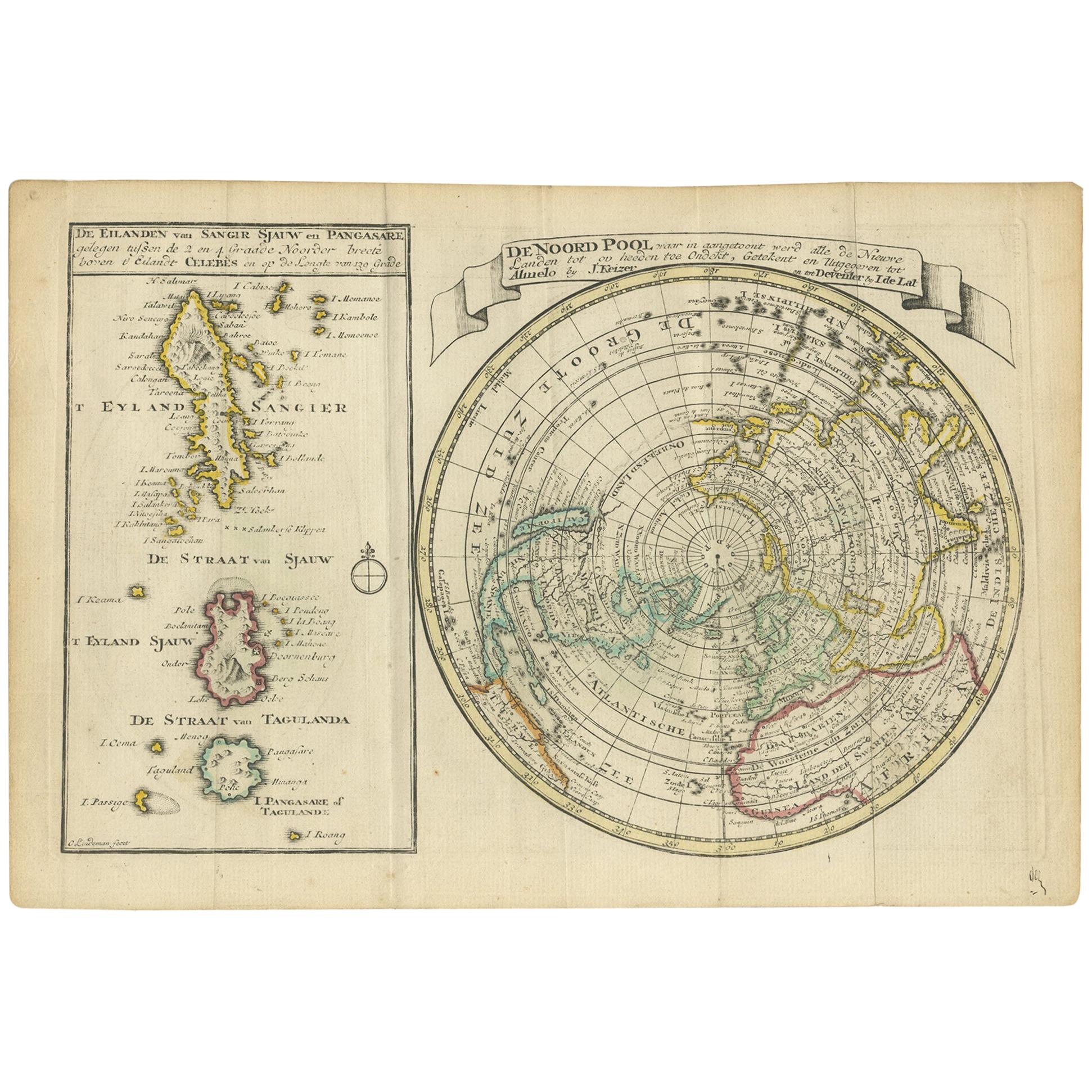
- Antique Map of the North Pole & Sangihe Archipelago by Keizer & de Lat, 1788Located in Langweer, NLAntique map titled 'De Noord Pool waar in aangetoont werd alle de Nieuwe Landen (..) - De Eilanden van Sangir Sjauw en Pangasare (..)'. Interesting map that includes a map of the Nor...Category
Antique Late 18th Century Maps
MaterialsPaper
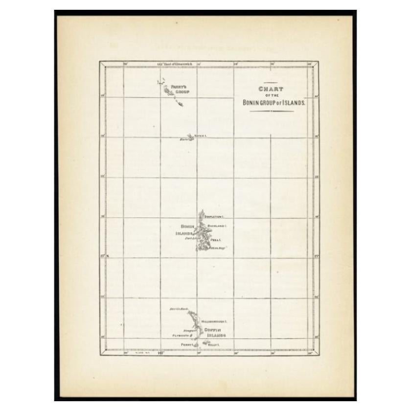
- Antique Map of the Bonin Islands by Hawks, 1856Located in Langweer, NLAntique map titled 'Chart of the Bonin Group of Islands.' The Bonin Islands, known in Japan as the Ogasawara Group are an archipelago of over 30 subtropical and tropical islands, som...Category
Antique 19th Century Maps
MaterialsPaper
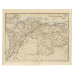
- Antique Map of the Northern Part of South America by Fullarton, 1855Located in Langweer, NLAntique map titled 'South American States, New Granada & Venezuela'. Detailed map of the northern part of South America. With a small inset map of Panama. Originates from the 'Royal ...Category
Antique 19th Century Maps
MaterialsPaper


You May Also Like
- Large Original Antique Map of The World, Fullarton, C.1870Located in St Annes, LancashireGreat map of the World. Showing both hemispheres From the celebrated Royal Illustrated Atlas Lithograph. Original color. Published by Fullarton, Edinburgh, C.1870 Unframed. Rep...Category
Antique 1870s Scottish Maps
MaterialsPaper
- Large Original Vintage Map of The North Pole, circa 1920Located in St Annes, LancashireGreat maps of The North Pole. Unframed. Original color. By John Bartholomew and Co. Edinburgh Geographical Institute. Published, circa 1920. Free shipp...Category
Vintage 1920s British Maps
MaterialsPaper
- Large Original Antique Map of The Pacific Ocean, Fullarton, C.1870Located in St Annes, LancashireGreat map of The Pacific Ocean From the celebrated Royal Illustrated Atlas Lithograph by Swanston. Original color. Published by Fullarton,...Category
Antique 1870s Scottish Maps
MaterialsPaper
- Large Original Antique Map of the World, Fullarton, circa 1870Located in St Annes, LancashireGreat map of the World. From the celebrated Royal Illustrated Atlas Lithograph. Original color. Published by Fullarton, Edinburgh, circa 1870. Unframed.Category
Antique 1870s Scottish Maps
MaterialsPaper
- Large Original Antique Map of Australia, Fullarton, C.1870Located in St Annes, LancashireGreat map of Australia From the celebrated Royal Illustrated Atlas Engraved by Swanston after the drawing by Augustus Petermann Lithograph. Original color. Published by ...Category
Antique 1870s Scottish Maps
MaterialsPaper
- Large Original Antique Map of China, Fullarton, C.1870Located in St Annes, LancashireGreat map of China From the celebrated Royal Illustrated Atlas Lithograph by Swanston. Original color. Published by Fullarton, Edinburgh. C.1870 Repairs to minor edge te...Category
Antique 1870s Scottish Maps
MaterialsPaper