Items Similar to Antique Map of the Northern Coast of Africa and Southern Europe, circa 1745


Want more images or videos?
Request additional images or videos from the seller
1 of 6
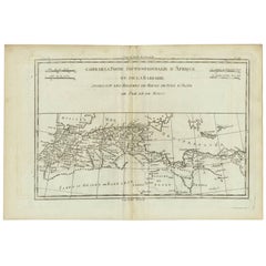
Antique Map of the Northern Coast of Africa and Southern Europe, circa 1745
About the Item
Antique map titled 'In Notitiam Ecclesiasticam Africae Tabula Geographica'. Very decorative hand-colored map of the northern coast of Africa, Spain, Italy and the Mediterranean with the islands of Sardinia, Corsica, Majorca, Minorca etc. Sicily features a smoking Mount Aetna. Embellished with three architectural cartouches and a compass rose.
- Creator:Covens & Mortier (Artist)
- Dimensions:Height: 21.07 in (53.5 cm)Width: 25.4 in (64.5 cm)Depth: 0.02 in (0.5 mm)
- Materials and Techniques:
- Period:
- Date of Manufacture:circa 1745
- Condition:Original hand-colouring. Please study images carefully.
- Seller Location:Langweer, NL
- Reference Number:
About the Seller
5.0
Platinum Seller
These expertly vetted sellers are 1stDibs' most experienced sellers and are rated highest by our customers.
Established in 2009
1stDibs seller since 2017
1,940 sales on 1stDibs
Typical response time: <1 hour
- ShippingRetrieving quote...Ships From: Langweer, Netherlands
- Return PolicyA return for this item may be initiated within 14 days of delivery.
More From This SellerView All
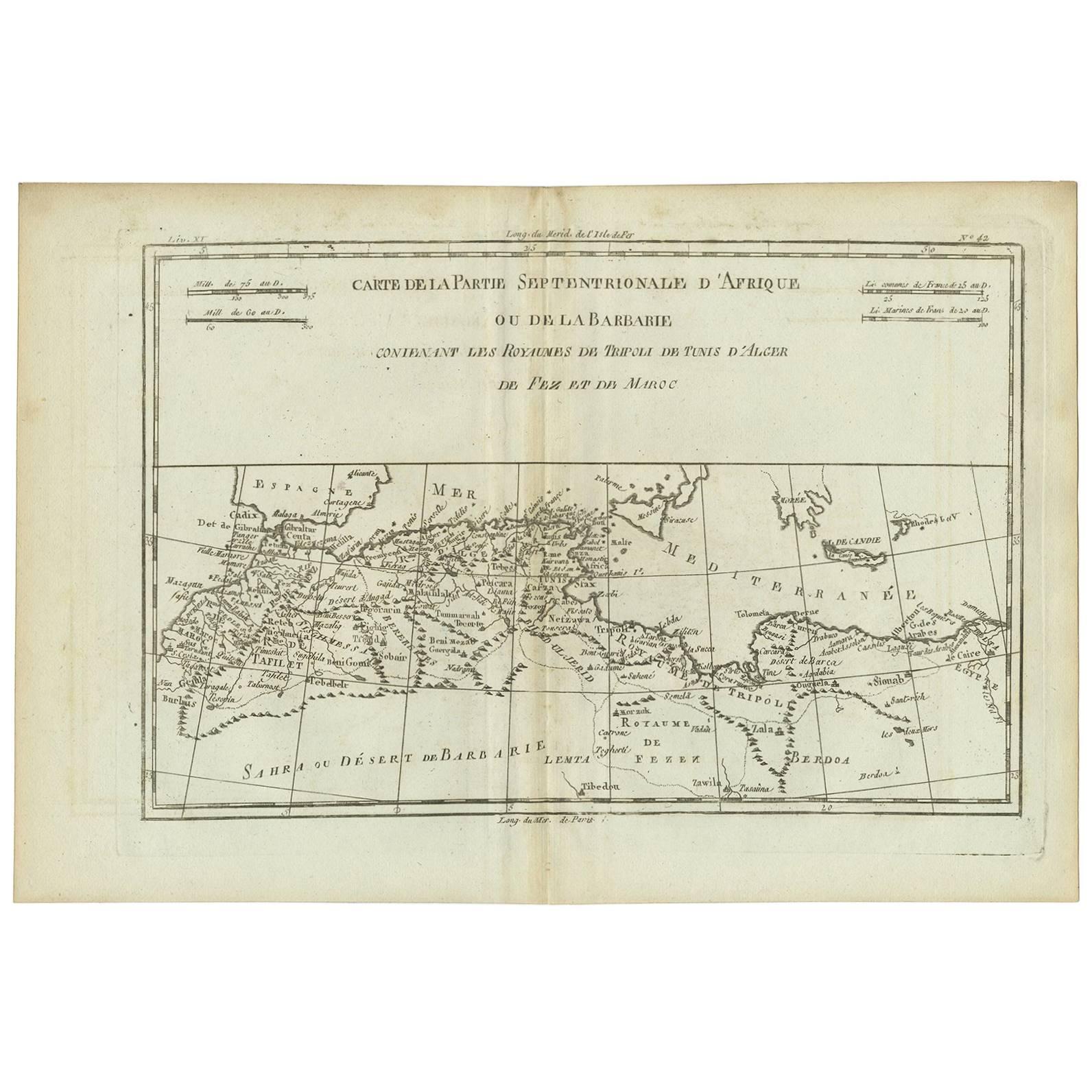
- Antique Map of Northern Africa "Barbary Coast" by R. Bonne, circa 1780Located in Langweer, NLA fine example of Rigobert Bonne and Guilleme Raynal’s 1780 map of northwestern Africa or the Barbary Coast. Includes the modern day countries of Morocco, Algeria, Tunisia, Libya, and parts of adjacent Spain, Italy and Greece. This map was made in response to European interest in the region due to coastal attacks and incursions by the Barbary Pirates...Category
Antique Late 18th Century Maps
MaterialsPaper
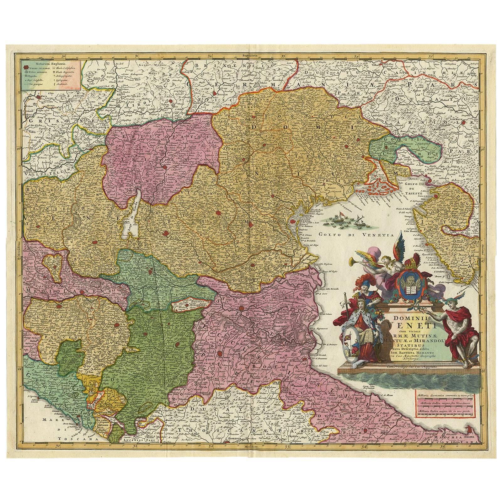
- Stunning Antique Map of Northern Italy by J.B. Homann, circa 1745By Johann Baptist HomannLocated in Langweer, NLThis beautiful hand-colored map covers from Bergamo east as far as Albona (Labin) and from Vipiteno Sterzing south as far as Florence. The map is exceptionally detailed, noting towns, rivers, lakes, cities and a host of additional topographical features. Includes neighboring Parma, Modena, Mantua and Mirandol. The map depicts the Veneto region and its vicinity during the decline of the Republic of Venice. A key in included in the top left quadrant of the map, while a beautifully engraved title cartouche adorns the lower right quadrant. This map was issued in Homann Heirs circa 1745 edition of Atlas Novus Terrarum Orbis.Category
Antique Mid-18th Century Maps
MaterialsPaper
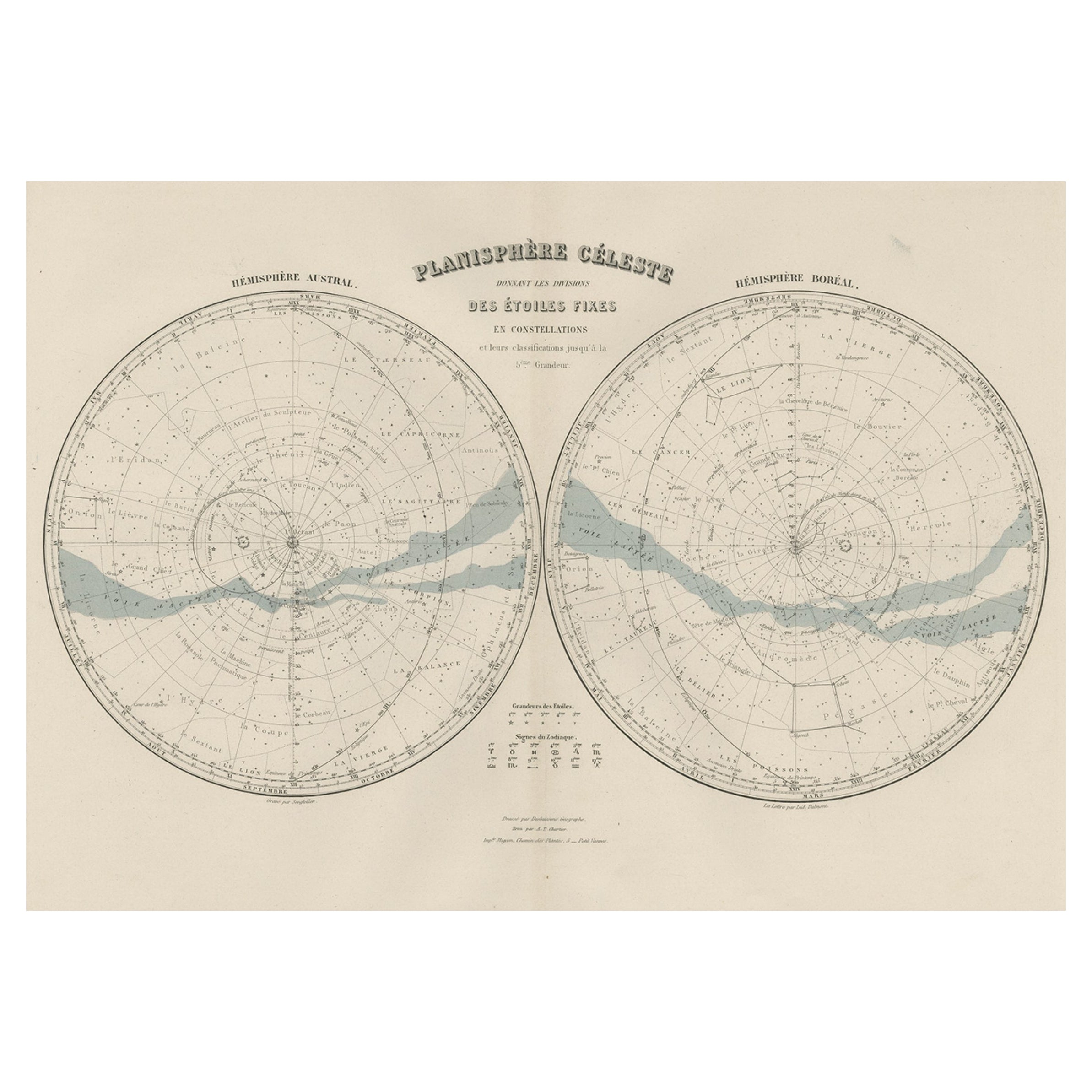
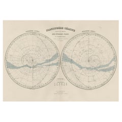
- Antique Map of the Night Skies of the Northern and Southern Hemispheres, 1880Located in Langweer, NLAntique world map titled 'Planisphère en Céleste'. This map depicts the night skies of both the northern and southern hemispheres. This map originates from 'Géographie Universell...Category
Antique 1880s Maps
MaterialsPaper
- Antique Map of Europe Stretching from Northern Africa to the Baltic Sea, 1719Located in Langweer, NLAntique map titled 'Carte de la Germanie et les diferents Etats ou ses Peuples ont porté leurs conquestes'. Original antique map of Europe stretching from northern Africa to the Balt...Category
Antique 18th Century Maps
MaterialsPaper
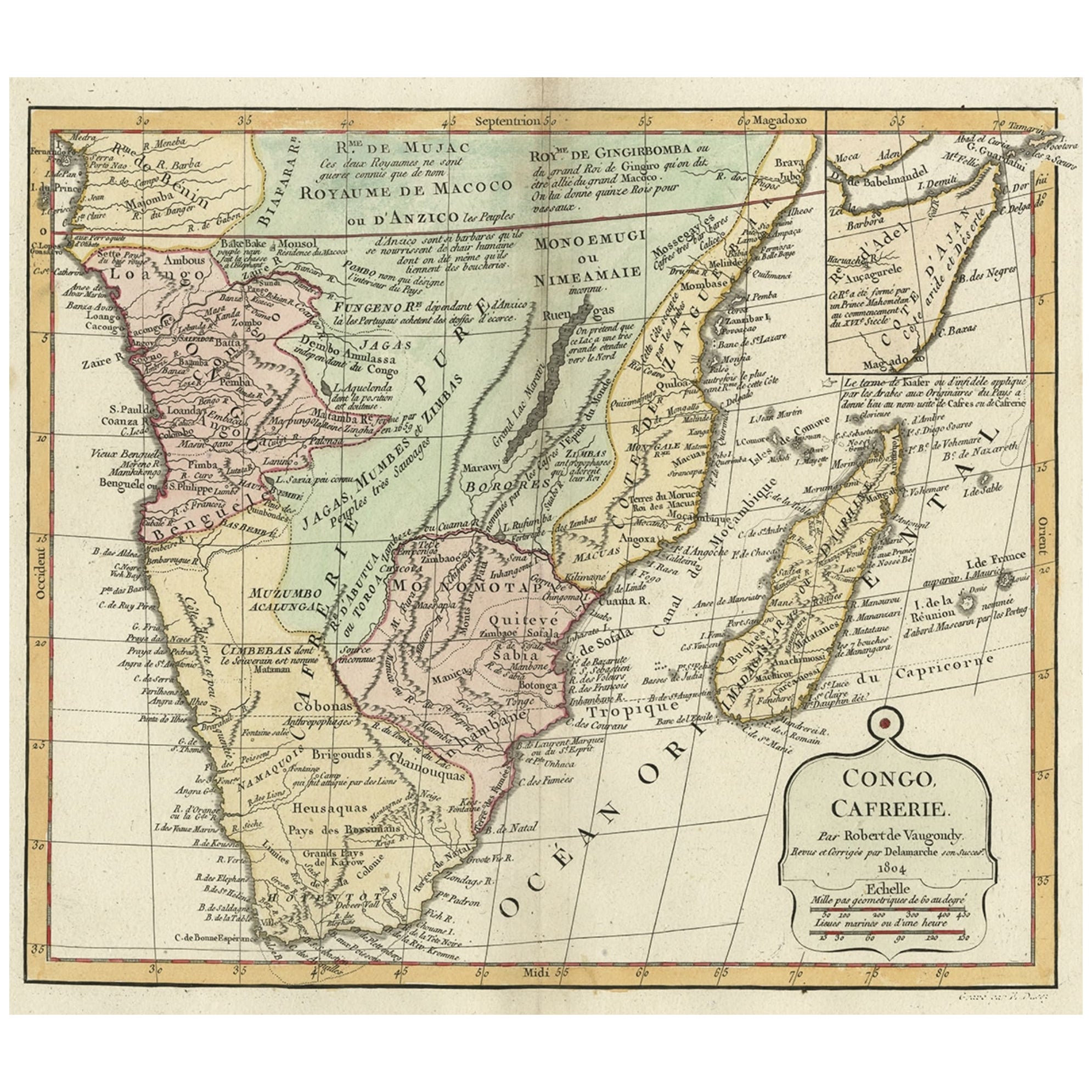
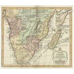
- Decorative Antique Map of the Southern Part of Africa, 1806Located in Langweer, NLAntique map titled 'Congo, Cafrerie.' Decorative map of the southern part of Africa by Robert de Vaugondy, revised and published by Delamarche. Source unknown, to be determined. Artists and Engravers: Charles Francois Delamarche (1740-1817) founded the important and prolific Paris based Maison Delamarche map publishing firm in the late 18th century. A lawyer by trade Delamarche entered the map business with the acquisition from Jean-Baptiste Fortin of Robert de Vaugondy's map plates...Category
Antique Early 1800s Maps
MaterialsPaper
- Antique Map of Northern Europe and European Russia, ca.1780Located in Langweer, NLAntique map titled 'Le Nord de L'Europe, Contenant Le Danemark, La Norwege; La Suede et La Laponie avec la Majeure Partie de al Russie Europeenne.' Map of Northern Europe and Eur...Category
Antique 1780s Maps
MaterialsPaper


You May Also Like
- Original Antique Map of Europe, Arrowsmith, 1820Located in St Annes, LancashireGreat map of Europe Drawn under the direction of Arrowsmith. Copper-plate engraving. Published by Longman, Hurst, Rees, Orme and Brown, 1820 ...Category
Antique 1820s English Maps
MaterialsPaper
- Original Antique Map of South Africa, Arrowsmith, 1820Located in St Annes, LancashireGreat map of South Africa. Drawn under the direction of Arrowsmith. Copper-plate engraving. Published by Longman, Hurst, Rees, Orme and Br...Category
Antique 1820s English Maps
MaterialsPaper
- West Coast of Africa, Guinea & Sierra Leone: An 18th Century Map by BellinBy Jacques-Nicolas BellinLocated in Alamo, CAJacques Bellin's copper-plate map entitled "Partie de la Coste de Guinee Dupuis la Riviere de Sierra Leona Jusquau Cap das Palmas", depicting the coast of Guinea and Sierra Leone in ...Category
Antique Mid-18th Century French Maps
MaterialsPaper
- Southern & Eastern Europe: A Large 17th C. Hand-colored Map by Sanson & JaillotBy Nicolas SansonLocated in Alamo, CAThis large hand-colored map entitled "Estats de L'Empire des Turqs en Europe, ou sont les Beglerbeglicz our Gouvernements" was originally created by Nicholas Sanson d'Abbeville and t...Category
Antique 1690s French Maps
MaterialsPaper
- The Kingdom of Naples and Southern Italy: A Hand-Colored 18th Century Homann MapBy Johann Baptist HomannLocated in Alamo, CA"Novissima & exactissimus Totius Regni Neapolis Tabula Presentis Belli Satui Accommo Data" is a hand colored map of southern Italy and the ancient Kingdom of Naples created by Johann...Category
Antique Early 18th Century German Maps
MaterialsPaper
- Original Antique Map of Spain and Portugal, circa 1790Located in St Annes, LancashireSuper map of Spain and Portugal Copper plate engraving by A. Bell Published, circa 1790. Unframed.Category
Antique 1790s English Other Maps
MaterialsPaper


Recently Viewed
View AllMore Ways To Browse
Antique Smoking
Maps Of Mediterranean
Map Of Southern Europe
Hand Colored Italy Map
Antique Map Mediterranean
Map Southern Africa
Antique Map Of Northern Italy
Map Of Sicily
Sicily Map
Map Mediterranean
Antique Mediterranean Map
Antique Maps Of Sicily
Sardinia Map
Antique Sicily Map
Antique Map Sicily
Map Of Majorca
Covens & Mortier On Sale
Bag With Map