Items Similar to Antique Map of South America by V. Levasseur, 1854

Want more images or videos?
Request additional images or videos from the seller
Antique Map of South America by V. Levasseur, 1854
About the Item
Antique map titled 'Amérique Méridionale'. Map shows South America, beautiful surrounded by typical scenes of natives and their life. Depicting Colombia, Brazil, Chile, Bolivia and more. This map originates from ‘Atlas National de la France Illustré’. Published by A. Combette, Paris, 1854.
- Creator:Victor Levasseur (Artist)
- Dimensions:Height: 13.98 in (35.5 cm)Width: 20.67 in (52.5 cm)Depth: 0.02 in (0.5 mm)
- Materials and Techniques:
- Period:
- Date of Manufacture:1854
- Condition:General age-related toning. Please study image carefully.
- Seller Location:Langweer, NL
- Reference Number:
About the Seller
5.0
Platinum Seller
These expertly vetted sellers are 1stDibs' most experienced sellers and are rated highest by our customers.
Established in 2009
1stDibs seller since 2017
1,949 sales on 1stDibs
Typical response time: <1 hour
- ShippingRetrieving quote...Ships From: Langweer, Netherlands
- Return PolicyA return for this item may be initiated within 14 days of delivery.
More From This SellerView All
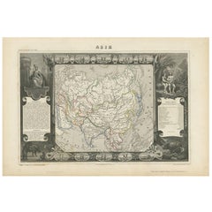
- Antique Map of Asia by V. Levasseur, 1854By Victor LevasseurLocated in Langweer, NLAntique map titled 'Asie'. Map of the main Asian continent. The decorated border shows various images, as well as two blocks of statistical text on the continent, including populatio...Category
Antique Mid-19th Century Maps
MaterialsPaper
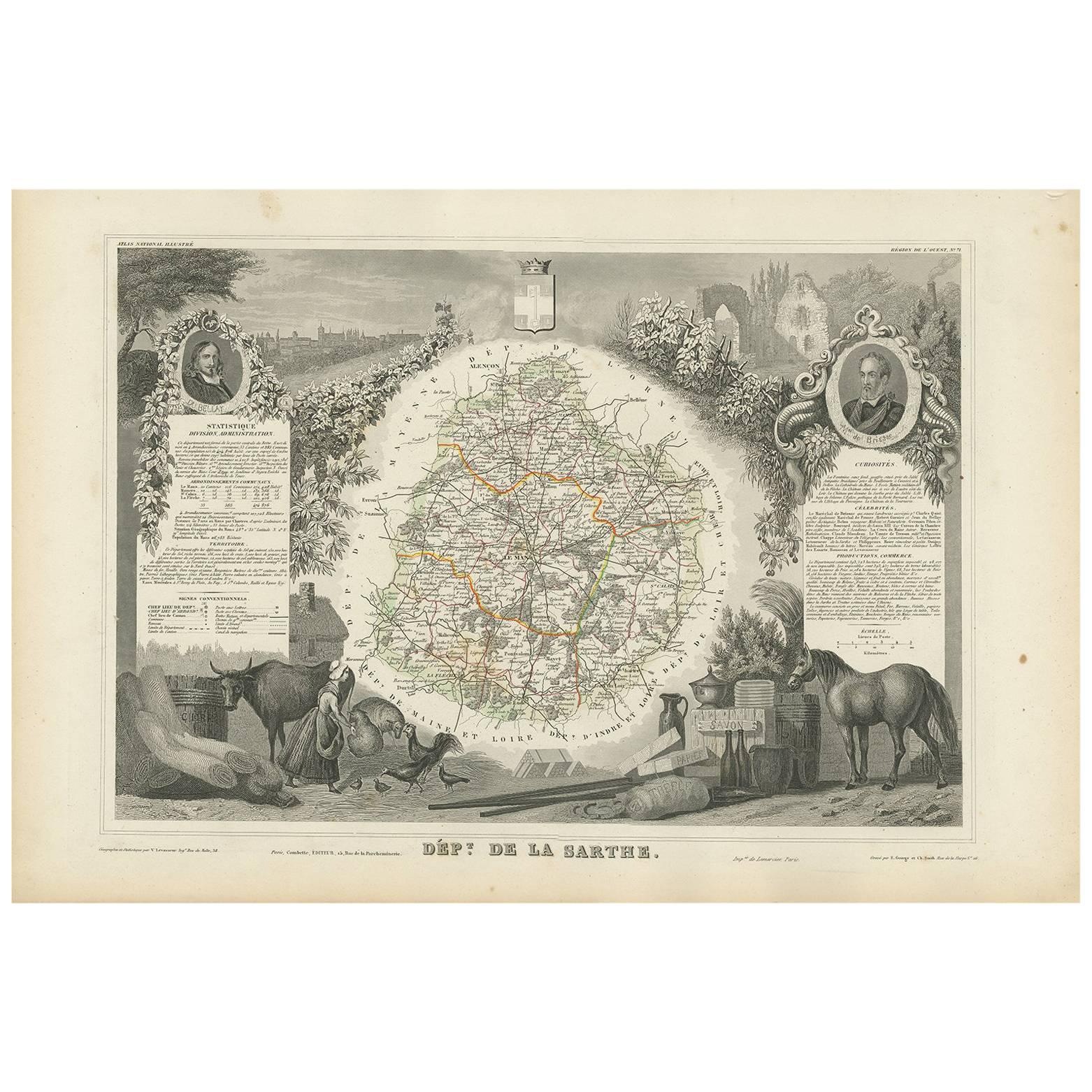
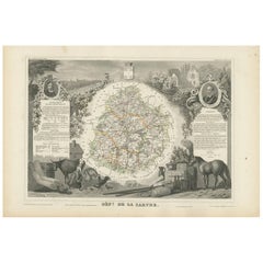
- Antique Map of Sarthe 'France' by V. Levasseur, 1854By Victor LevasseurLocated in Langweer, NLAntique map titled 'Dépt. de la Sarthe'. The north-west France Department of Sarthe is in the Pays de la Loire region of Le Mans, the location of the great endurance sports car road-...Category
Antique Mid-19th Century Maps
MaterialsPaper
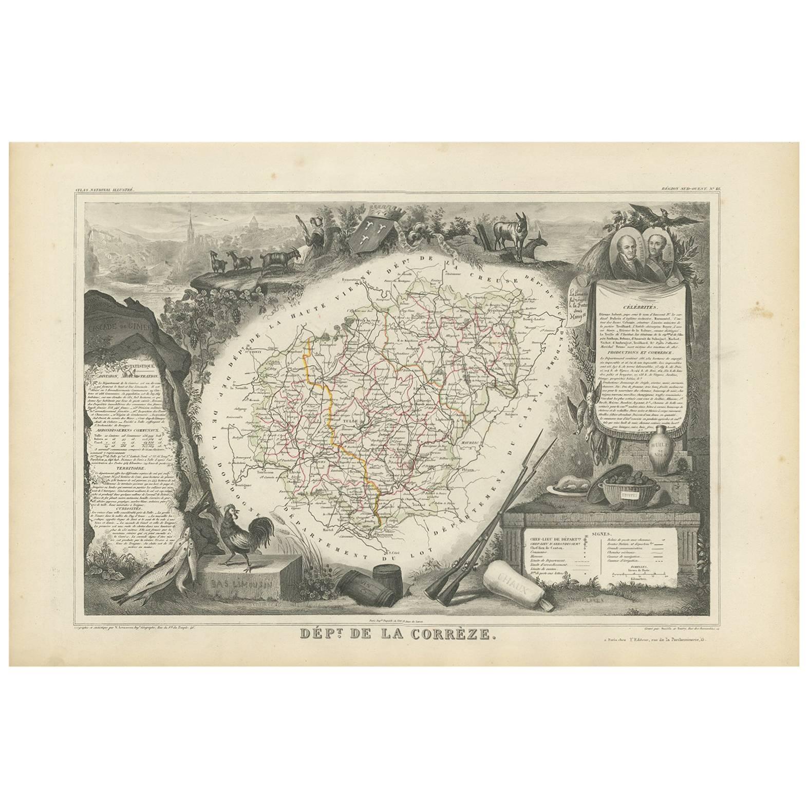
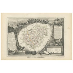
- Antique Map of Corrèze ‘France’ by V. Levasseur, 1854By Victor LevasseurLocated in Langweer, NLAntique map titled 'Dépt. da la Corrèze'. Map of the French department of Correze, France. This area of France is known for its production of Straw Wine, a sweet red or white wine. T...Category
Antique Mid-19th Century Maps
MaterialsPaper
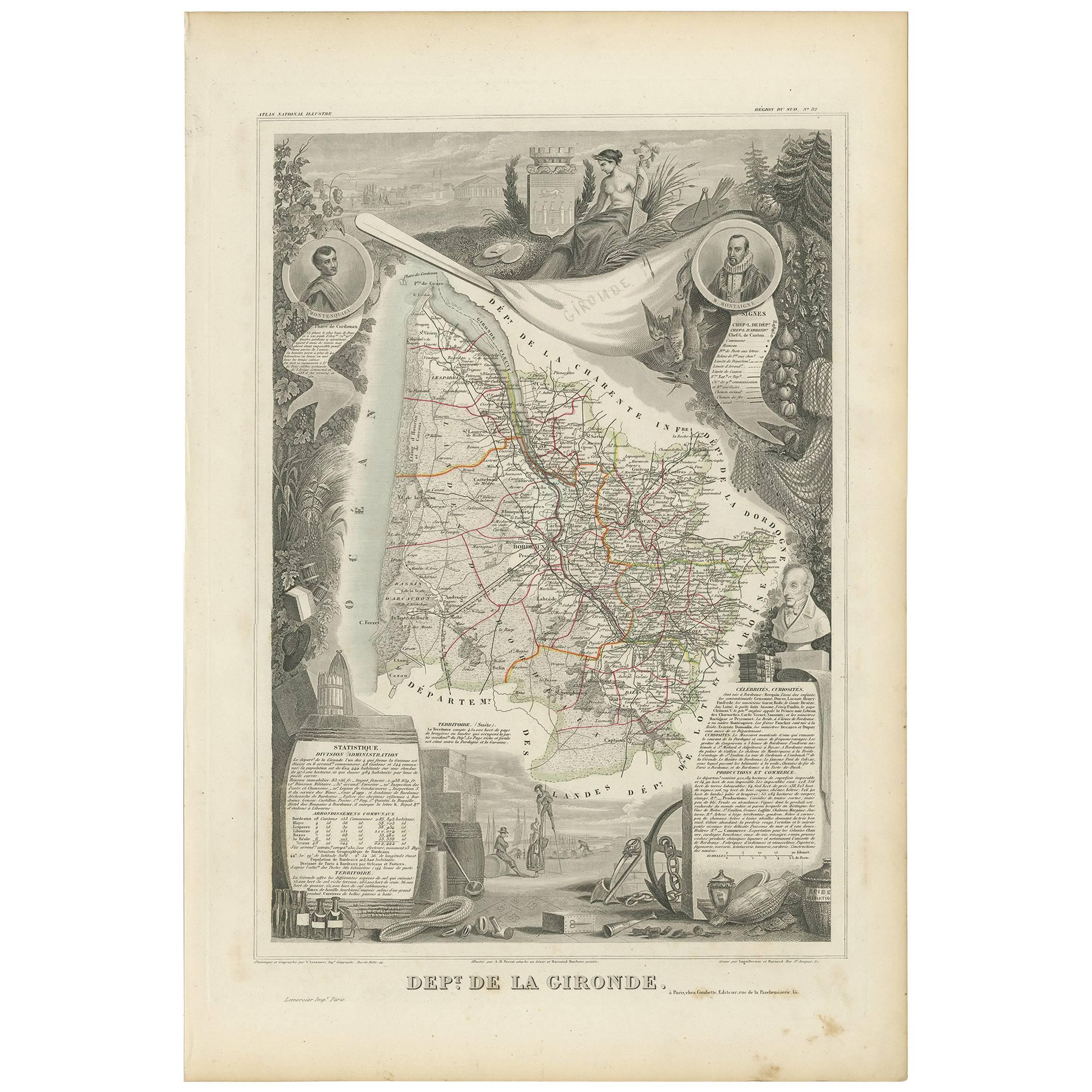
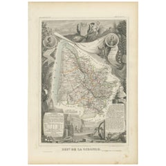
- Antique Map of Gironde ‘France’ by V. Levasseur, 1854By Victor LevasseurLocated in Langweer, NLAntique map titled 'Dépt. de la Gironde'. Map of the French department of Gironde. This coastal department is the seat of the Bordeaux wine region and produces many of the world's fi...Category
Antique Mid-19th Century Maps
MaterialsPaper
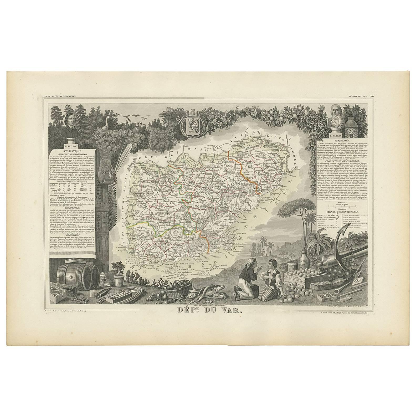
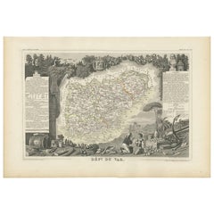
- Antique Map of Var 'France' by V. Levasseur, 1854By Victor LevasseurLocated in Langweer, NLAntique map titled 'Dépt. du Var'. Map of the French department of Var, the heart of the French Riviera or Côte d'Azur. Includes the resort cities of Cannes, Nice and San Tropez...Category
Antique Mid-19th Century Maps
MaterialsPaper
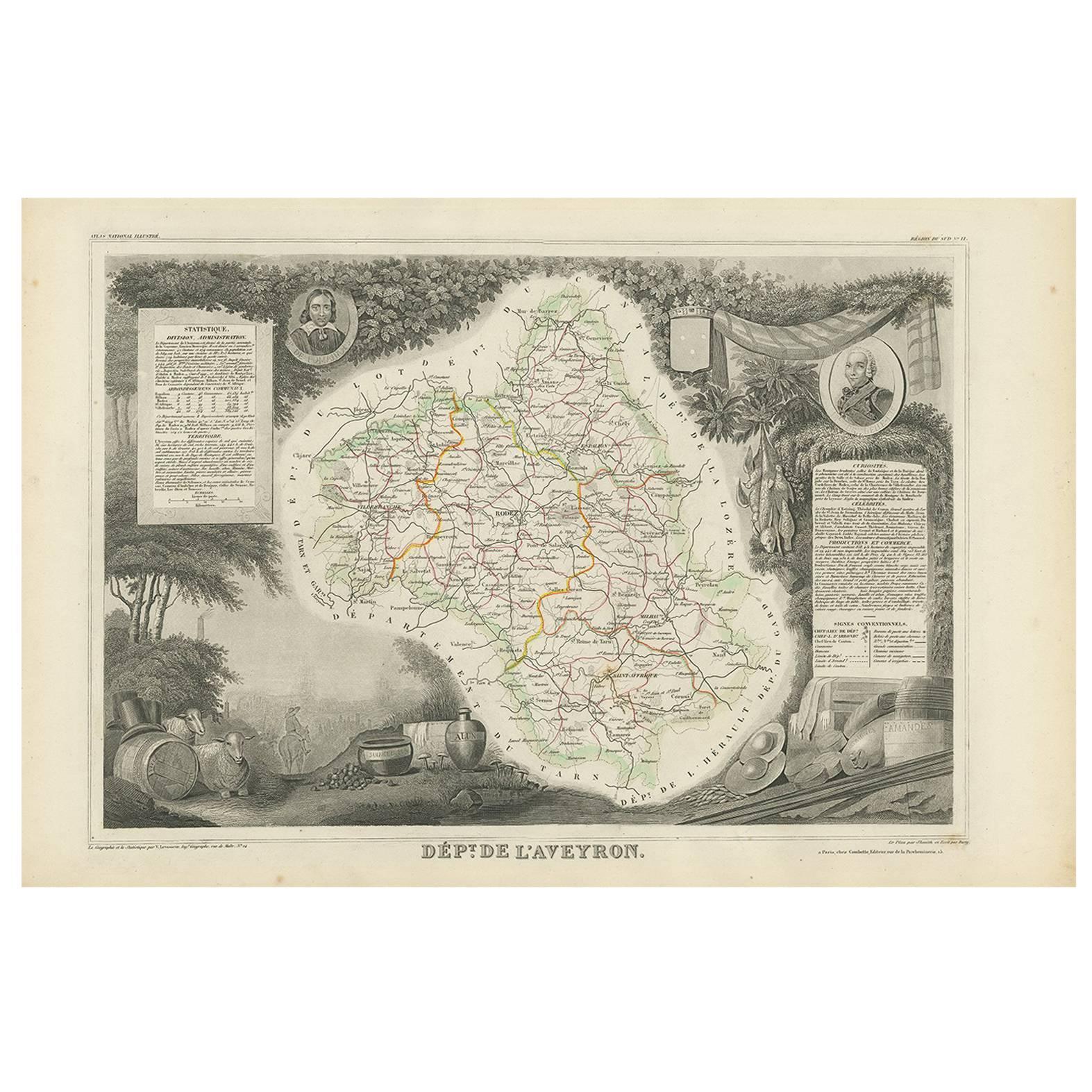
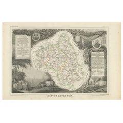
- Antique Map of Aveyron ‘France’ by v. Levasseur, 1854By Victor LevasseurLocated in Langweer, NLAntique map titled 'Dépt. de 'l'Aveyron'. Map of the French department of Aveyron, France. This area of France, centred on Rodez, is famous for its production of Roquefort, a flavorf...Category
Antique Mid-19th Century Maps
MaterialsPaper
You May Also Like
- Original Antique Map of South America. C.1780Located in St Annes, LancashireGreat map of South America Copper-plate engraving Published C.1780 Two small worm holes to left side of map Unframed.Category
Antique Early 1800s English Georgian Maps
MaterialsPaper
- Original Antique Map of South America, circa 1830Located in St Annes, LancashireGreat map of South America Copper plate engraving Published by Butterworth, Livesey & Co., circa 1830 Unframed.Category
Antique Early 1800s English Other Maps
MaterialsPaper
- Original Antique Map of South America by Thomas Clerk, 1817Located in St Annes, LancashireGreat map of South America Copper-plate engraving Drawn and engraved by Thomas Clerk, Edinburgh. Published by Mackenzie And Dent, 1817 Unframed.Category
Antique 1810s English Maps
MaterialsPaper
- Original Antique Map of South Africa, Arrowsmith, 1820Located in St Annes, LancashireGreat map of South Africa. Drawn under the direction of Arrowsmith. Copper-plate engraving. Published by Longman, Hurst, Rees, Orme and Br...Category
Antique 1820s English Maps
MaterialsPaper
- Large Antique 1859 Map of North AmericaLocated in Sag Harbor, NYThis Map was made by Augustus Mitchell in 1859 It is in amazing condition for being 163 years old. This price is for the rolled up easy to ship version of this piece. I will be Frami...Category
Antique Mid-19th Century American Maps
MaterialsCanvas, Paper

- Original Antique Map of South East Asia by Becker, circa 1840Located in St Annes, LancashireGreat map of South East Asia Steel engraving with original color outline Engraved by Becker Published by Virtue, circa 1840. Unframed.Category
Antique 1840s English Other Maps
MaterialsPaper


Recently Viewed
View AllMore Ways To Browse
La France
South America
La France Antique
South Of France Mid Century Furniture
South America Brazil
Map Paris
Paris Map
Map Of Paris
Mid Century Brazil Antiques
Antique Map America
Antique American Maps
Antique American Map
America Antique Map
Antique Map Of America
Antique Maps Of America
Antique Paris Map
Paris Antique Maps
Antique Maps Paris