Items Similar to Antique Map of St. Andries 'Heerewaarden' by Orlers, 1615
Want more images or videos?
Request additional images or videos from the seller
1 of 5
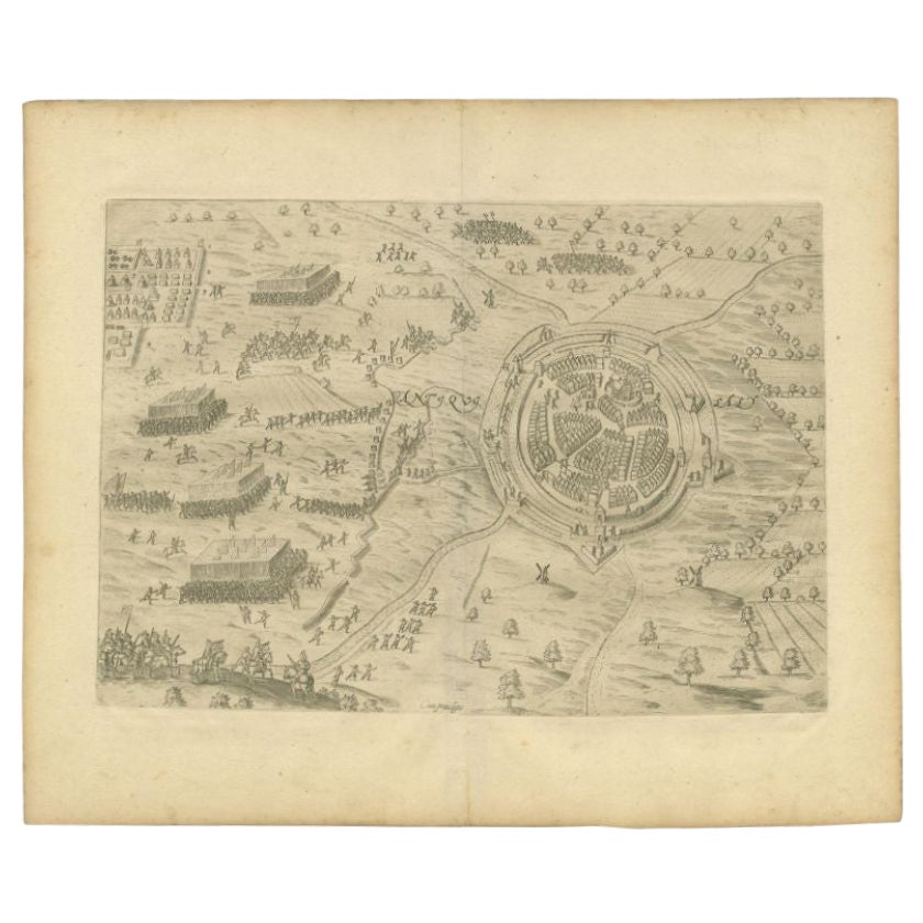
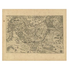
Antique Map of St. Andries 'Heerewaarden' by Orlers, 1615
About the Item
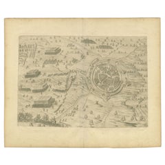
Antique map titled 'Prata Inundata'. This map depicts the area between the Maas and Waal river (The Netherlands) during the siege of St. Andries and Voorne under command of prince Maurits, May 1600. This map originates from 'La genealogie des illustres Comtes de Nassau' by Jan Jansz. Orlers. Artists and Engravers: Jan Janszoon Orlers (1570 - 1646), Dutch historian.
Artist: Jan Janszoon Orlers (1570 - 1646), Dutch historian.
Condition: Very good, some creasing. Please study image carefully.
Date: 1615
Overall size: 33 x 25 cm.
Image size: 0.001 x 26.5 x 22 cm.
Antique prints have long been appreciated for both their aesthetic and investment value. They were the product of engraved, etched or lithographed plates. These plates were handmade out of wood or metal, which required an incredible level of skill, patience and craftsmanship. Whether you have a house with Victorian furniture or more contemporary decor an old engraving can enhance your living space. We offer a wide range of authentic antique prints for any budget.
- Dimensions:Height: 9.85 in (25 cm)Width: 13 in (33 cm)Depth: 0 in (0.01 mm)
- Materials and Techniques:
- Period:
- Date of Manufacture:1615
- Condition:
- Seller Location:Langweer, NL
- Reference Number:
About the Seller
5.0
Platinum Seller
These expertly vetted sellers are 1stDibs' most experienced sellers and are rated highest by our customers.
Established in 2009
1stDibs seller since 2017
1,960 sales on 1stDibs
Typical response time: <1 hour
- ShippingRetrieving quote...Ships From: Langweer, Netherlands
- Return PolicyA return for this item may be initiated within 14 days of delivery.
More From This SellerView All
- Antique Map of the City of Oldenzaal by Orlers, 1615Located in Langweer, NLAntique map depicting the Siege of Oldenzaal, the Netherlands. The Siege of Oldenzaal was a short siege that took place during the Eighty Years' War and the Anglo–Spanish War by a Du...Category
Antique 17th Century Maps
MaterialsPaper
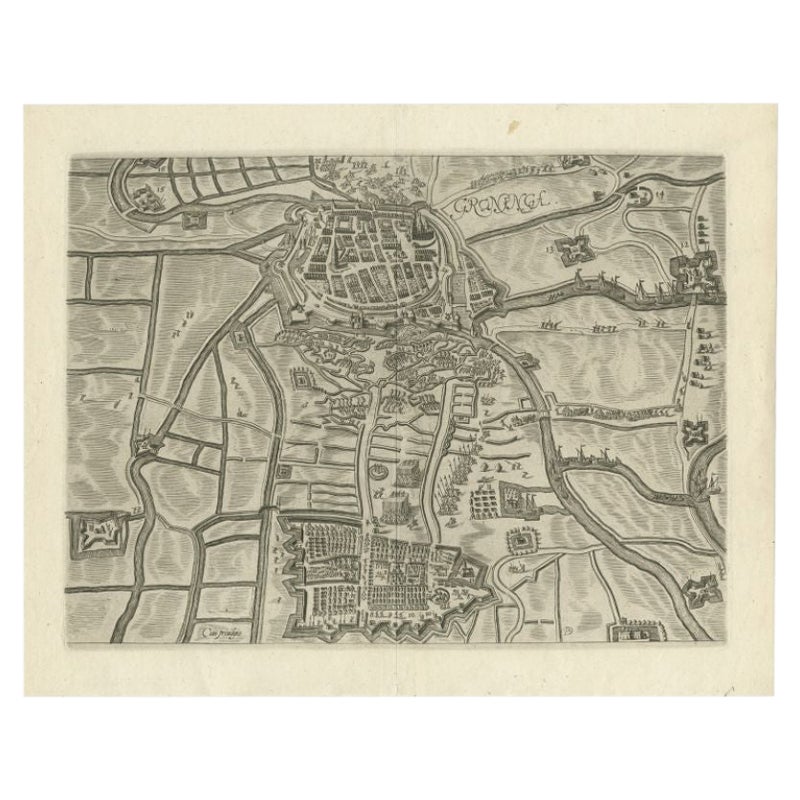
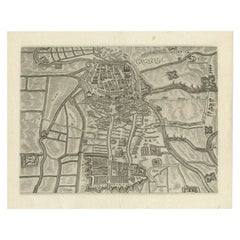
- Antique Map of the City of Groningen by Orlers, 1615Located in Langweer, NLAntique map titled 'Gronenga'. Map of the city of Groningen, the Netherlands. This map originates from 'La genealogie des illustres Comtes de Nassau' by Jan Jansz. Orlers. Artists...Category
Antique 17th Century Maps
MaterialsPaper
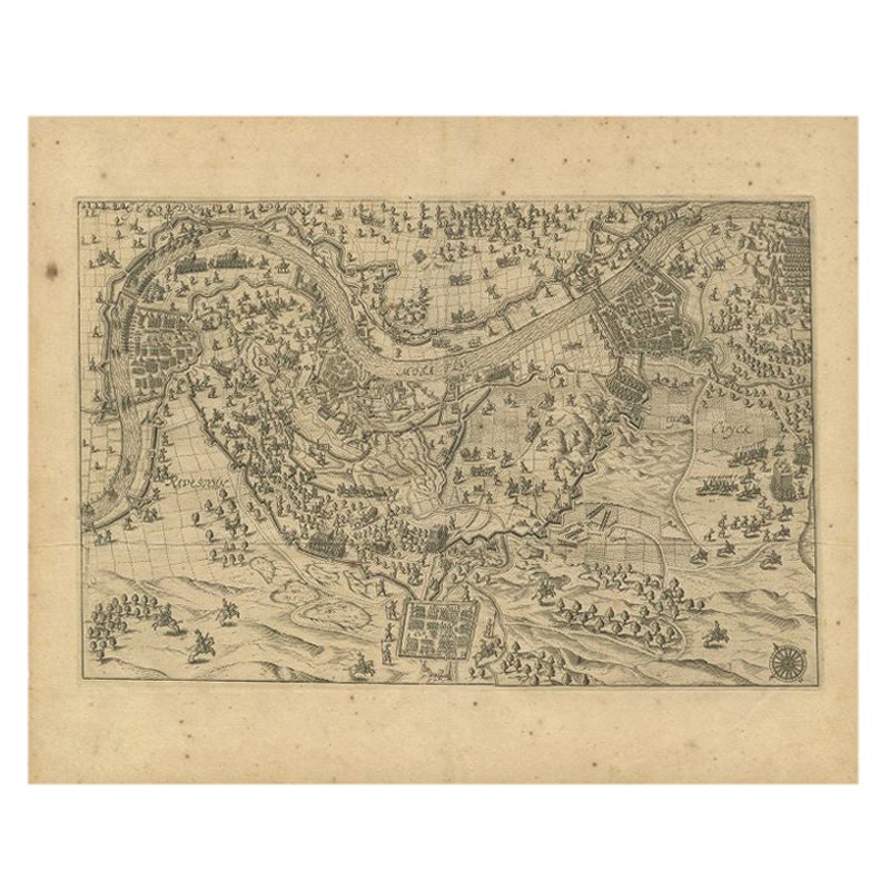
- Antique Map of the Region of Grave by Orlers, 1615Located in Langweer, NLAntique map of the region of Grave, also including Cuijk and Ravestein. This map originates from 'La genealogie des illustres Comtes de Nassau' by Jan Jansz. Orlers. Artists and E...Category
Antique 17th Century Maps
MaterialsPaper
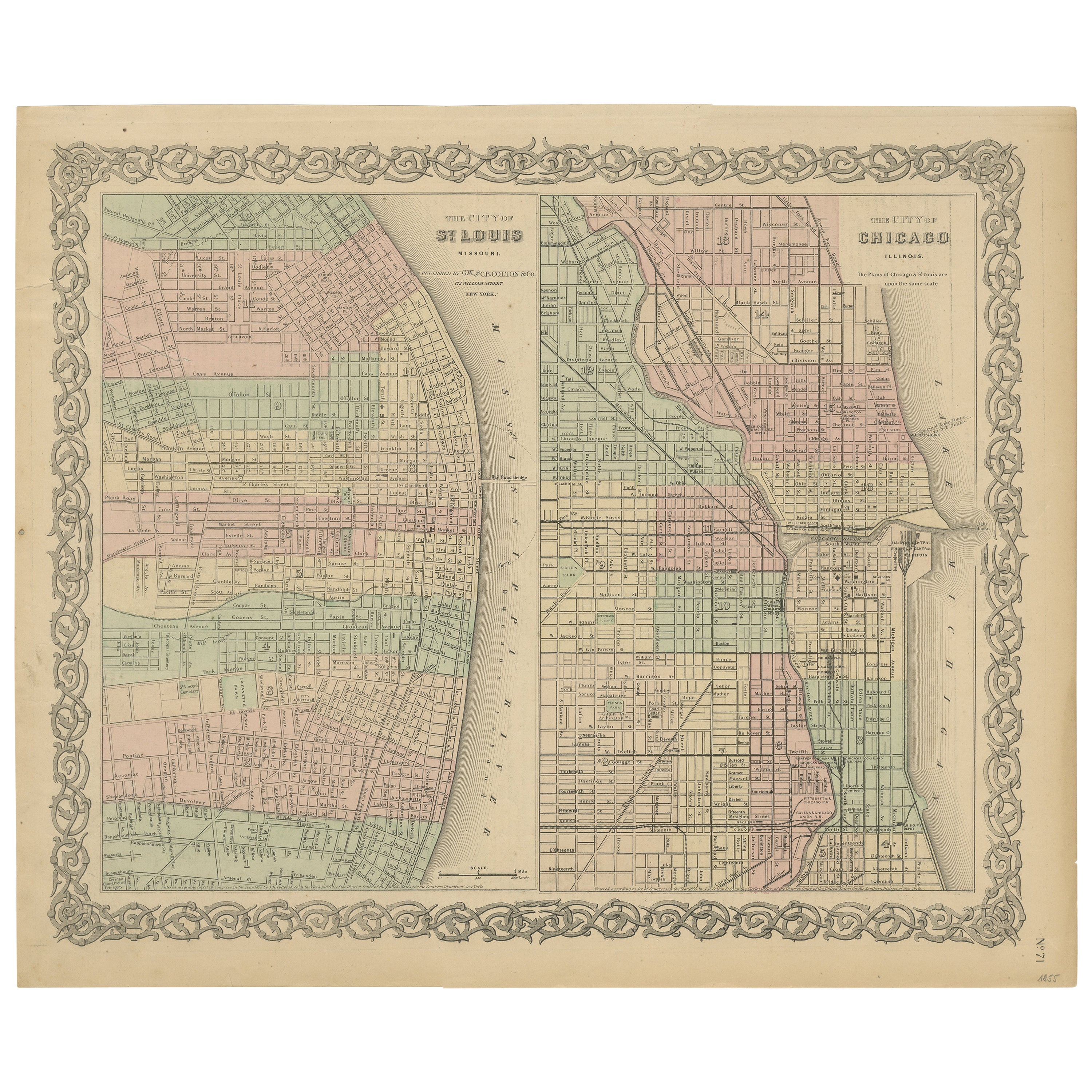
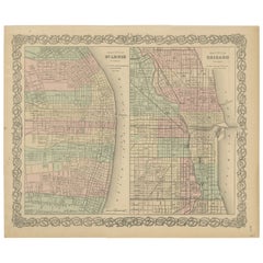
- Antique Map of St. Louis and ChicagoLocated in Langweer, NLAntique map titled 'The City of St. Louis Missouri - The City of Chicago Illinois'. Dual map on single page showing St. Louis and Chicago. Finely produ...Category
Antique Mid-19th Century Maps
MaterialsPaper
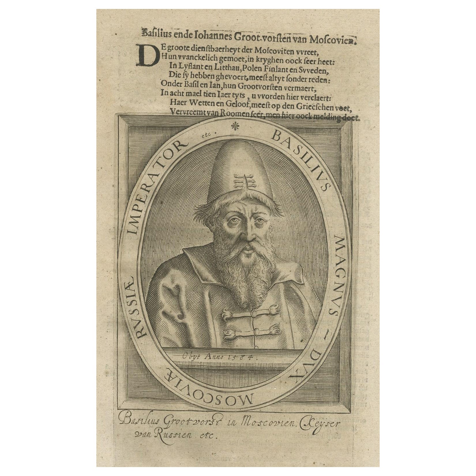
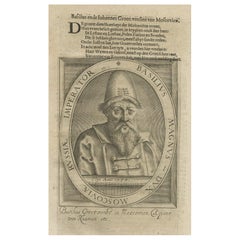
- Antique Portrait of Ivan IV The Terrible, 1st Csar of All Russia, 1615Located in Langweer, NLAntique portrait titled 'Basilius Magnus (..)'. Portrait of Ivan IV (1530-84, 'the Terrible'). This print originates from 'Tooneel der keyseren ende coningen van christenryck sedert den onderganck van het Griecks keyserdom vervatende hare beeltnissen afcomsten ende voornaemste daden (..)'. Ivan IV Vasilyevich (Russian: ???´? ????´??????; 25 August 1530 – 28 March [O.S. 18 March] 1584),[2] commonly known in English as Ivan the Terrible...Category
Antique 17th Century Prints
MaterialsPaper
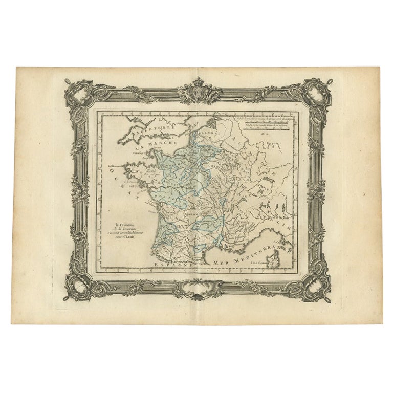
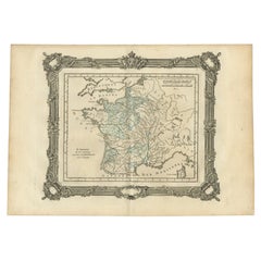
- Antique Map of France under the Reign of St. Louis by Zannoni, 1765Located in Langweer, NLAntique map France titled 'Le Domaine de la Couronne (..)'. Beautiful old map of France. This map originates from 'Atlas Historique de la France Ancienne et Moderne' by M. Rizzi Zann...Category
Antique 18th Century Maps
MaterialsPaper
You May Also Like
- 1861 Topographical Map of the District of Columbia, by Boschke, Antique MapLocated in Colorado Springs, COPresented is an original map of Albert Boschke's extremely sought-after "Topographical Map of the District of Columbia Surveyed in the Years 1856 ...Category
Antique 1860s American Historical Memorabilia
MaterialsPaper
- 1907 Map of Colorado, Antique Topographical Map, by Louis NellLocated in Colorado Springs, COThis highly detailed pocket map is a topographical map of the state of Colorado by Louis Nell from 1907. The map "has been complied from all availabl...Category
Antique Early 1900s American Maps
MaterialsPaper
- Antique Map of Italy by Andriveau-Goujon, 1843By Andriveau-GoujonLocated in New York, NYAntique Map of Italy by Andriveau-Goujon, 1843. Map of Italy in two parts by Andriveau-Goujon for the Library of Prince Carini at Palazzo Carini i...Category
Antique 1840s French Maps
MaterialsLinen, Paper
- Antique Map of Principality of MonacoBy Antonio Vallardi EditoreLocated in Alessandria, PiemonteST/619 - "Old Geographical Atlas of Italy - Topographic map of ex-Principality of Monaco" - ediz Vallardi - Milano - A somewhat special edition ---Category
Antique Late 19th Century Italian Other Prints
MaterialsPaper
- Original Antique Map of Russia By Arrowsmith. 1820Located in St Annes, LancashireGreat map of Russia Drawn under the direction of Arrowsmith Copper-plate engraving Published by Longman, Hurst, Rees, Orme and Brown, 1820 Unframed.Category
Antique 1820s English Maps
MaterialsPaper
- Geographical Antique Map of Principality of MonacoBy Bruno SantiniLocated in Alessandria, PiemonteST/609 - Interesting antique color map of Monaco Principality in French language : "Carte qui contient le Principauté de Piémont, le Monferrat et la comté de...Category
Antique Late 18th Century Italian Other Maps
MaterialsPaper


Recently Viewed
View AllMore Ways To Browse
Jans Antiques
Siege Of
Siege Antique
Prince Dutch
River Map Long
Antique Furniture Nassau
Antique Maps California
Antique Maps Of California
Belgian Army
Belgium Army
New Zealand Map
British Empire Map
Map Of Boston
Map Of New Zealand
Antique Portuguese Plates
Antique Egypt Map
Antique Furniture Malta
Antique Galleon