Items Similar to Antique Map of Sweden and Norway by Mitchell, 1846


Want more images or videos?
Request additional images or videos from the seller
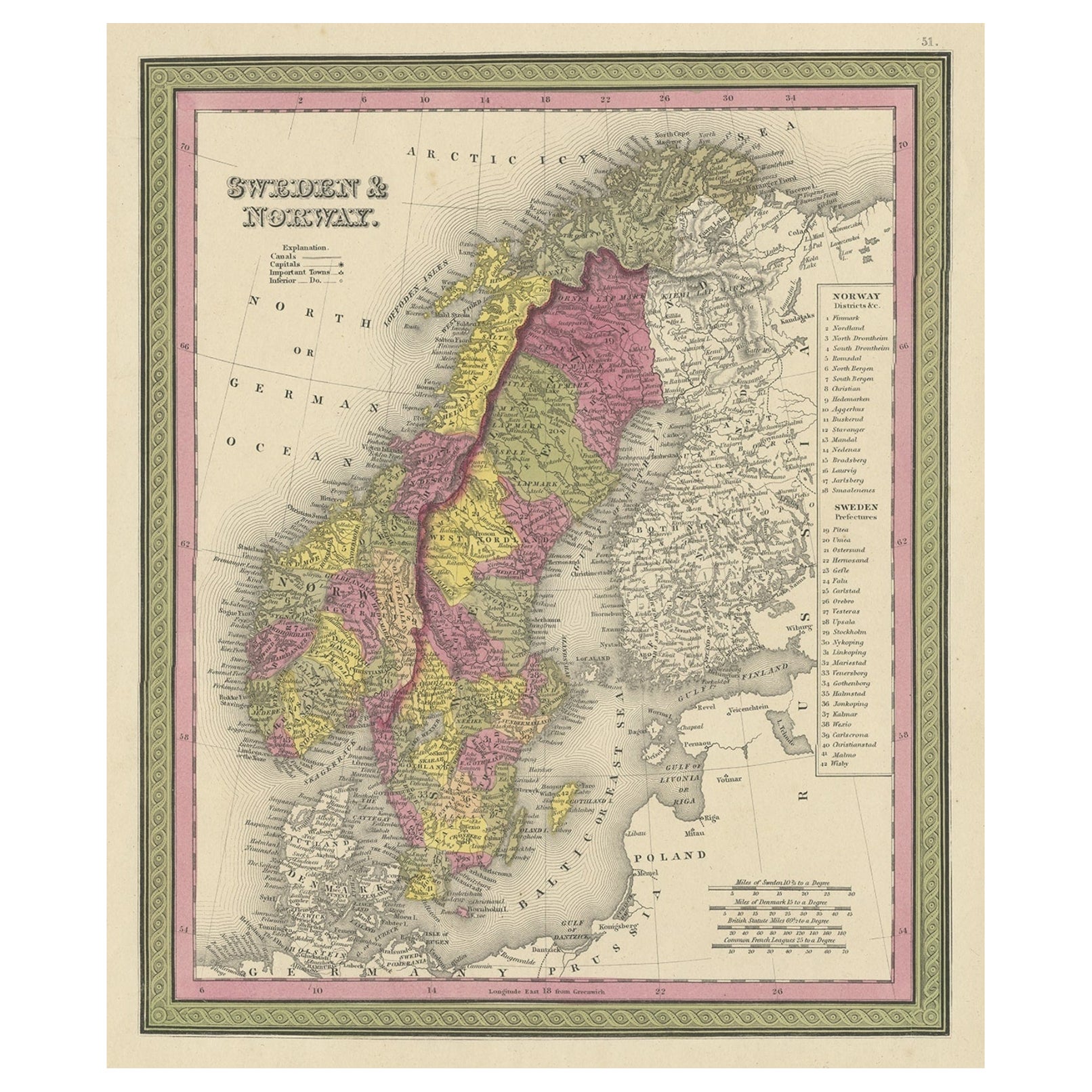
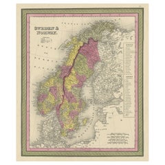
Antique Map of Sweden and Norway by Mitchell, 1846
About the Item
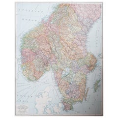
Antique map titled 'Sweden & Norway'. Old map of Sweden and Norway. This map originates from 'A New Universal Atlas Containing Maps of the various Empires, Kingdoms, States and Republics Of The World (..) by S.A. Mitchell. Artists and Engravers: Samuel Augustus Mitchell was an American geographer. Mitchell worked as a teacher before turning to publishing geography textbooks and maps. He became involved in geography after teaching and realizing that there were so many poor quality geographical resources available to teachers. He was in Philadelphia when he founded his company. His son, S. Augustus Mitchell, became owner in 1860. Their publications covered all genres of geography: maps, travel guides, textbooks, and more.
Artist: Samuel Augustus Mitchell was an American geographer. Mitchell worked as a teacher before turning to publishing geography textbooks and maps. He became involved in geography after teaching and realizing that there were so many poor quality geographical resources available to teachers. He was in Philadelphia when he founded his company. His son, S. Augustus Mitchell, became owner in 1860. Their publications covered all genres of geography: maps, travel guides, textbooks, and more.
Condition: Good, original/contemporary hand coloring. Age-related toning and some wear, mainly in margins. Blank verso, please study image carefully.
Date: 1846
Overall size: 35 x 43.5 cm.
Image size: 0.001 x 24.5 x 30 cm.
Antique prints have long been appreciated for both their aesthetic and investment value. They were the product of engraved, etched or lithographed plates. These plates were handmade out of wood or metal, which required an incredible level of skill, patience and craftsmanship. Whether you have a house with Victorian furniture or more contemporary decor an old engraving can enhance your living space. We offer a wide range of authentic antique prints for any budget.
- Dimensions:Height: 17.13 in (43.5 cm)Width: 13.78 in (35 cm)Depth: 0 in (0.01 mm)
- Materials and Techniques:
- Period:
- Date of Manufacture:1846
- Condition:
- Seller Location:Langweer, NL
- Reference Number:
About the Seller
5.0
Platinum Seller
These expertly vetted sellers are 1stDibs' most experienced sellers and are rated highest by our customers.
Established in 2009
1stDibs seller since 2017
1,949 sales on 1stDibs
Typical response time: <1 hour
- ShippingRetrieving quote...Ships From: Langweer, Netherlands
- Return PolicyA return for this item may be initiated within 14 days of delivery.
More From This SellerView All
- Old Colourful Map of Sweden and Norway, 1846Located in Langweer, NLAntique map titled 'Sweden & Norway'. Old map of Sweden and Norway. This map originates from 'A New Universal Atlas Containing Maps of the various Em...Category
Antique 1840s Maps
MaterialsPaper
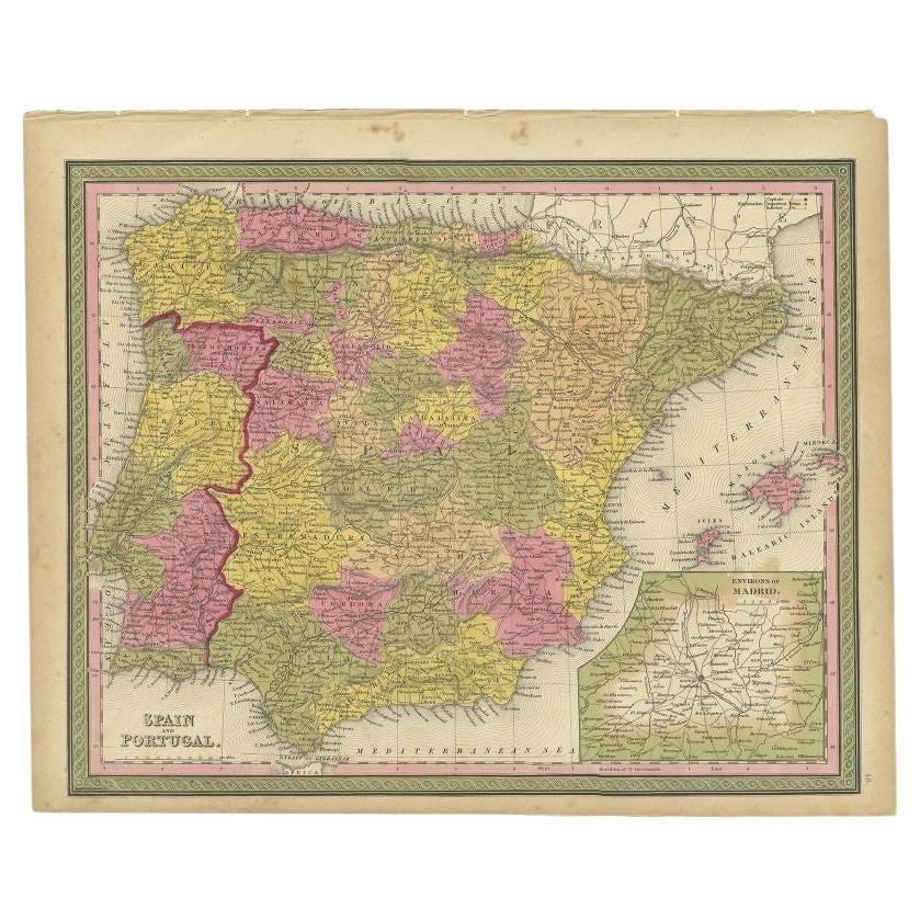
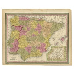
- Antique Map of Spain and Portugal by Mitchell, 1846Located in Langweer, NLAntique map titled 'Kingdom of Spain and Portugal'. Old map of Spain and Portugal, with an inset map of the region of Madrid. This map originates from 'A New Universal Atlas Containi...Category
Antique 19th Century Maps
MaterialsPaper
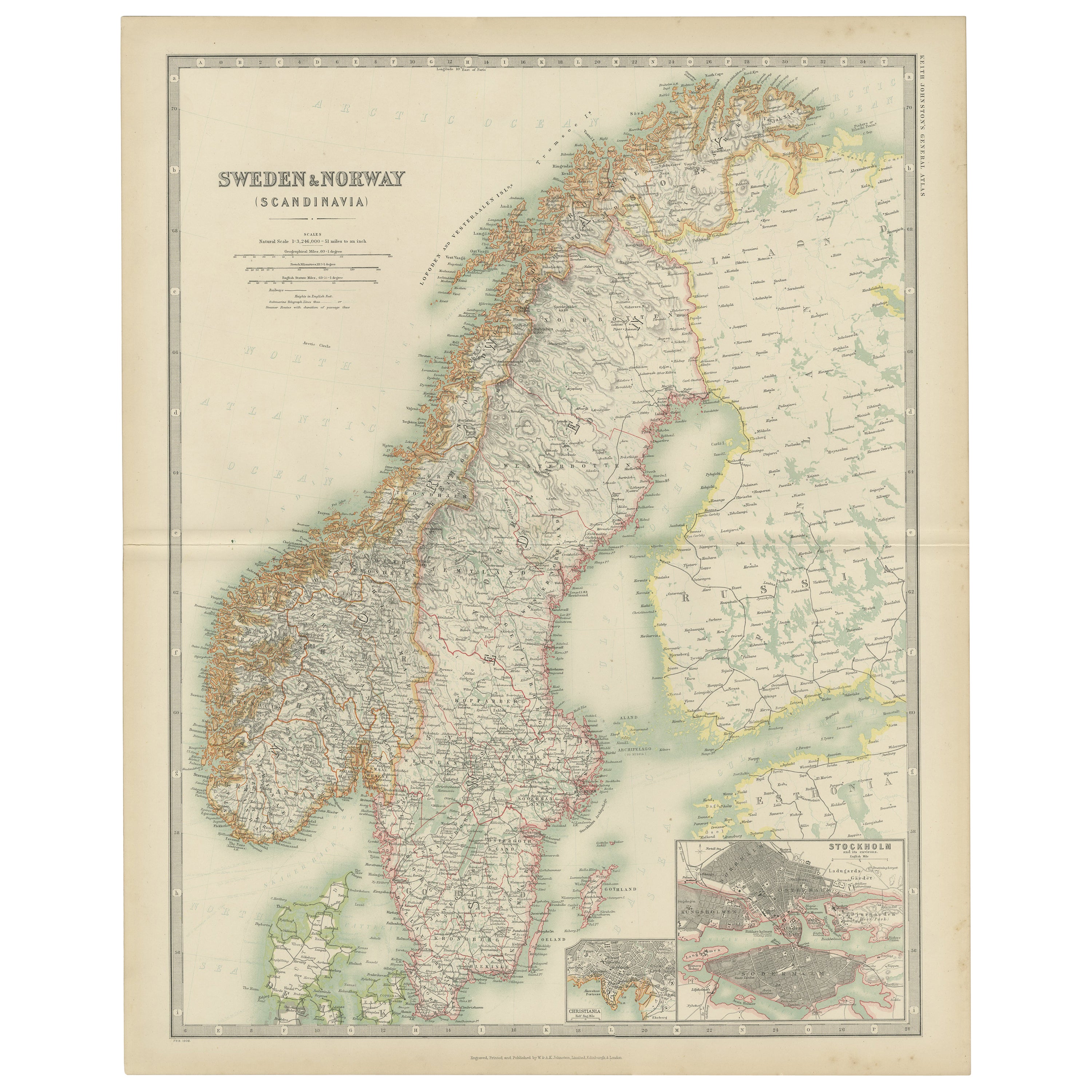
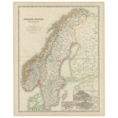
- Antique Map of Sweden and Norway by W. G. Blackie, 1859Located in Langweer, NLAntique map titled 'Sweden and Norway'. Original antique map of Sweden and Norway. This map originates from ‘The Imperial Atlas of Modern Geography’. Published by W. G. Blackie, 1859.Category
Antique Mid-19th Century Maps
MaterialsPaper
- Antique Map of Sweden and Norway by Johnston (1909)Located in Langweer, NLAntique map titled 'Sweden and Norway'. Original antique map of Sweden and Norway. With inset maps of Christiania and Stockholm. This map originates from...Category
Early 20th Century Maps
MaterialsPaper
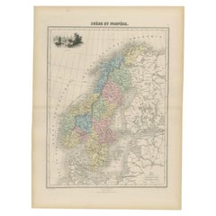
- Antique Map of Sweden and Norway by Petri, c.1873Located in Langweer, NLAntique map titled 'Zweden en Noorwegen'. Old map depicting Sweden and Norway. This map originates from 'School-Atlas van alle Deelen der Aarde'. Artists and Engravers: Published by ...Category
Antique 19th Century Maps
MaterialsPaper
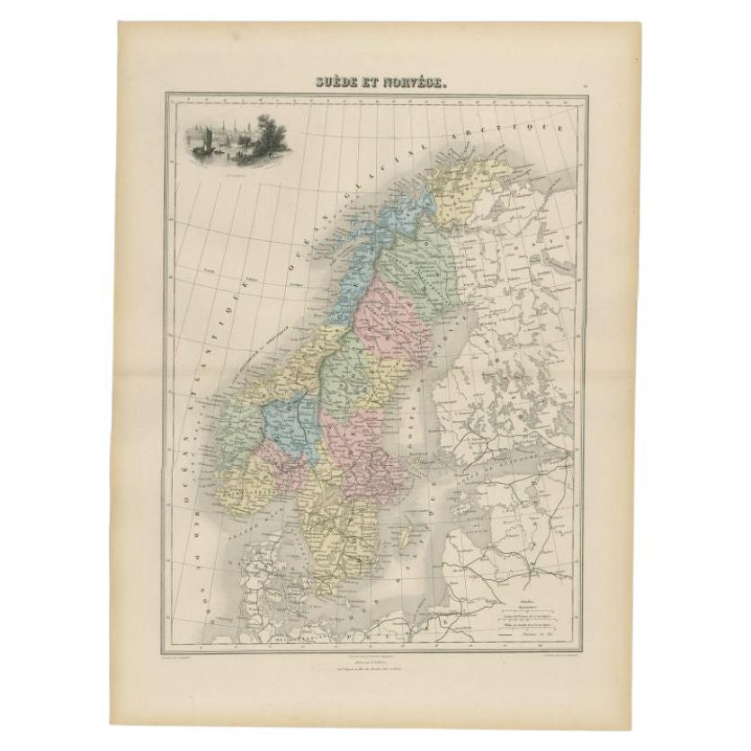
- Antique Map of Sweden and Norway by Migeon, 1880Located in Langweer, NLAntique map titled 'Suède et Norvége'. Old map of Sweden and Norway. With decorative vignette of Stockholm. This map originates from 'Géographie Universe...Category
Antique 19th Century Maps
MaterialsPaper


You May Also Like
- Original Antique Map of Sweden and Norway, Grattan and Gilbert, 1843Located in St Annes, LancashireGreat map of Sweden and Norway Drawn and engraved by Archer Published by Grattan and Gilbert Original color Unframed.Category
Antique 1840s English Other Maps
MaterialsPaper
- Large Original Vintage Map of Sweden and Norway circa 1920Located in St Annes, LancashireGreat map of Sweden and Norway Original color. Good condition Published by Alexander Gross Unframed.Category
Vintage 1920s English Victorian Maps
MaterialsPaper
- 1847 Antique Map of Mexico, Texas and California by Samuel Augustus MitchellBy Samuel Augustus Mitchell 1Located in Colorado Springs, COPresented is the second edition of Samuel Augustus Mitchell's Map of Mexico, Including Yucatan & Upper California, an important map showing the progress of the Mexican-American War. ...Category
Antique 1840s American Maps
MaterialsPaper
- Original Antique Map of Sweden, Engraved by Barlow, 1806Located in St Annes, LancashireGreat map of Sweden Copper-plate engraving by Barlow Published by Brightly & Kinnersly, Bungay, Suffolk. 1806 Unframed.Category
Antique Early 1800s English Maps
MaterialsPaper
- 1842 Wall Map of the United States by J. H. Young, Published by S. A. MitchellLocated in Colorado Springs, COPresented is an 1842 hanging “Map of the United States,” engraved by J. H. Young and published by Samuel Augustus Mitchell, Philadelphia. This is a beautiful example of the rare 1842...Category
Antique 1840s American Maps
MaterialsPaper
- 1837 Mitchell's "Tourist's Pocket Map of the State of Virginia" by J.H. YoungLocated in Colorado Springs, COThis is J. H. Young's pocket map of the Virginia, which shows county development current to 1835. The map was engraved by E. Yeager and F. Dankworth and published by S. A. Mitchell. ...Category
Antique 1830s American Maps
MaterialsPaper


Recently Viewed
View AllMore Ways To Browse
Antique Norwegian
Norwegian Antique
Antique Norwegian Furniture
Norwegian Antique Furniture
19th Norwegian
19th Century Norwegian
Norway 19th Century
Norwegian Plates
Antique Norway
19th Century Norwegian Furniture
Philadelphia Map
Antique Swedish Plates
Norway Plate
Antique Resources
Philadelphia Print Antique
Antique Swedish Print
Norwegian Antiques
Antique Travel Map