Items Similar to Antique Map of Thracia ‘Greece’ by J. Janssonius, circa 1650


Want more images or videos?
Request additional images or videos from the seller
1 of 9
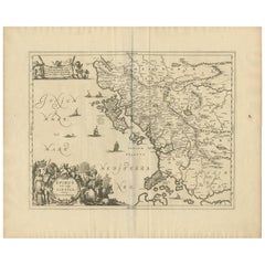
Antique Map of Thracia ‘Greece’ by J. Janssonius, circa 1650
About the Item
This antique map of Thracia is engraved and published by J. Janssonius after the cartographical sources by Abraham Ortelius. Ornated in the upper left corner with a title cartouche and dedication to Ortelius. Further on we find two extensive text cartouches with listings of place names. In the upper right corner the cartouche 'Loca Circa Byzantium' with a listing of place names belonging to Byzant and in the lower right corner a large text cartouche 'Thraciae Aliquot Incogniti Situs Loca' with a listing of place names belonging to Thraciae. Fine and early historical map on Thracia. The area on this map covers mainly Thracia in Northern Greece and parts of Romania. The map is ornated with three cartouches, in the upper left corner the title cartouche, on the lower and upper right side extensive listings of place name in two cartouches. Villages and towns are shown as miniature views.
- Dimensions:Height: 20.75 in (52.7 cm)Width: 25.2 in (64 cm)Depth: 0.02 in (0.5 mm)
- Materials and Techniques:
- Period:Mid-17th Century
- Date of Manufacture:circa 1650
- Condition:Minor fading. Please study image carefully.
- Seller Location:Langweer, NL
- Reference Number:
About the Seller
5.0
Platinum Seller
These expertly vetted sellers are 1stDibs' most experienced sellers and are rated highest by our customers.
Established in 2009
1stDibs seller since 2017
1,957 sales on 1stDibs
Typical response time: <1 hour
- ShippingRetrieving quote...Ships From: Langweer, Netherlands
- Return PolicyA return for this item may be initiated within 14 days of delivery.
More From This SellerView All
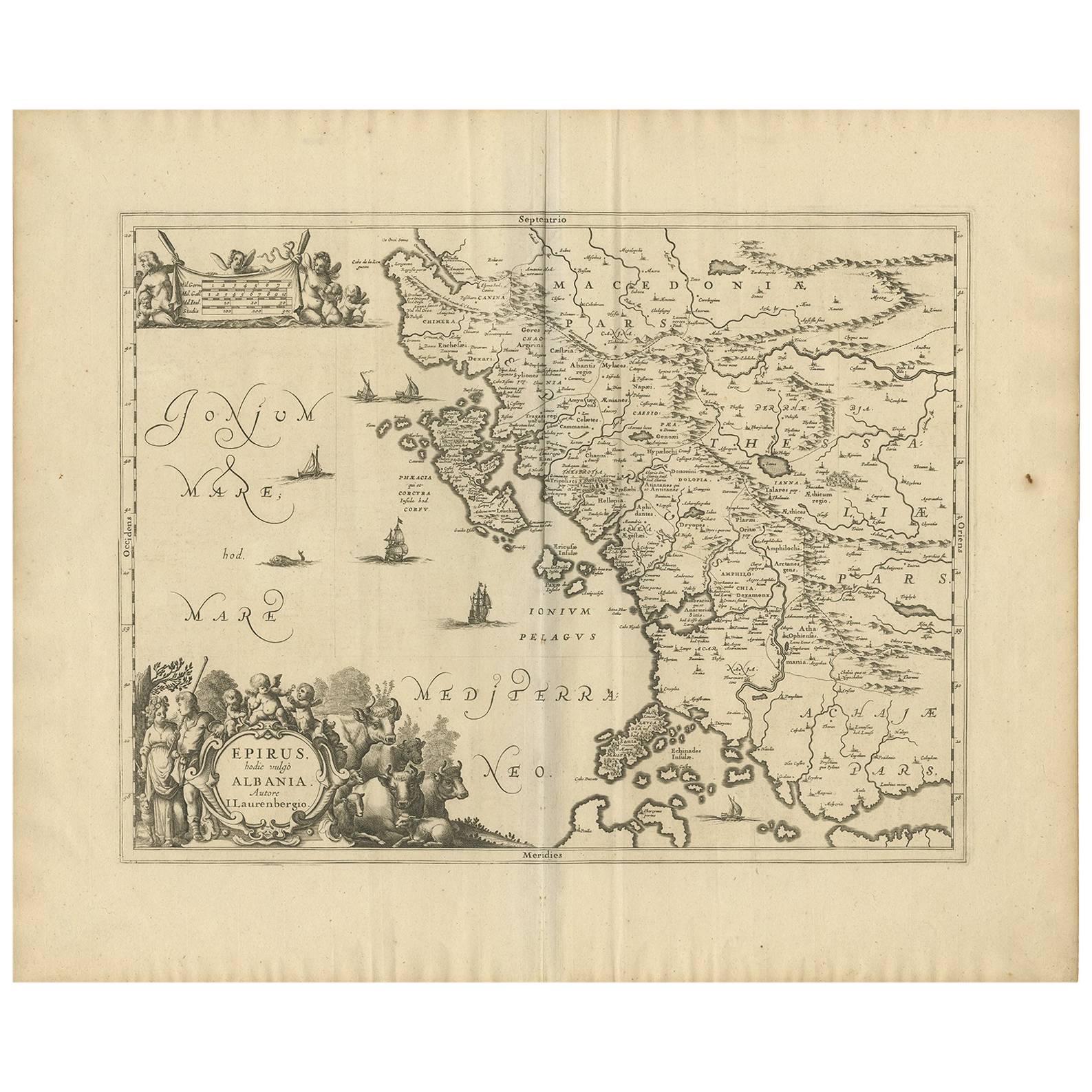
- Antique Map of Epirus 'Albania, Greece' by J. Janssonius, circa 1650Located in Langweer, NLThis map covers the northwestern coast of Greece and part of present-day Albania. The map was drawn by Johannes Wilhelm Laurenberg, a mathematician and historian who produced several...Category
Antique Mid-17th Century Maps
MaterialsPaper
- Antique Map of Java by Janssonius, circa 1650Located in Langweer, NLAntique map titled 'Insulae Iavae cum parte insularum Borneo Sumatrae, et circumjacentium insularum novissima delineatio'. Beautiful map of Java and parts of Bali, Borneo, Sumatra an...Category
Antique Mid-17th Century Maps
MaterialsPaper
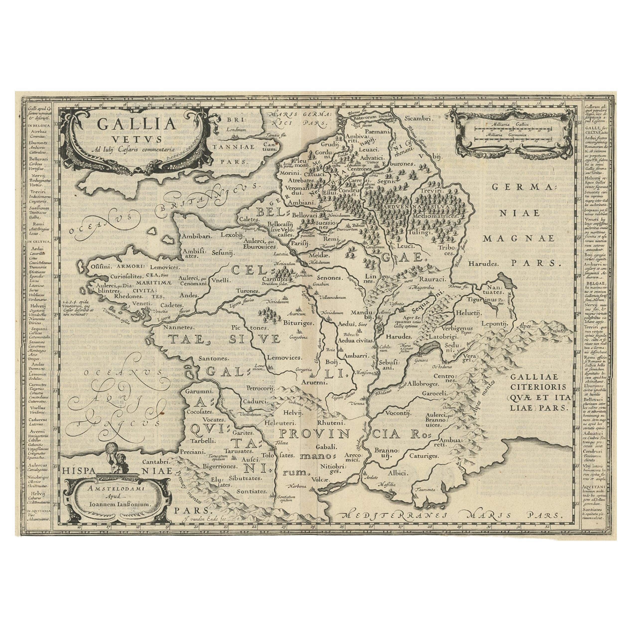
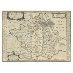
- Antique Map of France by Janssonius, c.1650Located in Langweer, NLAntique map titled 'Gallia Vetus'. Beautiful map of France based on Caesar's De Bello Gallico. In the columns to the left and right important tribes and people are described. Art...Category
Antique 17th Century Maps
MaterialsPaper
- Antique Map of France by Janssonius, c.1650Located in Langweer, NLAntique map titled 'Gallia Vetus'. Beautiful map of France based on Caesar's De Bello Gallico. In the columns to the left and right important tribes and people are described. Art...Category
Antique 17th Century Maps
MaterialsPaper
- Antique Map of the Vermandois Region by Janssonius, circa 1650By Johannes JanssoniusLocated in Langweer, NLAntique map titled 'Vermandois'. Old map of the Vermandois region, France. Vermandois was a French County that appeared in the Merovingian period. Its na...Category
Antique Mid-17th Century Maps
MaterialsPaper
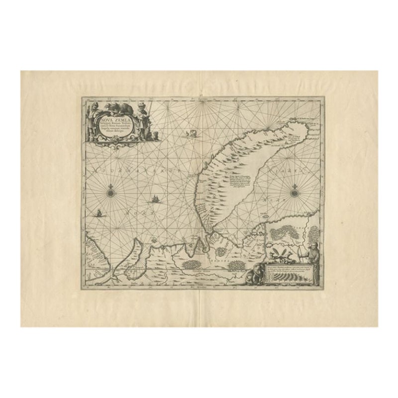
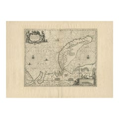
- Antique Map of Nova Zembla by Janssonius, c.1650Located in Langweer, NLAntique map titled 'Nova Zemla, waygats fretum Nassovi cum et terra Samoiedum singula omnium emendatissime descripta'. This map depicts Nova Zembla and the northern continental coast...Category
Antique 17th Century Maps
MaterialsPaper


You May Also Like
- 1657 Janssonius Map of Vermandois and Cappelle, Ric. A-004Located in Norton, MA1657 Janssonius map of Vermandois and Cappelle Ric.a004 Description: Antique map of France titled 'Descriptio Veromanduorum - Gouvernement de la Cappelle'. Two detailed maps o...Category
Antique 17th Century Unknown Maps
MaterialsPaper
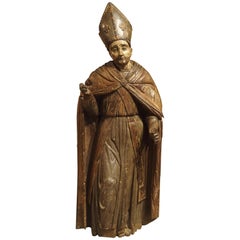
- Large Antique Polychromed Wood Statue of a Bishop, circa 1650Located in Dallas, TXThis 64 inch high antique statue of a Bishop dates to circa 1650 and is German in origin. Starting in the 15th and 16th centuries, there was a large demand for ecclesiastical carvings throughout central and western Europe. Large statues were commissioned for churches and smaller items were for private use. This bishop statue...Category
Antique 17th Century German Figurative Sculptures
MaterialsFabric, Glass, Wood, Paint
- 17th Century Hand-Colored Map of a Region in West Germany by JanssoniusBy Johannes JanssoniusLocated in Alamo, CAThis attractive highly detailed 17th century original hand-colored map is entitled "Archiepiscopatus Maghdeburgensis et Anhaltinus Ducatus cum terris adjacentibus". It was published ...Category
Antique Mid-17th Century Dutch Maps
MaterialsPaper
- Original Antique Map of Ancient Greece, Phocis, Gulf of Corinth, 1787Located in St Annes, LancashireGreat map of Ancient Greece. Showing the region of Phocis, including the Gulf of Corinth Drawn by J.D. Barbie Du Bocage Copper plate engraving by P.F Tardieu Original hand c...Category
Antique 1780s French Other Maps
MaterialsPaper
- Original Antique Map of Belgium by Tallis, Circa 1850Located in St Annes, LancashireGreat map of Belgium Steel engraving Many lovely vignettes Published by London Printing & Publishing Co. ( Formerly Tallis ), C.1850 Origin...Category
Antique 1850s English Maps
MaterialsPaper
- Original Antique Map of Cyprus. Circa 1880Located in St Annes, LancashireGreat map of Cyprus Drawn and Engraved by R.Walker Published W.Mackenzie, London Original colour Unframed.Category
Antique 1880s English Maps
MaterialsPaper


Recently Viewed
View AllMore Ways To Browse
Antique Maps Ortelius
Antique Map Ortelius
Romania Antique Map
Romania Map
Byzantium Antiques
Antique Fireplaces And Ranges
Antique Florida Collectibles
Antique Victoria Australia
Map Berlin
Antique Sailing Maps
Berlin Maps
Antique Sailing Map
West Coat Of Arms
Bay Area Antique Furniture
World Map Copper
Antique Map Of Portugal
Antique Map Portugal
Antique Map Egypt