Items Similar to Antique Map of the United States by Lowry, '1852'


Want more images or videos?
Request additional images or videos from the seller
1 of 6
Antique Map of the United States by Lowry, '1852'
About the Item
Antique map titled 'United States'. Four individual sheets of the United States. This map originates from 'Lowry's Table Atlas constructed and engraved from the most recent Authorities' by J.W. Lowry. Published 1852.
- Dimensions:Height: 9.65 in (24.5 cm)Width: 12.21 in (31 cm)Depth: 0.02 in (0.5 mm)
- Sold As:Set of 4
- Materials and Techniques:
- Period:
- Date of Manufacture:1852
- Condition:General age-related toning, blank verso. Minor wear, please study images carefully.
- Seller Location:Langweer, NL
- Reference Number:
About the Seller
5.0
Platinum Seller
These expertly vetted sellers are 1stDibs' most experienced sellers and are rated highest by our customers.
Established in 2009
1stDibs seller since 2017
1,916 sales on 1stDibs
Typical response time: <1 hour
- ShippingRetrieving quote...Ships From: Langweer, Netherlands
- Return PolicyA return for this item may be initiated within 14 days of delivery.
More From This SellerView All
- Antique Map of Australasia by Lowry, 1852Located in Langweer, NLAntique map titled 'Australasia'. Original map of Australasia. This map originates from 'Lowry's Table Atlas constructed and engraved from the most recent Authorities' by J.W. Lowry....Category
Antique Mid-19th Century Maps
MaterialsPaper
- Antique Map of Europe by Lowry, 1852Located in Langweer, NLAntique map titled 'Europe'. Original map of Europe. This map originates from 'Lowry's Table Atlas constructed and engraved from the most recent authorities' by J.W. Lowry. Published...Category
Antique Mid-19th Century Maps
MaterialsPaper
- Antique Map of Denmark by Lowry, 1852Located in Langweer, NLAntique map titled 'Denmark'. Original map of Denmark. This map originates from 'Lowry's Table Atlas constructed and engraved from the most recent Authorities' by J.W. Lowry. Publish...Category
Antique Mid-19th Century Maps
MaterialsPaper
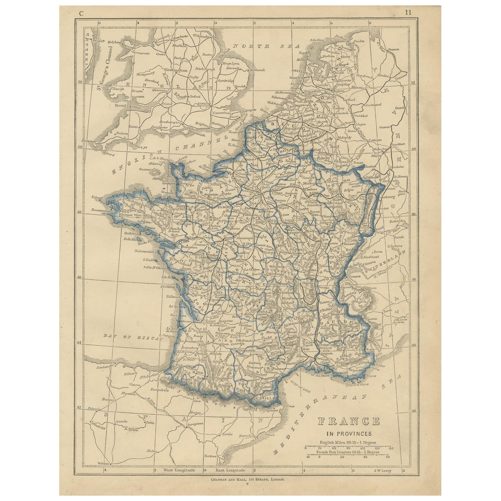
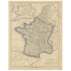
- Antique Map of France by Lowry, '1852'Located in Langweer, NLAntique map titled 'France in Provinces'. Original map of France. This map originates from 'Lowry's Table Atlas constructed and engraved from the most recent Authorities' by J.W. Low...Category
Antique Mid-19th Century Maps
MaterialsPaper
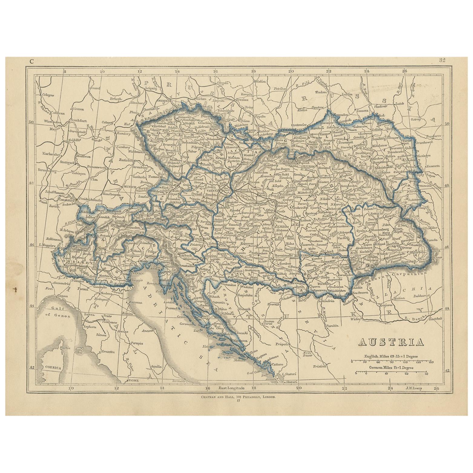
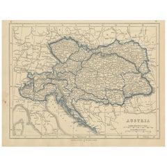
- Antique Map of Austria by Lowry, 1852Located in Langweer, NLAntique map titled 'Austria'. Original map of Austria. This map originates from 'Lowry's Table Atlas constructed and engraved from the most recent Autho...Category
Antique Mid-19th Century Maps
MaterialsPaper
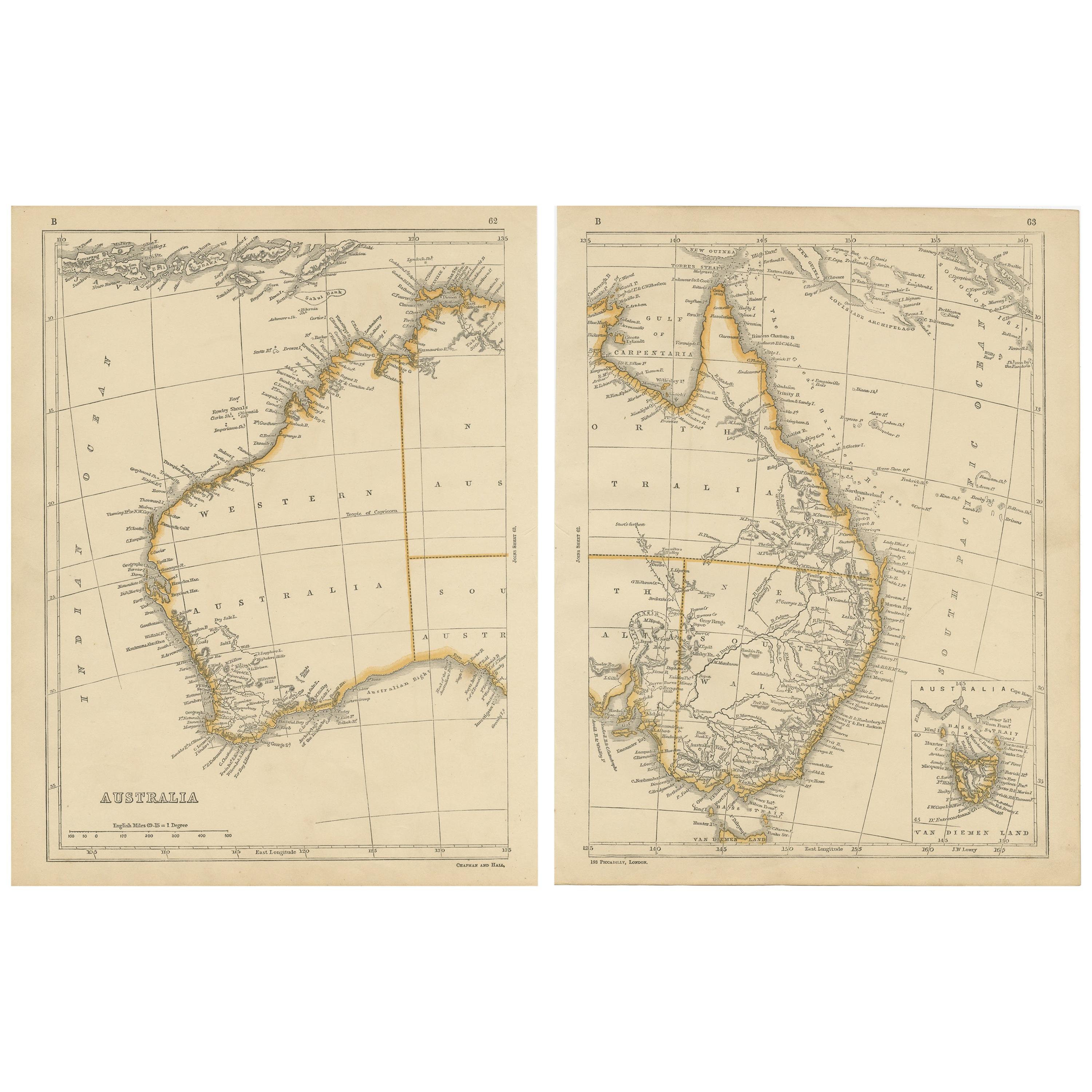
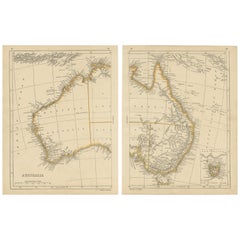
- Antique Map of Australia by Lowry, 1852Located in Langweer, NLAntique map titled 'Australia'. Two individual sheets of Australia. This map originates from 'Lowry's table Atlas constructed and engraved from the most recent authorities' by J.W. L...Category
Antique Mid-19th Century Maps
MaterialsPaper


You May Also Like
- N.E. View of the United States Capitol, Washington, DC Antique Proof Print 1858Located in Colorado Springs, COThis engraved print shows a view of the United States Capitol Building, in Washington, D.C. The print depicts the neoclassical building from the northeast orientation, with a bustling street scene in front. The steel engraving is a proof printing, drawn and engraved by Henry Sartain and published in 1858. Plans began in May 1854 to build a new cast-iron dome for the United States Capitol. The then-architect of the Capitol Thomas Walter and his team were sold on the aesthetics of a new dome, as well as the utility of a fire-proof one. A year later, on March 3, 1855, President Franklin Pierce...Category
Antique 1850s American Prints
MaterialsPaper
- 1859 "Map of the United States of America..." by J. H. ColtonBy J.H. ColtonLocated in Colorado Springs, COPresented is an 1859 “Map of the United States of America, the British Provinces, Mexico, the West Indies and Central America with Part of...Category
Antique 1850s American Maps
MaterialsPaper
- Large Original Antique Map of the United States of America. 1891By Rand McNally & Co.Located in St Annes, LancashireFabulous map of The United States Original color By Rand, McNally & Co. Dated 1891 Unframed Free shipping.Category
Antique 1890s American Maps
MaterialsPaper
- 1847 Ornamental Map of the United States & Mexico by H. PhelpsLocated in Colorado Springs, COOffered is an original 1847 ornamental map of the U.S. entitled "Ornamental Map of the United States & Mexico" by Humphrey Phelps. The map was issued as an act of Congress by Phelps on Fulton Street, New York. The broadside is elaborately hand-colored. This is a very detailed and graphic propaganda map of the United States expressing U.S. dominance of the North American continent. The hand-colored map proclaims the Manifest Destiny, with the recent acquisition of Upper California and Texas at the conclusion of the Mexican-American War. The newly acquired land is boldly colored, standing in stark contrast to the rest of the U.S. The map details a potential route for a railroad running from New York City, to Buffalo, to Chicago, then west along the Oregon Trail to Oregon City. This route anticipates the construction of the transcontinental railroad by nearly 20 years. The map includes elaborately detailed renderings of George Washington, Hernan Cortez, and Montezuma at top to represent European expansion to the Americas. At bottom are four inset designs with text showing the following: a chronological history of the U.S. beginning from settlement to the U.S. victory in the Mexican-American war; an illustration of General Zachary Taylor with details on the Oregon Territory; an illustration of the Aztec Temple of the Sun in Tenochtitlan and a chronology of the Conquest of the Aztec Empire under Cortez; a portrait of General Antonio Lopez de Santa Anna...Category
Antique 1840s American Maps
MaterialsPaper
- 1812 United States Map, by Pierre Tardieu, Antique French Map Depicting the U.S.By Pierre François TardieuLocated in Colorado Springs, CO1812 "United States of Nth America -- Carte des Etats-Unis De L'Amerique Septentrionale" Two-Sheet Map by Tardieu This attractive map, published in Paris in 1812, is one of the most rare large format maps from the period. It features a view of the East Coast of the U.S. from Maryland to just below South Carolina. Additionally, Ellicott’s plan for the City of Washington D.C. is included at the top right and an illustration of Niagara Falls is shown at the bottom right with a description in both French and English. This extremely detailed map not only depicts the mountainous regions of the southeastern U.S., but also includes names of regions, rivers, and towns. Based on the first state of Arrowsmith’s 4-sheet map of the United States, this map is completely engraved by Tardieu in Paris and showcases high quality engravings. This detailed map of the recently independent United States includes one of the largest and earliest examples of the Ellicott plan of Washington DC. The artist, Pierre François Tardieu (PF Tardieu) was a very well-known map engraver, geographer, and illustrator. Awarded a bronze medal by King Louis-Phillipe for the accuracy and beauty of his map-making, Tardieu produced many fine works including maps of Louisiana...Category
Antique 1810s French Maps
MaterialsPaper
- Original Antique Map of The World by Thomas Clerk, 1817Located in St Annes, LancashireGreat map of The Eastern and Western Hemispheres On 2 sheets Copper-plate engraving Drawn and engraved by Thomas Clerk, Edinburgh. Published by Mackenzie And Dent, 1817 ...Category
Antique 1810s English Maps
MaterialsPaper


Recently Viewed
View AllMore Ways To Browse
Antique Furniture United States
Antique United States
Antique United States Maps
Antique Map United States
Antique United States Map
United States Map Antique
Antique Maps Of United States
Antique Maps Of States
Antique Map Of The United States
Antique Maps Of The United States
Antique Map Table
Antique Copper Collectibles
Modern World Antique Map
Map Europe
Maps Europe
Used Furniture Edinburgh
English General
Map Of Europe