Items Similar to Antique Map of Western Africa and the Cape Verde Islands by Coronelli, 1691


Want more images or videos?
Request additional images or videos from the seller
1 of 6
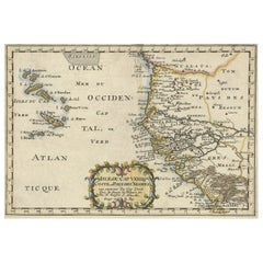
Antique Map of Western Africa and the Cape Verde Islands by Coronelli, 1691
About the Item
Antique map titled 'Bocche del Fiume Negro et Isole di Capo Verde'. Antique map of Western Africa with the Cape Verde Islands and an inset of Goree Island. Originates from 'Atlante Veneto, nel quale si contiene la descrittione (..)'. by G. Albrizzi, 1691.
- Creator:G. Albrizzi (Author),Vincenzo Coronelli (Artist)
- Dimensions:Height: 19.1 in (48.5 cm)Width: 25.99 in (66 cm)Depth: 0.02 in (0.5 mm)
- Materials and Techniques:Paper,Engraved
- Place of Origin:
- Period:Late 17th Century
- Date of Manufacture:1691
- Condition:Please study image carefully.
- Seller Location:Langweer, NL
- Reference Number:
About the Seller
5.0
Platinum Seller
These expertly vetted sellers are 1stDibs' most experienced sellers and are rated highest by our customers.
Established in 2009
1stDibs seller since 2017
1,957 sales on 1stDibs
Typical response time: <1 hour
- ShippingRetrieving quote...Ships From: Langweer, Netherlands
- Return PolicyA return for this item may be initiated within 14 days of delivery.
More From This SellerView All
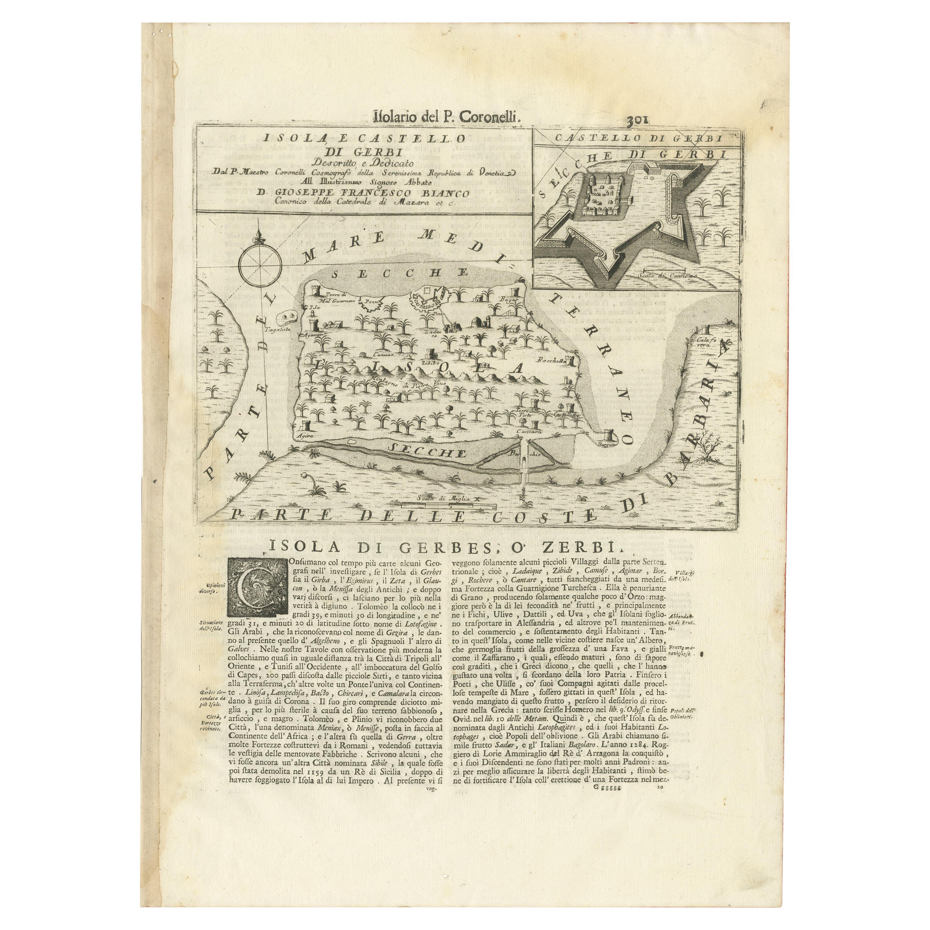
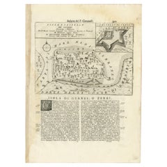
- Antique Map of the Island of Djerba by Coronelli '1691'Located in Langweer, NLAntique map titled 'Isola e Castello di Gerbi'. Original antique map of the Island of Djerba, Tunisia, in Africa. Includes an inset of the Djerba Castle in upper right. This map orig...Category
Antique Late 17th Century Prints
MaterialsPaper
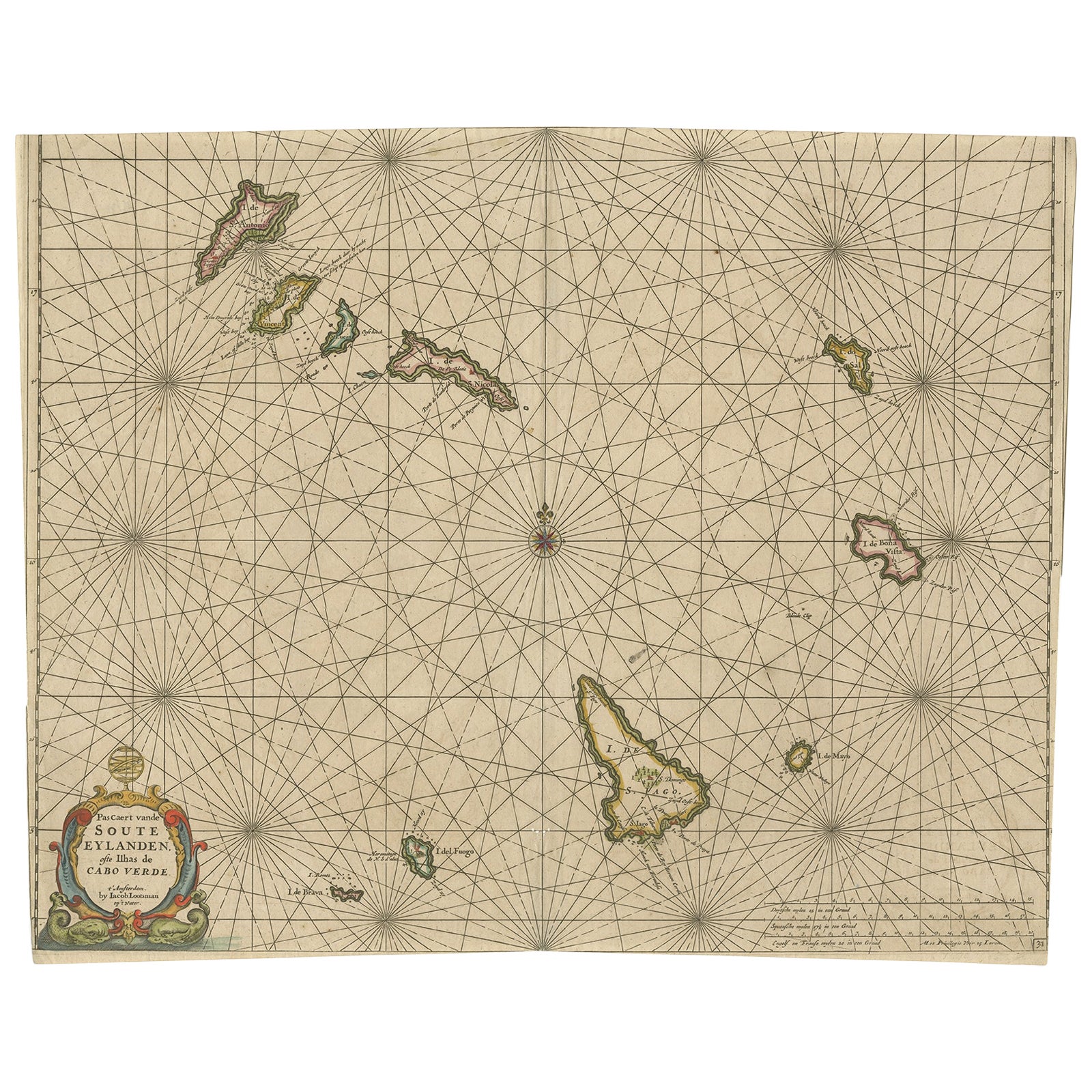
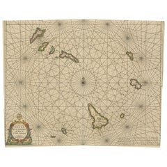
- Antique Map of the Cape Verde Islands, Africa, ca.1670Located in Langweer, NLAntique map titled 'Pascaert van de Soute Eylanden ofte Ilhas de Cabo Verde'. This map depicts the Cape Verde Islands (Africa). Islands titled 'Ile de B...Category
Antique 1670s Maps
MaterialsPaper
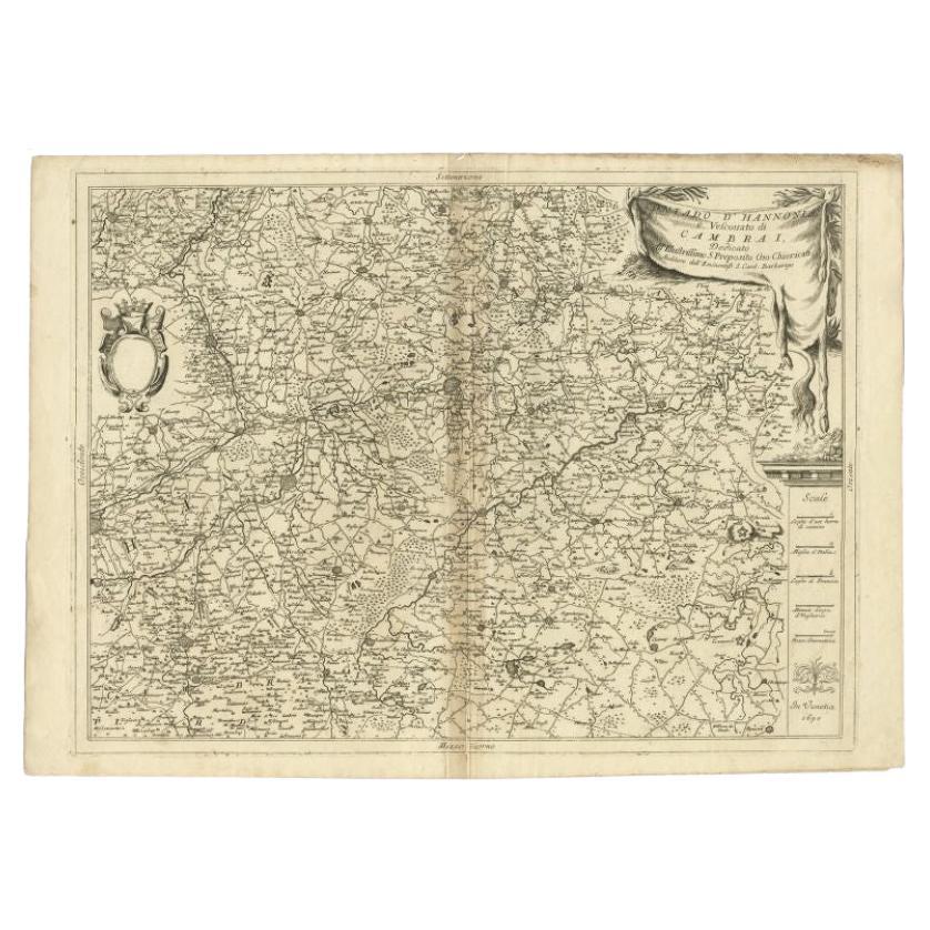
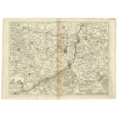
- Detailed Antique Map of Western Belgium and Eastern France by Coronelli, 1690By Vincenzo CoronelliLocated in Langweer, NLAntique map titled 'Contado d'Hannonia (..)'. Map of western Belgium and eastern France, from south of Brussels (not shown) to Cambrai, France, generally centered around the towns of...Category
Antique 17th Century Maps
MaterialsPaper
- Antique Map of the West African Coast and the Cape Verde Islands, c.1680Located in Langweer, NLAntique map Africa titled 'Isles du Cap Verd Coste et Pays des Negres'. Antique map of the coast of Africa and the Cape Verde islands. Artists a...Category
Antique 17th Century Maps
MaterialsPaper
- Antique Map of the Coast of Africa and the Cape Verde Islands, ca.1680Located in Langweer, NLAntique map Africa titled 'Isles du Cap Verd Coste et Pays des Negres'. Antique map of the coast of Africa and the Cape Verde islands. Artis...Category
Antique 1680s Maps
MaterialsPaper
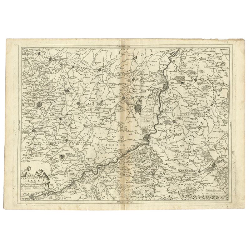
- Antique Map of the Region of Liege by Coronelli, 1690By Vincenzo CoronelliLocated in Langweer, NLAntique map titled 'Vescovato di Liege (..)'. Map of the Belgium area centered on Liege and the course of Meuse/Maas River. Also depicts the cities of Maastricht, Namur and Tienen. O...Category
Antique 17th Century Maps
MaterialsPaper


You May Also Like
- Original Antique Map of South Africa, Arrowsmith, 1820Located in St Annes, LancashireGreat map of South Africa. Drawn under the direction of Arrowsmith. Copper-plate engraving. Published by Longman, Hurst, Rees, Orme and Br...Category
Antique 1820s English Maps
MaterialsPaper
- Hand-Colored 18th Century Homann Map of Denmark and Islands in the Baltic SeaBy Johann Baptist HomannLocated in Alamo, CAAn 18th century copper plate hand-colored map entitled "Insulae Danicae in Mari Balthico Sitae utpote Zeelandia, Fionia, Langelandia, Lalandia, Falstria, Fembria Mona" created by Joh...Category
Antique Early 18th Century German Maps
MaterialsPaper
- Original Antique Map of The World by Thomas Clerk, 1817Located in St Annes, LancashireGreat map of The Eastern and Western Hemispheres On 2 sheets Copper-plate engraving Drawn and engraved by Thomas Clerk, Edinburgh. Published by Mackenzie And Dent, 1817 ...Category
Antique 1810s English Maps
MaterialsPaper
- Original Antique Map of The Netherlands, Engraved by Barlow, Dated 1807Located in St Annes, LancashireGreat map of Netherlands Copper-plate engraving by Barlow Published by Brightly & Kinnersly, Bungay, Suffolk. Dated 1807 Unframed.Category
Antique Early 1800s English Maps
MaterialsPaper
- 17th Century Hand-Colored Map of West Africa by Mercator/HondiusLocated in Alamo, CAA 17th century hand-colored map entitled "Guineae Nova Descriptio" by Gerard Mercator and Jodocus Hondius, published in their 'Atlas Minor' in Amsterdam in 1635. It is focused on the...Category
Antique Mid-17th Century Dutch Maps
MaterialsPaper
- Map of the Republic of GenoaLocated in New York, NYFramed antique hand-coloured map of the Republic of Genoa including the duchies of Mantua, Modena, and Parma. Europe, late 18th century. Dimension: 25...Category
Antique Late 18th Century European Maps


Recently Viewed
View AllMore Ways To Browse
Map Italy
Cape Beige
Antique Cape
Antique Capes
Africa Map
Antique Western Collectibles
Cape Antique Furniture
Antique Italian Map
Antique Italy Map
Italy Antique Map
Italy Map Antique
Antique Italian Maps
Antique Italy Maps
Antique Maps Italy
Antique Map Italy
Antique Africa Map
Antique African Map
Antique Maps Africa