Items Similar to Antique Map of Wuxi and Huzhou by Prévost '1746'


Want more images or videos?
Request additional images or videos from the seller
1 of 5
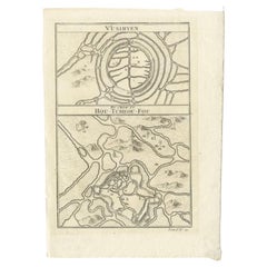
Antique Map of Wuxi and Huzhou by Prévost '1746'
About the Item
Antique map titled 'Vusihyen. Hu Chew Fu'. Plans of Wuxi and Huzhou, China. Originates from Prévost's 'Histoire générale des voyages'.
- Dimensions:Height: 10.04 in (25.5 cm)Width: 7.09 in (18 cm)Depth: 0.02 in (0.5 mm)
- Materials and Techniques:
- Period:
- Date of Manufacture:1746
- Condition:General age-related toning, blank verso. Please study images carefully.
- Seller Location:Langweer, NL
- Reference Number:
About the Seller
5.0
Platinum Seller
These expertly vetted sellers are 1stDibs' most experienced sellers and are rated highest by our customers.
Established in 2009
1stDibs seller since 2017
1,960 sales on 1stDibs
Typical response time: <1 hour
- ShippingRetrieving quote...Ships From: Langweer, Netherlands
- Return PolicyA return for this item may be initiated within 14 days of delivery.
More From This SellerView All
- Antique Map of Wuxi and Huzhou in China, 1746Located in Langweer, NLAntique map titled 'Vusihyen. Hu Chew Fu'. Plans of Wuxi and Huzhou, China. Originates from Prévost's 'Histoire générale des voyages'. Artists and Engravers: Antoine François Prévo...Category
Antique 18th Century Maps
MaterialsPaper
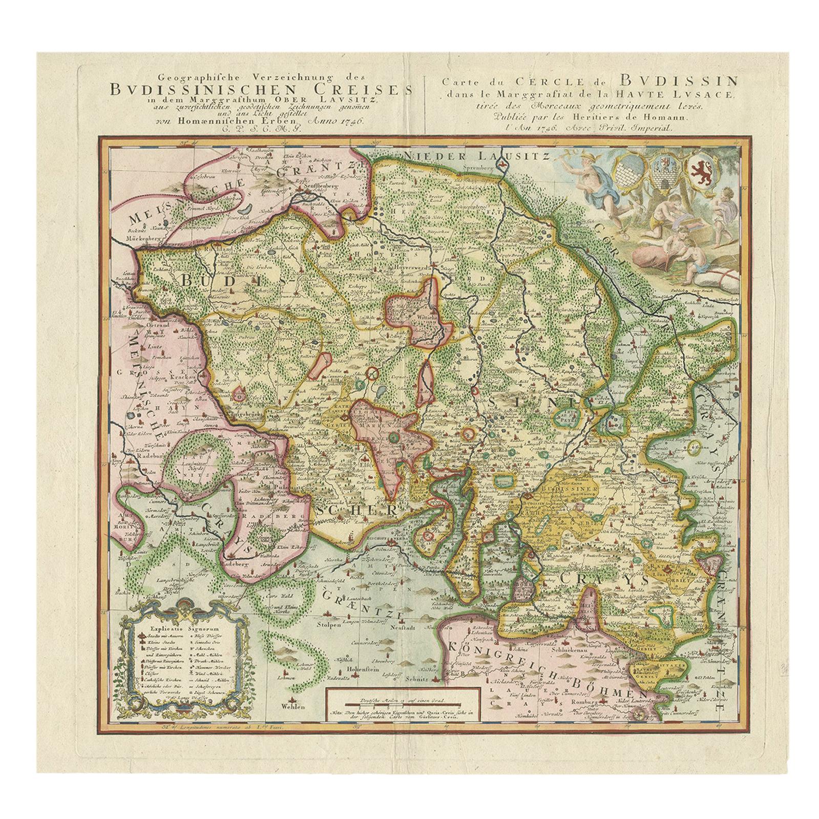
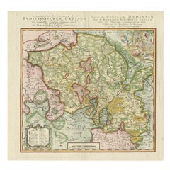
- Antique Map of Oberlausitz by Homann Erben, '1746'Located in Langweer, NLAntique map titled 'Geographische Verzeichnung des Budissinischen Creises (..) - Carte du Cercle de Budissin (..)'. Copper engraved map of Oberlausitz, a historical region of Saxony ...Category
Antique Mid-18th Century Maps
MaterialsPaper
- Original Antique Map of the Cape Verde Islands, 1746Located in Langweer, NLAntique map titled 'Carte Des Isles Du Cap Verd.' Original antique map of the Cape Verde Islands. Decorative cartouche and compass rose. Extends from Isle d...Category
Antique 18th Century Maps
MaterialsPaper
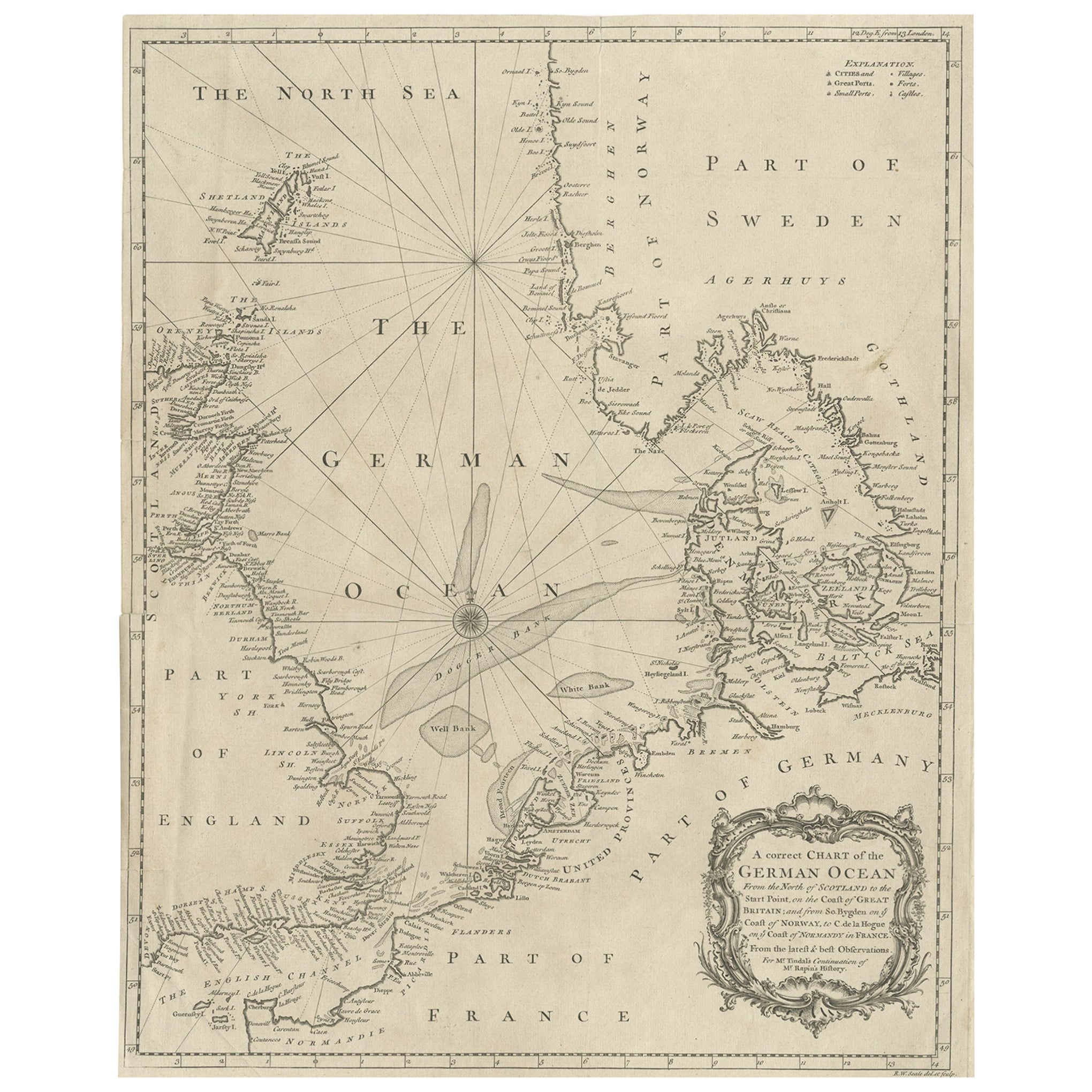
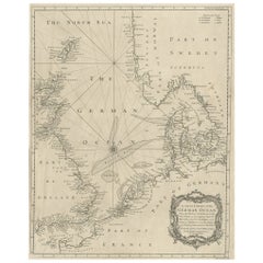
- Antique Map of the North Sea From the English Channel to Norway & Sweden, 1746Located in Langweer, NLAntique map titled 'A correct Chart of the German Ocean from the North of Scotland to the Start Point, on the Coast of Great Britain; and from So. Bygden on ye coast of Norway, to C....Category
Antique 1740s Maps
MaterialsPaper
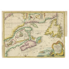
- Antique Map Dedicated to British Merchants Trading to North America, ca.1746Located in Langweer, NLDescription: Antique map titled 'A New Chart of the Coast of New England, Nova Scotia, New France or Canada, with the islands of Newfoundland, Capte Breton, St John's (..)'. Map stre...Category
Antique 1740s Maps
MaterialsPaper
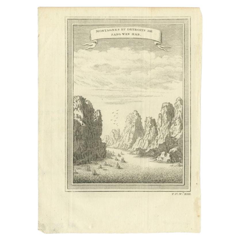
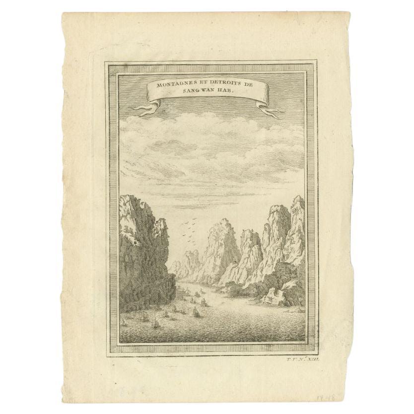
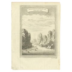
- Antique Print of the Mountains and Strait of Sang Wan Hab by Prévost, 1746Located in Langweer, NLAntique print titled 'Montagnes et Detroits de Sang Wan Hab'. View of the mountains and strait of Sang Wan Hab, China. This print originates from Prevost's 'Histoire Generale des Voy...Category
Antique 18th Century Prints
MaterialsPaper

You May Also Like
- Antique Map of Italy by Andriveau-Goujon, 1843By Andriveau-GoujonLocated in New York, NYAntique Map of Italy by Andriveau-Goujon, 1843. Map of Italy in two parts by Andriveau-Goujon for the Library of Prince Carini at Palazzo Carini i...Category
Antique 1840s French Maps
MaterialsLinen, Paper
- Antique Map of Principality of MonacoBy Antonio Vallardi EditoreLocated in Alessandria, PiemonteST/619 - "Old Geographical Atlas of Italy - Topographic map of ex-Principality of Monaco" - ediz Vallardi - Milano - A somewhat special edition ---Category
Antique Late 19th Century Italian Other Prints
MaterialsPaper
- Original Antique Map of Spain and Portugal, Engraved By Barlow, 1806Located in St Annes, LancashireGreat map of Spain And Portugal Copper-plate engraving by Barlow Published by Brightly & Kinnersly, Bungay, Suffolk. 1806 Unframed.Category
Antique Early 1800s English Maps
MaterialsPaper
- Original Antique Map of Russia By Arrowsmith. 1820Located in St Annes, LancashireGreat map of Russia Drawn under the direction of Arrowsmith Copper-plate engraving Published by Longman, Hurst, Rees, Orme and Brown, 1820 Unframed.Category
Antique 1820s English Maps
MaterialsPaper
- Original Antique Map of Spain and Portugal, circa 1790Located in St Annes, LancashireSuper map of Spain and Portugal Copper plate engraving by A. Bell Published, circa 1790. Unframed.Category
Antique 1790s English Other Maps
MaterialsPaper
- Original Antique Map of Ireland- Tipperary and Waterford. C.1840Located in St Annes, LancashireGreat map of Tipperary and Waterford Steel engraving Drawn under the direction of A.Adlard Published by How and Parsons, C.1840 Unframed.Category
Antique 1840s English Maps
MaterialsPaper


Recently Viewed
View AllMore Ways To Browse
China Map
Map Of China
Antique Chinese Maps
Antique Map China
Chinese Hu
Antique Geography
Antique World Atlas
Folding Maps
Antique Map Of Holland
Antique Maps Of Holland
Antique Furniture Plans
Map Plate
Copper Collectables
19th Century World Map
Antique City Map
Antique City Maps
Antique Maps Of Cities
Antique Portuguese