Items Similar to Antique Old Map of Africa with Insets of Mauritius, Reunion and Natal, 1882

Want more images or videos?
Request additional images or videos from the seller
1 of 9
Antique Old Map of Africa with Insets of Mauritius, Reunion and Natal, 1882
About the Item
The uploaded image is a historical map of Africa from the 1882 atlas by Blackie & Son. The map includes the entire African continent, with various countries, regions, and topographical features such as mountain ranges and rivers delineated. The map uses shading and color to indicate different territories and colonial interests, with different European powers controlling different regions at the time. Insets on the right-hand side show detailed maps of Mauritius, "Bourbon" (now Réunion), and Natal (a region in South Africa). These insets provide a closer look at these areas, showcasing details like towns, roads, and physical geography.
The main map includes the outline of the continent with a latitude and longitude grid. The detail and labeling reflect the contemporary knowledge and territorial claims of the period, including areas marked as deserts or under-explored regions. It's a snapshot of a time when the "Scramble for Africa" was in full swing, with European nations establishing and expanding their colonies and spheres of influence across the continent.
- Dimensions:Height: 14.97 in (38 cm)Width: 22.45 in (57 cm)Depth: 0 in (0.02 mm)
- Materials and Techniques:
- Period:
- Date of Manufacture:1882
- Condition:Good condition, folding line in the middle. The outer borders are slightly discolored due to age, but not the image. This map is ideal for framing. Study the image carefully.
- Seller Location:Langweer, NL
- Reference Number:
About the Seller
5.0
Platinum Seller
These expertly vetted sellers are 1stDibs' most experienced sellers and are rated highest by our customers.
Established in 2009
1stDibs seller since 2017
1,940 sales on 1stDibs
Typical response time: <1 hour
- ShippingRetrieving quote...Ships From: Langweer, Netherlands
- Return PolicyA return for this item may be initiated within 14 days of delivery.
More From This SellerView All
- Antique Map of Eastern Canada with an inset Map of Newfoundland, 1882Located in Langweer, NLAntique map titled 'Dominion of Canada'. Old map of Eastern Canada with an inset map of Newfoundland. This map originates from 'The Royal Atlas of Modern Geography, Exhibiting, in a ...Category
Antique 19th Century Maps
MaterialsPaper
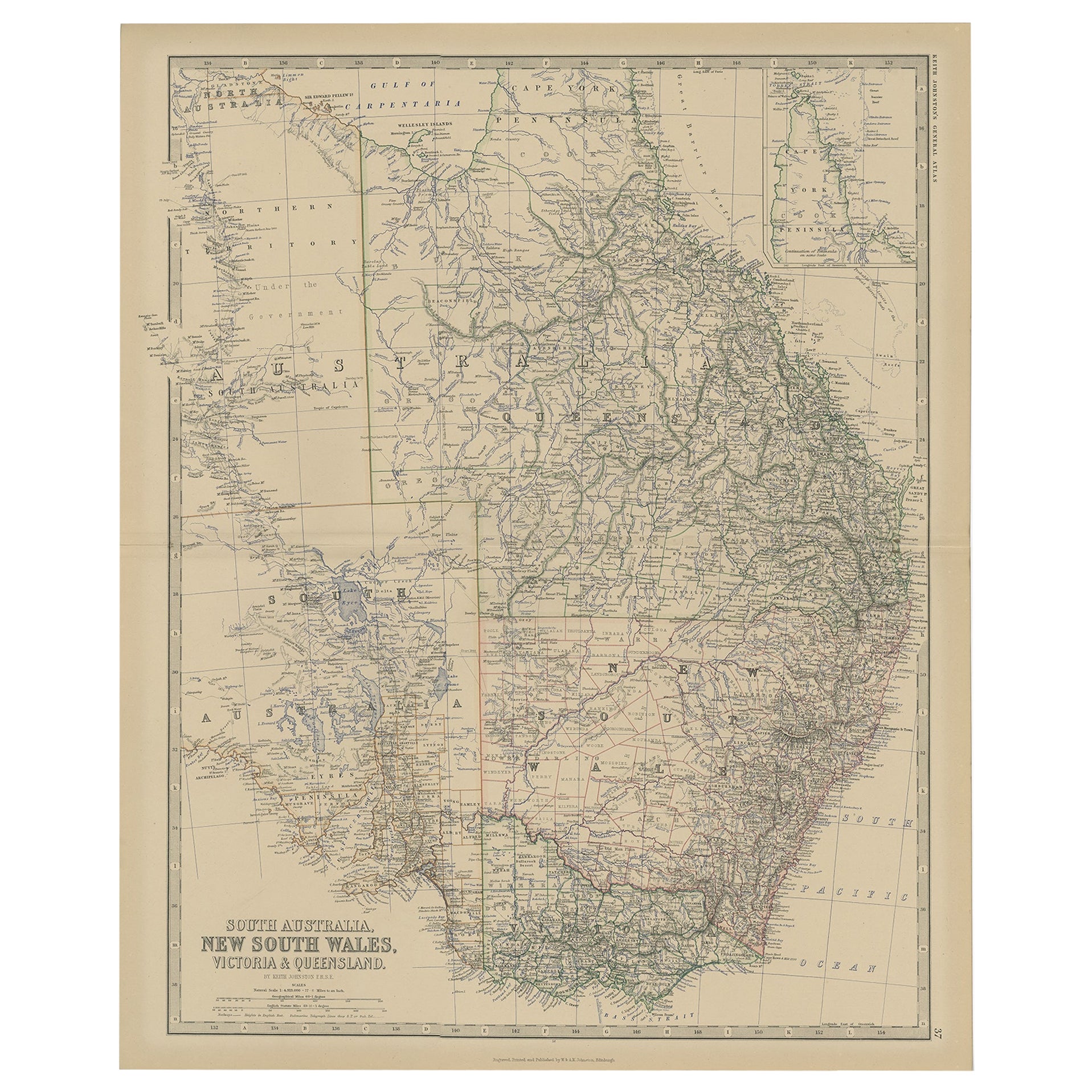
- Old Map of Southern Australia, with an Inset Map of Cape York Peninsula, 1882Located in Langweer, NLAntique map titled 'South Australia, New South Wales, Victoria & Queensland'. Old map of Southern Australia, with an inset map of Cape York Peninsula. This map originates from 'T...Category
Antique 1880s Maps
MaterialsPaper
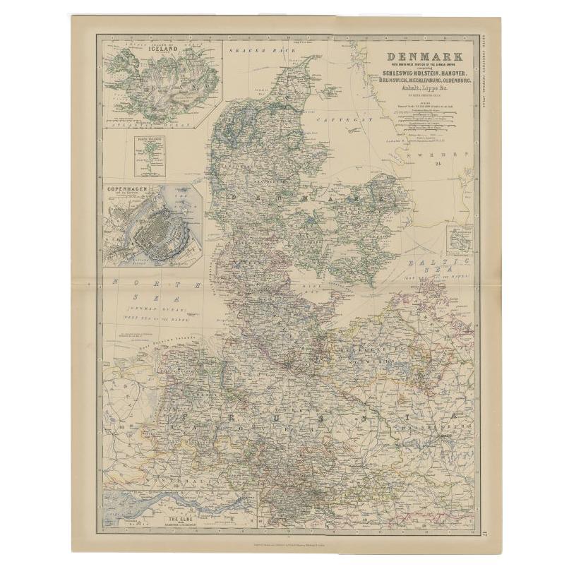
- Antique Map of Denmark with Inset Maps of Iceland, Copenhagen and the Elbe, 1882Located in Langweer, NLAntique map titled 'Denmark with North-West portion of the German Empire comprising Schleswic-Holstein, Hanover, Brunswick, Meckleburg, Oldenburg, Anhalt, Lippe & c'. Old map of Denm...Category
Antique 19th Century Maps
MaterialsPaper
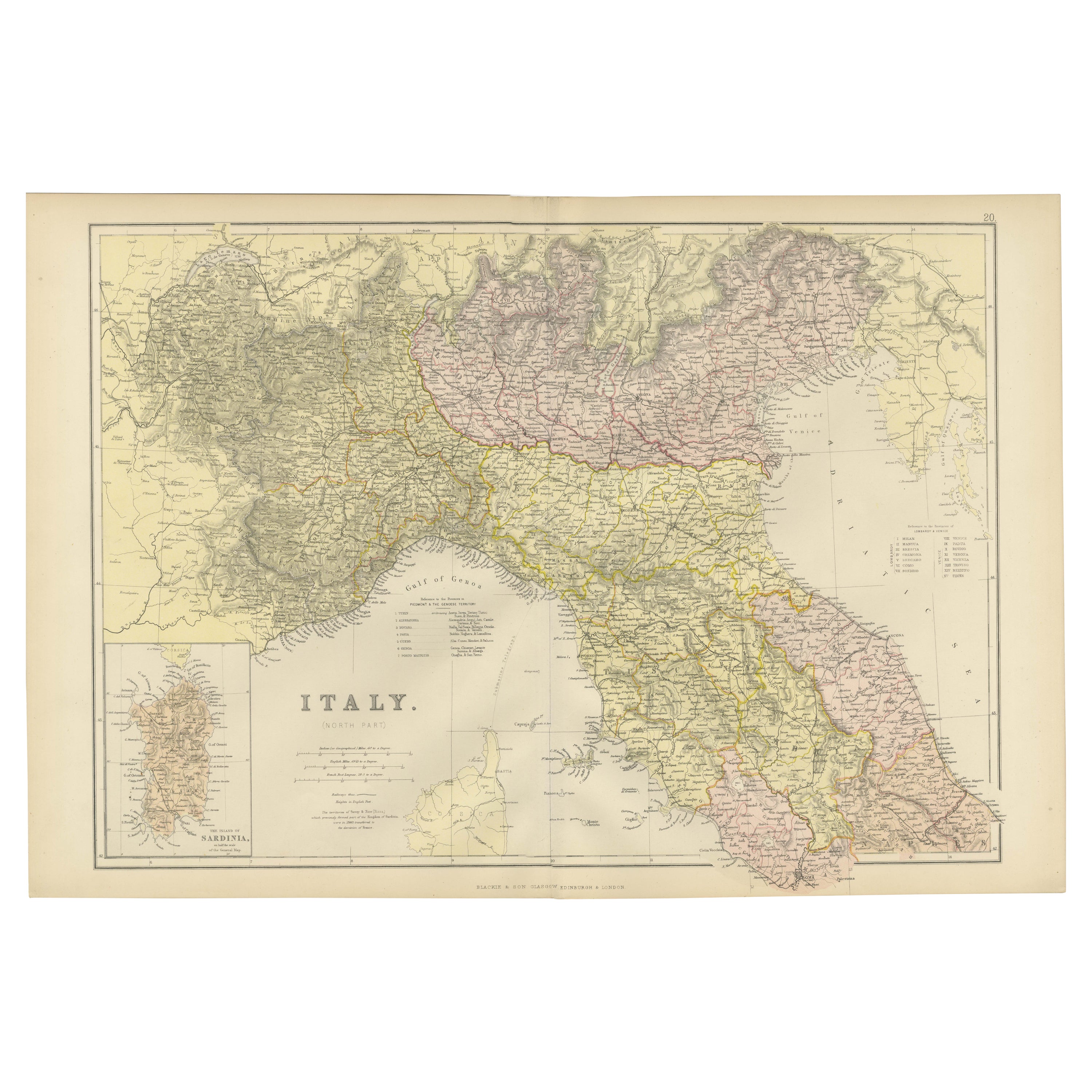
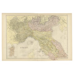
- Original Antique Map of Italy with an Inset of Sardinia, 1882Located in Langweer, NLEmbark on a historical odyssey with an original Antique Map of Italy from the esteemed 'Comprehensive Atlas and Geography of the World,' meticulously crafted in 1882. This captivatin...Category
Antique 1880s Maps
MaterialsPaper
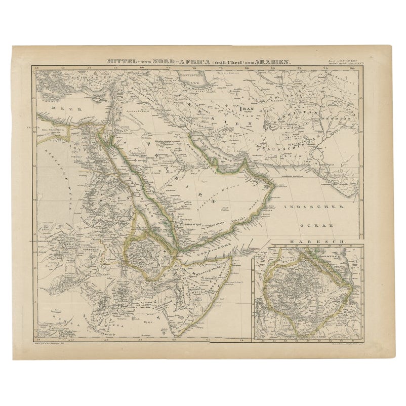
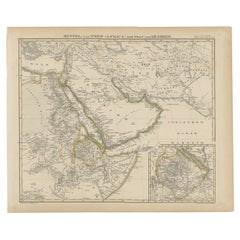
- Antique Map of Africa and Arabia with Inset Map of Ethiopia and Eritrea, 1845Located in Langweer, NLAntique map titled 'Mittel- und Nord-Africa (östl. Theil) und Arabien'. This map depicts North and Central Africa and Arabia with an inset map of Habesch (Ethiopia and Eritrea). Ar...Category
Antique 19th Century Maps
MaterialsPaper
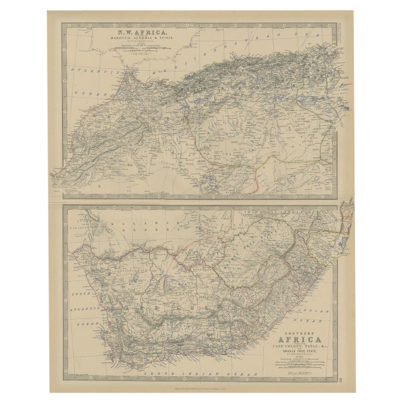
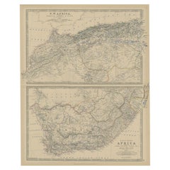
- Antique Map of North and South Africa by Johnston, 1882Located in Langweer, NLTwo antique maps on one sheet titled 'N.W. Africa, Marocco, Algeria & Tunis' and 'Southern Africa, comprising Cape Colony, Natal & c'. This map originates from 'The Royal Atlas of ...Category
Antique 19th Century Maps
MaterialsPaper

You May Also Like
- Original Antique Map of South Africa, Arrowsmith, 1820Located in St Annes, LancashireGreat map of South Africa. Drawn under the direction of Arrowsmith. Copper-plate engraving. Published by Longman, Hurst, Rees, Orme and Br...Category
Antique 1820s English Maps
MaterialsPaper
- Old Nautical Map of CorsicaLocated in Alessandria, PiemonteST/556/1 - Old map of Corsica isle, surveyed by Captain Hell, of the French Royal Navy in 1824, engraved and published on 1874, with additions and corre...Category
Antique Early 19th Century English Other Prints
MaterialsPaper
- Old Horizontal Map of EnglandBy TassoLocated in Alessandria, PiemonteST/520 - Old rare Italian map of England, dated 1826-1827 - by Girolamo Tasso, editor in Venise, for the atlas of M.r Le-Sage.Category
Antique Early 19th Century Italian Other Prints
MaterialsPaper
- Antique Lithography Map, West Africa, English, Framed, Cartography, VictorianLocated in Hele, Devon, GBThis is an antique lithography map of Western Africa. An English, framed atlas engraving of cartographic interest by John Rapkin, dating to the early Victorian period and later, circ...Category
Antique Mid-19th Century British Early Victorian Maps
MaterialsWood
- London 1744 Published Watercolour Antique Map of East Africa by Eman BowenLocated in GBWe are delighted to offer for sale this New and Accurate Map of Nubia & Abissinia, together with all the Kingdoms Tributary Thereto, and bordering upon them published in 1744 by Emanuel Bowen This is a decorative antique engraved map of East Africa...Category
Antique 1740s English George III Maps
MaterialsPaper
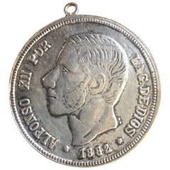
- Antique Spanish Coin Dated 1882Located in Miami, FLFine Spanish coin that was previously on a silver bracelet (sold separately). Spain, Alphonse XII (1874-1885), 5 Peseta, 1882, Year: 1882 Metal: Silver.Category
Antique 19th Century Spanish Collectible Jewelry
MaterialsSilver