Items Similar to Colourful Antique Map of England and Wales Divided in Counties, 1854


Want more images or videos?
Request additional images or videos from the seller
Colourful Antique Map of England and Wales Divided in Counties, 1854
About the Item
Antique map titled 'A Map Shewing the Places in England & Wales Sending Members to Parliament with the numbers returned, divisions of counties and population, places of county election, polling places and boroughs disfranchised according to the reform and boundary act.'
A map of England and Wales, divided in counties. A small table shows the populations of various cities. From James Wyld's 'A New General Atlas of Modern Geography.', published by James Wyld. Geographer to Her Majesty Charing Cross East. 1854.
Artists and Engravers: Cartographer: James Wyld. James Wyld (1812-1887) was a British publisher and cartographer. His greatest geographical achievement was Wyld's Great Globe, exhibited in Leicester Square between 1851 and 1862. The globe, sixty feet high and lighted with gas, was at that point the largest ever constructed. He was geographer to Queen Victoria and H.R.H. Prince Albert.
- Dimensions:Height: 21.38 in (54.3 cm)Width: 17.64 in (44.8 cm)Depth: 0 in (0.01 mm)
- Materials and Techniques:
- Period:
- Date of Manufacture:1854
- Condition:Condition: Very good, given age. A small brown stain in the right margin. A small tear in the right margin (not affecting image). General age-related toning and/or occasional minor defects from handling. Please study scan carefully.
- Seller Location:Langweer, NL
- Reference Number:
About the Seller
5.0
Platinum Seller
These expertly vetted sellers are 1stDibs' most experienced sellers and are rated highest by our customers.
Established in 2009
1stDibs seller since 2017
1,950 sales on 1stDibs
Typical response time: <1 hour
- ShippingRetrieving quote...Ships From: Langweer, Netherlands
- Return PolicyA return for this item may be initiated within 14 days of delivery.
More From This SellerView All
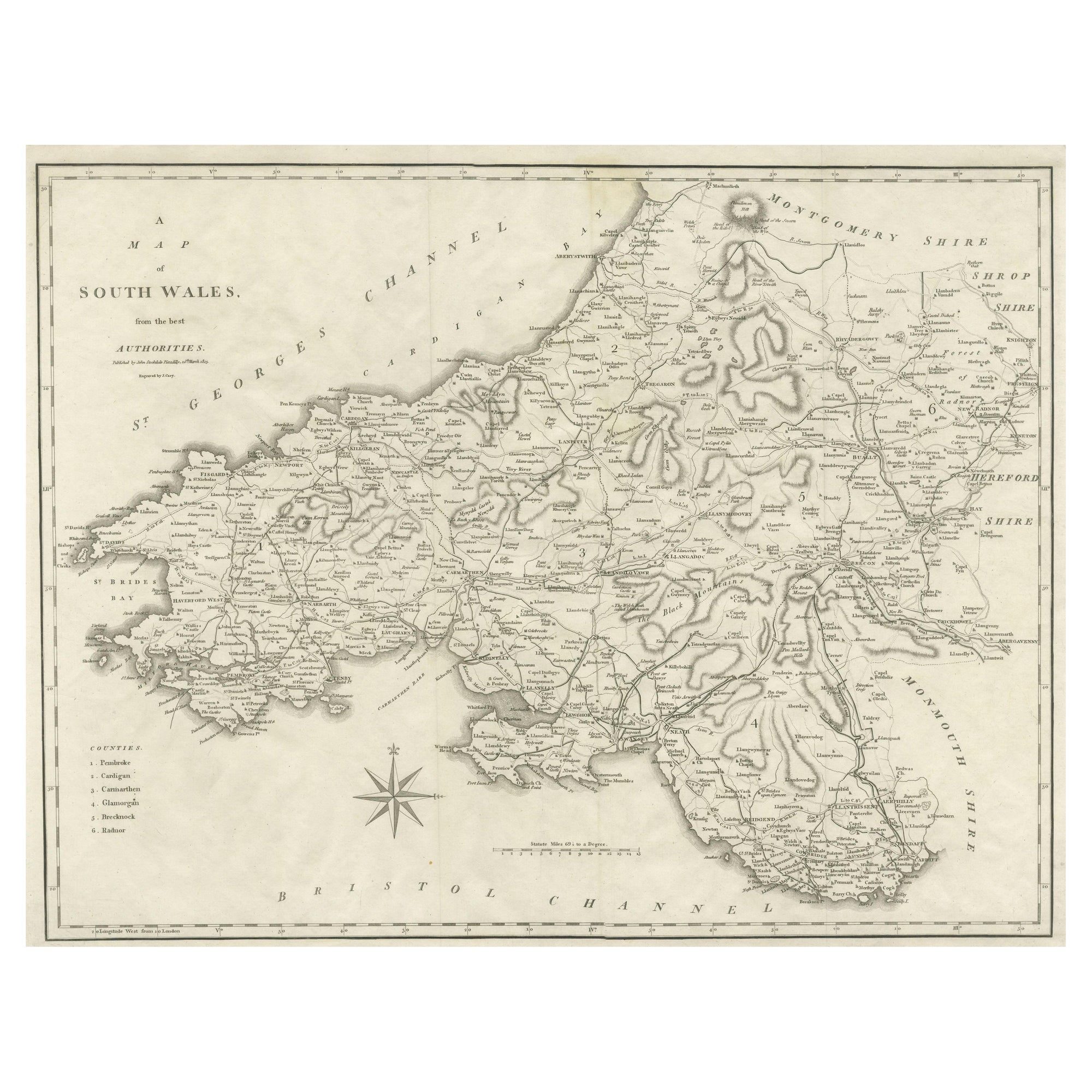
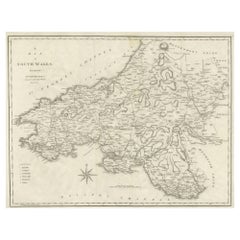
- Large Antique County Map of South Wales, EnglandLocated in Langweer, NLAntique map titled 'A Map of South Wales from the best Authorities'. Original old county map of South Wales, England. Engraved by John Cary. Originates from 'New British Atlas' by Jo...Category
Antique Early 19th Century Maps
MaterialsPaper
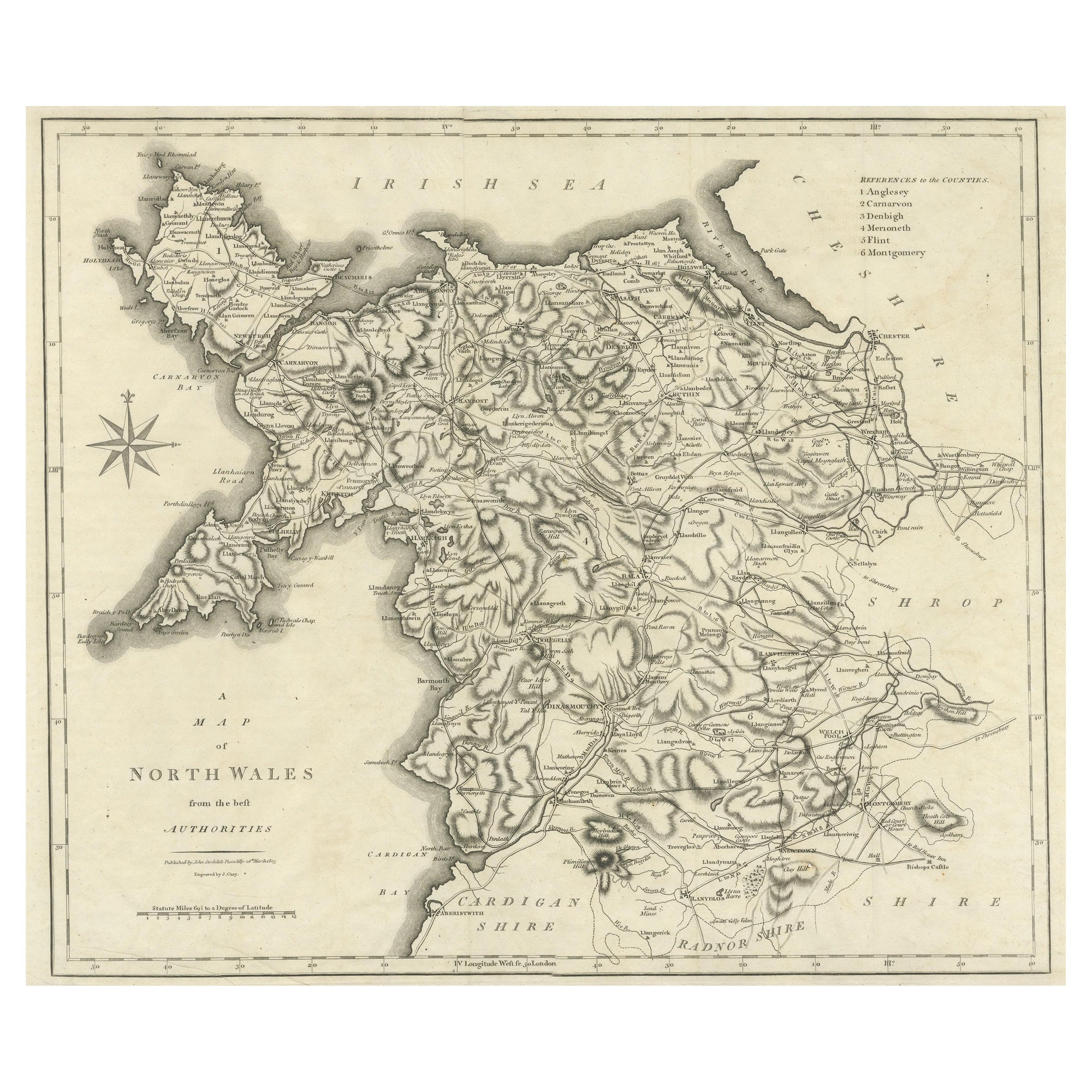
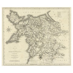
- Large Antique County Map of North Wales, EnglandLocated in Langweer, NLAntique map titled 'A Map of North Wales from the best Authorities'. Original old county map of North Wales, England. Engraved by John Cary. Originates from 'New British Atlas' by Jo...Category
Antique Early 19th Century Maps
MaterialsPaper
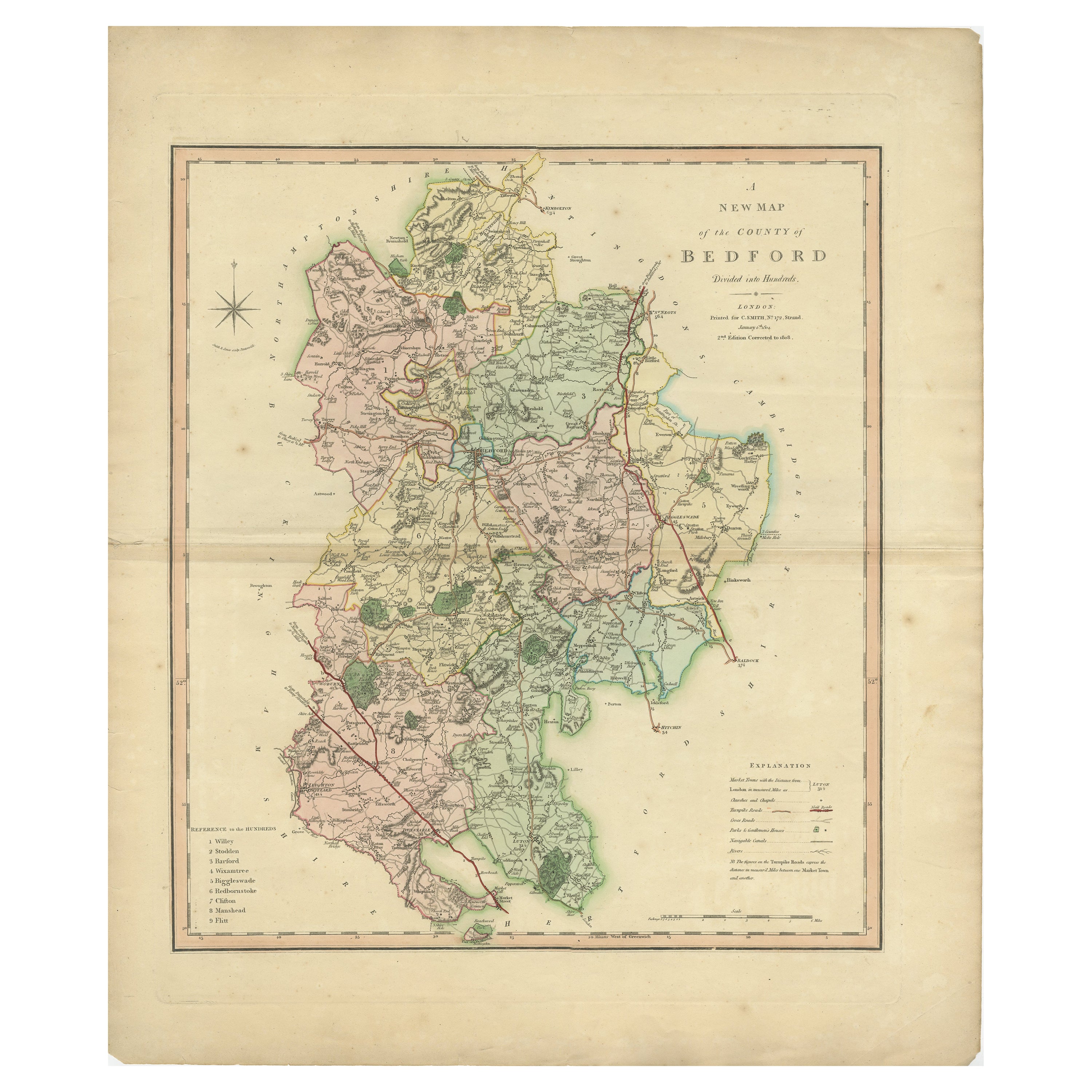
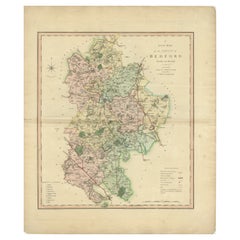
- Antique Colourful and Decorative County Map of Bedfordshire, England, 1804Located in Langweer, NLAntique county map of Bedfordshire first published c.1800. Villages, towns, and cities illustrated include Bedford, Todington, and Potton. Charl...Category
Antique Early 1800s Maps
MaterialsPaper
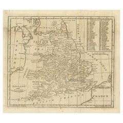
- Antique Map of England and Wales, with References to the CountiesLocated in Langweer, NLAntique map titled 'England and Wales'. Original antique map of England and Wales, with references to the counties. Source unknown, to be determined. Published circa 1820.Category
Antique Early 19th Century Maps
MaterialsPaper
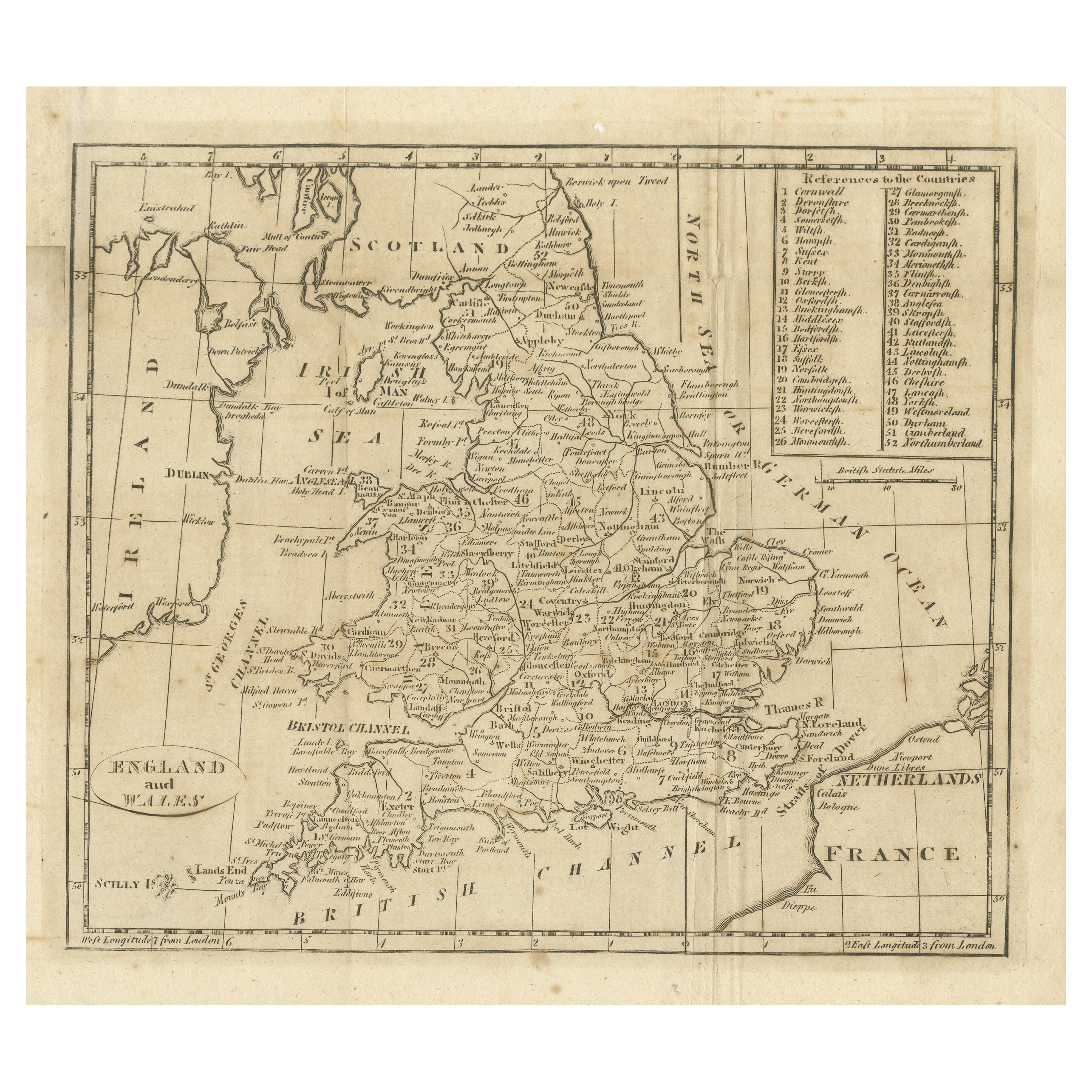
- Large Antique Map of England and WalesLocated in Langweer, NLAntique map titled 'An Accurate Map of England and Wales'. Original old map of England and Wales. Engraved by John Cary. Originates from 'New British Atlas' by John Stockdale, publis...Category
Antique Early 19th Century Maps
MaterialsPaper
- Lithographed Antique Map of England and WalesLocated in Langweer, NLOriginal antique map titled 'Map XXIII England & Wales'. Lithographed map of England and Wales. Published by Fisk & See, circa 1890.Category
Antique Late 19th Century Maps
MaterialsPaper


You May Also Like
- Hampshire County, Britain/England: A Map from Camden's" Britannia" in 1607By John NordenLocated in Alamo, CAAn early hand-colored map of Britain's Hampshire county, published in the 1607 edition of William Camden's great historical description of the British Isles, "Britannia". This map was drawn by cartographer John Norden (c. 1547-1625) and engraved by William Hole (active 1607-1624) and William Kip...Category
Antique Early 17th Century English Maps
MaterialsPaper
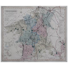
- Original Antique English County Map, Worcestershire, J & C Walker, 1851Located in St Annes, LancashireGreat map of Worcestershire Original colour By J & C Walker Published by Longman, Rees, Orme, Brown & Co. 1851 Unframed.Category
Antique 1850s English Other Maps
MaterialsPaper
- Original Antique English County Map, Hampshire, J & C Walker, 1851Located in St Annes, LancashireGreat map of Hampshire Original colour By J & C Walker Published by Longman, Rees, Orme, Brown & Co. 1851 Unframed.Category
Antique 1850s English Other Maps
MaterialsPaper
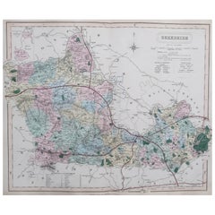
- Original Antique English County Map, Berkshire. J & C Walker, 1851Located in St Annes, LancashireGreat map of Berkshire Original colour By J & C Walker Published by Longman, Rees, Orme, Brown & Co. 1851 Unframed.Category
Antique 1850s English Other Maps
MaterialsPaper
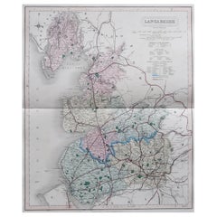
- Original Antique English County Map, Lancashire, J & C Walker, 1851Located in St Annes, LancashireGreat map of Lancashire Original colour By J & C Walker Published by Longman, Rees, Orme, Brown & Co. 1851 Unframed.Category
Antique 1850s English Other Maps
MaterialsPaper
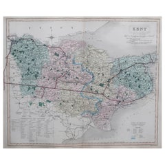
- Original Antique English County Map, Kent. J & C Walker, 1851Located in St Annes, LancashireGreat map of Kent Original colour By J & C Walker Published by Longman, Rees, Orme, Brown & Co. 1851 Unframed.Category
Antique 1850s English Other Maps
MaterialsPaper


Recently Viewed
View AllMore Ways To Browse
New England Antiques
Wales And Wales Furniture
Antique Furniture From New England
Prince Wales
Antique Prince And
Map Light
Prince Albert
Wales Table
Queen Victoria Of England
Map Of Britain
Antique Map England
Antique Maps England
Antique England Map
Antique Map Of England
Antique Maps Of England
Population Of Antique
Antique Prince Albert
Antique Gas