Items Similar to Engraving by Tallis and Rapkin of Map of the West Indies in The Caribbean, 1851


Want more images or videos?
Request additional images or videos from the seller
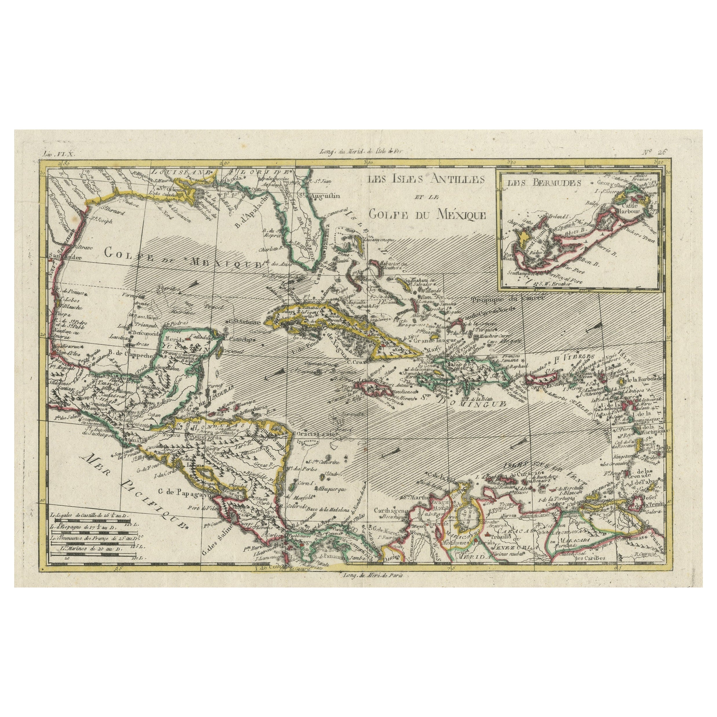
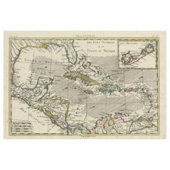
Engraving by Tallis and Rapkin of Map of the West Indies in The Caribbean, 1851
About the Item
John Tallis' 1851 map of the West Indies stands as a striking example of his renowned cartographic work. With meticulous detail and artistic embellishments, this map offers a comprehensive view of the Caribbean region during the mid-19th century.
**Title:** Map of the West Indies
**Cartographer/Engraver:** John Rapkin (engraved by)
**Publisher:** John Tallis
**Date:** 1851
The map spans from Cuba and the Caribbean coast of Central America to Barbados, encompassing a vast area from southern Florida to Colombia and the mouth of the Orinoco River. Notable features include:
1. **Island Labels:** Each of the islands in the Greater and Lesser Antilles is meticulously labeled, showcasing important locations such as Cuba, Santo Domingo (Hispaniola / Hayti), Puerto Rico (Porto Rico), the Virgin Islands, Guadeloupe, Martinique, and St. Lucia. The Bahamas and the Turks and Caicos Islands are also featured.
2. **Detailed Labeling:** Numerous locations along coastlines are labeled, offering a wealth of geographical information, especially along the coastlines of Cuba, Santo Domingo, Puerto Rico, and Jamaica. Smaller islands along the Central American coast are also identified.
3. **Vignettes:** The map is adorned with stunning vignettes. A view of Kingston, Jamaica, showcases the city's commercial rooms and harbor scenes, giving a glimpse into the bustling trade activities of the time. The inclusion of indigenous scenes, such as two Islanders, adds a touch of cultural richness. Additionally, a vignette in the Caribbean Sea depicts numerous large sailing ships, possibly ships-of-the-line, sailing toward an island, capturing the maritime atmosphere of the region.
Tallis' maps, renowned for their decorative elements, capture not only geographic accuracy but also the spirit and essence of the depicted regions. This particular map is part of Tallis' Illustrated Atlas, an esteemed collection known for its ornate designs and attention to detail.
The exquisite vignettes showcasing scenes of local life, trade, and the Seal of Jamaica reflect Tallis' mastery in combining cartography with artistry. Such maps remain highly prized for their aesthetic beauty and historical significance, providing a captivating glimpse into the Caribbean during the mid-19th century.
VERSO: There is nothing printed on the reverse side, which is plain
AUTHENTICITY: This is an authentic historic print, published at the date stated above. I do not offer reproductions. It is not a modern copy. The term 'original' when applied to a print means that it was printed at the first or original date of publication; it does not imply that the item is unique. 'Print' means any image created by applying an inked block to paper or card under pressure by any method including wood engraving, steel engraving, copperplate, wood cut and lithography.
- Dimensions:Height: 10.44 in (26.5 cm)Width: 14.57 in (37 cm)Depth: 0 in (0.02 mm)
- Materials and Techniques:
- Period:
- Date of Manufacture:1851
- Condition:Good; suitable for framing. Borders colored by hand. Some light spotting in top left corner. Most antiquarian maps and prints are subject to some normal aging due to use and time which is not obtrusive unless otherwise stated.
- Seller Location:Langweer, NL
- Reference Number:
About the Seller
5.0
Platinum Seller
These expertly vetted sellers are 1stDibs' most experienced sellers and are rated highest by our customers.
Established in 2009
1stDibs seller since 2017
1,949 sales on 1stDibs
Typical response time: <1 hour
- ShippingRetrieving quote...Ships From: Langweer, Netherlands
- Return PolicyA return for this item may be initiated within 14 days of delivery.
More From This SellerView All
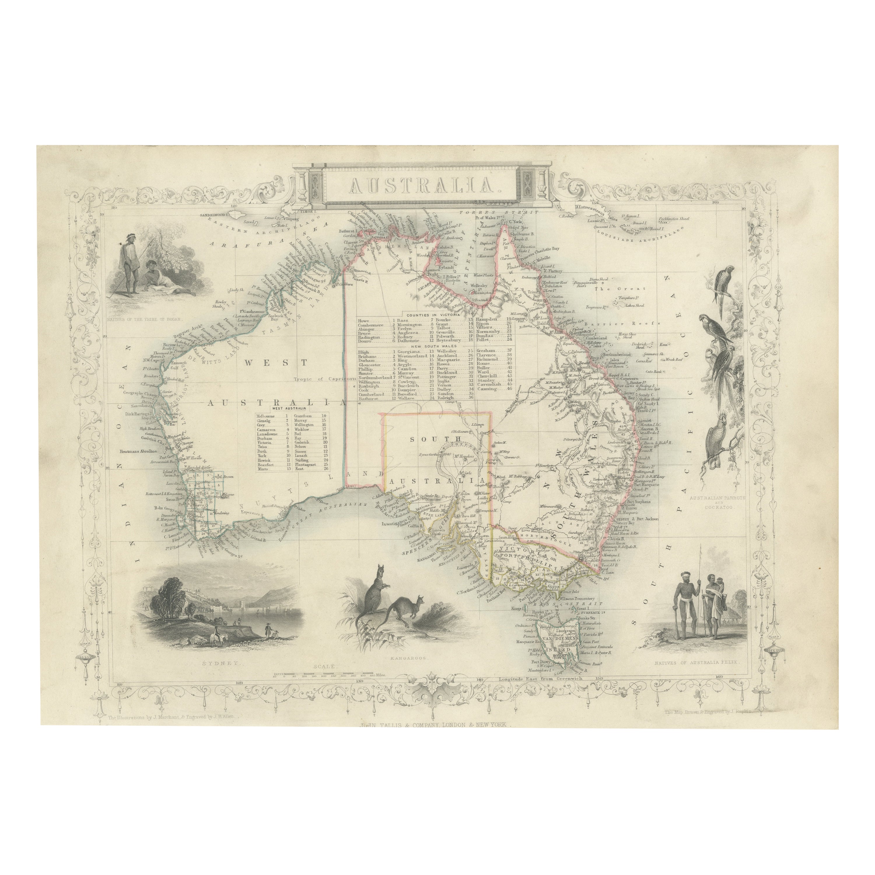
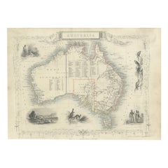
- Gold Rush Era Masterpiece: The Tallis & Rapkin Rare Map of Pre-Queensland, 1851Located in Langweer, NLThe image is an original historical map of Australia from the year 1851, created by John Rapkin with illustrations by J. Marchant and engravings by J. B. Allen. The map was published...Category
Antique 1850s Maps
MaterialsPaper
- Original Engraving of the West Indies, Gulf of Mexico, Antilles, Caribbean, 1780Located in Langweer, NLRigobert Bonne and G. Raynal's 1780 map of the West Indies, Gulf of Mexico, Antilles, and the Caribbean stands as a remarkable cartographic piece, offering a detailed and expansive v...Category
Antique Late 18th Century Maps
MaterialsPaper
- Antique Map of Russia in Europe by Tallis, '1851'Located in Langweer, NLAntique map titled 'Russia in Europe'. Map of European Russia. Showing vignettes of the Neoskoi Prospect, St. Petersburg, Polish Captives on their way to Siberia, a Russian Bear...Category
Antique Mid-19th Century Maps
MaterialsPaper
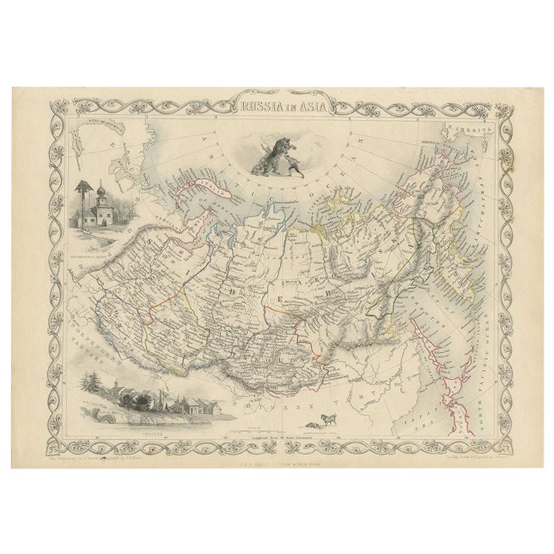
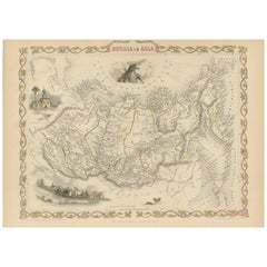
- Antique Map of Russia in Asia by Tallis, '1851'Located in Langweer, NLAntique map titled 'Russia in Asia'. Map of Russia in Asia. Showing vignettes of a polar hunting scene, Skorskarskoi Pagost, Troitsk and Kamchatkan Dogs. Originates from 'The Illustr...Category
Antique Mid-19th Century Maps
MaterialsPaper
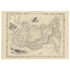
- Antique Map of Russia in Asia by Tallis, c.1851Located in Langweer, NLAntique map titled 'Russia in Asia'. Map of Russia in Asia. Showing vignettes of a polar hunting scene, Skorskarskoi Pagost, Troitsk and Kamchatkan Dogs. Originates from 'The Illustrated Atlas, And Modern History Of The World Geographical, Political, Commercial & Statistical, Edited By R. Montgomery Martin'. Published; John Tallis London, New York, Edinburgh & Dublin. 1851. Drawn and Engraved by J. Rapkin. Artists and Engravers: John Tallis (1817-1876) was a British map...Category
Antique 19th Century Maps
MaterialsPaper
- Antique Map of Belgium by J. Tallis, circa 1851Located in Langweer, NLA highly decorative and detailed mid-19th century map of Belgium which was drawn and engraved by J. Rapkin (vignettes by J. Marchant and J. B. Allen) an...Category
Antique Mid-19th Century Maps
MaterialsPaper


You May Also Like
- Large Original Antique Map of The West Indies by Sidney Hall, 1847Located in St Annes, LancashireGreat map of The West Indies Drawn and engraved by Sidney Hall Steel engraving Original colour outline Published by A & C Black. 1847 Unframed Free shipping.Category
Antique 1840s Scottish Maps
MaterialsPaper
- Seminal guide to the East and West Indies, with 42 coloured maps and platesBy Jan Huygen van LinschotenLocated in ZWIJNDRECHT, NLSeminal guide to the East and West Indies, with 42 double-page and folding plates, including 6 maps, all engravings beautifully coloured by a contemporary hand LINSCHOTEN, Jan Huygh...Category
Antique Early 17th Century Dutch Dutch Colonial Books
MaterialsPaper
- Original Antique English County Map - West Yorkshire. J & C Walker. 1851Located in St Annes, LancashireGreat map of The West Riding of Yorkshire Original colour By J & C Walker Published by Longman, Rees, Orme, Brown & Co. 1851 Unframed.Category
Antique 1850s English Other Maps
MaterialsPaper
- Original Antique Map of Belgium by Tallis, Circa 1850Located in St Annes, LancashireGreat map of Belgium Steel engraving Many lovely vignettes Published by London Printing & Publishing Co. ( Formerly Tallis ), C.1850 Origin...Category
Antique 1850s English Maps
MaterialsPaper
- Cricket Print, England v. West Indies at the Oval, by Arthur WeaverBy Arthur WeaverLocated in Oxfordshire, GB1990's Arthur Weaver Oval Cricket Ground Print, England v West Indies. A colourful cricket lithograph signed by the artist, Arthur Weaver, of the 'Final Test' at The Oval Cricket Gr...Category
1990s English Sporting Art Sports Equipment and Memorabilia
MaterialsPaper
- Original Antique Map / City Plan of Brussels by Tallis, circa 1850Located in St Annes, LancashireGreat map of Brussels. Steel engraving. Published by London Printing & Publishing Co. (Formerly Tallis), C.1850 Free shipping.Category
Antique 1850s English Maps
MaterialsPaper


