Items Similar to Four 18th Century Engraved and Hand-Colored Maps by Weigel


Want more images or videos?
Request additional images or videos from the seller
1 of 11
Four 18th Century Engraved and Hand-Colored Maps by Weigel
About the Item
Small collection of four engraved maps of Italy, Balkan and of Central Asia.
Two are of Italy, one Corsica and Northern Italy and the other of the Southern Italian boot.
All are hand-colored and framed in antique silver frames.
- Creator:Christoph Weigel (Artist)
- Dimensions:Height: 15.75 in (40 cm)Width: 18.12 in (46 cm)Depth: 0.79 in (2 cm)
- Materials and Techniques:
- Place of Origin:
- Period:
- Date of Manufacture:circa 1780
- Condition:Wear consistent with age and use. Maps without frames 32 cm high 40cm deep.
- Seller Location:Copenhagen, DK
- Reference Number:
About the Seller
4.9
Vetted Seller
These experienced sellers undergo a comprehensive evaluation by our team of in-house experts.
Established in 1949
1stDibs seller since 2013
135 sales on 1stDibs
Typical response time: 1 to 2 days
- ShippingRetrieving quote...Ships From: Haddonfield, NJ
- Return PolicyA return for this item may be initiated within 3 days of delivery.
More From This SellerView All
- German 18th Century Silver And Hardwood Snuff BoxLocated in Copenhagen, KWonderful carved German or Austrian snuff box hunting motive and silver mounting. Carved to fit "hand in glove." Provenance: Exhibited at the Dome M...Category
Antique Mid-18th Century German Baroque Tobacco Accessories
MaterialsSilver
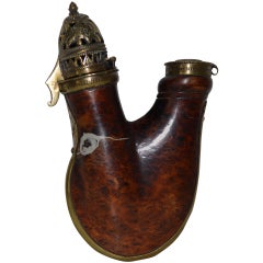
- 18th Century, German or Dutch PipeheadLocated in Copenhagen, KFantastic wood and brass pipe.Category
Antique 18th Century and Earlier Tobacco Accessories
MaterialsBrass
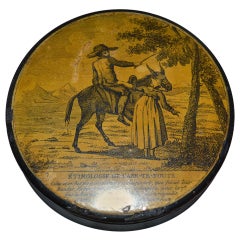
- 18th Century Snuff Box With Secret Erotic MotiveLocated in Copenhagen, KVery funny little snuff box with a text about Etimologie; the true learning or real learning, on the lids outside and a hidden erotic motive on the inside of the lid.Category
Antique Late 18th Century French Empire Tobacco Accessories
MaterialsWood, Paper
- 17th Century Map of Denmark by French Cartographer Sanson, Dated 1658By Nicolas SansonLocated in Copenhagen, K17th century map of Denmark by French cartographer Sanson. Nicolas Sanson (20 December 1600-7 July 1667) was a French cartographer, termed by some the creator of French geography an...Category
Antique 17th Century French Maps
MaterialsPaper
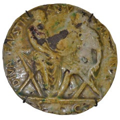
- 19th Century Roman Plaquette with Faustina and Antoninus PiusLocated in Copenhagen, KVery nice roman plaquette with inscription on it. The inscription says something with Diva Faustina and Antoninus. So it must be in reference or to coin...Category
Antique 19th Century European Greco Roman Historical Memorabilia
MaterialsCeramic
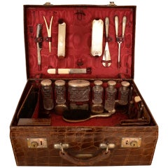
- German Late 19th Century Crocodile And Silver Vanity Suitcase CaseLocated in Copenhagen, KBeautiful old crocodile vanity and necessaire case, with eight jars in facetted glass and silver lids, one box in silver, several brushes and combs in silver, inkwell in silver, perfume container in silver and glass, travel clock, lipstick container...Category
Antique Late 19th Century German Trunks and Luggage
MaterialsSilver

You May Also Like
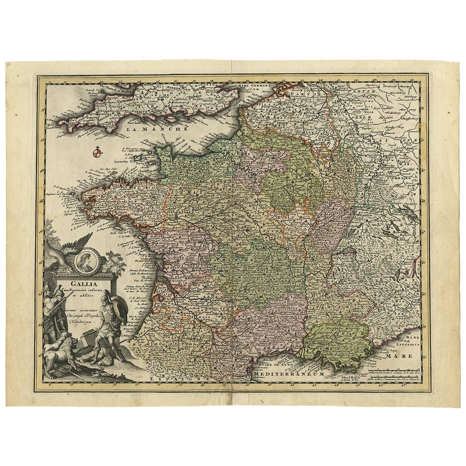
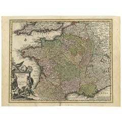
- Original High Detailed Antique Map of France by C. Weigel, 1719By Christoph WeigelLocated in Langweer, NLAntique map titled 'Gallia'. This highly detailed map shows France divided up into its provinces. The map provides a lot of information on place names, rivers, mountains, etc. The ...Category
Antique Early 18th Century Maps
MaterialsPaper
- 18th Century Hand Colored Map of Spain and Portugal by VisscherBy Nicolaes Visscher IILocated in Alamo, CAThis is an early 18th century map of Spain and Portugal, with attractive original hand-coloring, entitled "Hispaniae et Portugalliae Regna per Nicolaum Visscher cum Privilegio Ordinu...Category
Antique Early 18th Century Dutch Maps
MaterialsPaper
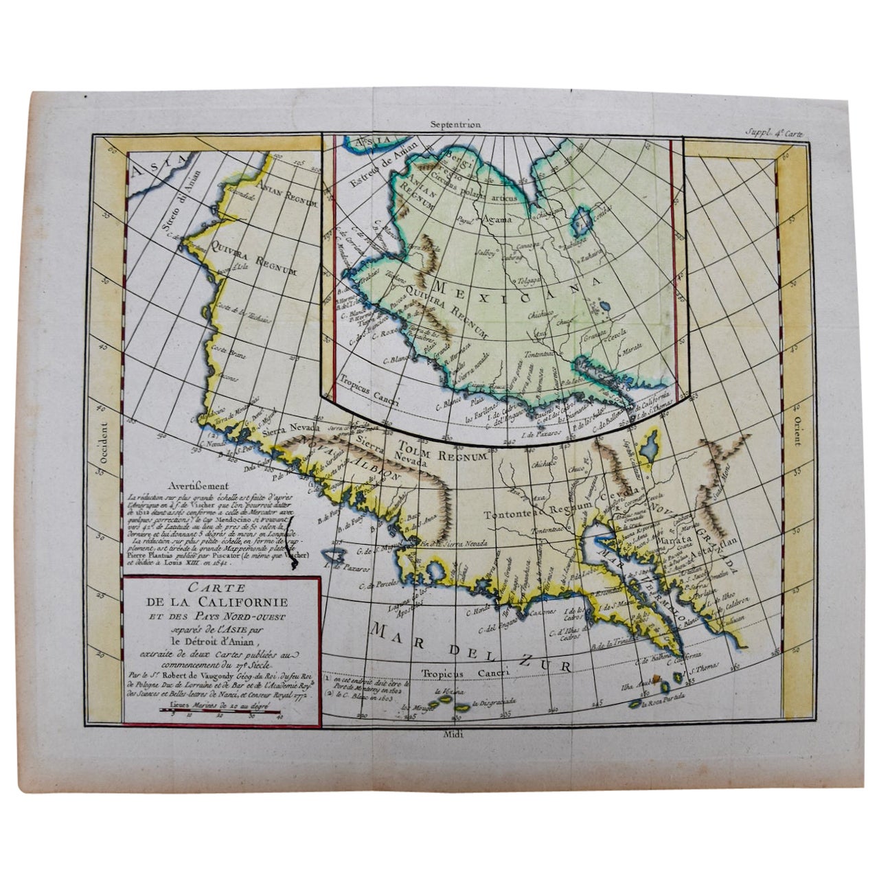
- California, Alaska and Mexico: 18th Century Hand-Colored Map by de VaugondyBy Didier Robert de VaugondyLocated in Alamo, CAThis an 18th century hand-colored map of the western portions of North America entitled "Carte de la Californie et des Pays Nord-Ouest separés de l'Asie par le détroit d'Anian, extra...Category
Antique 1770s French Maps
MaterialsPaper
- South America: Hand-colored 18th Century Framed Map by Thomas JefferysBy Thomas JefferysLocated in Alamo, CAThis detailed hand-colored map of South America by Thomas Jefferys was published in London in 1750. The map shows countries, early colonial possessions, towns, rivers, mountains, and...Category
Antique Mid-18th Century English Maps
MaterialsPaper
- 18th Century Hand-Colored Homann Map of Germany, Including Frankfurt and BerlinBy Johann Baptist HomannLocated in Alamo, CAAn 18th century hand-colored map entitled "Tabula Marchionatus Brandenburgici et Ducatus Pomeraniae quae sunt Pars Septentrionalis Circuli Saxoniae Superioris" by Johann Baptist Homa...Category
Antique Early 18th Century German Maps
MaterialsPaper
- Scandinavia & Portions of Eastern Europe: 18th Century Hand-Colored Homann MapBy Johann Baptist HomannLocated in Alamo, CAAn early 18th century hand-colored copper-plate map entitled "Regni Sueciae in omnes suas Subjacentes Provincias accurate divisi Tabula Generalis" by Johann Baptist Homann (1663-1724...Category
Antique Early 18th Century German Maps
MaterialsPaper


Recently Viewed
View AllMore Ways To Browse
Maps Balkans
Balkan Silver
Antique Handcrafted Model Sailboat
Miles Johnston
Toledo Scale Company Antique
Charente Map
F Colton
Ian Maguire
Ithaca Antique Map
Pakistan Antique Map
Antique Map Copenhagen
Antique Map Nova Scotia
Antique Maps Of Ukraine
Armenia Map
Armenian Map
Ecuador Antique Map
Serbia Antique Map
Ukraine Antique Map