Items Similar to Large Italian Map of Islands of Oceania, incl Papua, Timor, Banda, Ceram, 1855


Want more images or videos?
Request additional images or videos from the seller
1 of 6
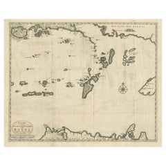
Large Italian Map of Islands of Oceania, incl Papua, Timor, Banda, Ceram, 1855
About the Item
Description: Antique map titled 'Carta di una parte dell'Oceania'. Beautiful large map of the (Spice) islands of Oceania. Depicting Papua, Timor, Ceram, Gilolo and many more. Source unknown, to be determined. More research to be done. Rare.
Rev. Msgr. Carlos Cuarteron (1816 – 12 March 1880) is mentioned on the Map and potentially took the initiative for the map to be presented to Allesandro Barnabo.
Carlos Cuarteron was a Spanish mariner who later became a priest and established the first Roman Catholic missions in northern Borneo. Born in Cadiz to an Italian father and Spanish mother, Carlos went to sea at the age of 13. He was based in the Philippines and built up his experience on the route between Manila and Macao until he became a full captain in 1841. By February 1844 he had bought his own 146 ton topsail schooner, Il Martiri de Tunkin, and set out to find and salvage a valuable cargo from the wreck of the Christina, which had been reported in July 1842. He succeeded, surrendered (after some delay) the treasure to its insurers in Hong Kong, and was well rewarded.
Having undertaken several voyages in the islands south and east of the Philippines during which he freed several slaves and did some evangelising he became more interested in missionary work and went back to Europe for support and training. In 1855 he was appointed Priest Apostolic to Borneo by the Pope and left for the east in 1856 with two Italian priests to assist him.
The mission was welcomed in Labuan in 1857, and also established stations in Brunei and at Looc Porin (near where Kota Kinabalu is now). However, problems with his assistants left him alone from 1860 and the mission made little progress.
Cuarteron, already ill, resigned his post in Rome in December 1879, then returned to his sister's home in Cadiz, where he died of pneumonia on 12 March 1880.
Artists and Engravers: Anonymous.
Condition: Good, minor defects from handling. Please study image carefully.
- Dimensions:Height: 29.14 in (74 cm)Width: 21.26 in (54 cm)Depth: 0 in (0.02 mm)
- Materials and Techniques:
- Period:
- Date of Manufacture:1855
- Condition:
- Seller Location:Langweer, NL
- Reference Number:
About the Seller
5.0
Platinum Seller
These expertly vetted sellers are 1stDibs' most experienced sellers and are rated highest by our customers.
Established in 2009
1stDibs seller since 2017
1,933 sales on 1stDibs
Typical response time: <1 hour
- ShippingRetrieving quote...Ships From: Langweer, Netherlands
- Return PolicyA return for this item may be initiated within 14 days of delivery.
More From This SellerView All
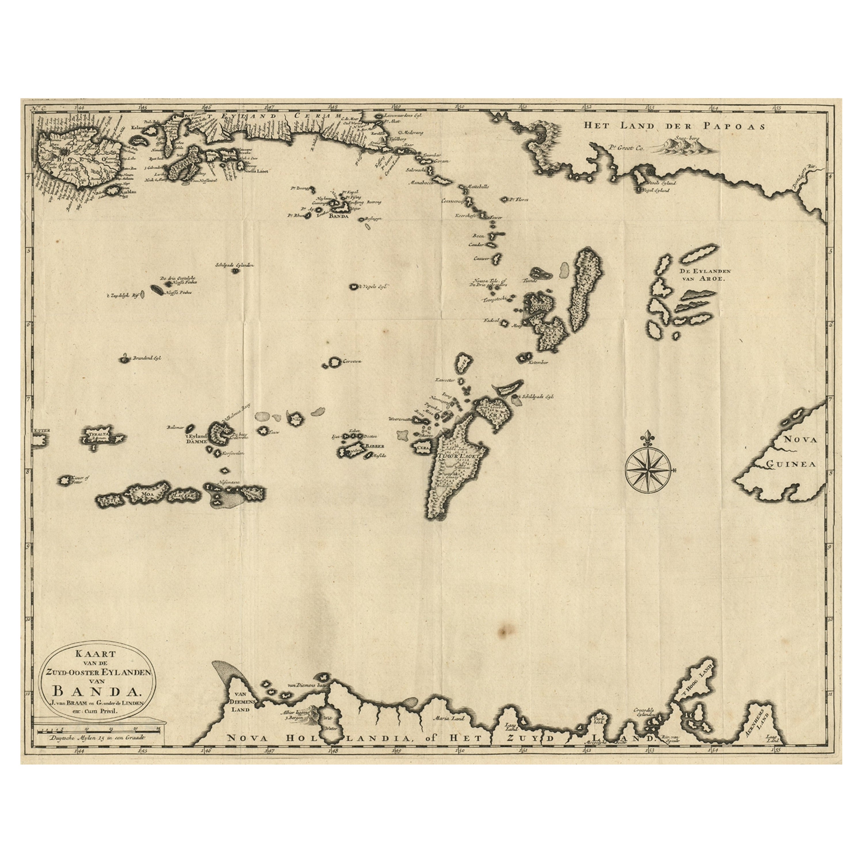
- Map of the Southeastern Part of the Banda Islands, Incl Northern Australia, 1726Located in Langweer, NLAntique map titled 'Kaart van de Zuyd-Ooster Eylanden van Banda.' Map of the southeastern part of the Banda islands. This map originates from 'Oud en Nieuw Oost-Indiën' by Franço...Category
Antique 1720s Maps
MaterialsPaper
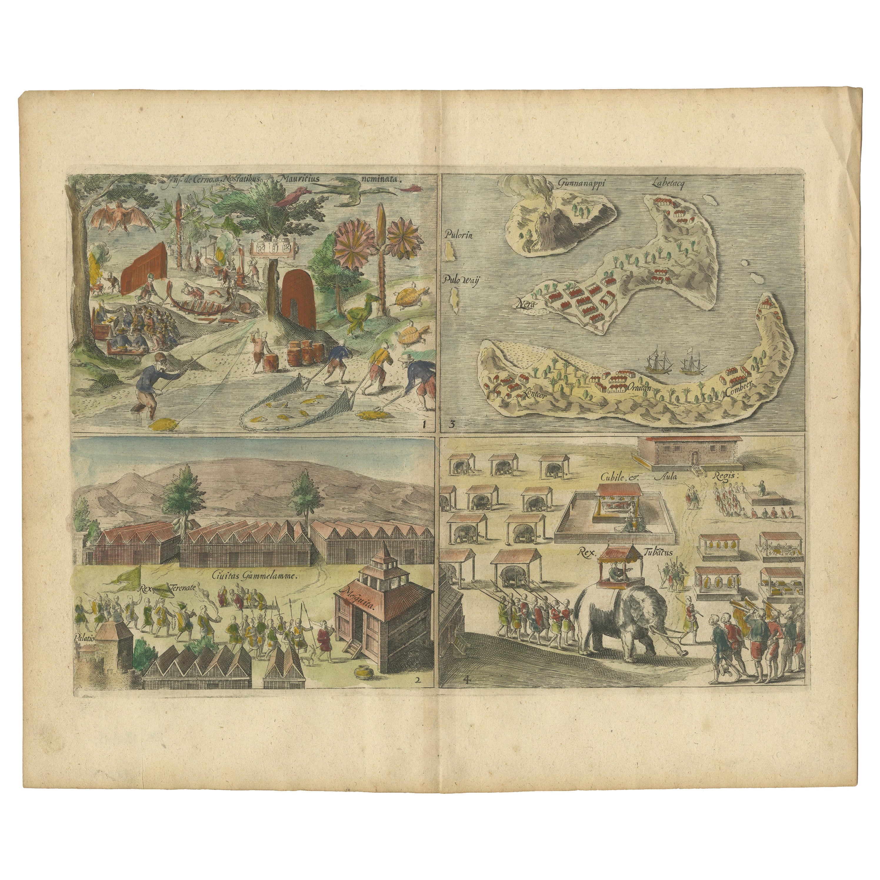
- Antique Engravings of Mauritius and Indonesia, incl de Banda Islands, c.1730Located in Langweer, NLTitle on page: "Ins. de Cerno a. Nostatibus Mauritius Nominata [on sheet with] Gunnanappi Labetacq [and] Civitas Gammelamme [and] Rex Tubatus", Le Clerc, Jean This sheet includes fo...Category
Antique 1730s Maps
MaterialsPaper
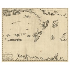
- Antique Map of the Banda Islands in Indonesia by Valentijn, 1726Located in Langweer, NLAntique map Indonesia titled 'Kaart der Zuyd-Wester Eylanden van Banda'. Map of the islands in the southwestern part of the Banda Sea including ...Category
Antique Mid-18th Century Maps
MaterialsPaper
- Old Antique Map of the Banda Islands (Southeast), Indonesia & Northern AustraliaBy F. ValentijnLocated in Langweer, NLOriginal antique map titled 'Kaart van de Zuyd-Ooster Eylanden van Banda'. Important map of the seas and islands surrounding the Banda Islands, Indonesia, extending south to northern Australia, east to Papua New Guinea and north to Ceram. Published 1724-1726 by Joannes van Braam...Category
Antique Early 18th Century Maps
MaterialsPaper
- Original Antique Map Southeast of the Banda or Spice Islands, Indonesia, 1726Located in Langweer, NLAntique map titled 'Kaart van de Zuyd-Ooster Eylanden van Banda'. Map of the southeastern part of the Banda islands. This map originates from 'Oud en Nieuw Oost-Indiën' by F. Valen...Category
Antique 1720s Maps
MaterialsPaper
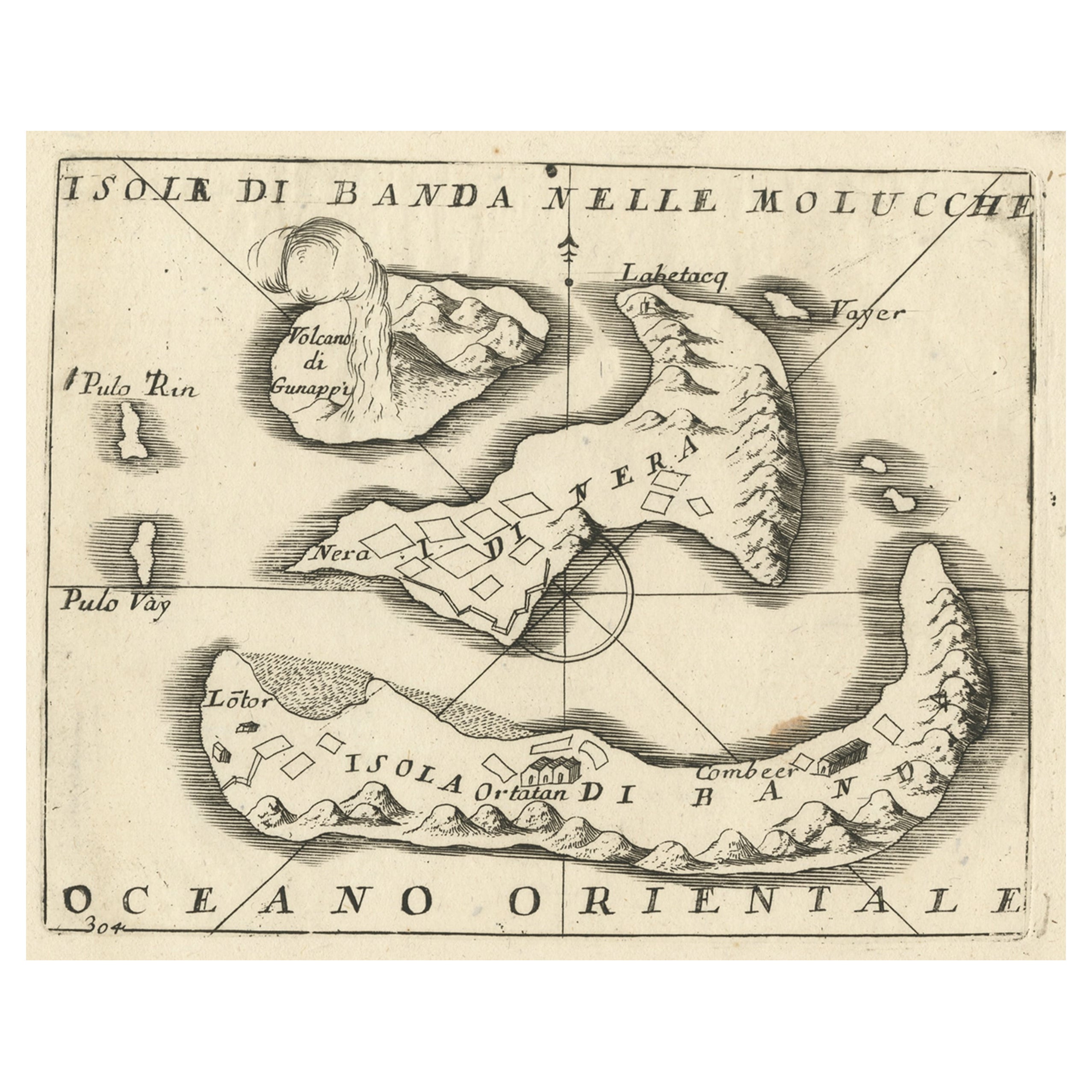
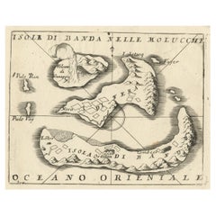
- Small Old Map Depicting the Banda Islands or the Spice Islands, Indonesia, 1706Located in Langweer, NLAntique map titled 'Isole di Banda Nelle Molucche'. Small old map depicting the Banda Islands, Indonesia. Artists and Engravers: Published by V.M. Coronelli in Venice, 1706.Category
Antique Early 1700s Maps
MaterialsPaper


You May Also Like
- Original Antique Map of Italy. C.1780Located in St Annes, LancashireGreat map of Italy Copper-plate engraving Published C.1780 Unframed.Category
Antique Early 1800s English Georgian Maps
MaterialsPaper

- Large Antique 1859 Map of North AmericaLocated in Sag Harbor, NYThis Map was made by Augustus Mitchell in 1859 It is in amazing condition for being 163 years old. This price is for the rolled up easy to ship version of this piece. I will be Frami...Category
Antique Mid-19th Century American Maps
MaterialsCanvas, Paper

- Original Antique Map of Italy. Arrowsmith. 1820Located in St Annes, LancashireGreat map of Italy Drawn under the direction of Arrowsmith Copper-plate engraving Published by Longman, Hurst, Rees, Orme and Brown, 1820 Unframed.Category
Antique 1820s English Maps
MaterialsPaper
- Antique Map of Italy by Andriveau-Goujon, 1843By Andriveau-GoujonLocated in New York, NYAntique Map of Italy by Andriveau-Goujon, 1843. Map of Italy in two parts by Andriveau-Goujon for the Library of Prince Carini at Palazzo Carini i...Category
Antique 1840s French Maps
MaterialsLinen, Paper
- Hand-Colored 18th Century Homann Map of Denmark and Islands in the Baltic SeaBy Johann Baptist HomannLocated in Alamo, CAAn 18th century copper plate hand-colored map entitled "Insulae Danicae in Mari Balthico Sitae utpote Zeelandia, Fionia, Langelandia, Lalandia, Falstria, Fembria Mona" created by Joh...Category
Antique Early 18th Century German Maps
MaterialsPaper
- The Holy Land at the Time of Jesus: A 17th Century Dutch Map by VisscherBy Nicolaes Visscher IILocated in Alamo, CAThis detailed Dutch map entitled "Het Beloofe de Landt Canaan door wandelt van onsen Salichmaecker Iesu Christo, nessens syne Apostelen" by Nicolaes Visscher was published in Amsterd...Category
Antique Mid-17th Century Dutch Maps
MaterialsPaper


