Items Similar to Large Original Vintage Map of North America, circa 1920


Want more images or videos?
Request additional images or videos from the seller
1 of 5
Large Original Vintage Map of North America, circa 1920
About the Item
Great map of North America
Original color. Good condition
Published by Alexander Gross
Unframed.
- Dimensions:Height: 25 in (63.5 cm)Width: 19.5 in (49.53 cm)Depth: 0.07 in (1.78 mm)
- Style:Edwardian (Of the Period)
- Materials and Techniques:Paper,Other
- Place of Origin:
- Period:
- Date of Manufacture:1920
- Condition:Wear consistent with age and use.
- Seller Location:St Annes, GB
- Reference Number:1stDibs: LU1836328919652
About the Seller
4.9
Platinum Seller
These expertly vetted sellers are 1stDibs' most experienced sellers and are rated highest by our customers.
1stDibs seller since 2016
2,594 sales on 1stDibs
Typical response time: <1 hour
Associations
International Confederation of Art and Antique Dealers' Associations
- ShippingRetrieving quote...Ships From: St Annes, United Kingdom
- Return PolicyA return for this item may be initiated within 3 days of delivery.
Auctions on 1stDibs
Our timed auctions are an opportunity to bid on extraordinary design. We do not charge a Buyer's Premium and shipping is facilitated by 1stDibs and/or the seller. Plus, all auction purchases are covered by our comprehensive Buyer Protection. Learn More
More From This SellerView All
- Large Original Vintage Map of New Zealand, North Island, circa 1920Located in St Annes, LancashireGreat map of North Island, New Zealand Original color. Good condition / minor foxing to right edge Published by Alexander Gross Unframed.Category
Vintage 1920s English Edwardian Maps
MaterialsPaper
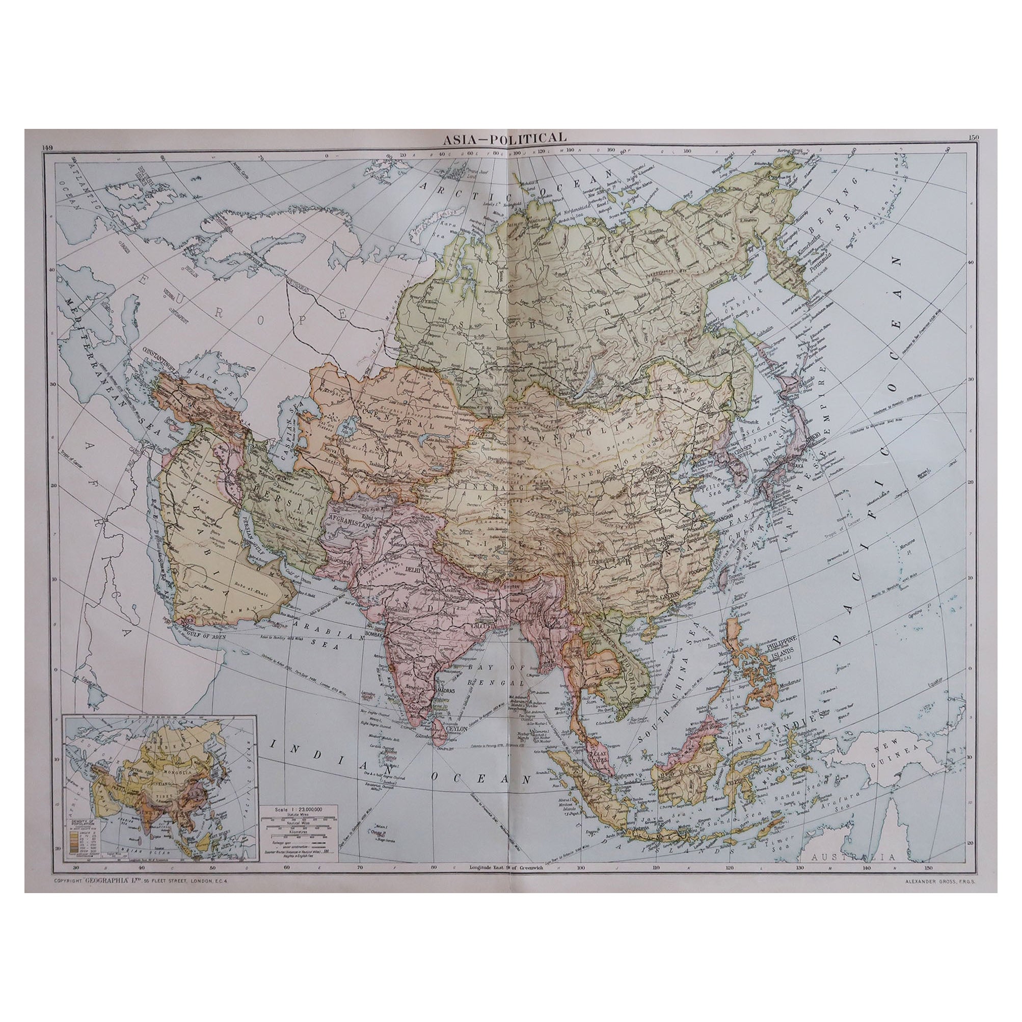
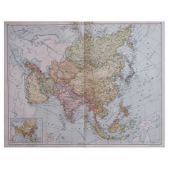
- Large Original Vintage Map of Asia, circa 1920Located in St Annes, LancashireGreat map of Asia Original color. Good condition Published by Alexander Gross Unframed.Category
Vintage 1920s English Edwardian Maps
MaterialsPaper
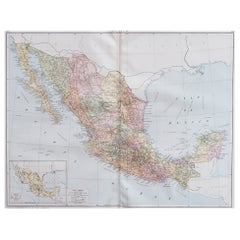
- Large Original Vintage Map of Mexico, circa 1920Located in St Annes, LancashireGreat map of Mexico Original color. Good condition Published by Alexander Gross Unframed.Category
Vintage 1920s English Edwardian Maps
MaterialsPaper
- Large Original Vintage Map of Israel, circa 1920Located in St Annes, LancashireGreat map of Israel Original color. Good condition Published by Alexander Gross Unframed.Category
Vintage 1920s English Edwardian Maps
MaterialsPaper
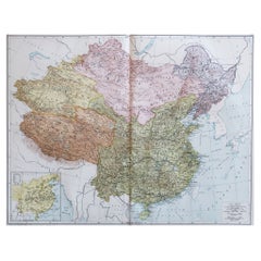
- Large Original Vintage Map of China, circa 1920Located in St Annes, LancashireGreat map of China. Original color. Good condition. Published by Alexander Gross Unframed.Category
Vintage 1920s English Edwardian Maps
MaterialsPaper
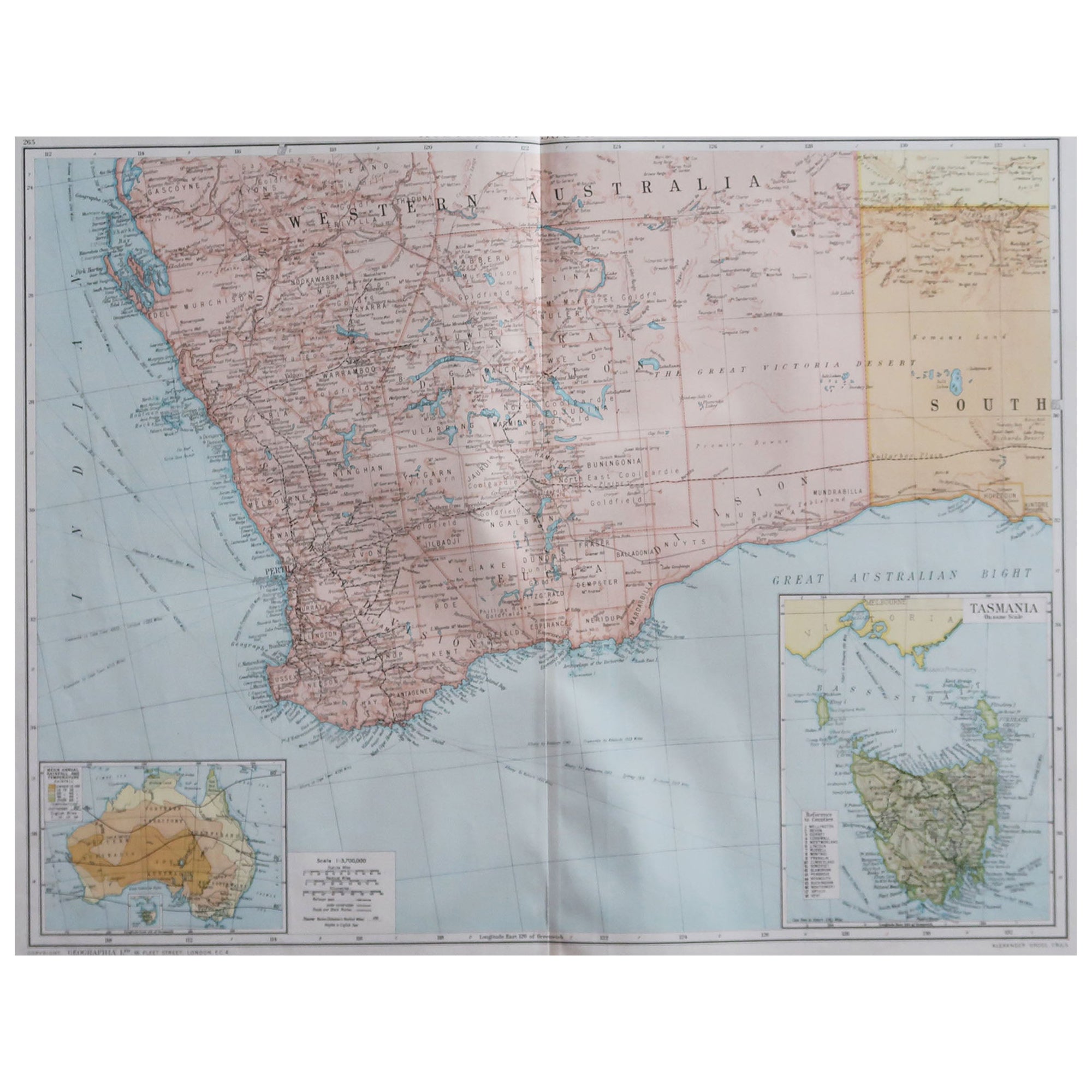
- Large Original Vintage Map of Western Australia, circa 1920Located in St Annes, LancashireGreat map of Western Australia with a vignette of Tasmania. Original color. Good condition Published by Alexander Gross Unframed.Category
Vintage 1920s English Edwardian Maps
MaterialsPaper


You May Also Like
- Antique Map of North America by Dufour 'circa 1834'Located in Langweer, NLAntique map titled 'Amérique Septentrionale'. Uncommon map of North America. Published by or after A.H. Dufour, circa 1834. Source unknown, to be determined.Category
Antique Mid-19th Century Maps
MaterialsPaper
- Antique Map of North East Borneo and North Sulawesi by P.M.G. VandermaelenLocated in Langweer, NLContemporary colored lithographed map. Relief shown pictorially and by hachures. Covers North Eastern Borneo and part of Northern Sulawesi.Category
Antique Early 19th Century Maps
MaterialsPaper
- Large Antique 1859 Map of North AmericaLocated in Sag Harbor, NYThis Map was made by Augustus Mitchell in 1859 It is in amazing condition for being 163 years old. This price is for the rolled up easy to ship version of this piece. I will be Frami...Category
Antique Mid-19th Century American Maps
MaterialsCanvas, Paper

- Antique Map of Coiba Island, Panama, South America, C.1740Located in Langweer, NLAntique map titled 'Plan de la partie orientale de l'Isle de Quibo'. Map of the eastside of Coiba Island (Quibo), Panama, showing the shoreline around Port de Dames indicating soft s...Category
Antique 18th Century Maps
MaterialsPaper
- Antique Map of North America, 1821Located in Langweer, NLAntique map of America titled 'Carte de l'Amerique septentrionale'. Scarce map of North America, shortly after the Louisiana Purchase and the first ...Category
Antique 19th Century Maps
MaterialsPaper
- Antique Map of Asia by Dufour, circa 1834Located in Langweer, NLAntique map titled 'Asie par A.H. Dufour'. Uncommon map of Asia. Published by or after A.H. Dufour, circa 1834. Source unknown, to be determined.Category
Antique Mid-19th Century Maps
MaterialsPaper


Recently Viewed
View AllMore Ways To Browse
Original Vintage Maps
Large Vintage Maps
American Edwardian Furniture
Large Vintage Map
Nautical Chart Nautical Chart
Hemispheres Map
Antique Travel Map
Portugal Map
Used Nautical Charts
Map Of Portugal
Antique World Chart
Turkish Map
Antique Char
Map Of Great Britain
Hand Painted Antique Map
Antique Furniture Depot
Antique Map Mexico
Hemisphere Antiques