Items Similar to Large Scale Antique Scroll Map of Lincolnshire, England, Dated 1778


Want more images or videos?
Request additional images or videos from the seller
1 of 12
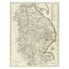
Large Scale Antique Scroll Map of Lincolnshire, England, Dated 1778
About the Item
Wonderful scroll map of Lincolnshire
By Captain Armstrong, 1778
Copper plate engraving on paper laid on canvas
Original ebonized wood frame with lovely turned finials
The map can be rolled up for easy transport
There are signs of distress but no serious problems.
- Dimensions:Height: 84 in (213.36 cm)Width: 60 in (152.4 cm)Depth: 1.5 in (3.81 cm)
- Style:Georgian (Of the Period)
- Materials and Techniques:
- Place of Origin:
- Period:1770-1779
- Date of Manufacture:1778
- Condition:Wear consistent with age and use.
- Seller Location:St Annes, GB
- Reference Number:
About the Seller
4.9
Platinum Seller
These expertly vetted sellers are 1stDibs' most experienced sellers and are rated highest by our customers.
1stDibs seller since 2016
2,558 sales on 1stDibs
Typical response time: <1 hour
Associations
International Confederation of Art and Antique Dealers' Associations
- ShippingRetrieving quote...Ships From: St Annes, United Kingdom
- Return PolicyA return for this item may be initiated within 3 days of delivery.
More From This SellerView All
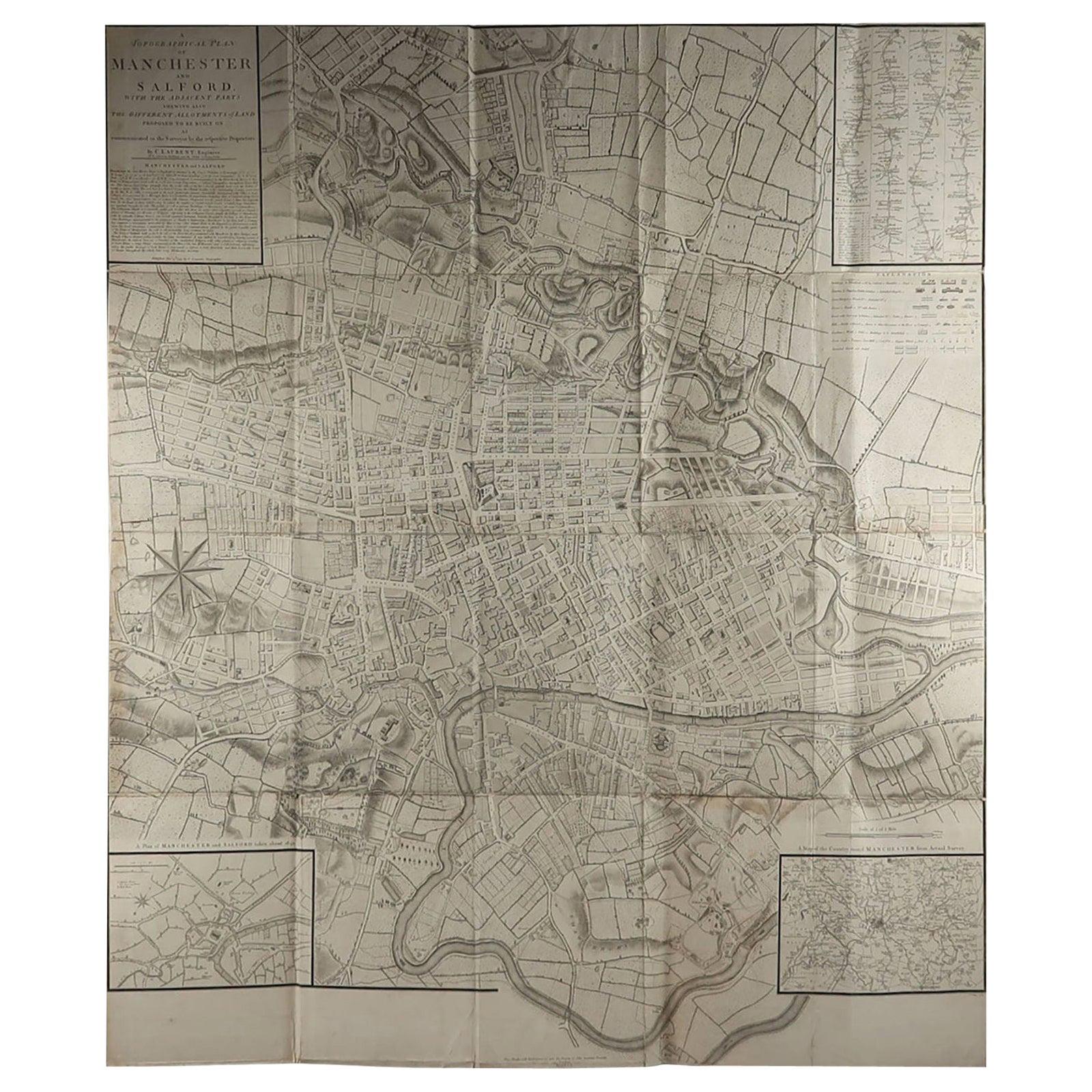
- Large Original Antique Folding Map of Manchester, England, Dated 1793Located in St Annes, LancashireSuperb map of Manchester and Salford Folding map. Printed on paper laid on to the original canvas Unframed. Published by C. Laurent, 1793. ...Category
Antique 1790s English Georgian Maps
MaterialsCanvas, Paper
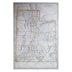
- Large Original Antique Map of Utah, USA, 1894By Rand McNally & Co.Located in St Annes, LancashireFabulous map of Utah Original color By Rand, McNally & Co. Published, 1894 Unframed Free shipping.Category
Antique 1890s American Maps
MaterialsPaper
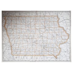
- Large Original Antique Map of Iowa, USA, 1894By Rand McNally & Co.Located in St Annes, LancashireFabulous map of Iowa. Original color. By Rand, McNally & Co. Published, 1894. Unframed. Free shipping.Category
Antique 1890s American Maps
MaterialsPaper
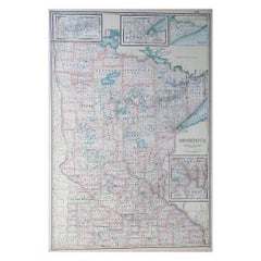
- Large Original Antique Map of Minnesota, USA, C.1900Located in St Annes, LancashireFabulous map of Minnesota Original color Engraved and printed by the George F. Cram Company, Indianapolis. Published, C.1900 Unframed Repair to a small tear bottom left corner ...Category
Antique 1890s American Maps
MaterialsPaper
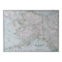
- Large Original Antique Map of Alaska, USA, C.1900Located in St Annes, LancashireFabulous map of Alaska Original color Engraved and printed by the George F. Cram Company, Indianapolis. Published, C.1900 Unframed Free shipping.Category
Antique 1890s American Maps
MaterialsPaper
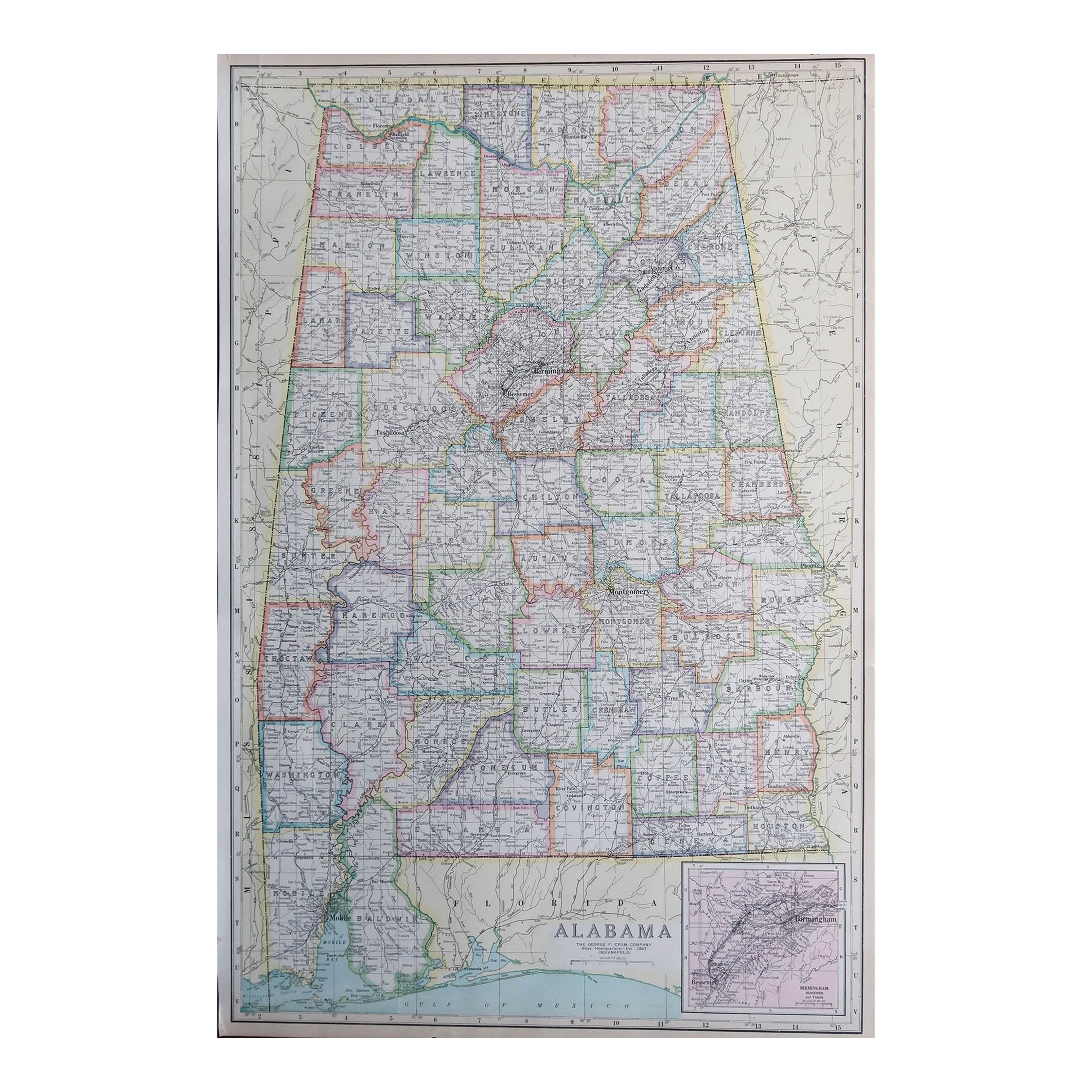
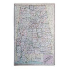
- Large Original Antique Map of Alabama, USA, C.1900Located in St Annes, LancashireFabulous map of Alabama Original color Engraved and printed by the George F. Cram Company, Indianapolis. Published, C.1900 Unframed Repair to a minor edge tear top left corner ...Category
Antique 1890s American Maps
MaterialsPaper

You May Also Like
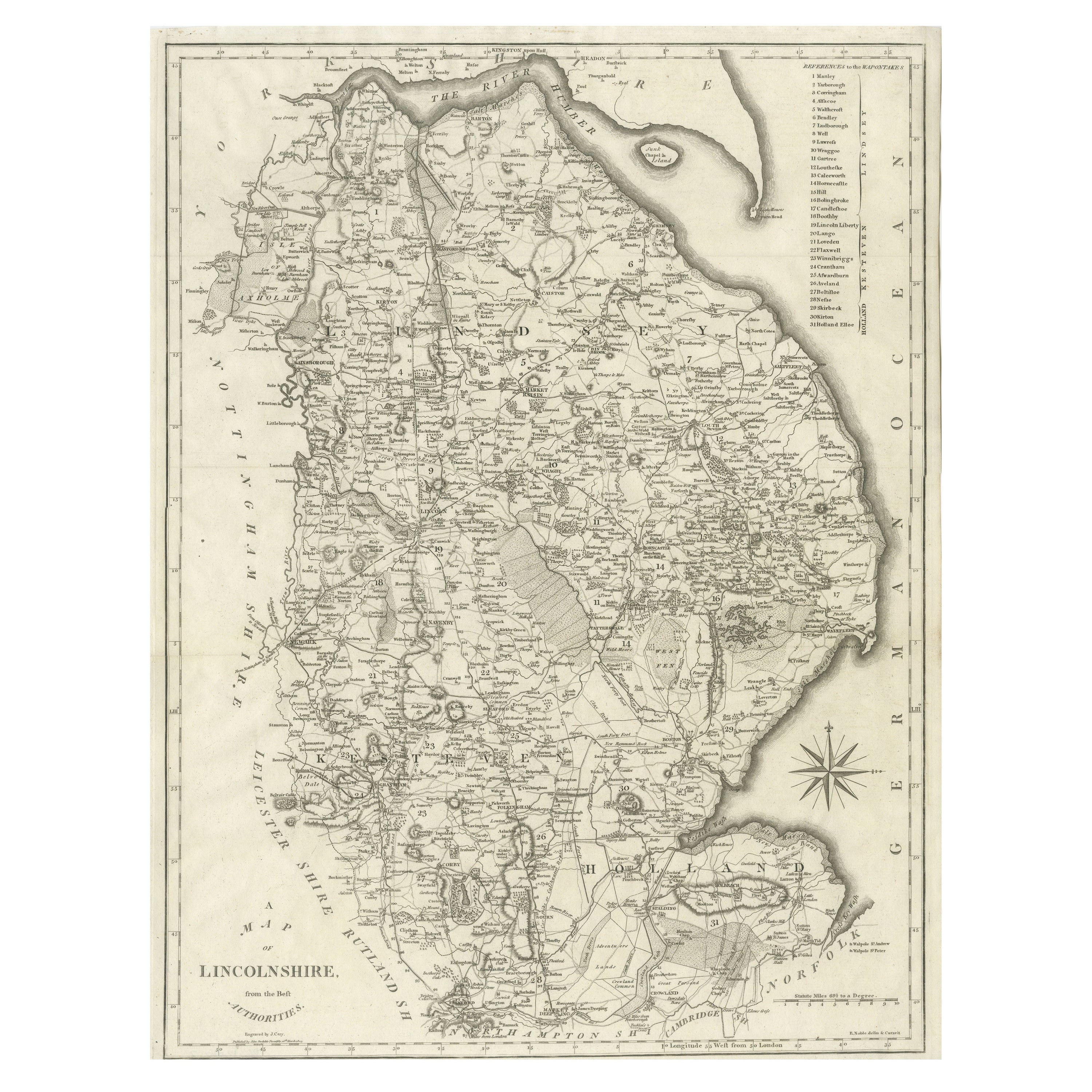
- Large Antique County Map of Lincolnshire, EnglandLocated in Langweer, NLAntique map titled 'A Map of Lincolnshire from the best Authorities'. Original old county map of Lincolnshire, England. Engraved by John Cary. Originates from 'New British Atlas' by ...Category
Antique Early 19th Century Maps
MaterialsPaper
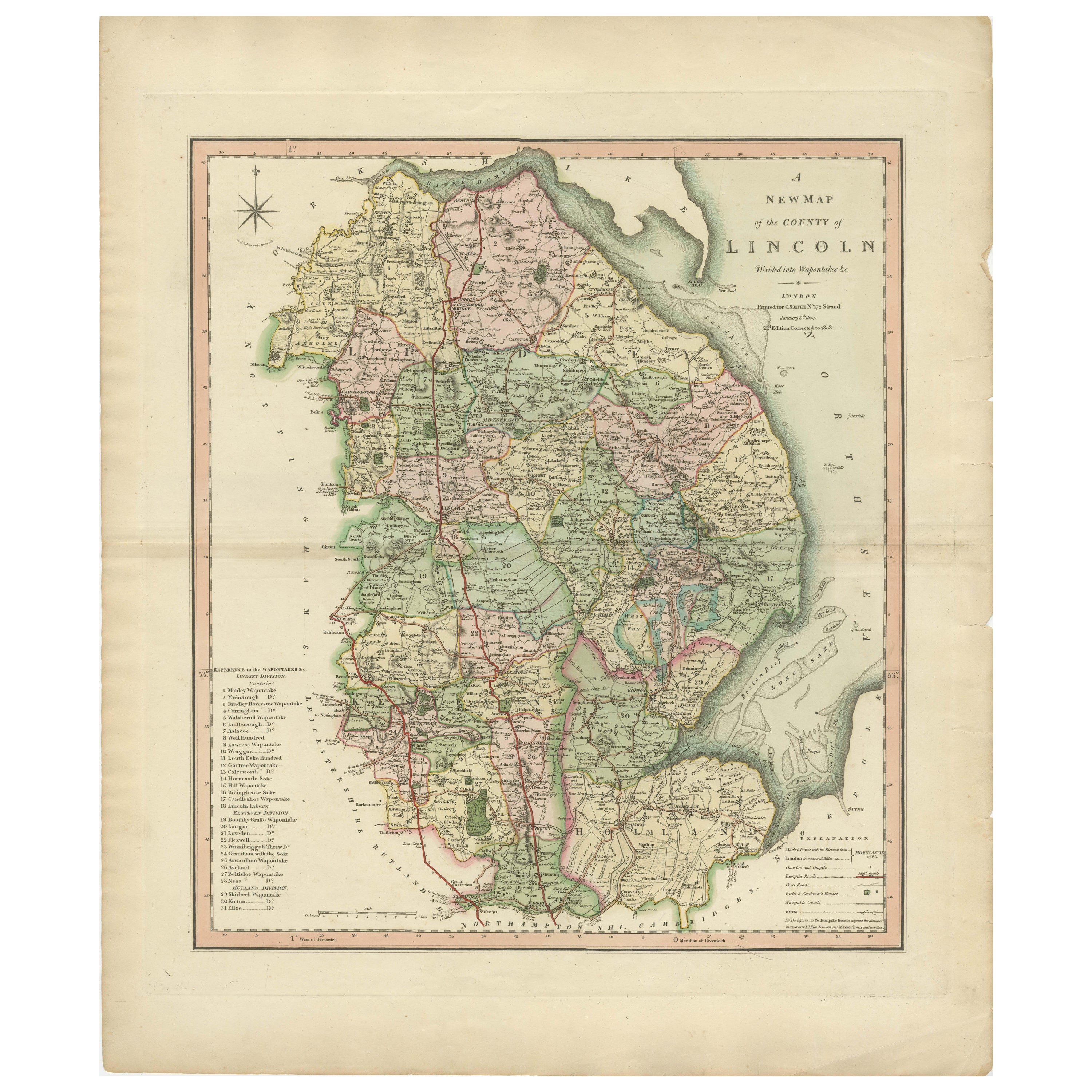
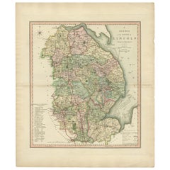
- Antique Decorative County Map of Lincolnshire, England, 1804Located in Langweer, NLAntique county map of Lincolnshire first published circa 1800 Cities illustrated include Grantham, Spalding, Boston, and Market Raisin. Charles Smith was a cartographer working in...Category
Antique Early 1800s Maps
MaterialsPaper
- Gold Leaf Foil Pictorial Plan Map of the West Country of England Antique StyleLocated in GBWe are delighted to offer for sale this lovely Antique style pictorial plan map of the West Country of England etched in gold leaf foil This is a very interesting and decorative p...Category
20th Century English Adam Style Maps
MaterialsGold Leaf
- Antique Map of America by Vaugondy, 1778Located in Langweer, NLAntique map titled 'Amerique ou Indes Occidentales (..)'. Vaugondy's map of America, pre-dating information from any of the Cook Voyages. The NW Coast of Amer...Category
Antique Late 18th Century Maps
MaterialsPaper
- Antique Map of Asia by Dussy, 1778Located in Langweer, NLAntique map of Asia titled 'Indostan presqu'isles de l'Inde, Chine, Tartarie Independante'. Depicting South-East Asia including Hindustan, India an...Category
Antique Late 18th Century French Maps
MaterialsPaper
- Large Antique Wall Map of Friesland by Vegelin van Claerbergen, 1739Located in Langweer, NLAntique map titled 'Nieuwe Caert van Frieslant, Vermeerdert en verbetert op order der Ed. Mo. Heeren Gedeputeerde Staeten'. Rare and large attractive wall map of Friesland, the so-called 'Vegelin-map'. It shows the region of Oostergo, Westergo and Zevenwolden in Friesland, the Netherlands. Decorated with coats of arms of Friesland, Oostergo, Zevenwolden and other regions and cities/villages of Friesland. Artists and Engravers: For this particular map, Bernhardus Schotanus à Sterringa prepared the plates. However, these plates were never published in his 'Schotanus Atlas'. He wanted the plates to be published as a large wall map...Category
Antique 18th Century Maps
MaterialsPaper


Recently Viewed
View AllMore Ways To Browse
Framed England
Antique Wood Scale
Antique Scales Collectables
Antique Scales Collectibles
Antique Scales Collectable Scales
Copper Plate Engraving
Wood Antique Finials
Antique Scale Plate
Framed Maps
Framed Map
Large Wood Finial
Scale Map
Turned Wood Furniture With Finials
England Engraving Framed
Antique Map Framing
Antique Map Framed
Antique Maps Framed
Antique Map Framers