Items Similar to Late 16th Century Sheet with Copper Engravings of India, Pakistan, etc, 1598
Want more images or videos?
Request additional images or videos from the seller
1 of 7
Late 16th Century Sheet with Copper Engravings of India, Pakistan, etc, 1598
About the Item
One sheet with two engraved maps, one on each site, and text in Italian. Late 16th century copper engravings in great condition, considering its age.
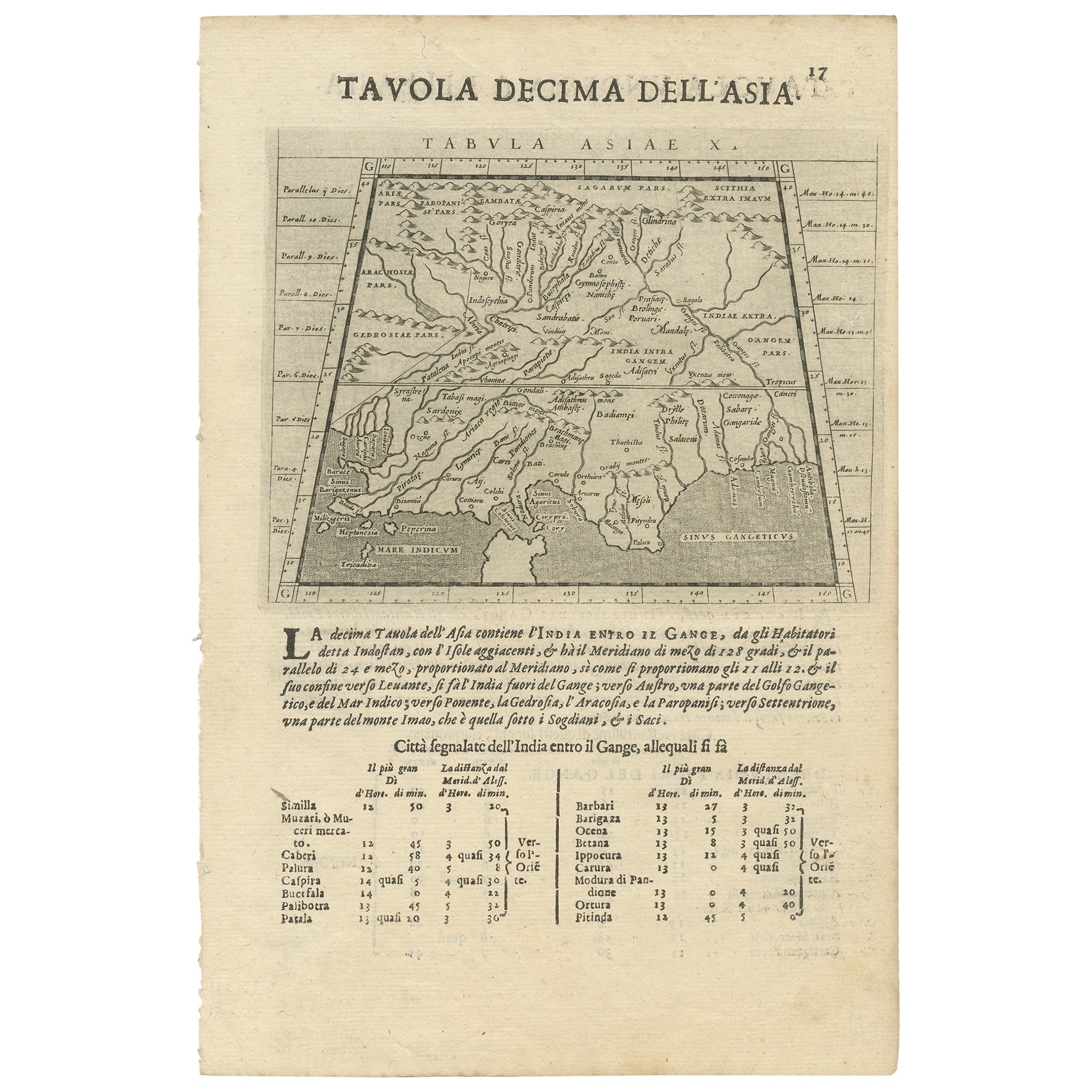
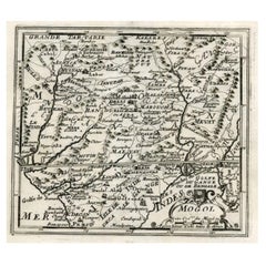
"Tavola Decima Dell'Asia" - Tabula Asiae X" Plate X (10). Pakistan, Cashmir, Bangla Desh, North-India between Indus and Ganges
Type of print: Copper etching
Artist: Girolamo Porro after Ptolemy
Published in: "Geografia cioe Descrittione Universale della Terra"
Publisher: Gio. Battista & Giorgio Galignani Fratelli
Edition: Italian edition
Editor: Giovanni Antonio Magini (1555-1617)
Text: Italian. Complete on front and on reverse side: Tavola Undecicima Asiae (11)
Published in: Venice
Date: 1598
Measurements:
Map size: Ca. 12,5 x 17 cm (ca. 4.9 x 6.7")
Page size: Ca. 28,5 x 19 cm (ca. 11.2 x 7.5")
Condition: Very minor traces of age.
REVERSE SIDE:
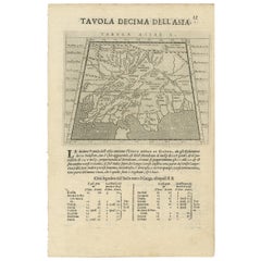
"Tavola Undecima Dell'Asia" - Tabula Asiae XI" Plate XI (11). Bangla Desh, Northeast-India,
Myanmar (Birma), Laos, Thailand, Southwest-China, Singapore
Type of print: Copper etching
Artist: Girolamo Porro after Ptolemy
Published in:"Geografia cioe Descrittione Universale della Terra"
Publisher: Gio. Battista & Giorgio Galignani Fratelli
Edition: Italian edition
Editor: Giovanni Antonio Magini (1555-1617)
Text:Italian. Complete on front and on reverse side: Tavola Decima Asiae
Published in: Venice
Date: 1598
Measurements:
Map size: Ca. 12,5 x 17 cm (ca. 4.9 x 6.7")
Page size: Ca. 28,5 x 19 cm (ca. 11.2 x 7.5")
Condition: Very minor traces of age.
- Dimensions:Height: 11.82 in (30 cm)Width: 8.08 in (20.5 cm)Depth: 0 in (0.02 mm)
- Materials and Techniques:
- Period:
- Date of Manufacture:1598
- Condition:Excellent condition, considering age. Very light browning of the paper. Check the image carefully.
- Seller Location:Langweer, NL
- Reference Number:
About the Seller
5.0
Platinum Seller
These expertly vetted sellers are 1stDibs' most experienced sellers and are rated highest by our customers.
Established in 2009
1stDibs seller since 2017
1,919 sales on 1stDibs
Typical response time: <1 hour
- ShippingRetrieving quote...Ships From: Langweer, Netherlands
- Return PolicyA return for this item may be initiated within 14 days of delivery.
More From This SellerView All
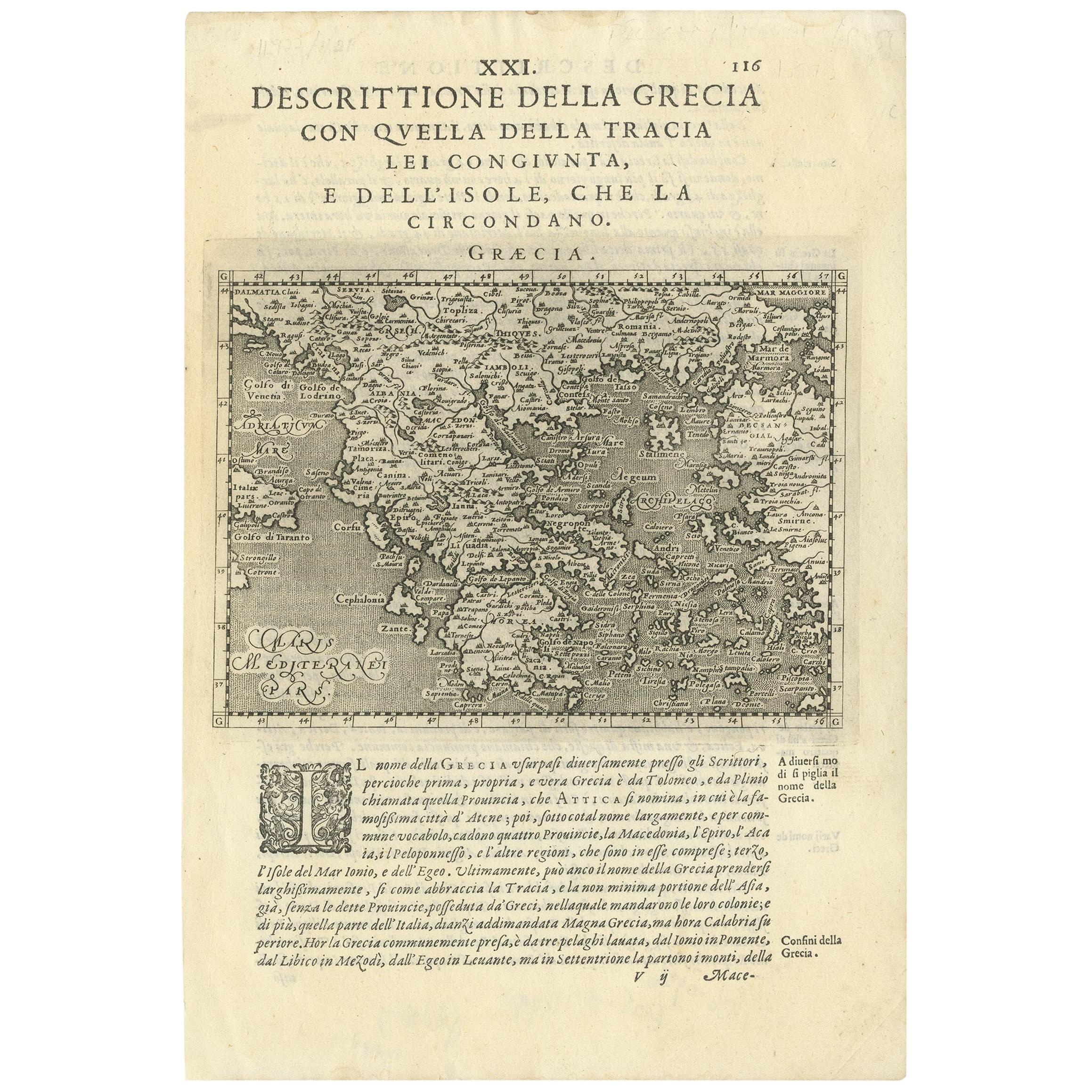
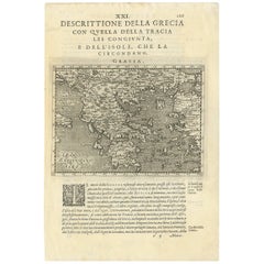
- Rare Original 16th Century Antique Map of Greece, 1598Located in Langweer, NLBeautiful and rare antique map of Greece with Albania, Mecedonia, Romania, Dalmatia and the peninsula of Salento to the Golf of Taranto. Also clearly shown the islands of the Aegaian...Category
Antique 16th Century Maps
MaterialsPaper
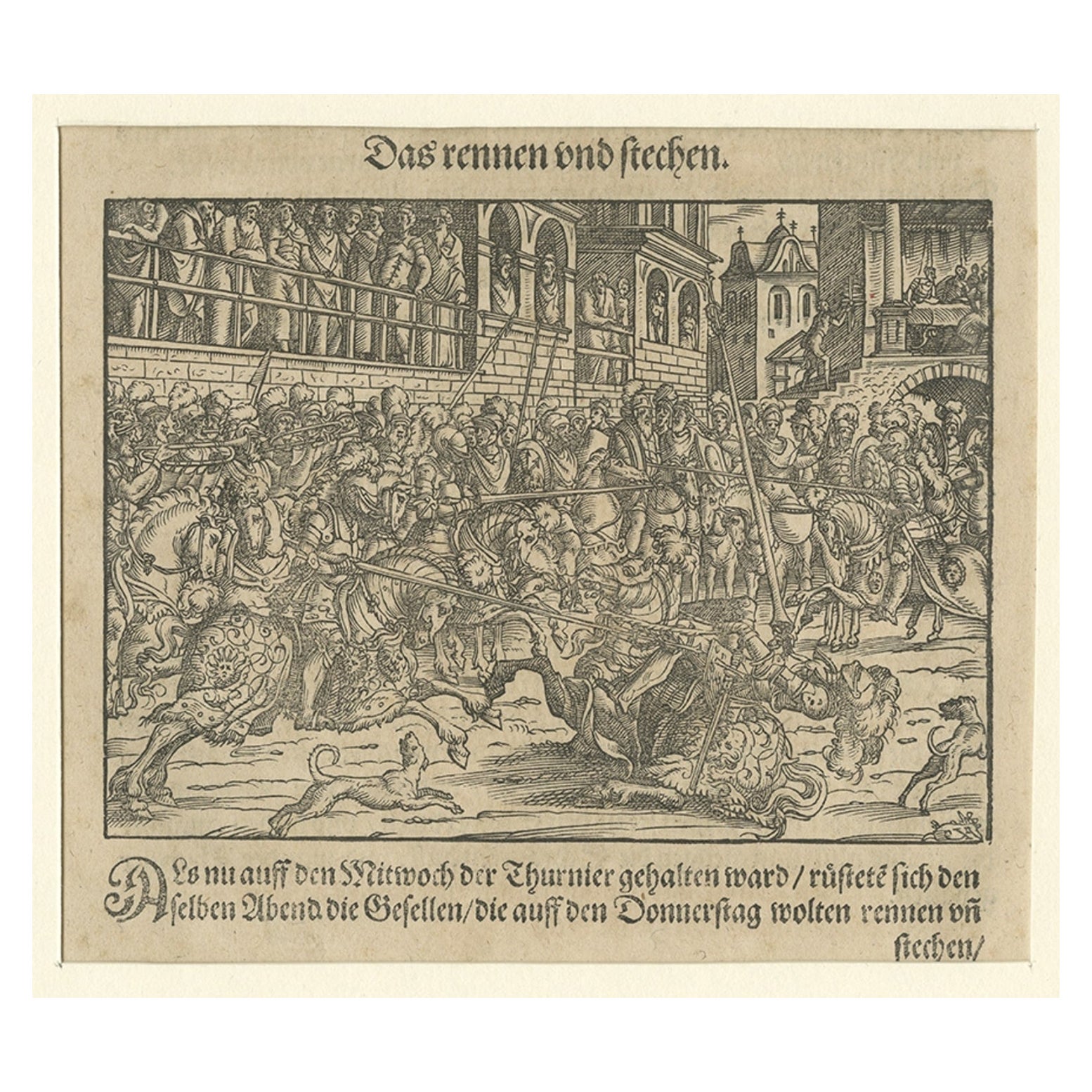
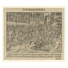
- Original 16th Century Engraving of a Medieval Tournament, ca.1578Located in Langweer, NLAntique print titled 'Das rennen und stechen'. Engraving of a Medieval tournament. This print originates from 'Thurnier Buch. Von Anfang, Ursachen, ursprung und herkommen (..)' b...Category
Antique 16th Century Prints
MaterialsPaper
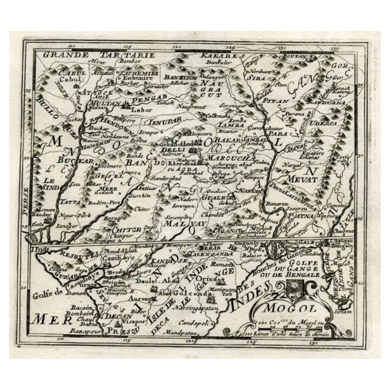
- Map of Northern India and Pakistan 'Mogol', Showing Kabul, Delhi Etc., 1758Located in Langweer, NLAntique map titled 'Mogol'. Map of Northern India and Pakistan ('Mogol'), showing Kabul, Delhi and surroundings. This map originates from 'Kort begrip der Oude en Nieuwe Staatkun...Category
Antique 1750s Maps
MaterialsPaper
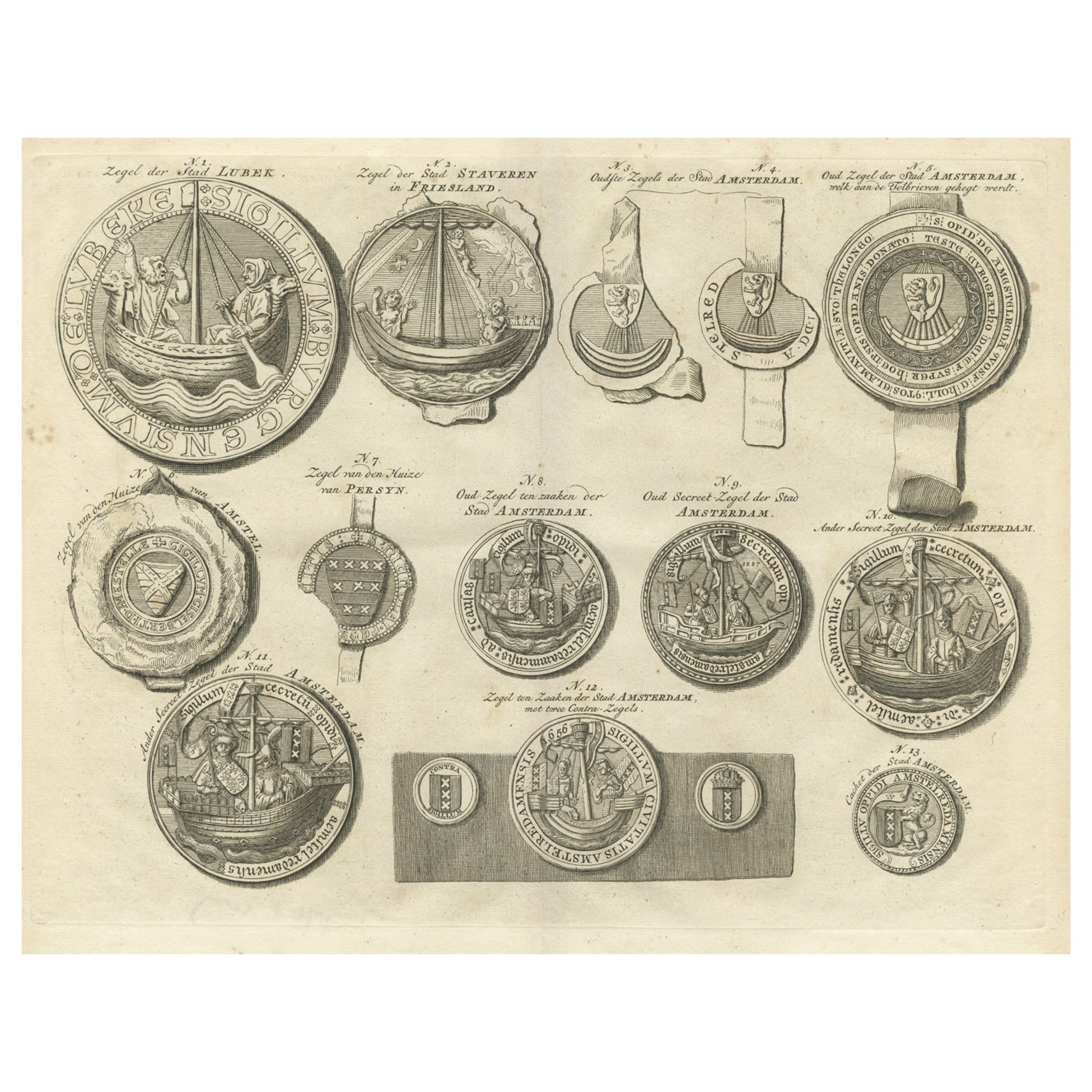
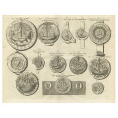
- Original Old Copper Engravings of Seals of Lubeck, Stavoren, Amsterdam etc. 1767Located in Langweer, NLAntique print titled ‚Zegel der stad Lubek (..)’. Seals of the city of Lubeck and others: Stavoren, Amsterdam (8x), van Amstel, Persijn (..). This print originates from ‘Amsterda...Category
Antique 1760s Prints
MaterialsPaper
- Two Maps of Asia on One Sheet, India, Bangladesh and Malaysia & Burma etc., 1617Located in Langweer, NLAntique map titled 'Tabula Asiae'. Two maps of Asia on one sheet, recto and verso. The recto features an interesting map of India, Bangladesh and the Ganges River. On the verso, ...Category
Antique 1610s Maps
MaterialsPaper
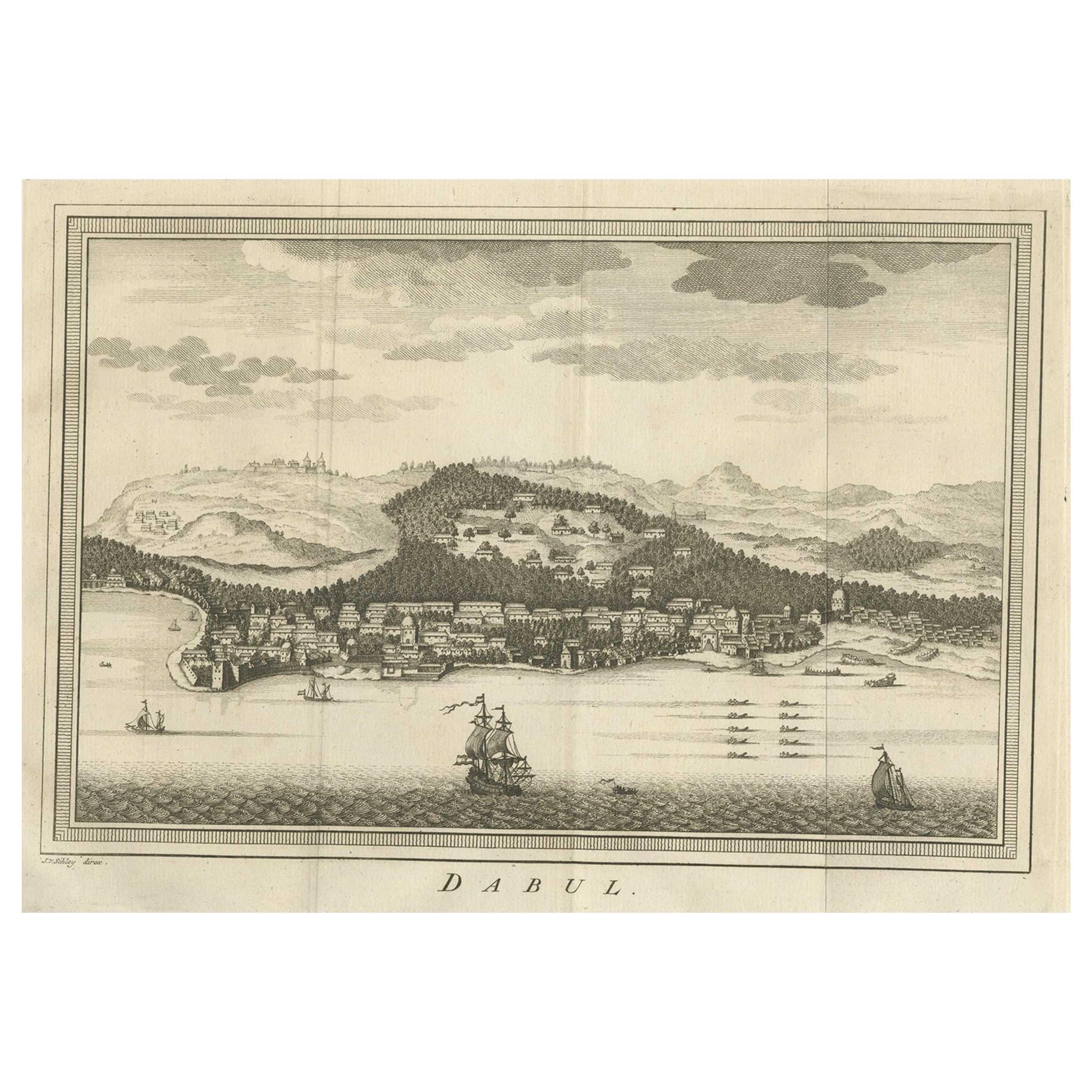
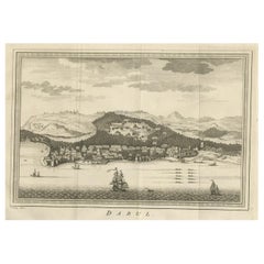
- Old Copper Engraving of the Port City Dabhol in India, 1757Located in Langweer, NLAntique print titled 'Dabul'. Old print of the port city Dabhol in India. In the 15th and 16th centuries, Dabul was an opulent Muslim trade center. Around 1660 it was annexed to th...Category
Antique 1750s Maps
MaterialsPaper
You May Also Like
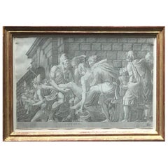
- 16th Century School of Fontainebleau EngravingBy Master F.G.Located in New York, NYThis 16th century French engraving illustrates an episode in the Trojan War – although the actual one illustrated is in question. According to recent scholarship, it depicts the corp...Category
Antique 16th Century French Renaissance Prints
MaterialsPaper
- Northern Scotland: A 16th Century Hand-colored Map by MercatorBy Gerard MercatorLocated in Alamo, CAA framed hand-colored 16th century map of Northern Scotland by Gerard Mercator entitled "Scotiae pars Septentrionalis", published in Amsterdam in 1636. It is a highly detailed map of the northern part of Scotland, with the northwest Highlands and the cities Inverness and Aberdeen, as well as the Orkney Islands and the Hebrides. There is a decorative title cartouche in the upper left corner. The map is presented in an antiqued brown wood...Category
Antique 16th Century Dutch Maps
MaterialsPaper
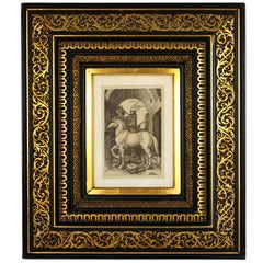
- Albrecht Dürer "The Small Horse, " 19th Century Copper Plate EngravingBy Albrecht DürerLocated in Barcelona, ES"The Small Horse" copper plate engraving by Albrecht Dürer, circa 1505. This is a 19th century engraving, printed in black on laid paper, framed by a beautiful gilt and ebonized carv...Category
Antique Late 19th Century French Renaissance Prints
MaterialsWood, Paper
- Antoine Lafrery Set of 6 Engraving "Speculun Romanae Magnificen" 16th CenturyLocated in Beuzevillette, FRBeautiful and very rare set of six engravings extracted from the work entitled “speculun romanae superbeiae” produced between 1554 and 1573 by An...Category
Antique 16th Century Italian Renaissance Picture Frames
MaterialsPaper
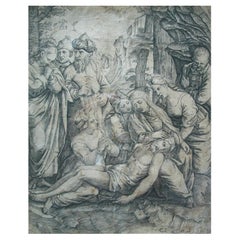
- Marcantonio Raimondi 'Pupil of, Antique Engraving, Italy, Mid-16th CenturyLocated in Chatham, ONA very rare - finest quality - mid 16th century Italian Renaissance engraving (after Raphael) by an anonymous pupil of MARCANTONIO RAIMONDI (1480-...Category
Antique 16th Century Italian Renaissance Prints
MaterialsPaper
- Prussia, Poland, N. Germany, Etc: A Hand-colored 17th Century Map by JanssoniusBy Johannes JanssoniusLocated in Alamo, CAThis is an attractive hand-colored copperplate engraved 17th century map of Prussia entitled "Prussia Accurate Descripta a Gasparo Henneberg Erlichensi", published in Amsterdam by Joannes Janssonius in 1664. This very detailed map from the golden age of Dutch cartography includes present-day Poland, Latvia, Lithuania, Estonia and portions of Germany. This highly detailed map is embellished by three ornate pink, red, mint green and gold...Category
Antique Mid-17th Century Dutch Maps
MaterialsPaper


Recently Viewed
View AllMore Ways To Browse
Antique Copper Engravings
Copper Sheet
Italian Late 16th Century
16th Century Plate
China Engraving
Engraving Chinese
16th Engraving
16th Century Engraving
India Burma
Pakistani Artist
Used Furniture Venice Ca
Antique In Pakistan
Giorgio Della
Antique Furniture In Pakistan
Thai Artists
Antonio Asia
Giovanni Copper Engravings
Singapore Antique