Items Similar to Map of Philadelphia with a Historical Tribute to its Volunteer Fire Companies
Want more images or videos?
Request additional images or videos from the seller
1 of 6
Map of Philadelphia with a Historical Tribute to its Volunteer Fire Companies
About the Item
This elaborate map of Philadelphia in Pennsylvania served as a historical tribute to the city's first volunteer fire departments. It was drawn by Jacob Riegel and published by The Insurance Company of North America (INA). Founded in 1792, the INA is the oldest insurance company in the United States. At center is a reproduced version of A.P. Folie's plan of Philadelphia, which was issued only two years after the founding of the INA at a time when the city served as the Nation's capital. Added to the map are the locations of 36 "Engine & Hose Houses" and 33 important buildings with a key naming these locations at left. Flanking the map are vignettes of fire fighting scenes, with various uniforms and fire engines shown at top and bottom. The composition is completed by a decorative title cartouche and border.
- Dimensions:Height: 21.42 in (54.4 cm)Width: 29.89 in (75.9 cm)Depth: 0 in (0.02 mm)
- Materials and Techniques:
- Period:
- Date of Manufacture:1938
- Condition:A colorful example with some minor creasing. There are a few narrow dampstains along the top sheet edge and some minor edge tears along the bottom sheet edge.
- Seller Location:Langweer, NL
- Reference Number:
About the Seller
5.0
Platinum Seller
These expertly vetted sellers are 1stDibs' most experienced sellers and are rated highest by our customers.
Established in 2009
1stDibs seller since 2017
1,948 sales on 1stDibs
Typical response time: <1 hour
- ShippingRetrieving quote...Ships From: Langweer, Netherlands
- Return PolicyA return for this item may be initiated within 14 days of delivery.
More From This SellerView All
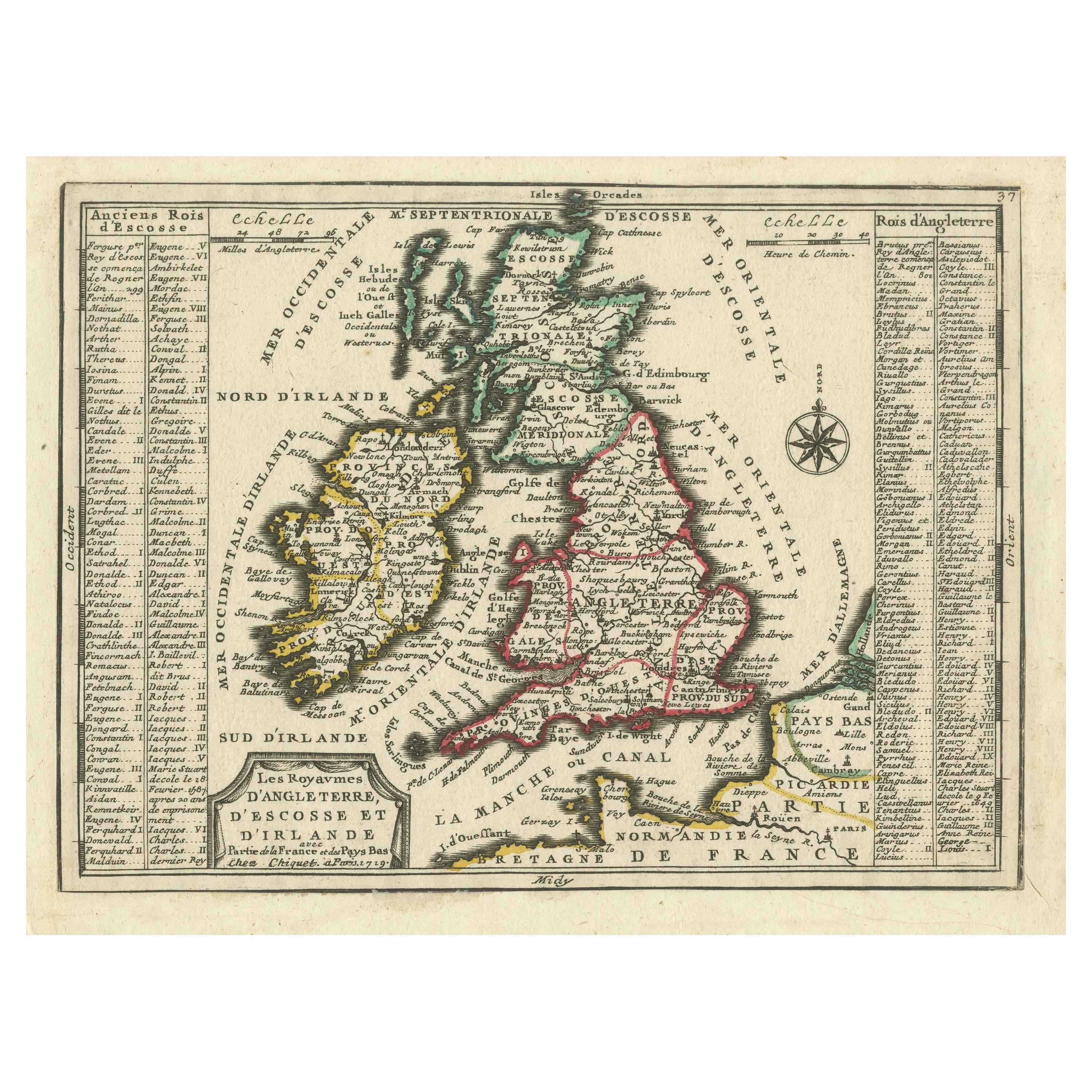
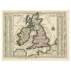
- Map of the British Isles with Historical Kings, 1719Located in Langweer, NLThis antique map, titled "Les Royaumes d'Angleterre d'Escosse et d'Irlande," offers a detailed view of the British Isles, including England, Wales, Scotland, and Ireland. Additionall...Category
Antique Early 18th Century Maps
MaterialsPaper
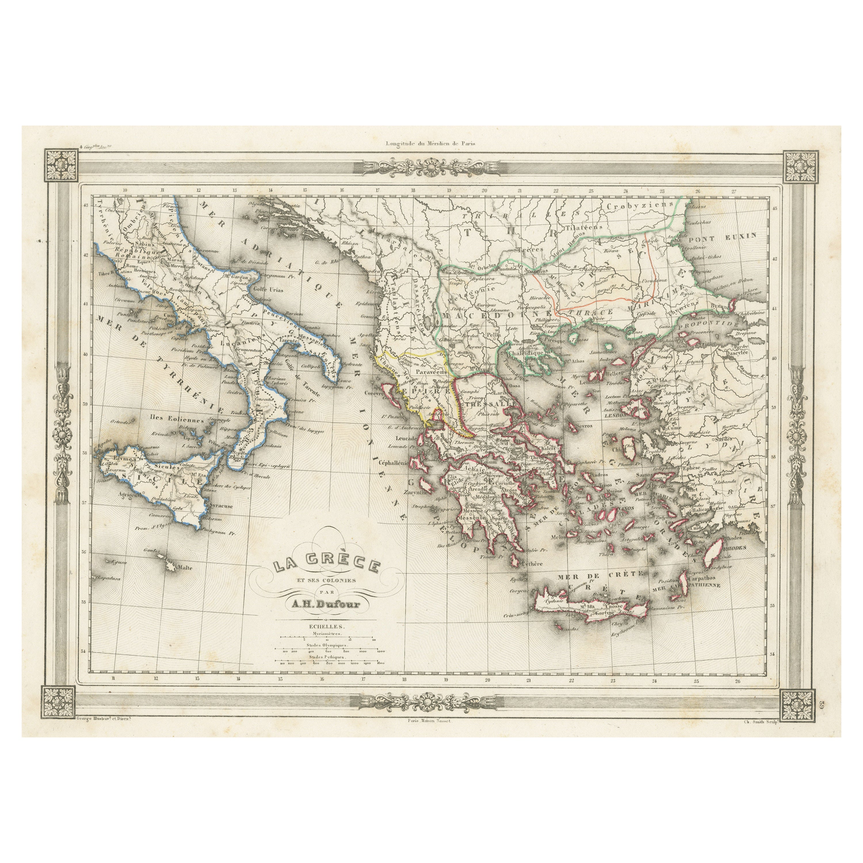
- Antique Map of Greece and Its Colonies, with Frame Style BorderLocated in Langweer, NLAntique map titled 'La Grèce'. Attractive map of Greece and its Colonies. The map covers from the southern part of Italy, including Sicily, to the western parts of Asia Minor and fro...Category
Antique Mid-19th Century Maps
MaterialsPaper
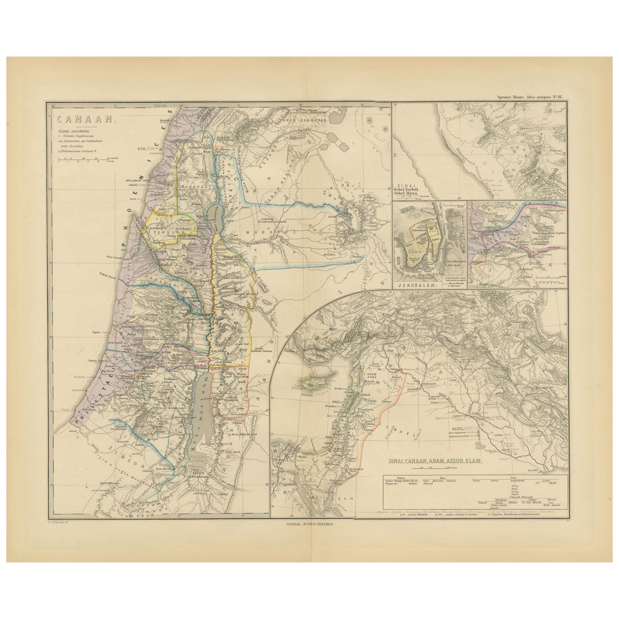
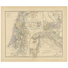
- Historical Map of Canaan with Insets of Jerusalem and Surrounding Regions, 1880Located in Langweer, NLThe map titled "CANAAN" depicts the historical region known as Canaan, located in the Levant, which corresponds to modern-day Israel, Palestinian territories, Lebanon, and parts of S...Category
Antique 1880s Maps
MaterialsPaper
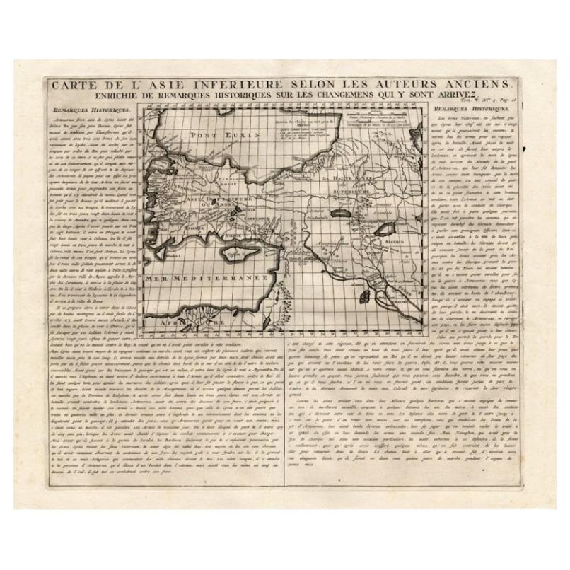
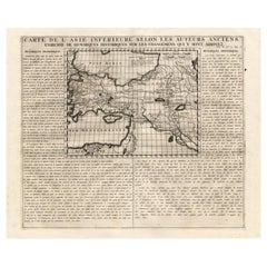
- Detailed Antique Map of Asia Minor & Cyprus with Historical Notes, 1732Located in Langweer, NLAntique map titled 'Carte De L'Asie Inferieure Selon Les Auteurs Anciens (..)'. Detailed map of Asia Minor & Cyprus. With historical notes. This original old antique print / plate or...Category
Antique 18th Century Maps
MaterialsPaper
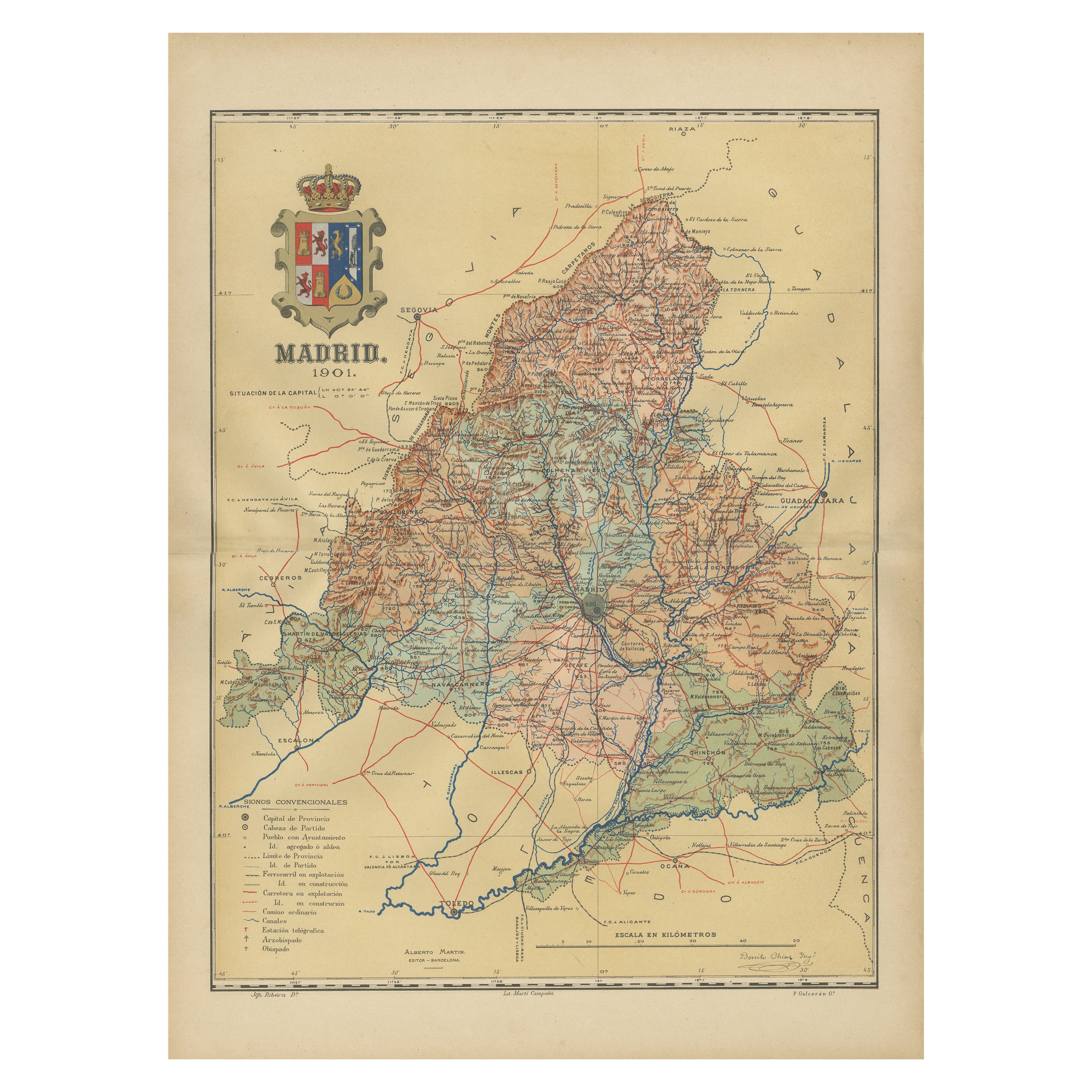
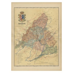
- Madrid 1901: A Historical Map of Spain's Capital ProvinceLocated in Langweer, NLThe map is of the province of Madrid, the capital region of Spain, as it appeared in 1901. Here are the key features it displays: The map shows the central part of Spain, with the Guadarrama mountain range prominently visible, marking the natural border to the north of Madrid. Blue lines likely indicate rivers, including the Manzanares River, which flows through Madrid, and the Jarama River, a tributary to the Tagus. Red lines depict the roads and railways, outlining the infrastructure that connects Madrid's various towns and cities within the province and beyond. Symbols and labels mark the locations of cities, towns, and villages, with Madrid itself likely being the focal point. Dotted lines may represent the administrative divisions within the province. The map includes a legend (Signos Convencionales) that explains the symbols used for provincial capitals, roads, railways, and other geographic features. The coat of arms of Madrid, featuring a bear and a strawberry tree (madroño), is prominently featured, symbolizing the city's and the province's historical coat of arms. About the province of Madrid: Madrid is not only the capital of Spain but also the heart of the Iberian Peninsula, both geographically and politically. The city is renowned for its rich repositories of European art, including the Prado Museum's works by Goya, Velázquez, and other Spanish masters. The province of Madrid is characterized by a blend of historical and modern elements, with a rich cultural life that includes theater, opera, and flamenco, as well as gastronomy that features a mix of traditional Spanish dishes and international cuisine...Category
Antique Early 1900s Maps
MaterialsPaper
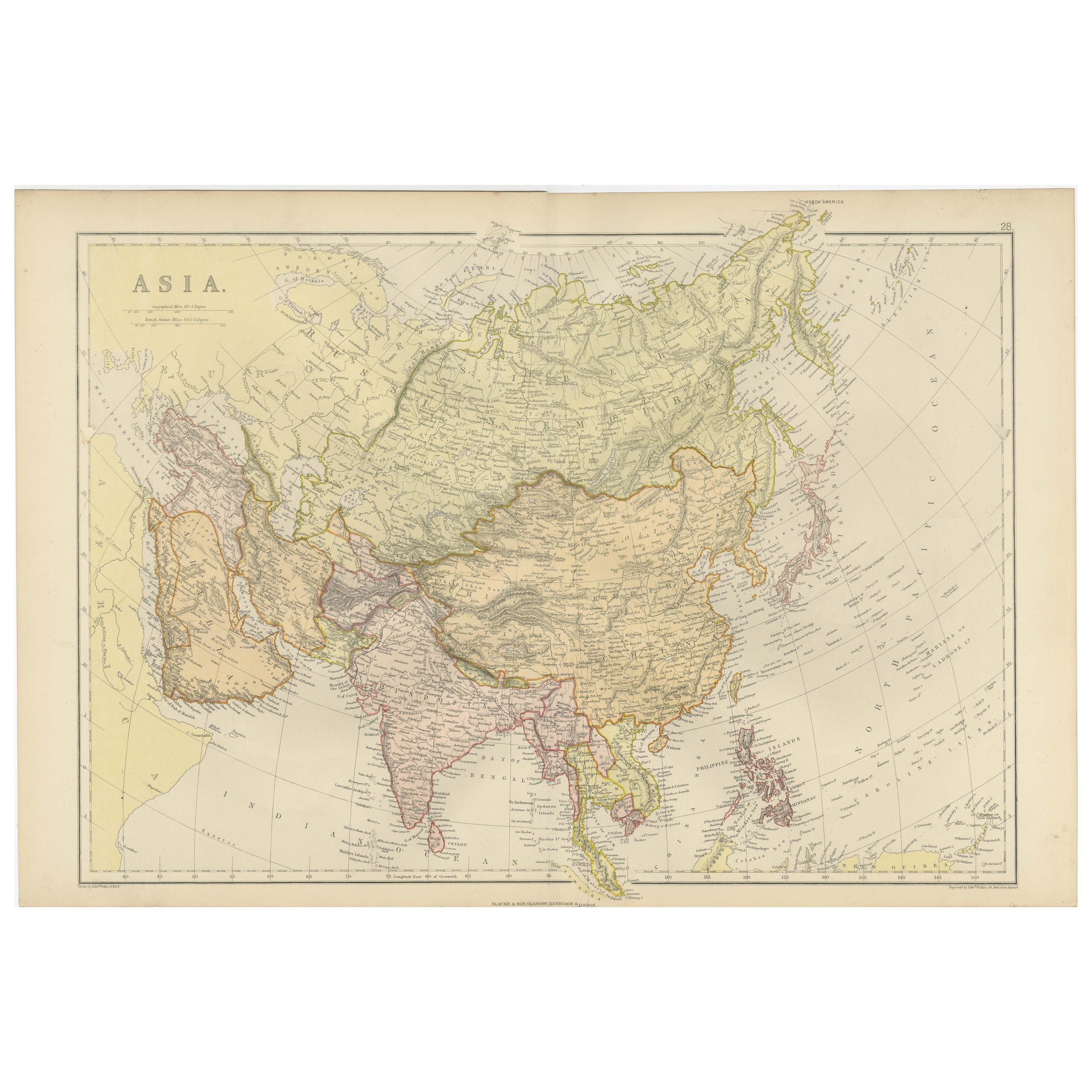
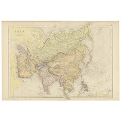
- Historical Map Depicting the Continent of Asia, 1882Located in Langweer, NLThis 1882 map presents a meticulously detailed representation of the continent of Asia, a testament to the cartographic skills of the era. Published as a part of 'Comprehensive Atlas...Category
Antique 1880s Maps
MaterialsPaper

You May Also Like
- 1908 "Map of Texas" by The Kenyon CompanyLocated in Colorado Springs, COPresented is an antique map of the state of Texas, printed as a pocket map in 1908 by The Kenyon Company. The state map is brightly colored by county, with principal cities and towns listed. The congressional districts are numbered and boldly outlined in red. Rivers, roads, and railroads all appear prominently on this fantastic map...Category
Antique Early 1900s American Maps
MaterialsPaper
- "Clason's Guide Map of Montana" by The Clason Map Company, Circa 1920sLocated in Colorado Springs, COPresented is “Clason's Guide Map of Montana,” published in the early 1920s by the Clason Map Company. Issued as a folding map, this map identifies county boundaries, county seats, Na...Category
Vintage 1920s American Art Deco Maps
MaterialsPaper
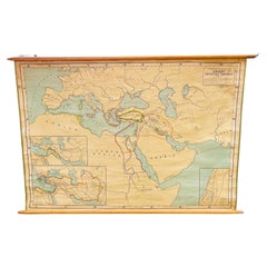
- Antique Rand McNally & Company Schoolmap. Ancient Oriental Empires. HistoricalBy Rand McNally & Co.Located in ROTTERDAM, ZHThis is a real unique map made by the famous Rand McNally Company. This rare schoolmap is probably made in the late 1920's. The map of all the ...Category
Vintage 1920s American American Classical Maps
MaterialsFabric, Paper
- "Greatest of All Time - A Tribute to Muhammad Ali" BookLocated in Los Angeles, CAGOAT: Greatest Of All Time - A tribute to Muhammad Ali is a book with the power, courage, depth, creativity and dazzling energy of its extraordinary subject. With thousands of images...Category
21st Century and Contemporary Italian Books
- Antique 1901 National Publishing Company's Road Map of New Jersey GeologicalLocated in Dayton, OHThe National Publishing Company's road map of New Jersey, showing all county and township divisions, cities villages and post-offices, railroads, ste...Category
Antique Early 1900s Victorian Prints
MaterialsPaper
- Greatest of All Time 'GOAT' a Tribute to Muhammad Ali Promotional BookLocated in North Hollywood, CAGreatest of All Time (GOAT) a Tribute to Muhammad Ali. Muhammad Ali Greatest of All Time Promotional Limited Edition: TASCHEN Promotional book in a tube. The publisher prospectus...Category
20th Century German Modern Books
MaterialsPaper


Recently Viewed
View AllMore Ways To Browse
Bolivian Antique
St Thomas Cross
Map Of Liverpool
Georgetown Antique
Map Of Gulf Of Mexico
Authentic Pirate
Historic Map Virginia
Map Of Indonesia
United States Antique Map
Antique Map Coats Of Arms
Antique Book Map France
Old Maps England
Map Sumatra
Scotland Coat Of Arms
Malaysia Antique
Map Of Siam
Antique Map Of Sri Lanka
Globes Antique Terrestre