Items Similar to Mediterranean Encounters: From the Punic Wars to the Hannibalic War, 1880


Want more images or videos?
Request additional images or videos from the seller
1 of 9
Mediterranean Encounters: From the Punic Wars to the Hannibalic War, 1880
About the Item
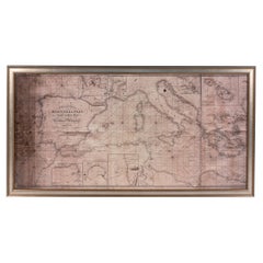
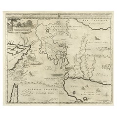
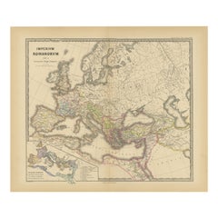
The map, with the title "MARE INTERNUM cum populis adiacentibus a bello Hannibalico usque ad Vespasiani M. princip," depicts the Mediterranean Sea and its surrounding territories, extending from the time of the Hannibalic War, also known as the Second Punic War (218-201 BC), through to the reign of Emperor Vespasian, around 69-79 AD.
Key Observations of the Map:
1. **Central Focus**: The Mediterranean Sea (Mare Internum) is central, emphasizing its importance as a hub of trade and cultural exchange during the indicated periods.
2. **Geopolitical Boundaries**: The map shows various geopolitical entities, kingdoms, and state boundaries that existed around the Mediterranean basin during the given time frame.
3. **Historical Annotations**: There are notes and annotations that possibly give context about significant historical events, such as battles or shifts in power.
4. **Inset Maps**: There are smaller inset maps along the bottom and the right side, including detailed areas such as "CARTHAGO," "GRAECIA," and "ASIA CIS TAVRVM," which provide focused views of important regions like Carthage, Greece, and parts of Asia Minor.
5. **Color Coding**: Different colors are used to delineate regions, which may represent the control or influence of different empires or peoples.
6. **Topographical Features**: Mountains, rivers, and other geographical features are depicted, giving an idea of the terrain and how it might have affected historical events.
7. **Cities and Roads**: Major cities, settlements, and possibly the network of Roman roads are marked, illustrating the infrastructure that supported movement and administration within the Empire.
8. **Navigation Lines**: Lines across the sea could represent major trade routes or voyages significant to the periods mentioned.
This map provides a comprehensive historical and geographical overview of the Mediterranean region during a span of almost three centuries, capturing the evolution of Roman dominance from the times of Hannibal to Emperor Vespasian. It serves as a valuable educational resource for understanding the complex history of this pivotal area in the ancient world.
- Dimensions:Height: 15.56 in (39.5 cm)Width: 18.51 in (47 cm)Depth: 0 in (0.02 mm)
- Materials and Techniques:
- Period:
- Date of Manufacture:1880
- Condition:Good, given age. General age-related toning, especially around the edges. Vertical folding line as issued. Please study scan carefully.
- Seller Location:Langweer, NL
- Reference Number:
About the Seller
5.0
Platinum Seller
These expertly vetted sellers are 1stDibs' most experienced sellers and are rated highest by our customers.
Established in 2009
1stDibs seller since 2017
1,929 sales on 1stDibs
Typical response time: <1 hour
- ShippingRetrieving quote...Ships From: Langweer, Netherlands
- Return PolicyA return for this item may be initiated within 14 days of delivery.
More From This SellerView All
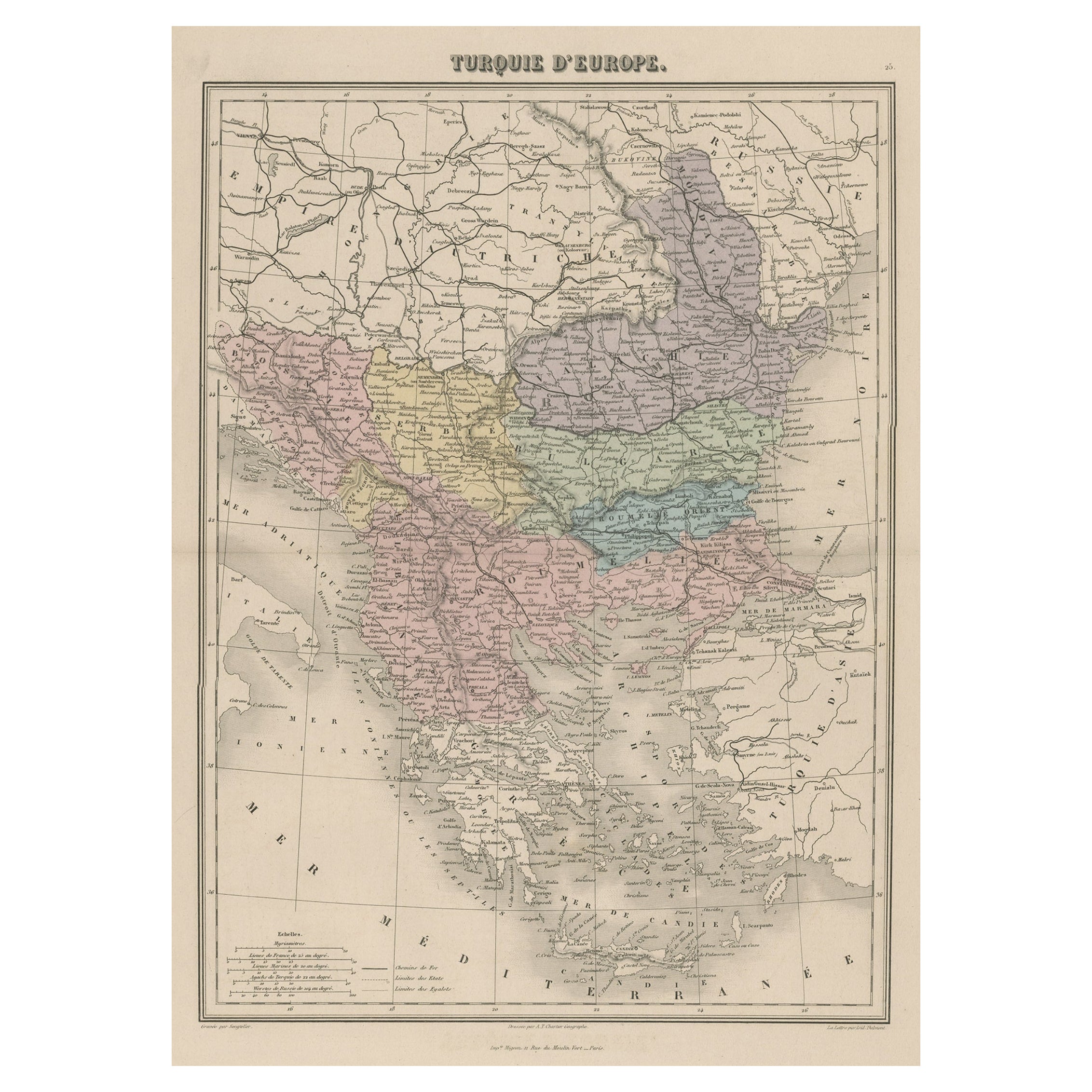
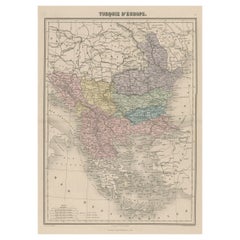
- Antique Map of Moldova to Thessaly and from the Adriatic to the Black Sea, 1880Located in Langweer, NLAntique map titled 'Turquie d'Europe'. Map of the european parts of Turkey. The map covers from Moldova to Thessaly and from the Adriatic to the Black Sea. Greece and the island ...Category
Antique 1880s Maps
MaterialsPaper
- Old Map of Mediterranean Powers: Pompey to Actium (66-31 BC), Published in 1880Located in Langweer, NLThis is a historical map that depicts the Mediterranean region during a specific timeframe in Roman history, from the return of Pompey the Great after his campaign in Asia Minor to t...Category
Antique 1880s Maps
MaterialsPaper
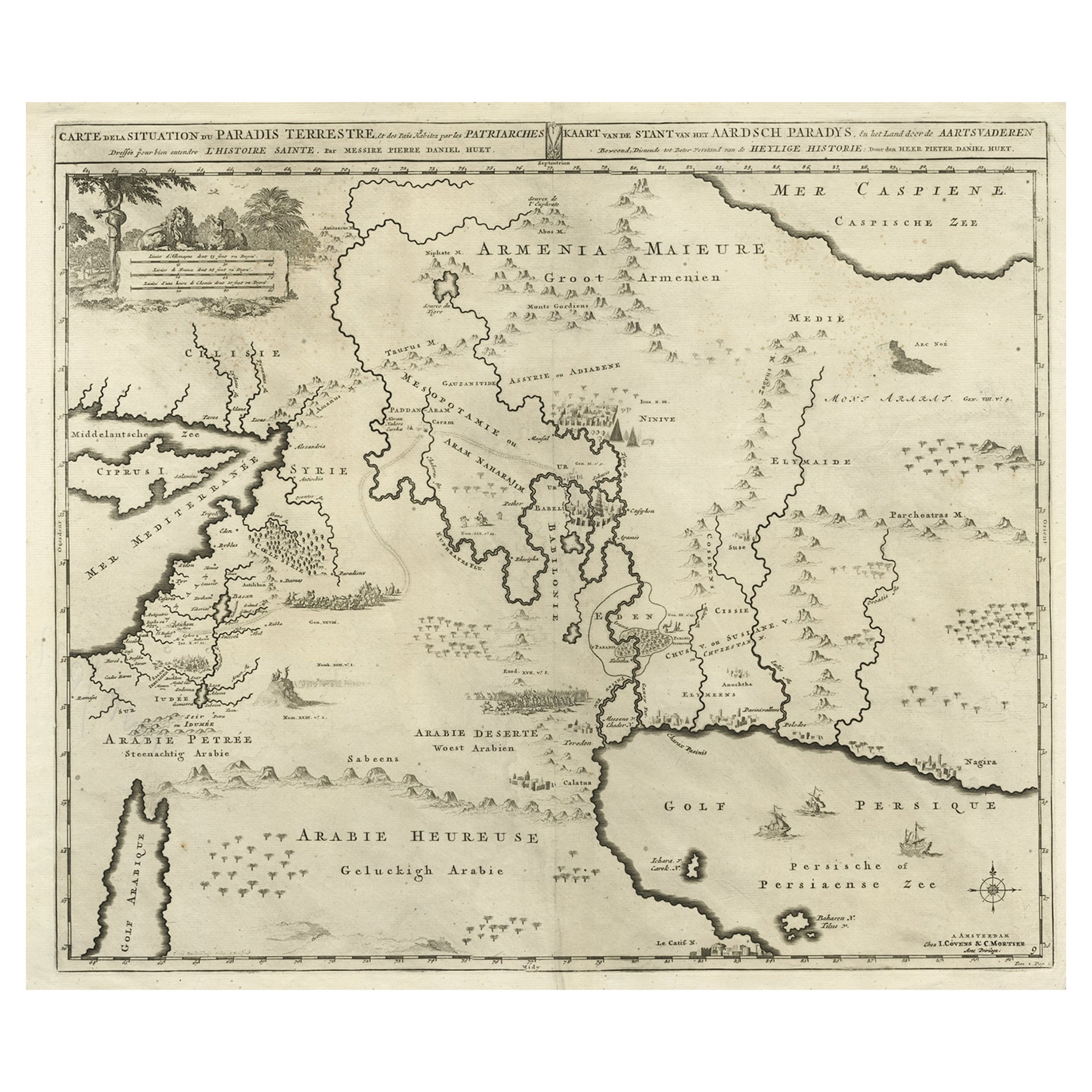
- Biblical Map of the Region from the Mediterranean through the Persian Gulf, 1720Located in Langweer, NLAntique map titled 'Carte de la Situation du Paradis Terrestre, Et des Pais Habitez par les Patriarches Dressee pour bien entendre l'Histoire Sainte, Par Messire Pierre Daniel Huet.' This interesting map covers the region from the Mediterranean through the Persian Gulf. Detail is omitted in favor of Biblical depictions including the Sermon on the Mount...Category
Antique 1720s Maps
MaterialsPaper
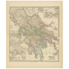
- Original Antique Map of Greece and Epirus after the Persian Wars, Published 1880Located in Langweer, NLThe map titled "GRAECIA, EPIRUS post bella Persica," translates to "Greece and Epirus after the Persian Wars." It covers the regions of ancient Greece and Epirus following the Greco-...Category
Antique 1880s Maps
MaterialsPaper
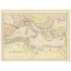
- Mediterranean Tapestry: A 19th Century Map of the Mediterranean Shores, 1882Located in Langweer, NLThis map, titled "The Shores of the Mediterranean," is part of the 1882 atlas by Blackie & Son, and it portrays the coastal regions that surround the Mediterranean Sea. It is a detailed representation of the diverse and historically rich countries that share the Mediterranean coastline, spanning from the Strait of Gibraltar in the west to the Levantine Sea in the east, and from the southern shores of Europe down to the northern coastlines of Africa. The map is a vivid document of the time, with each country along the Mediterranean basin meticulously outlined. The northern coast includes the southern parts of Europe, featuring Spain...Category
Antique 1880s Maps
MaterialsPaper
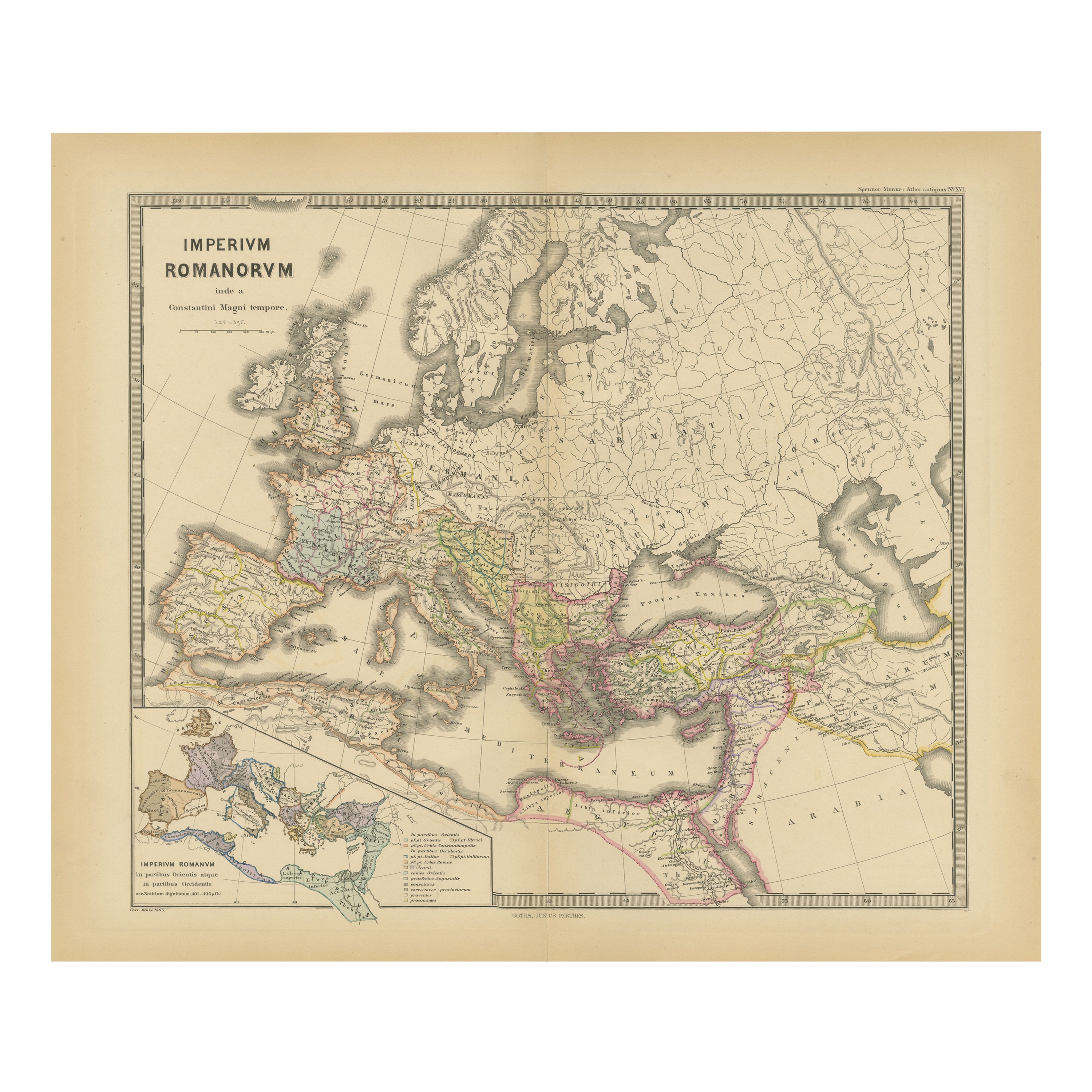
- The Roman Empire from the Time of Constantine the Great, Published in 1880Located in Langweer, NLAntique map titled: "IMPERIUM ROMANORUM inde a Constantini Magni tempore," which translates to "The Roman Empire from the time of Constantine the Great." This map is designed to re...Category
Antique 1880s Maps
MaterialsPaper

You May Also Like
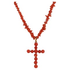
- Cross necklace. Mediterranean coral from Sciacca, England 1880.Located in Milan, ITA thin and long necklace constructed from fragments of Sciacca (Sicily) coral perforated in an irregular sequence is closed by a low-carat gold clasp with an elongated barrel. A regu...Category
Antique Late 19th Century English Collectible Jewelry
MaterialsCoral, Gold
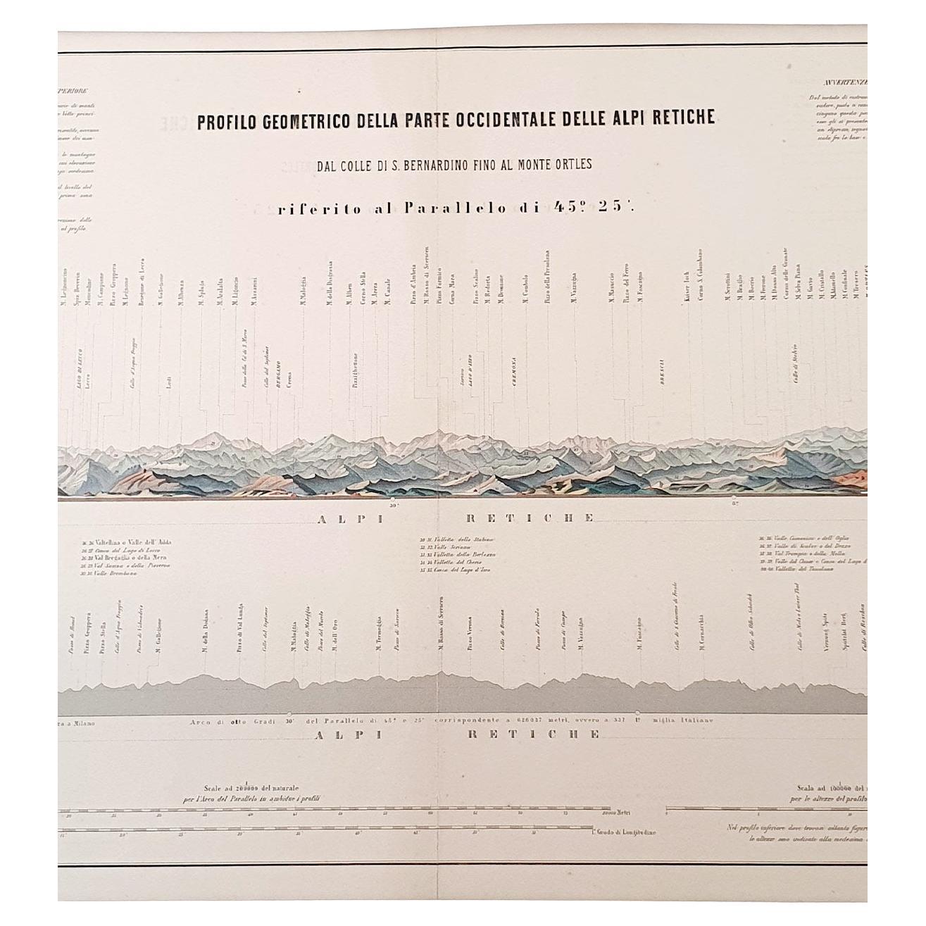
- 1880s Map of The Italian Alps from Milan to Lake GardaLocated in Roma, ITGeographical Map of the Profile and Elevation of the Italian Alps from Milano to Lake Garda. The map features the name of each peak and key cities including Monza, Brescia and Bergam...Category
Antique 1880s Italian Maps
MaterialsParchment Paper
- The Fendi Set: From Bloomsbury to BorgheseBy Rizzoli International PublicationsLocated in New York, NYAn enchanting exploration of the creative inspiration of the Bloomsbury Set on Kim Jones’s artistic direction of the fashion house Fendi. In September 2020, Kim Jones was named head of Fendi’s couture...Category
21st Century and Contemporary Books
MaterialsPaper
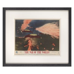
- War of the WorldsLocated in London, GBOriginal British front of house card for The War of the Worlds 1953 it was used inside the foyer of the cinema. This artwork featuring the invading spacecraft is the best card from the set of 8. The film is one of the most famous science fiction films ever made. It was directed by Byron Haskin and starred Gene Barry, Ann Robinson...Category
Vintage 1950s British Posters
MaterialsPaint
- Large Framed Map of the MediterraneanLocated in New York, NYLarge map/chart chart of The Mediterranean and the Grecian Archipelago showing Italy, Sardinia, Corsica, part of France, etc. in a black frame.Category
20th Century French Mid-Century Modern Maps
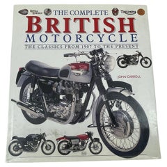
- The Complete British Motorcycle The Classics From 1907 To The Present J CarrollLocated in North Hollywood, CAThe Complete British Motorcycle The Classics From 1907 To The Present by J Carroll.Hardcover with dust jacket. Profusely illustrated throughout.British motorcycles attract a fanatica...Category
21st Century and Contemporary English Victorian Books
MaterialsPaper