Items Similar to Navigational Chart of Mexico's Coast, with Acapulco and Port Marquis, 1748

Want more images or videos?
Request additional images or videos from the seller
1 of 5
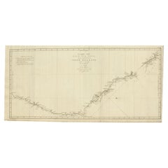
Navigational Chart of Mexico's Coast, with Acapulco and Port Marquis, 1748
About the Item
Antique map titled 'The Form of cruising off Acapulca on the Coast of Mexico in the South Seas in the Year 1742. by His Majesty's Ships, Centurion, Gloucester, Tryall Prize, Carmila Prize, Carmin Prize.' -
A navigational chart of the coast of Mexico, with the harbours Acapulco and Port Marquis (Puerto del Marques) indicated. From George Anson's "A Voyage round the world in the years MDCCXL, I, II, II, IV." London: J. and P. Knapton, 1748. Great Britain was at war with Spain in 1740. Admiral of the Fleet George Anson, 1st Baron Anson PC, FRS, RN (1697 -1762) was a British admiral and a wealthy aristocrat, noted for his circumnavigation of the globe and his role overseeing the Royal Navy during the Seven Years' War. Anson commanded the small British squadron sent at the beginning of the war with Spain to harass the Spaniards on the west coast of South America and cut off their supplies of wealth from the Pacific. Disasters and hardships plagued the expedition; most of the ships were lost around Cape Horn, and on the Chilean coast, and of a crew of 960, less than 350 survived. Eventually the Centurion alone was left, but Anson persevered and succeeded in capturing a gold-laden Spanish galleon near Manila. The prize he earned as a result settled his fortune for life. This is the official account of his voyage of circumnavigation, compiled from Anson's journals by Richard Walter, chaplain on board the Centurion, and revised by Benjamin Robins.
Artists and Engravers: Made by 'J. Mason' after 'George Anson'. No engraver given on the map. Some source attribute the maps in this work to J. Mason.
Condition: Good, given age. Original folds, as issued. Offsetting from letterpress text on the opposite page in the book. Small stains in the left edge of the image. Soiling in the top right corner. A faint dampstain in the top left image corner. Creasing in the right margin and lower left corner. Minimal paper separation in the lower edge of the folds (backed with acid-free archival tape). General age-related toning and/or occasional minor defects from handling. Please study scan carefully.
- Dimensions:Height: 9.81 in (24.9 cm)Width: 17.52 in (44.5 cm)Depth: 0.01 in (0.2 mm)
- Materials and Techniques:
- Period:1740-1749
- Date of Manufacture:1748
- Condition:Additions or alterations made to the original: Minimal paper separation in the lower edge of the folds (backed with acid-free archival tape). General age-related toning and/or occasional minor defects from handling. Please study scan carefully. Wear consistent with age and use. Original folds, as issued. Offsetting from letterpress text on the opposite page in the book. Small stains in the left edge of the image. Soiling in the top right corner. A faint dampstain in the top left image corner. Creasing in the right margin.
- Seller Location:Langweer, NL
- Reference Number:
About the Seller
5.0
Platinum Seller
These expertly vetted sellers are 1stDibs' most experienced sellers and are rated highest by our customers.
Established in 2009
1stDibs seller since 2017
1,928 sales on 1stDibs
Typical response time: <1 hour
- ShippingRetrieving quote...Ships From: Langweer, Netherlands
- Return PolicyA return for this item may be initiated within 14 days of delivery.
More From This SellerView All
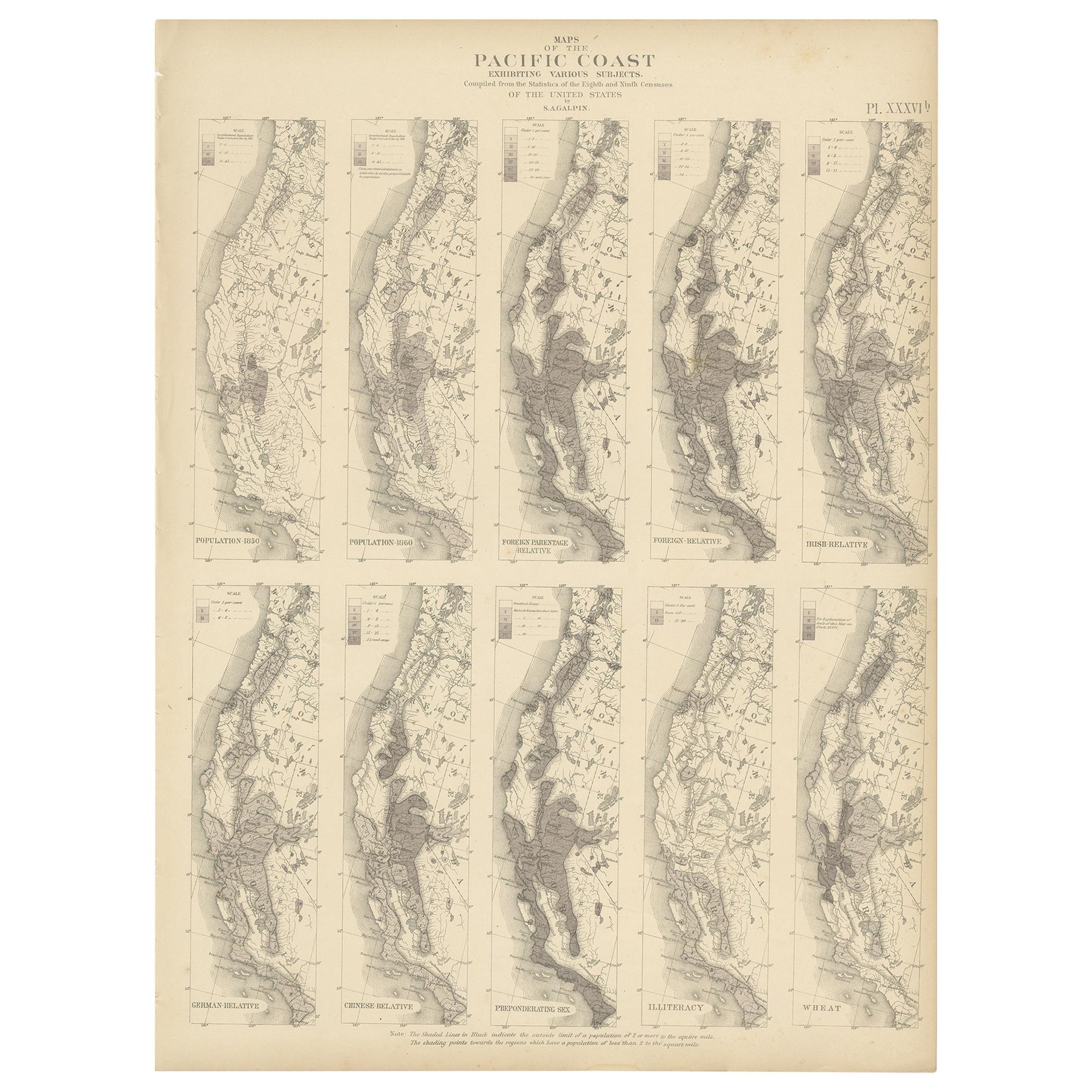
- Antique Chart of the Pacific Coast '1874'Located in Langweer, NLAntique chart titled 'Maps of the Pacific Coast exhibiting various subjects. Compiled from the statistics of the eight and ninth census of the United Sta...Category
Antique Late 19th Century Maps
MaterialsPaper
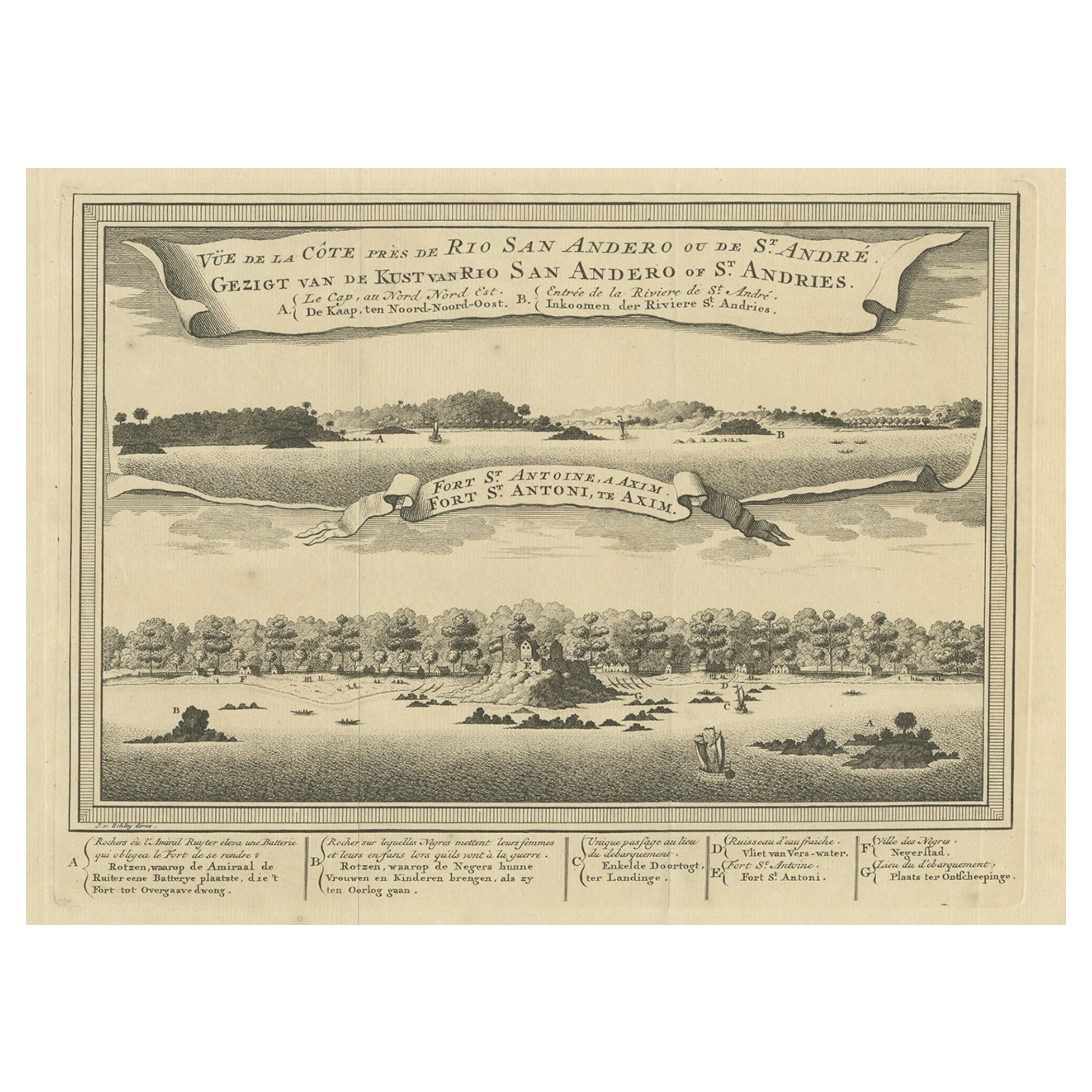
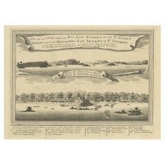
- Antique Print of a Fort on the Ivory Coast and Axim, Africa, 1748By Jakob van der SchleyLocated in Langweer, NLAntique print titled 'Vue de la Cote pres de Rio San Andero - Gezigt van de Kust van Rio San Andero' and 'Fort St. Antoine a Axim - Fort St. Antoni, te Axim'. View of the Ivory coast...Category
Antique 18th Century Prints
MaterialsPaper
- Chart of the Coast of Cochinchina' and 'Plan of Pulo Condor', Vietnam, 1778Located in Langweer, NLAntique map titled 'A Chart of a part of the Coast of Cochinchina' and 'Plan of Pulo Condor'. Two maps on one sheet. The upper map shows part of the coast of Cochinchina from Cha...Category
Antique 1770s Maps
MaterialsPaper
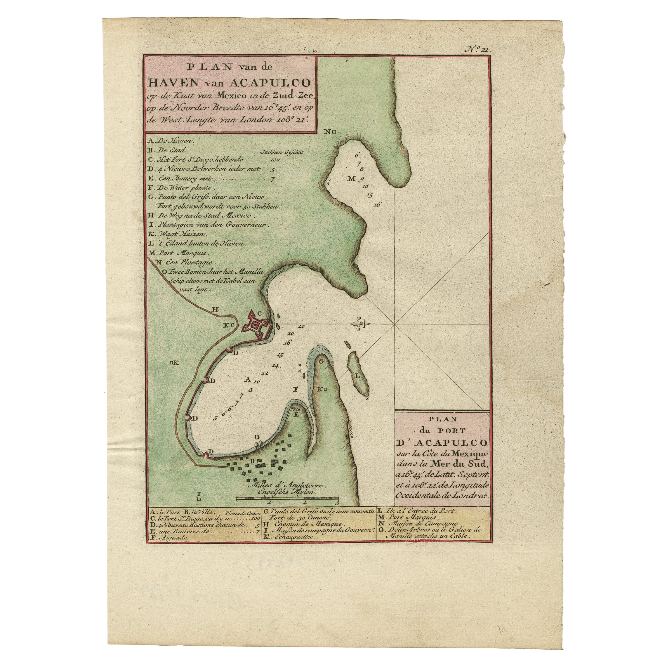
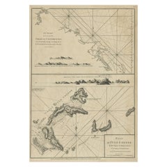
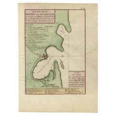
- Antique Map of The Harbour of Acapulco in Mexico, 1749Located in Langweer, NLDescription: Antique map titled 'Plan van de Haven van Acapulco (..) - Plan du Port d'Acapulco (..)'. Original antique map of the Port of Acapulco on the coast of Mexico in the South...Category
Antique 1740s Maps
MaterialsPaper
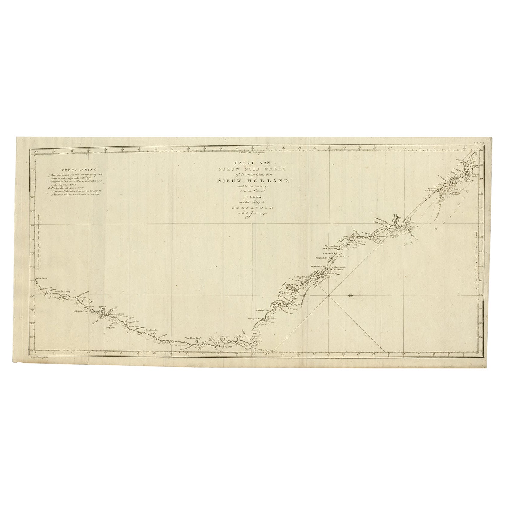
- Old Map of Cook's Discovery and Charting of the East Coast of Australia, 1803Located in Langweer, NLAntique map titled 'Kaart van Nieuw Zuid Wales of de Oostlyke Kust van Nieuw Holland ontdekt en onderzogt door den Luitenant J. Cook met het Schip de Endeavour in het Jaar 1770'. ...Category
Antique Early 1800s Maps
MaterialsPaper
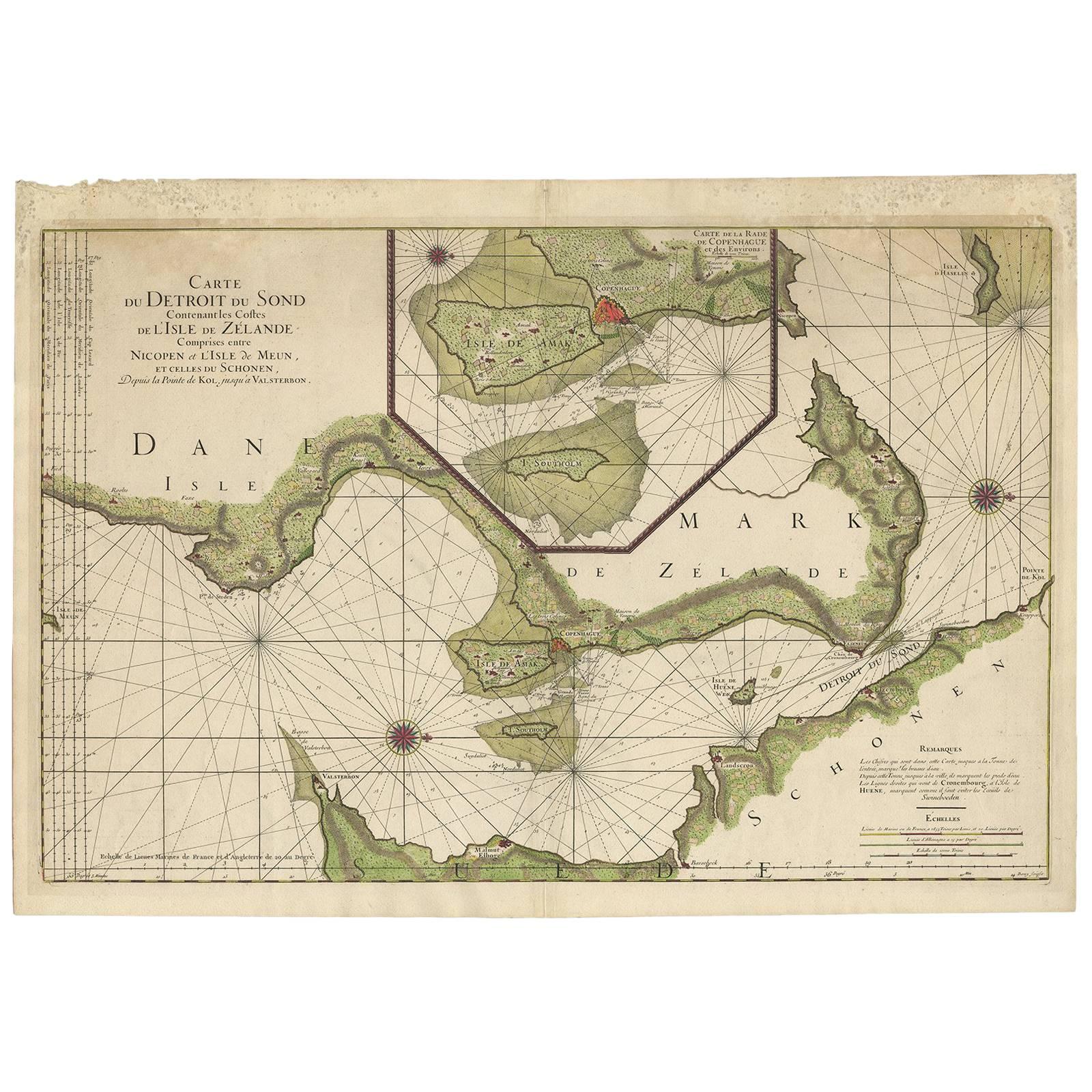
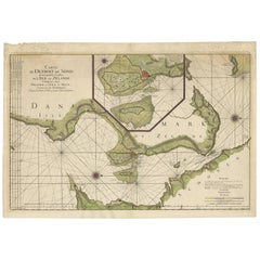
- Antique Sea Chart of the coasts of Denmark and Sweden by C.A. Berey, 1720Located in Langweer, NLThis beautiful large sea chart depicts the Oresund, which forms the border between Skane, Sweden and Sjaelland, Denmark. The chart is filled with navigational details and topographical information along the coastline. A large inset focuses on the area around Copenhagen and the islands of Amager and Saltholm. Two large compass...Category
Antique Early 18th Century Maps
MaterialsPaper

You May Also Like
- Anatomical Wall Chart Depicting the Human Lymphatic and Blood VesselsLocated in Berghuelen, DEA rare 19-carat anatomical wall chart depicting the human lymphatic and blood vessels. On the sides with detailed description in German language. Print...Category
Early 20th Century German Victorian Prints
MaterialsPaper
- Genito-Urinary Anatomical Chart Fritz FrohseBy Nystrom / Frohse Art, Fritz FrohseLocated in Philadelphia, PAGenito-Urinary Anatomical Chart by Fritz Frohse. Dated 1922. Paper mounted on canvas. Shows wear but still presents very well!Category
Vintage 1920s German American Classical Prints
MaterialsCanvas, Paper
- Foldable Anatomical Wall Chart Depicting Human MusculatureLocated in Berghuelen, DEA rare 19th century anatomical wall chart depicting human musculature and internal organs. With removable multicolored human organs like lung, heart, l...Category
Early 20th Century German Victorian Prints
MaterialsPaper
- Italy, Sicily, Sardinia, Corsica and Dalmatian Coast: A 17th Century Dutch MapBy Theodorus DanckertsLocated in Alamo, CAThis hand colored 17th century Dutch map entitled "Novissima et Accuratissima totius Italiae Corsicae et Sardiniae Descriptio" by Theodore Danckerts depicts the Italian Peninsula in ...Category
Antique Late 17th Century Dutch Maps
MaterialsPaper
- Antique Anatomical Wall Chart Depicting the Human SkeletonLocated in Berghuelen, DEA rare 19th century anatomical wall chart depicting the human skeleton. On the sides On the sides are detailed description in German language. The wall...Category
Early 20th Century German Victorian Prints
MaterialsPaper
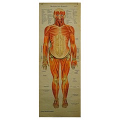
- Antique Foldable Anatomical Wall Chart Depicting Human MusculatureLocated in Berghuelen, DEAntique Foldable Anatomical Wall Chart Depicting Human Musculature The rare 19th century anatomical wall chart depicts the human musculature and inter...Category
Early 20th Century German Victorian Prints
MaterialsWood, Paper