Items Similar to Northwest Coast and Isle of Man Map


Want more images or videos?
Request additional images or videos from the seller
1 of 5
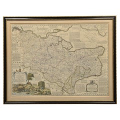
Northwest Coast and Isle of Man Map
About the Item
Greenville Collins Northwest Coast and Isle of Man. hand coloured chart, encased in an ebonised frame.
Dimensions
Height 26.5 Inches
Width 30 Inches
Depth 1 Inches
- Dimensions:Height: 26.5 in (67.31 cm)Width: 30 in (76.2 cm)Depth: 1 in (2.54 cm)
- Materials and Techniques:
- Place of Origin:
- Period:
- Date of Manufacture:circa 1900
- Condition:Wear consistent with age and use.
- Seller Location:Cheshire, GB
- Reference Number:1stDibs: LU947636261632
About the Seller
5.0
Platinum Seller
These expertly vetted sellers are 1stDibs' most experienced sellers and are rated highest by our customers.
Established in 1980
1stDibs seller since 2012
380 sales on 1stDibs
Typical response time: 1 hour
Associations
LAPADA - The Association of Arts & Antiques DealersInternational Confederation of Art and Antique Dealers' Associations
- ShippingRetrieving quote...Ships From: Cheshire, United Kingdom
- Return PolicyA return for this item may be initiated within 7 days of delivery.
More From This SellerView All
- Map of LancashireLocated in Cheshire, GBSaxton Map of Lancashire hand coloured. Encased in an ebonised frame. Dimensions Height 21 Inches Width 24 Inches Depth 1 InchesCategory
Early 20th Century British Maps
MaterialsPaper
- Map of Essex by Emanuel BowenLocated in Cheshire, GBMap of part of Essex and part of Kent, hand-coloured. Encased in an ebonized and gilded frame. Dimensions Height 25.5 Inches Length 32.5 Inches width 1 Inches.Category
Antique Late 19th Century British Maps
MaterialsPaper
- Chart of the Harbour of LiverpoolLocated in Cheshire, GBPL Burdett A Chart of the Harbour of Liverpool hand coloured. Encased in an ebonised frame. Dimensions Height 23.5 Inches Width 28 Inches Depth 1 InchesCategory
Early 20th Century British Maps
MaterialsPaper
- Set of Oak Doctors ScalesLocated in Cheshire, GBSet of doctors scales for C.F Thakray Chemists. The solid oak seat with shaped back alongside cast balance scale. standing on square sports with pull out ...Category
Early 20th Century British Scientific Instruments
MaterialsOak
- Oak cased barograph and barometerLocated in Cheshire, GBOak-cased barograph and barometer retailed by Harrods London, having five bevelled glass panelled removable lid, and a drawer below to house the charts. The mechanical eight-day move...Category
Early 20th Century British Scientific Instruments
MaterialsOak
- Oak and Brass Jockey ScalesLocated in Cheshire, GBJockey scales the seat upholstered in black deep buttoned leather above the oak base with carved frieze raised up on four square tapering fluted legs Dimensions Height 26.5 Inches ...Category
Early 20th Century British Sports Equipment and Memorabilia
MaterialsOak


You May Also Like
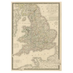
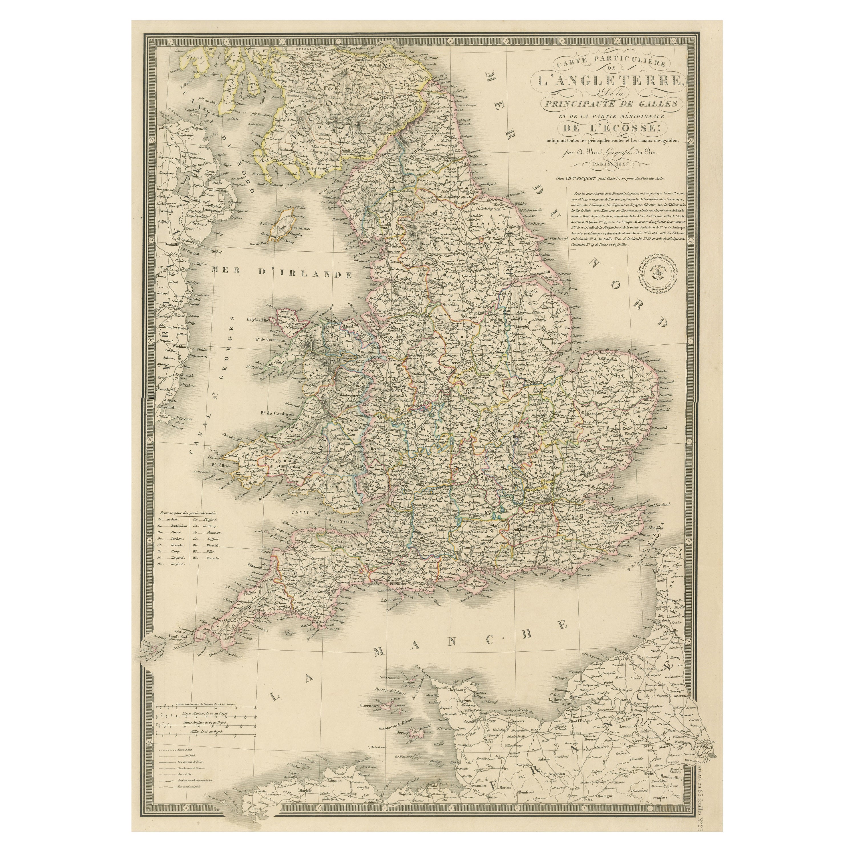
- Antique Map of the British Isles and Part of the Coast of FranceLocated in Langweer, NLAntique map titled 'Carte Particuliere l'Angleterre (..)'. Original antique map of the British Isles and part of the coast of France. It shows England and part of Wales. Published by...Category
Antique Mid-19th Century Maps
MaterialsPaper
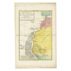
- Antique Map of the Coast of Northwest Africa by Dien, 1820Located in Langweer, NLAntique map Africa titled 'Partie Occidentale de l'Ancien Continent, depuis Lisbonne jusquá la Riviere de Sierra Leona'. Detailed map of Coastal Nor...Category
Antique 19th Century Maps
MaterialsPaper
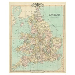
- Antique Map of England and Wales, Also Including the Isle of ManLocated in Langweer, NLAntique map titled 'England'. Original antique map of England and Wales from Northumberland to Cornwall from the St. George Channel east as far as the Strait of Dover. The Isle of Ma...Category
Antique Mid-19th Century Maps
MaterialsPaper
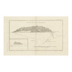
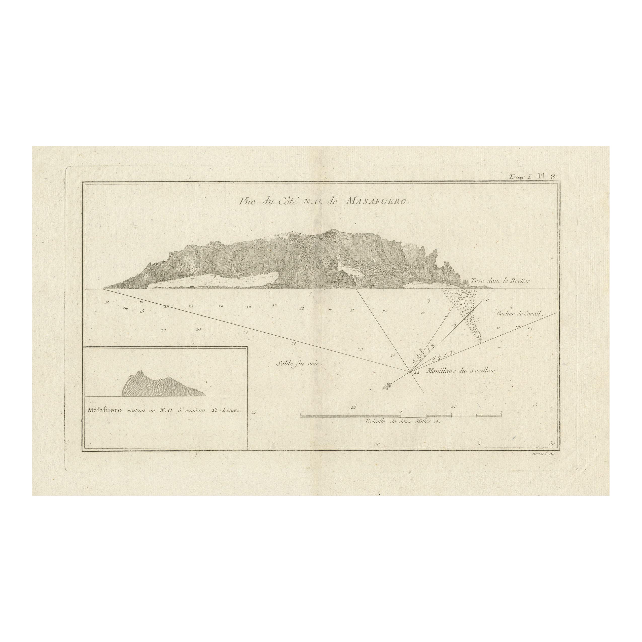
- Antique Map of the Northwest Coast of Masafuera Island or Selkirk IslandLocated in Langweer, NLAntique map titled 'Vue de Cote N.O. de Masafuero'. Profile view of the north-west coast of Masafuera Island (also called Alejandro Selkirk Island...Category
Antique Late 18th Century Maps
MaterialsPaper
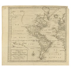
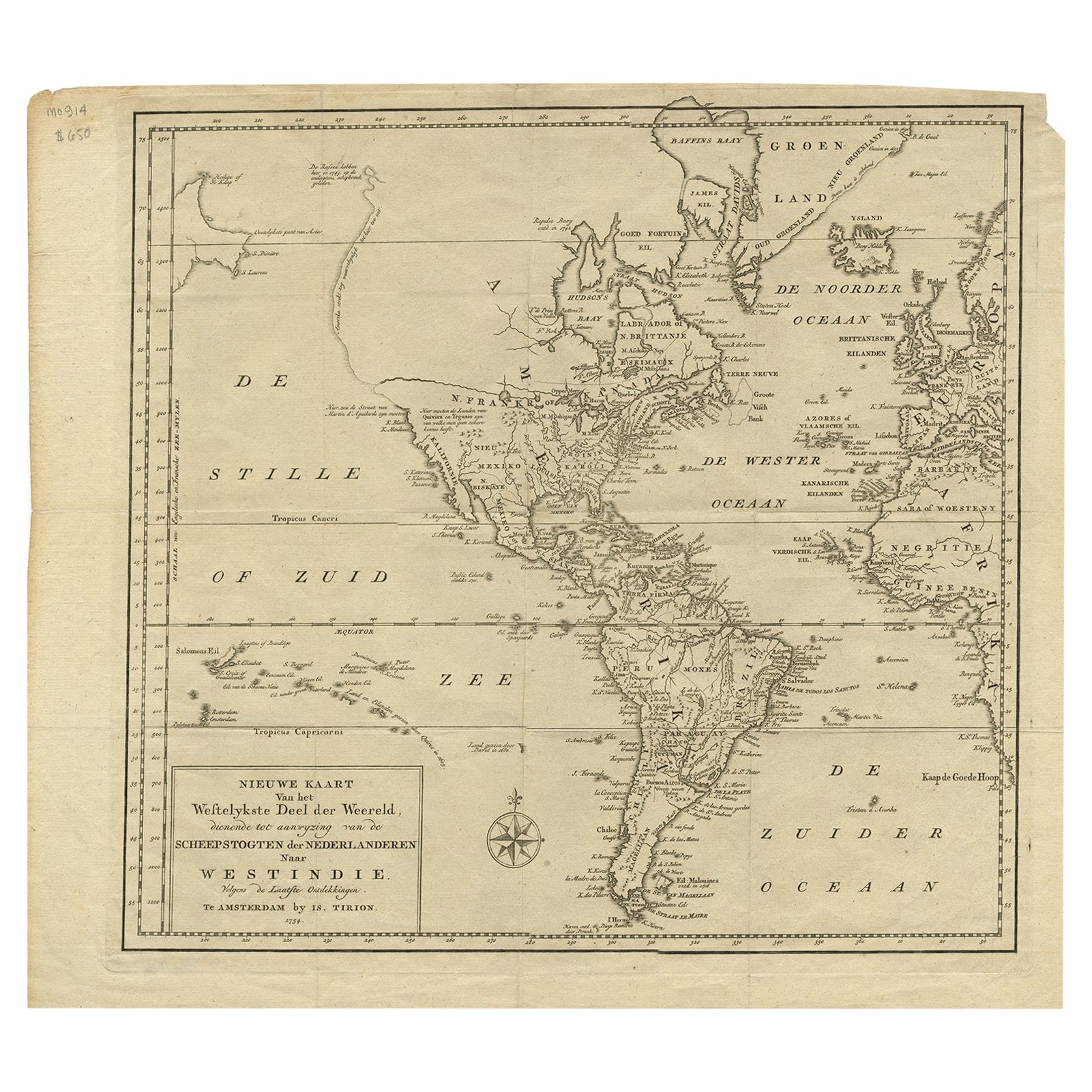
- Excellent Antique Map of America with Unusual Northwest Coast of America, c.1754Located in Langweer, NLDescription: Antique map titled 'Nieuwe Kaart Van het Westelykste Deel Der Weereld, dienende tot aanwyzing an de Scheepstogten der Nederlanderne Naar West Indie.' Excellent map of America, featuring an unusual northwest coast of America, which includes Martin d'Aguilar's strait which provides for a Northwest Passage via the Great Lakes. The rest of the NW coast...Category
Antique 1750s Maps
MaterialsPaper
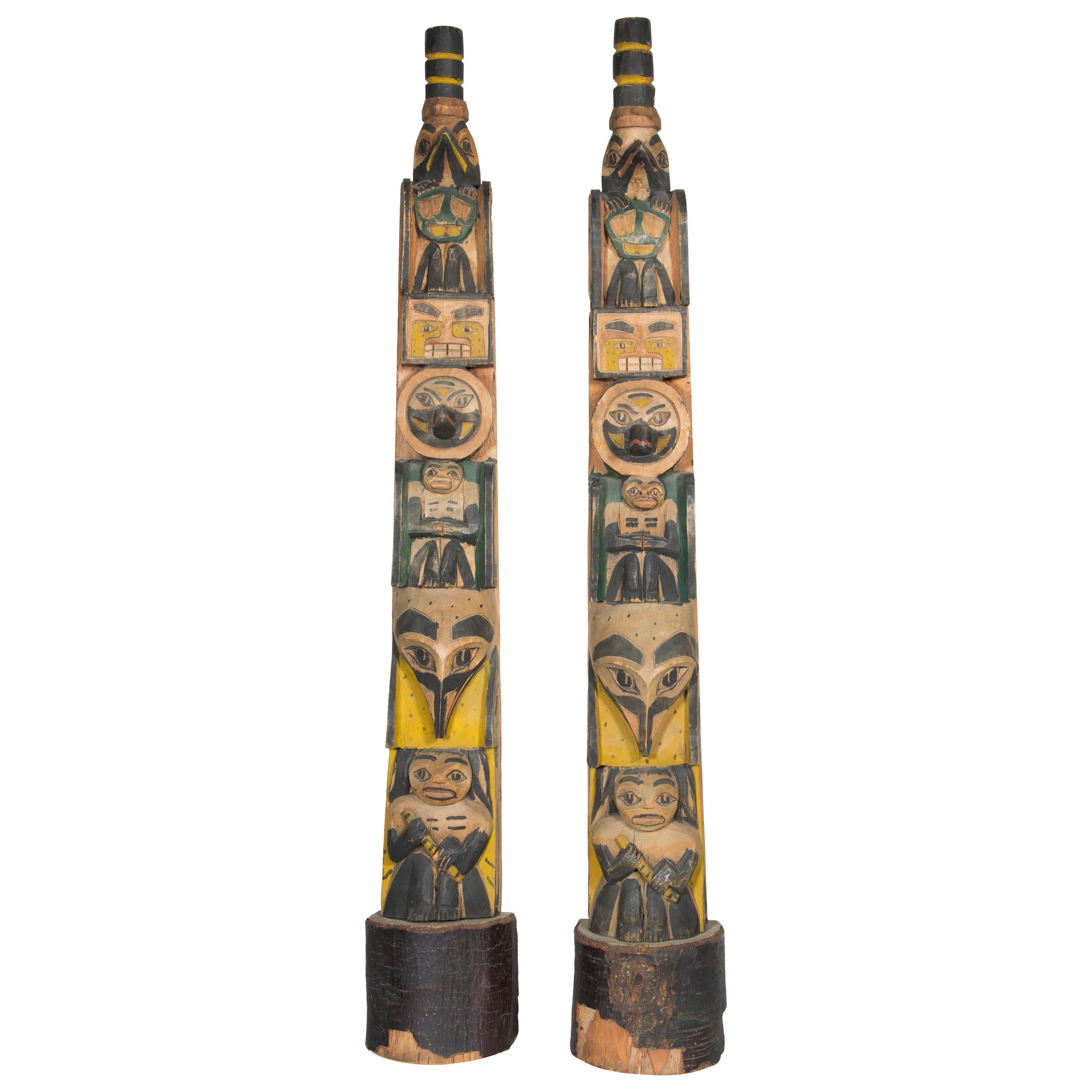
- Circa 1900 Pair of Northwest Coast TotemsBy Native American ArtLocated in Coeur d'Alene, IDMatching pair of Northwest Coast carved model totem poles. Polychrome decorated with carved humanoid and bird figures. Each twice signed "Betty Sanners" back and bottom. Provenance Hudson Bay Fur Company, Seattle, Washington. 29"H Period: Early 20th century Origin: Northwest Coast Size: 29" base 4 1/2 x 3 1/2 Family Owned & Operated Cisco’s Gallery deals in the rare, exceptional, and one-of-a-kind pieces that define the history of America and the Old West. Our pieces range from American Indian to Cowboy Western and include original items of everyday life, commerce, art, and warfare that tamed America’s frontier. Our 14,000 square foot gallery opened in 1996 in beautiful Coeur d’Alene, Idaho. Personal Service Cisco’s operates on old fashioned values – honesty and integrity, and all of our items are backed by our money back guarantee. We appreciate the opportunity to earn your business. Whether you desire assistance with a jewelry purchase, choosing a gift, identification, or even selling – we hope to be your trusted source. Native American carvings & totems native American Indian native American totem poles n.Category
Antique Early 1900s American Native American Native American Objects
MaterialsCedar