Items Similar to Old Antique Map of Borneo 'Kalimantan Indonesia, Sabah Malaysia & Brunei'

Want more images or videos?
Request additional images or videos from the seller
1 of 7
Old Antique Map of Borneo 'Kalimantan Indonesia, Sabah Malaysia & Brunei'
About the Item
Antique map titled 'Kaart van het Eyland Borneo'. Original antique map of the island of Borneo. Published 1724-1726 by Joannes van Braam and Gerard Onder de Linden in "Oud en nieuw Oost-Indiën, vervattende een naaukeurige en uitvoerige verhandelinge van Nederlands mogentheyd in die gewesten, benevens eene wydluftige beschryvige der Moluccos . en alle de eylanden onder dezelve landbestieringen behoorende; het Nederlands comptoir op Suratte, en de levens der Groote Mogols (.)," François Valentyn.
- Dimensions:Height: 18.71 in (47.5 cm)Width: 22.45 in (57 cm)Depth: 0.02 in (0.5 mm)
- Materials and Techniques:
- Period:
- Date of Manufacture:circa 1724
- Condition:General age-related toning, minor wear. Original folding lines, later hand coloring. Blank verso. Please study images carefully.
- Seller Location:Langweer, NL
- Reference Number:
About the Seller
5.0
Platinum Seller
These expertly vetted sellers are 1stDibs' most experienced sellers and are rated highest by our customers.
Established in 2009
1stDibs seller since 2017
1,957 sales on 1stDibs
Typical response time: <1 hour
- ShippingRetrieving quote...Ships From: Langweer, Netherlands
- Return PolicyA return for this item may be initiated within 14 days of delivery.
More From This SellerView All
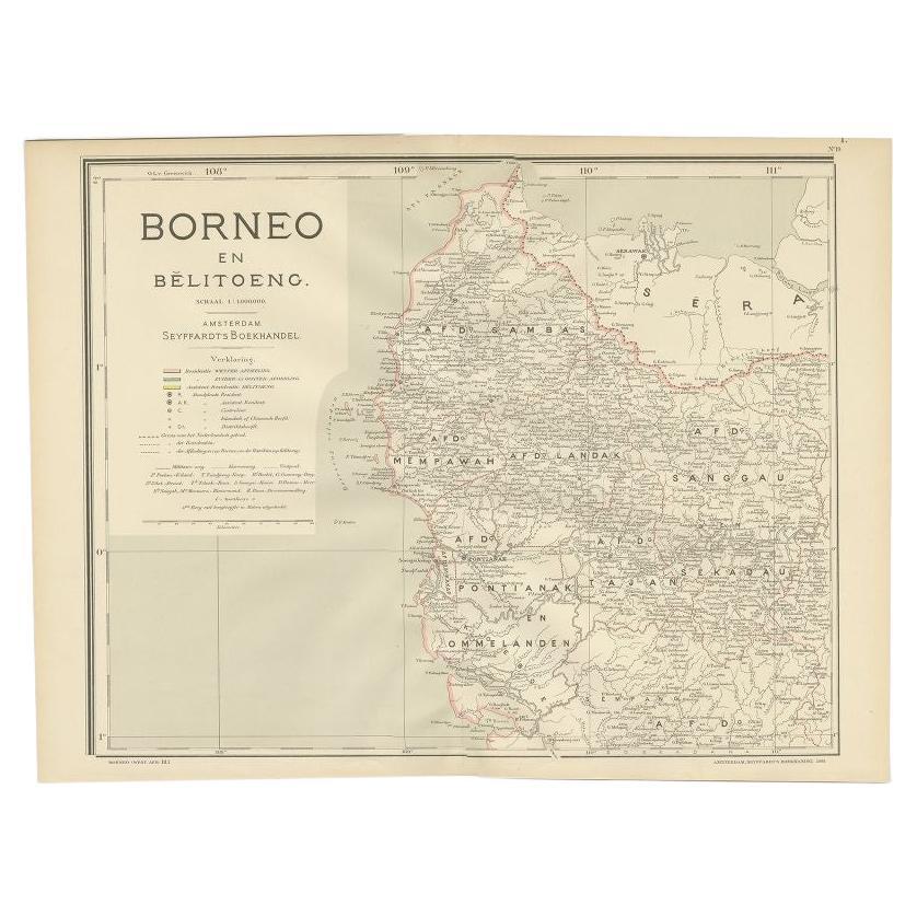
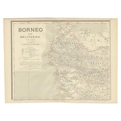
- Antique Map of West Kalimantan, Borneo, Indonesia, 1900Located in Langweer, NLAntique map titled 'Borneo en Belitoeng'. Old map of West Kalimantan, Borneo. This map originates from 'Atlas van Nederlandsch Oost- en West-Indië' by I. Dornseiffen. Artists and...Category
20th Century Maps
MaterialsPaper
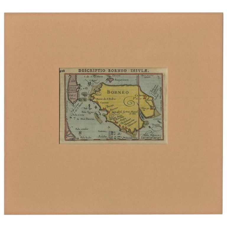
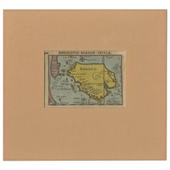
- Antique Miniature Map of Borneo, incl Kalimantan, Indonesia, c.1610Located in Langweer, NLAntique map titled 'Descriptio Borneo Insulae'. Old miniature map of the Indonesian island of Borneo. North is orientated to the left. The Equator runs through the southern part of...Category
Antique 17th Century Maps
MaterialsPaper
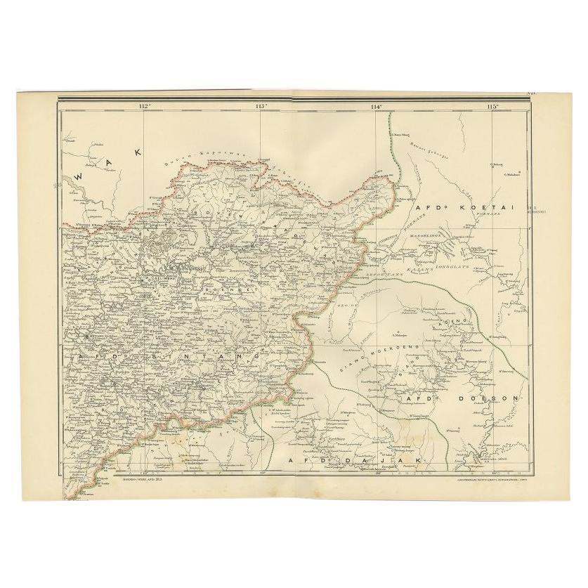
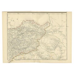
- Antique Map of West Kalimantan (Schwaner Mountains), Borneo, Indonesia, 1900Located in Langweer, NLAntique map of West Kalimantan, Borneo. It shows the region of the Schwaner Mountains. This map originates from 'Atlas van Nederlandsch Oost- en West-Indië' by I. Dornseiffen. Arti...Category
20th Century Maps
MaterialsPaper
- Antique Map of Singapore, Malaysia, Borneo, Sumatra and Java (Indonesia), 1739Located in Langweer, NL"Antique map titled 'Nieuwe kaart van de Sundasche Eilanden als Borneo, Sumatra en Groot Iava & c'. Detailed map of Southeast Asia, extending from the tip of Cambodia to Java. This m...Category
Antique 18th Century Maps
MaterialsPaper
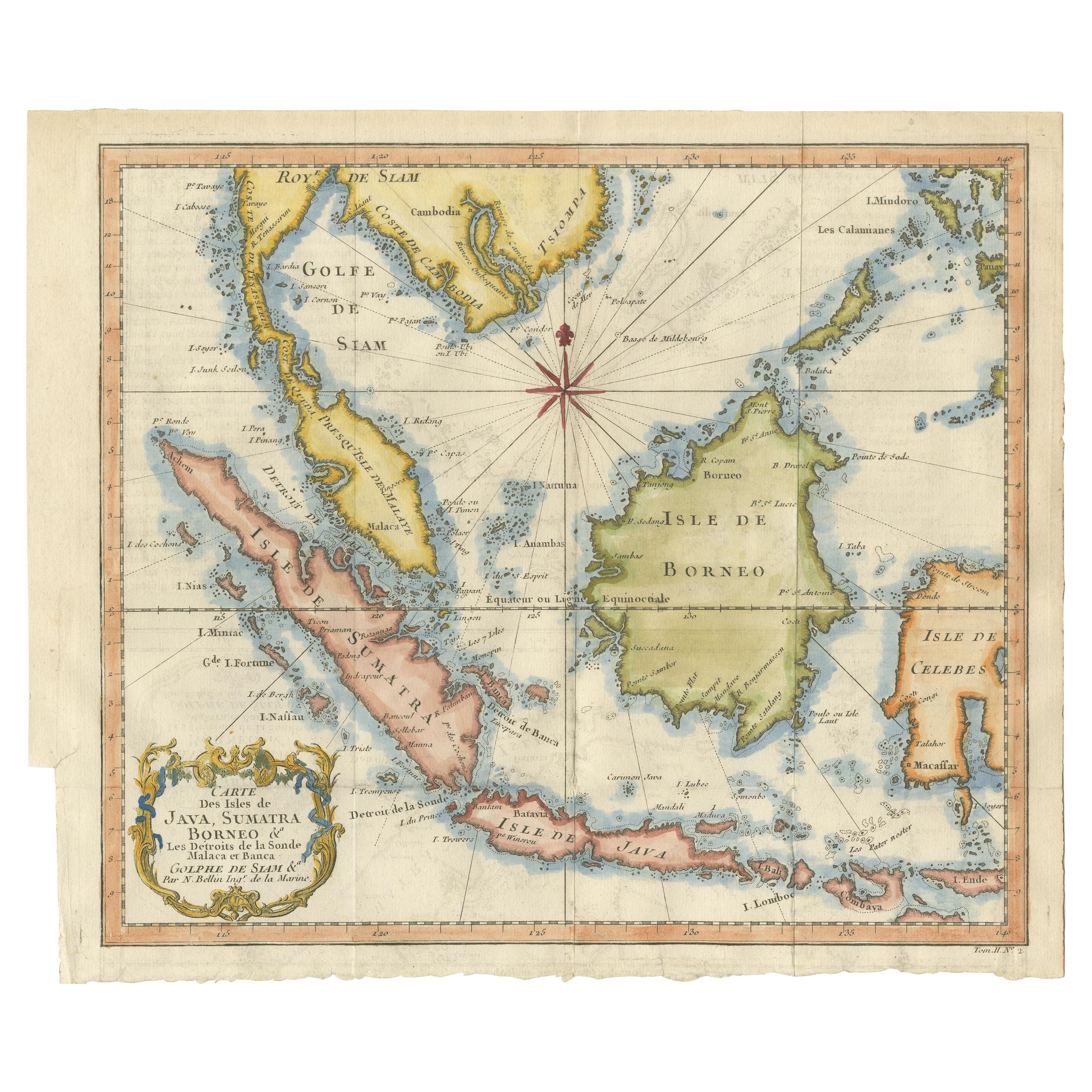
- Antique Engraving of Malaysia, Brunei, Singapore, Java, Borneo, Sumatra, c.1750Located in Langweer, NLNice decorative and detailed map from the Gulf of Siam and Mindoro to Timo, Java and Sumatra Borneo and Roy de Siam. Large compass rose and nice cartouche. Title: Carte des Isles ...Category
Antique Mid-18th Century Maps
MaterialsPaper
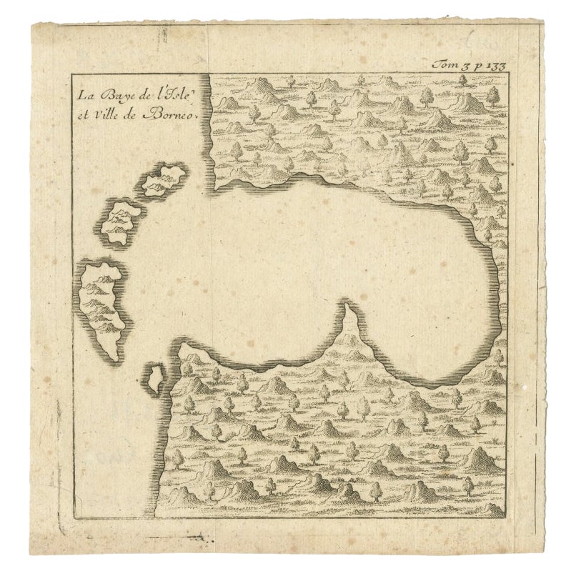
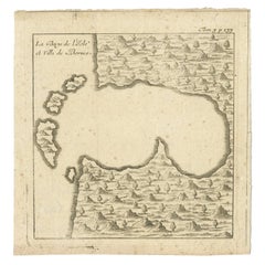
- Antique Map of a Bay of Borneo, Indonesia, c.1760Located in Langweer, NLAntique map titled 'La Baye de l'isle et Ville de Borneo'. Small map depicting a Bay of Borneo. Artists and Engravers: Anonymous. Condition: Good, general age-related toning. ...Category
Antique 18th Century Maps
MaterialsPaper


You May Also Like
- Old Nautical Map of CorsicaLocated in Alessandria, PiemonteST/556/1 - Old map of Corsica isle, surveyed by Captain Hell, of the French Royal Navy in 1824, engraved and published on 1874, with additions and corre...Category
Antique Early 19th Century English Other Prints
MaterialsPaper
- Old Horizontal Map of EnglandBy TassoLocated in Alessandria, PiemonteST/520 - Old rare Italian map of England, dated 1826-1827 - by Girolamo Tasso, editor in Venise, for the atlas of M.r Le-Sage.Category
Antique Early 19th Century Italian Other Prints
MaterialsPaper
- Antique Map of Principality of MonacoBy Antonio Vallardi EditoreLocated in Alessandria, PiemonteST/619 - "Old Geographical Atlas of Italy - Topographic map of ex-Principality of Monaco" - ediz Vallardi - Milano - A somewhat special edition ---Category
Antique Late 19th Century Italian Other Prints
MaterialsPaper
- Original Antique Map of Asia. C.1780Located in St Annes, LancashireGreat map of Asia Copper-plate engraving Published C.1780 Two small worm holes to right side of map Unframed.Category
Antique Early 1800s English Georgian Maps
MaterialsPaper

- Original Antique Map of Italy. C.1780Located in St Annes, LancashireGreat map of Italy Copper-plate engraving Published C.1780 Unframed.Category
Antique Early 1800s English Georgian Maps
MaterialsPaper

- Original Antique Map of India. C.1780Located in St Annes, LancashireGreat map of India Copper-plate engraving Published C.1780 Three small worm holes to right side of map and one bottom left corner Unframed.Category
Antique Early 1800s English Georgian Maps
MaterialsPaper


Recently Viewed
View AllMore Ways To Browse
18th Century Indonesia
18th Century Indonesian
Used Oud
Antique Oud
Antique Malaysia
Malaysian Antique Furniture
Antique Furniture Malaysia
Gerard Francois
Francois Gerard
Malaysian Antique
Malaysian Map
Malaysia Map
Antique Texas Collectables
Antique Furniture Alexandria
Victorian Fence
Alexandria Antique Furniture
Battle Maps
Antique Malaysia