Items Similar to Old Map of the Balkans Incl Greece, Turkey, Serbia, Montenegro, Bulgaria, C.1900

Want more images or videos?
Request additional images or videos from the seller
1 of 5
Old Map of the Balkans Incl Greece, Turkey, Serbia, Montenegro, Bulgaria, C.1900
About the Item
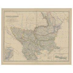
Antique map titled 'Carte de la presqu-île du Balcan - Karte der Balkan Halbinsel'.
Original antique map of the Balkans including Greece, Turkey, Serbia, Montenegro, Bulgaria and surroundings. Published circa 1900.
Artists and Engravers: Anonymous.
Condition: Fair, mounted to thin paper. Strong toning. Original folding lines. Please study image carefully.
- Dimensions:Height: 45 in (114.3 cm)Width: 49 in (124.46 cm)Depth: 0.002 in (0.06 mm)
- Materials and Techniques:
- Period:1900-1909
- Date of Manufacture:circa 1900
- Condition:Wear consistent with age and use.
- Seller Location:Langweer, NL
- Reference Number:
About the Seller
5.0
Platinum Seller
These expertly vetted sellers are 1stDibs' most experienced sellers and are rated highest by our customers.
Established in 2009
1stDibs seller since 2017
1,946 sales on 1stDibs
Typical response time: <1 hour
- ShippingRetrieving quote...Ships From: Langweer, Netherlands
- Return PolicyA return for this item may be initiated within 14 days of delivery.
More From This SellerView All
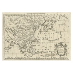
- Old Map of Turkey in Europe, incl Romania, Servia, Montenegro & Bulgaria, 1882Located in Langweer, NLAntique map titled 'Turkey in Europe'. Old map of Turkey in Europe, also depicting part of Romania, Servia, Montenegro and Bulgaria. With inset maps of the Bosphorus, Constantino...Category
Antique 1880s Maps
MaterialsPaper
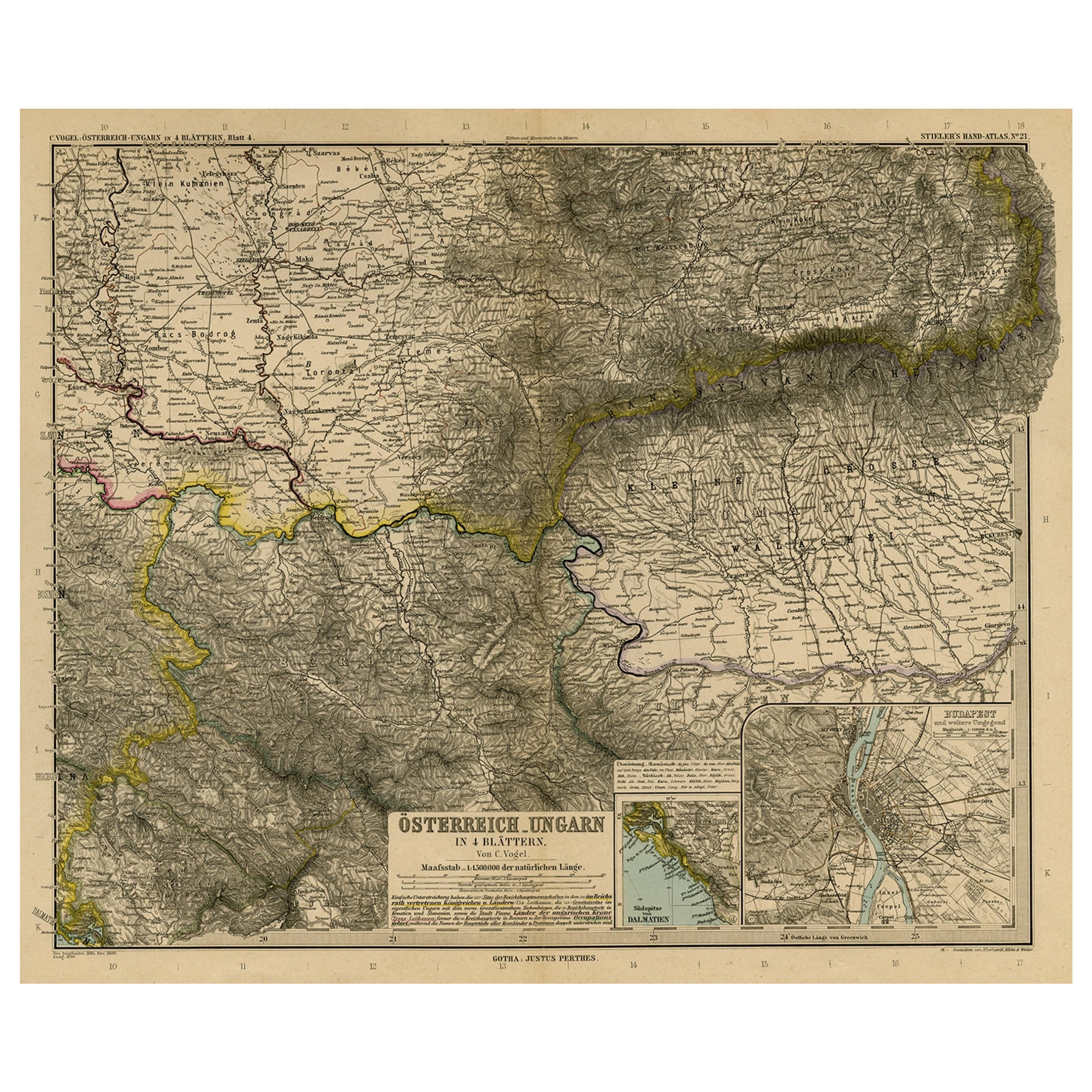
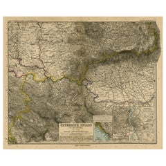
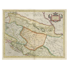
- Antique Map of Eastern Europe, Incl Montenegro & Serbia & a Budapest Map, 1890Located in Langweer, NLAntique map titled 'Osterreich-Ungarn in 4 Blattern, Blatt 4.' Map of Eastern Europe, with Montenegro in the lower left corner, the southern ...Category
Antique 1890s Maps
MaterialsPaper
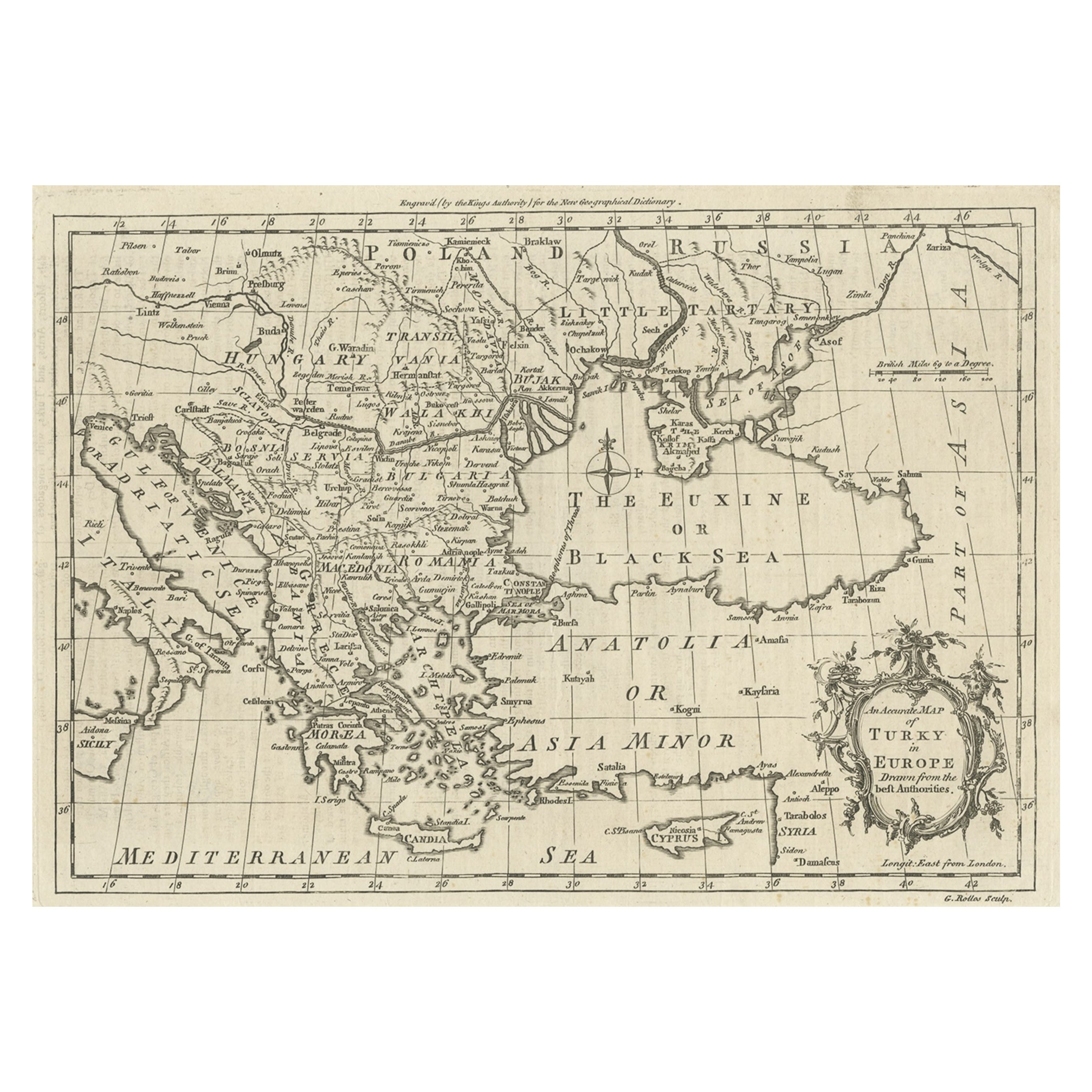
- Map of the Ottoman Empire in Europe, incl. the Balkans, Greece & Turkey, c.1760Located in Langweer, NLAntique map Turkey titled 'An Accurate Map of Turky in Europe drawn from the best Authorities'. Map of the Ottoman Empire in Europe, the Balkans, Greece, and Turkey in Europe. Engr...Category
Antique 1760s Maps
MaterialsPaper
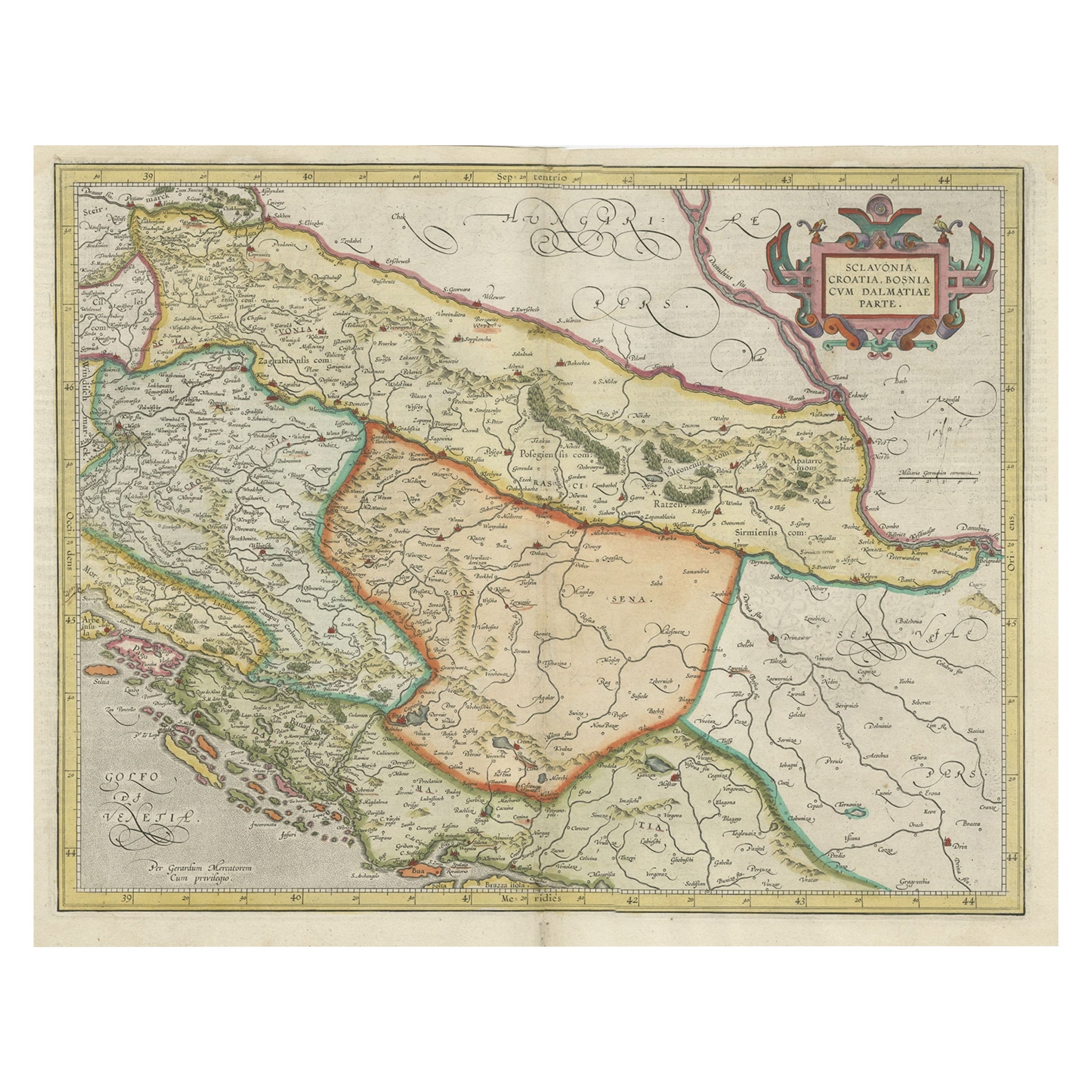
- Old Eastern Balkans Map, with Dalmatia, Croatia, Slavonia, Bosnia, Serbia, 1633Located in Langweer, NLAntique map titled 'Sclavonia, Croatia, Bosnia cum Dalmatiae Parte'. Old map of the Eastern Balkans with the geographical & political divisions of Dalmatia, Croatia, Slavonia, Bosnia, Serbia, etc. The map details the course of the Danube, Sauus, and Drauus Rivers. Originates from the 1633 German edition of the Mercator-Hondius Atlas Major, published by Henricus Hondius and Jan Jansson under the title: 'Atlas: das ist Abbildung der gantzen Welt, mit allen darin begriffenen Laendern und Provintzen: sonderlich von Teutschland, Franckreich, Niderland, Ost und West Indien: mit Beschreibung der selben.' Artists and Engravers: Gerard Mercator (1512 - 1594) originally a student of philosophy was one of the most renowned cosmographers and geographers of the 16th century, as well as an accomplished scientific instrument maker. He is most famous for introducing Mercators Projection, a system which allowed navigators to plot the same constant compass bearing on a flat map...Category
Antique 1630s Maps
MaterialsPaper
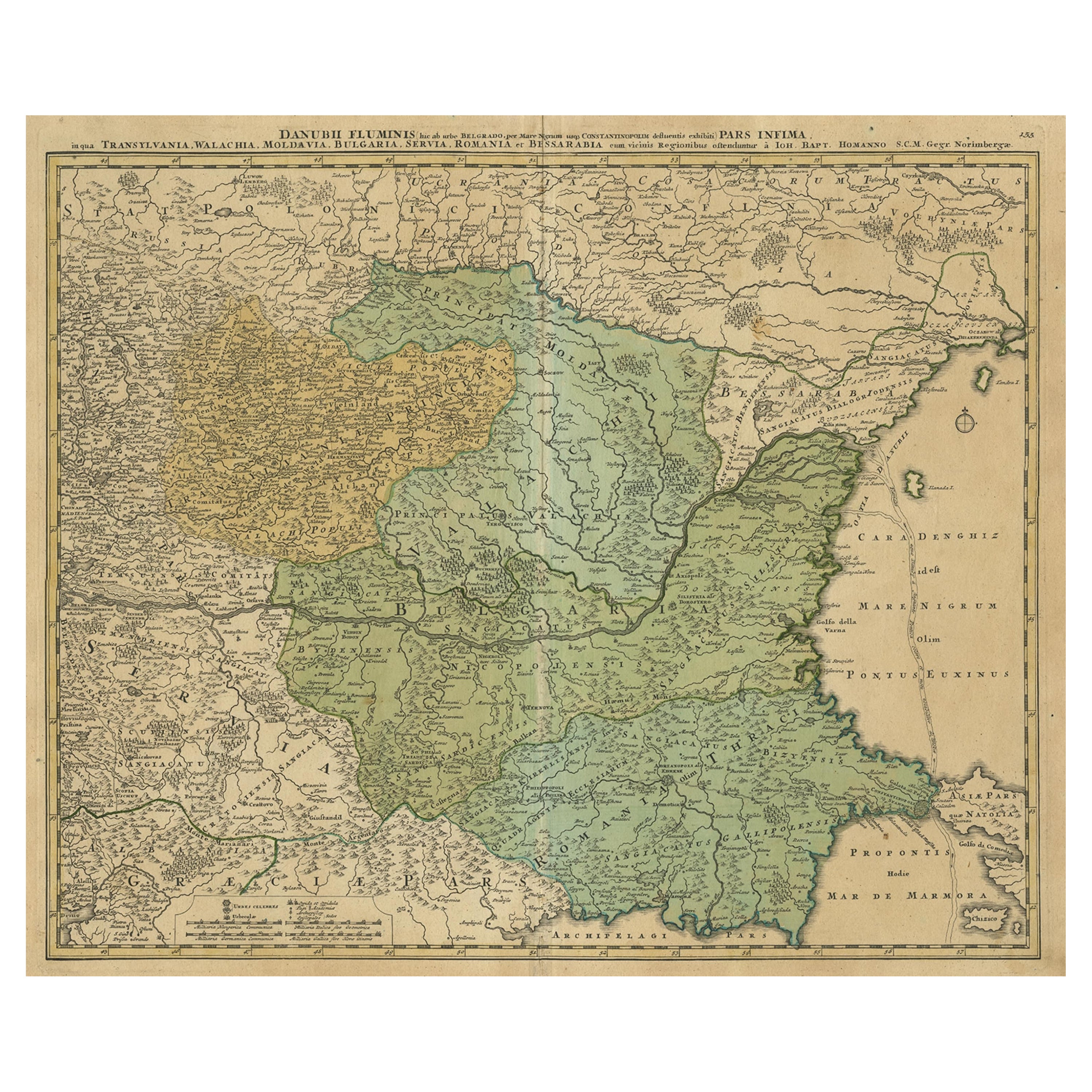
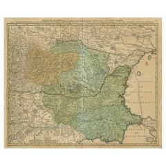
- Danube River Incl Serbia, Moldavia, Transylvania, Romania, Bulgaria Etc, ca.1720Located in Langweer, NLAntique map titled 'Danubii Fluminis (..)'. Regional map of the Donau river, Shows the Danube river from Belgrade in Serbia, along the border between ...Category
Antique 1720s Maps
MaterialsPaper
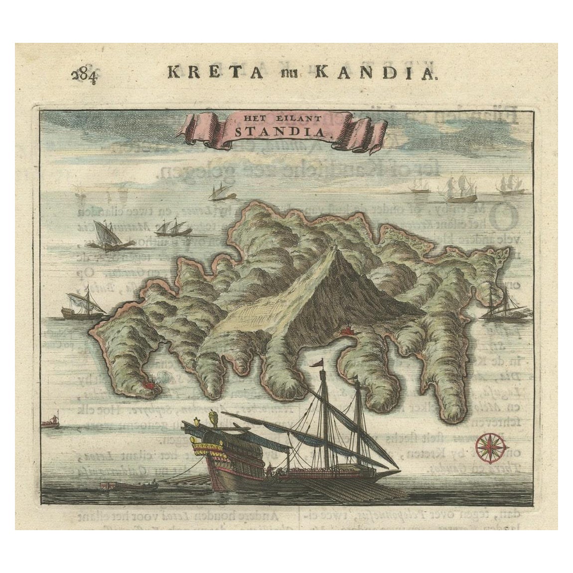
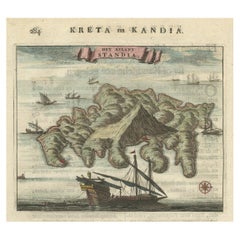
- Old Print of Standia, a Greek Island 'Heraklion, Crete, Greece, Balkans', 1688Located in Langweer, NLAntique print Greece titled 'Het Eilant Standia'. Old print of the island Standia, near Crete, Greece. This print originates from 'Nauwkeurige Bes...Category
Antique 17th Century Prints
MaterialsPaper
You May Also Like
- Old Nautical Map of CorsicaLocated in Alessandria, PiemonteST/556/1 - Old map of Corsica isle, surveyed by Captain Hell, of the French Royal Navy in 1824, engraved and published on 1874, with additions and corre...Category
Antique Early 19th Century English Other Prints
MaterialsPaper
- Old Horizontal Map of EnglandBy TassoLocated in Alessandria, PiemonteST/520 - Old rare Italian map of England, dated 1826-1827 - by Girolamo Tasso, editor in Venise, for the atlas of M.r Le-Sage.Category
Antique Early 19th Century Italian Other Prints
MaterialsPaper
- Hand-Colored 18th Century Homann Map of the Danube, Italy, Greece, CroatiaBy Johann Baptist HomannLocated in Alamo, CA"Fluviorum in Europa principis Danubii" is a hand colored map of the region about the Danube river created by Johann Baptist Homann (1663-1724) in his 'Atlas Novus Terrarum', publish...Category
Antique Early 18th Century German Maps
MaterialsPaper
- Original Antique Map of Ancient Greece, Achaia, Corinth, 1786Located in St Annes, LancashireGreat map of Ancient Greece. Showing the region of Thessaly, including Mount Olympus Drawn by J.D. Barbie Du Bocage Copper plate engraving by P.F Tardieu Original hand color...Category
Antique 1780s French Other Maps
MaterialsPaper
- Original Antique Map of Ancient Greece- Boeotia, Thebes, 1787Located in St Annes, LancashireGreat map of Ancient Greece. Showing the region of Boeotia, including Thebes Drawn by J.D. Barbie Du Bocage Copper plate engraving by P.F T...Category
Antique 1780s French Other Maps
MaterialsPaper
- Map of the Republic of GenoaLocated in New York, NYFramed antique hand-coloured map of the Republic of Genoa including the duchies of Mantua, Modena, and Parma. Europe, late 18th century. Dimension: 25...Category
Antique Late 18th Century European Maps


