Items Similar to Original Anitque Map of the Banda or Spice islands in the Dutch East Indies


Want more images or videos?
Request additional images or videos from the seller
Original Anitque Map of the Banda or Spice islands in the Dutch East Indies
About the Item
Dutch print with the title: Nieuw Caart der Eylanden van BANDA. Gemaakt door François Valentyn, J.van Braamen G.O. Linden
The map is taken from: 'Oud en Nieuw Oost-Indiën' van François Valentyn.
1) Ottens, Frederik (engraver / etcher)
2) Braam, J. van (publisher)
3) Linden, Gerard onder de (publisher)
This original antique map, "Nieuwe Caart der Eylanden van BANDA," is a cartographic gem crafted by François Valentyn. It showcases the islands of Banda, also know as the Spice Islands, captivating jewels nestled within the Indonesian archipelago. Valentyn's meticulous attention to detail and geographical precision illuminate the geography of these islands.
The map offers a vivid portrayal of the Banda Islands, renowned for their historical significance in the spice trade, particularly for nutmeg. It intricately delineates the archipelago's land masses, coastlines, and possibly notable landmarks or settlements on these exotic islands.
It also includes the Island of RUN.
Run, also known as Pulau Run, Pulo Run, Puloroon, or Rhun, represents one of the Banda Islands, nestled within the Moluccas archipelago in Indonesia. As one of the smallest islands within the Banda group.
In 1616, driven by apprehension of Dutch influence, the indigenous inhabitants of Run pledged loyalty to employees of the English East India Company, who acknowledged it on behalf of the Crown. Historian John Keay draws a parallel, likening Pulo Run's significance to the genesis of the British Empire, comparing it to Runnymede's role in British constitutional history. During the 17th century, this minuscule island held immense economic importance due to the precious spices it yielded, notably nutmeg and mace.
Crafted with precision and artistry, Valentyn's map might include cartographic elements such as compass roses, scale bars, or decorative embellishments, enriching its visual appeal and navigational utility.
Valentyn, a distinguished cartographer and historian, left an indelible mark with his comprehensive narratives. This map, likely a part of his works published in the 17th and 18th centuries, provides a historical window into the allure of the Banda Islands, reflecting their significance in the spice trade and the broader colonial history of the region.
Published between 1724-1726 in Dordrecht by Joannes van Braam and Gerard Onder de Linden as part of "Oud en nieuw Oost-Indiën," this captivating engraving forms part of François Valentyn's meticulous narrative. Offering a vivid portrayal of Dutch power in the region, it presents a rich tapestry of descriptions encompassing the Moluccas, the Dutch comptoir in Surat, and intriguing insights into the lives of the Great Moguls. An evocative piece, it invites you on a historical voyage through the treasures and maritime legacy of the Malabar Coast.
- Dimensions:Height: 13.19 in (33.5 cm)Width: 17.33 in (44 cm)Depth: 0 in (0.02 mm)
- Materials and Techniques:Paper,Engraved
- Period:1720-1729
- Date of Manufacture:1726
- Condition:Very good condition, especially considering its age. A view folding lines are visible. The coloring is from recent years on a slightly discolored sheet due to age. Study the image carefully.
- Seller Location:Langweer, NL
- Reference Number:Seller: BG-13424-61stDibs: LU3054337349092
About the Seller
5.0
Platinum Seller
These expertly vetted sellers are 1stDibs' most experienced sellers and are rated highest by our customers.
Established in 2009
1stDibs seller since 2017
1,951 sales on 1stDibs
Typical response time: <1 hour
- ShippingRetrieving quote...Ships From: Langweer, Netherlands
- Return PolicyA return for this item may be initiated within 14 days of delivery.
More From This SellerView All
- Original Antique Map Southeast of the Banda or Spice Islands, Indonesia, 1726Located in Langweer, NLAntique map titled 'Kaart van de Zuyd-Ooster Eylanden van Banda'. Map of the southeastern part of the Banda islands. This map originates from 'Oud en Nieuw Oost-Indiën' by F. Valen...Category
Antique 1720s Maps
MaterialsPaper
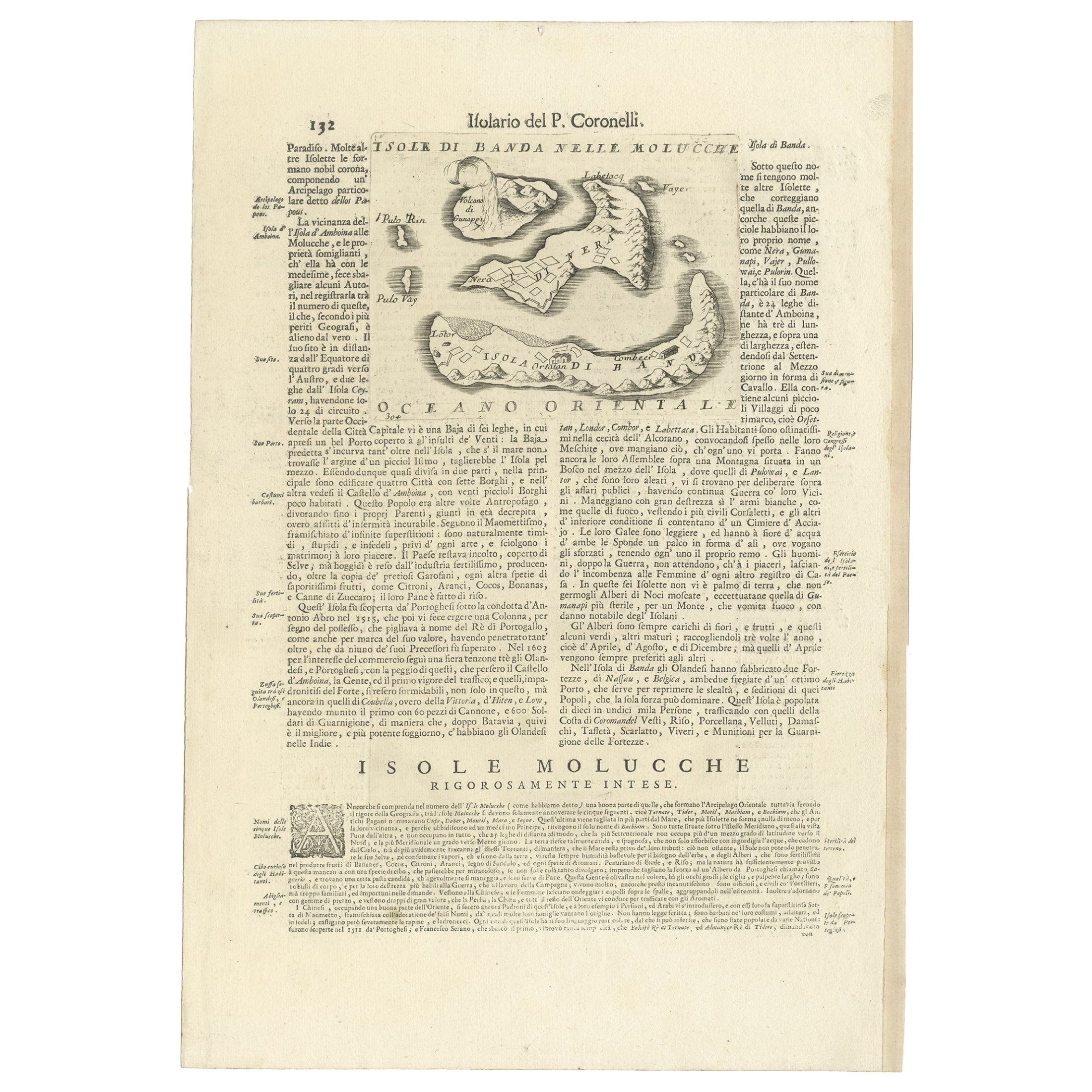
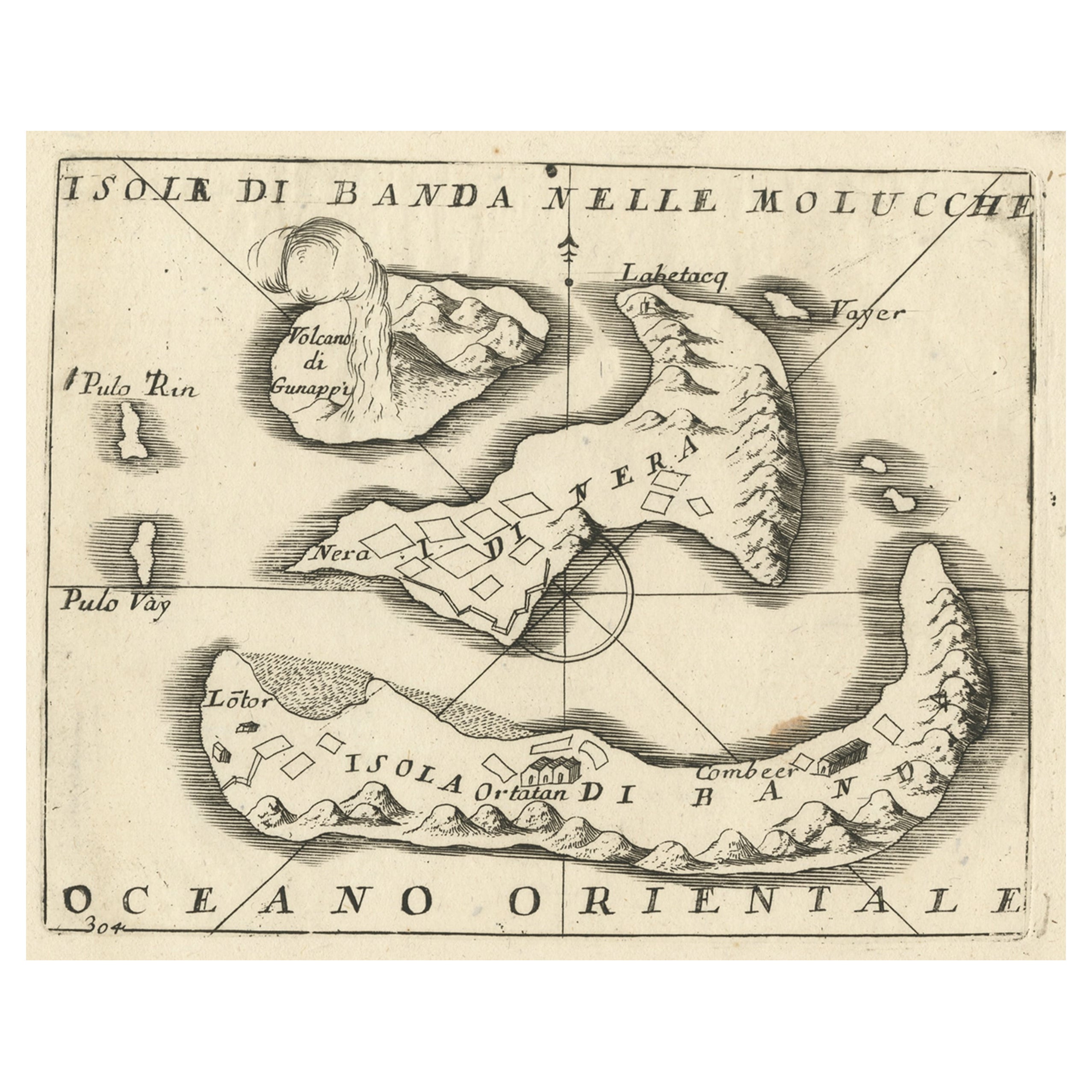
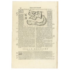
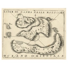
- Antique Map of the Banda Islands or Spice Islands, Moluccas, Indonesia, 1697Located in Langweer, NLAntique map titled 'Isole di Banda Nelle Molucche'. Engraved map of Isola di Banda, Nelle, Molucche. On verso: 'Isola di Solor'. Artists and Engravers: Vincenzo Maria (Padre)...Category
Antique 17th Century Maps
MaterialsPaper
- Small Old Map Depicting the Banda Islands or the Spice Islands, Indonesia, 1706Located in Langweer, NLAntique map titled 'Isole di Banda Nelle Molucche'. Small old map depicting the Banda Islands, Indonesia. Artists and Engravers: Published by V.M. Coronelli in Venice, 1706.Category
Antique Early 1700s Maps
MaterialsPaper
- Antique Chart of the Banda Islands or The Spice Islands, Indonesia, 1726Located in Langweer, NLAntique map titled 'Nieuwe Caart der Eylanden van Banda'. Beautiful chart of the Banda Islands including Banda Api, Banda Neira, Banda Besar, Pulau Hatta (Rosengain), Pulau Ai an...Category
Antique 1720s Maps
MaterialsPaper
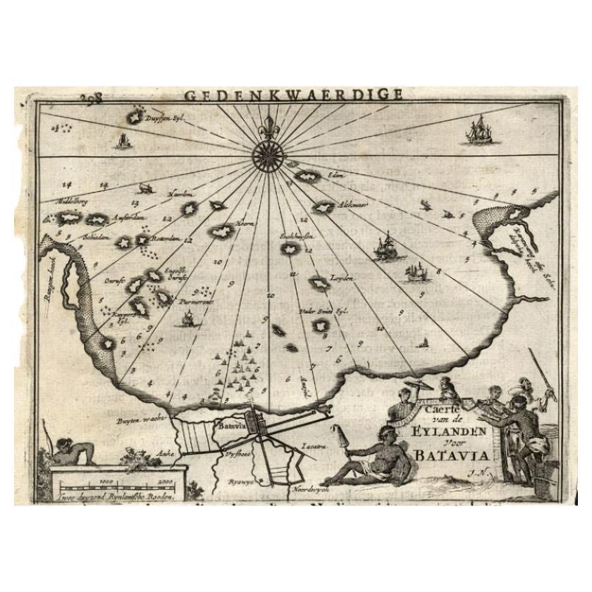
- Antique Map of the Islands Near Batavia, Capital of the Dutch East Indies, 1682Located in Langweer, NLAntique map titled 'Caerte van de Eylanden voor Batavia.' Map of the islands near Batavia, Indonesia. With scale, compass rose, cartouche and ships on the sea. Sheet with engraving...Category
Antique 17th Century Maps
MaterialsPaper
- Original Old Map of the Environs of Batavia in the Dutch East Indies (Indonesia)Located in Langweer, NLAntique map titled 'Carte des Environs de Batavia'. Map of the environs of Batavia (now Jakarta), Indonesia. This print originates from volume 8 of 'Histoire générale des voyages'. P...Category
Antique Mid-18th Century Maps
MaterialsPaper


You May Also Like
- Large Original Antique Map of The West Indies by Sidney Hall, 1847Located in St Annes, LancashireGreat map of The West Indies Drawn and engraved by Sidney Hall Steel engraving Original colour outline Published by A & C Black. 1847 Unframed Free shipping.Category
Antique 1840s Scottish Maps
MaterialsPaper
- Large Original Vintage Map of The Pacific Islands Including HawaiiLocated in St Annes, LancashireGreat map of The Pacific Islands Unframed Original color By John Bartholomew and Co. Edinburgh Geographical Institute Published, circa 1...Category
Vintage 1920s British Maps
MaterialsPaper
- Seminal guide to the East and West Indies, with 42 coloured maps and platesBy Jan Huygen van LinschotenLocated in ZWIJNDRECHT, NLSeminal guide to the East and West Indies, with 42 double-page and folding plates, including 6 maps, all engravings beautifully coloured by a contemporary hand LINSCHOTEN, Jan Huygh...Category
Antique Early 17th Century Dutch Dutch Colonial Books
MaterialsPaper
- Original Antique Map of South East Asia, Arrowsmith, 1820Located in St Annes, LancashireGreat map of South East Asia Drawn under the direction of Arrowsmith Copper-plate engraving Published by Longman, Hurst, Rees, Orme and Brown, 1820 Unframed.Category
Antique 1820s English Maps
MaterialsPaper
- Large Original Antique Map of Rhode Island, USA, C.1900Located in St Annes, LancashireFabulous map of Rhode Island Original color Engraved and printed by the George F. Cram Company, Indianapolis. Published, C.1900 Unframed Free ...Category
Antique 1890s American Maps
MaterialsPaper
- East German MapBy VEB Hermann HaackLocated in Baltimore, MDA brilliantly colourful map of the Leipzig, Karl Marx Stadt and Dresden area in the former German Democratic Republic by VEB Hermann Haack of Gotha.Category
Vintage 1970s German Maps


Recently Viewed
View AllMore Ways To Browse
Antique Map Of North And East Asia 1751
Map Of Mississippi
Bedfordshire Antique Map
Auge En Pierre
Covens & Mortier On Sale
Larousse Universel
Staffordshire Antique Map
Staffordshire Map
Tam Austria
Antique Furniture Manitoba
Nova Hollandia
William Wyld
Matthew Seutter On Sale
Menorca Map
Pierre Fran�ois Tardieu On Sale
Rand Mcnally Map Of Kansas
Sumba Map
1681 Moses Pitt