Items Similar to Original Antique Map of the Empire of Japan, Centered on the Bay of Osaka, c1752

Want more images or videos?
Request additional images or videos from the seller
1 of 6
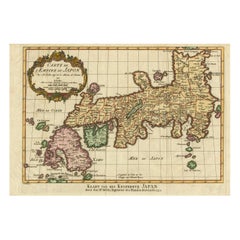
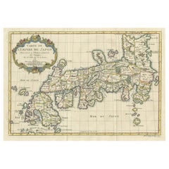
Original Antique Map of the Empire of Japan, Centered on the Bay of Osaka, c1752
About the Item
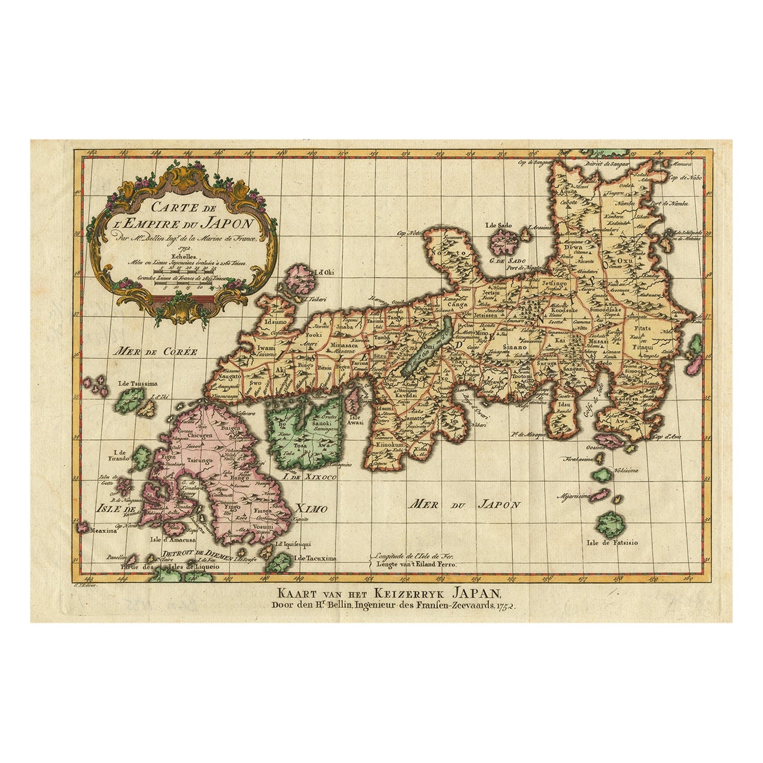
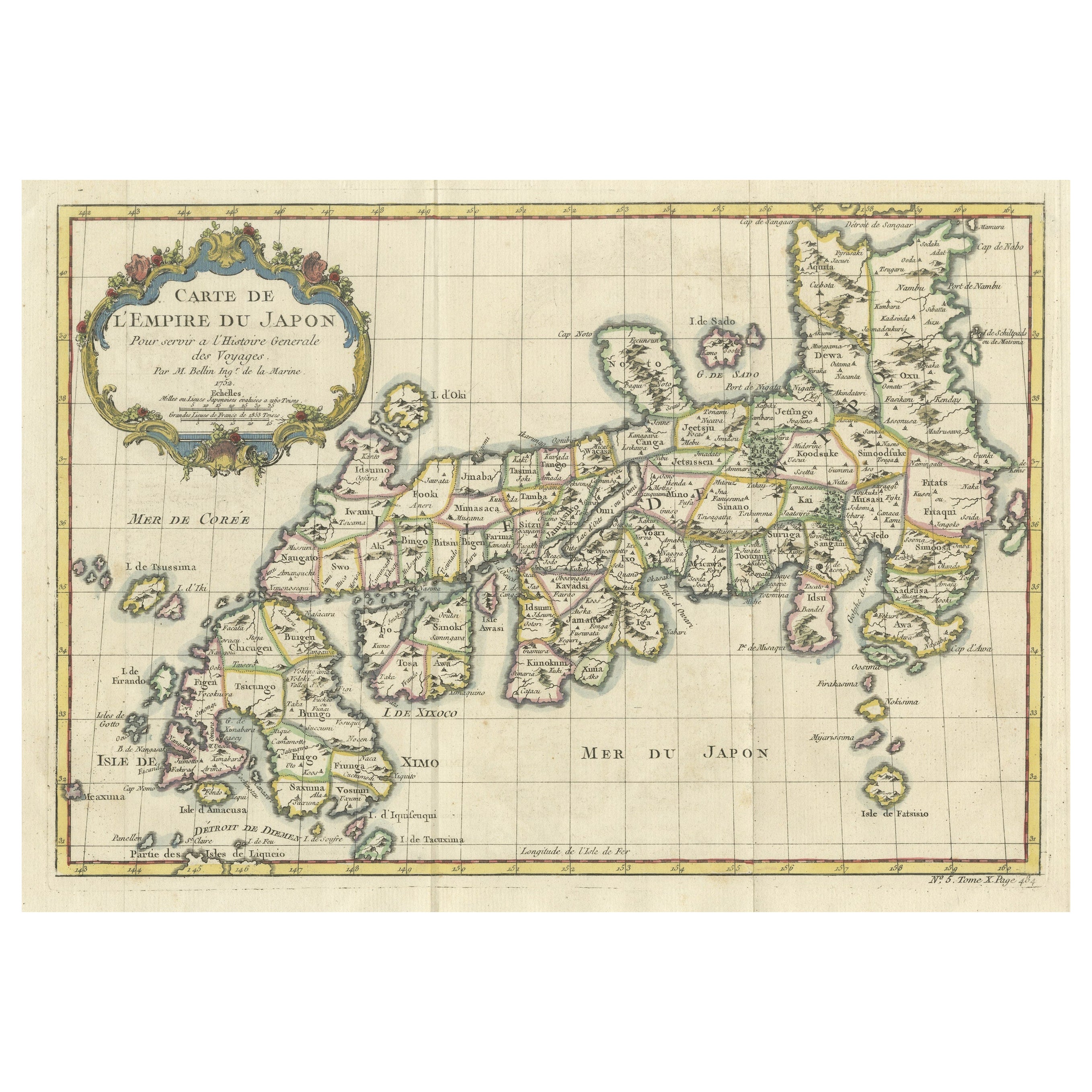
Antique map titled 'Carte de L'Empire de Japon (..).'
Map of the Empire of Japan. Centered on the Bay of Osaka, this map covers from Hirado (here identified as I. Firando) and Nagasaki to Akita (Aquita), to include most of Tokugawa (Edo) Era Japan. The island of Hokkaido is not included in this map. Various towns, harbors, bays, provinces, mountains and daimyo are noted, although many are speculative. Source unknown, to be determined.
Artists and Engravers: Jacques-Nicolas Bellin (1703 - 1772) was one of the most important cartographers of the 18th century. With a career spanning some 50 years, Bellin is best understood as geographe de cabinet and transitional mapmaker spanning the gap between 18th and early 19th century cartographic styles. His long career as Hydrographer and Ingénieur Hydrographe at the French Dépôt des cartes et plans de la Marine resulted in hundreds of high quality nautical charts of practically everywhere in the world. A true child of the Enlightenment Era, Bellin's work focuses on function and accuracy tending in the process to be less decorative than the earlier 17th and 18th century cartographic work. Unlike many of his contemporaries, Bellin was always careful to cite his references and his scholarly corpus consists of over 1400 articles on geography prepared for Diderot's Encyclopedie. Bellin, despite his extraordinary success, may not have enjoyed his work, which is described as "long, unpleasant, and hard." In addition to numerous maps and charts published during his lifetime, many of Bellin's maps were updated (or not) and published posthumously. He was succeeded as Ingénieur Hydrographe by his student, also a prolific and influential cartographer, Rigobert Bonne.
- Dimensions:Height: 10.63 in (27 cm)Width: 15.36 in (39 cm)Depth: 0 in (0.02 mm)
- Materials and Techniques:
- Period:1750-1759
- Date of Manufacture:circa 1752
- Condition:Condition: Very good, given age. Irregular bottom edge as issued. Original folds as issued. General age-related toning and/or occasional minor defects from handling. Please study image carefully.
- Seller Location:Langweer, NL
- Reference Number:
About the Seller
5.0
Platinum Seller
These expertly vetted sellers are 1stDibs' most experienced sellers and are rated highest by our customers.
Established in 2009
1stDibs seller since 2017
1,947 sales on 1stDibs
Typical response time: <1 hour
- ShippingRetrieving quote...Ships From: Langweer, Netherlands
- Return PolicyA return for this item may be initiated within 14 days of delivery.
More From This SellerView All
- Nice Antique Map of the Empire of Japan. Centered on the Bay of Osaka, ca.1752Located in Langweer, NLAntique map titled 'Carte de L'Empire de Japon (..).' Map of the Empire of Japan. Centered on the Bay of Osaka, this map covers from Hirado (here identified as I. Firando) and Naga...Category
Antique 1750s Maps
MaterialsPaper
- Antique Map of Japan by J.N. Bellin, 1752Located in Langweer, NLBellin's wonderfully detailed map of Japan from the atlas of Prevost d'Exiles' influential collection of travel narratives, Histoire Generale des Voyages. Considered the best general...Category
Antique Mid-18th Century Maps
MaterialsPaper
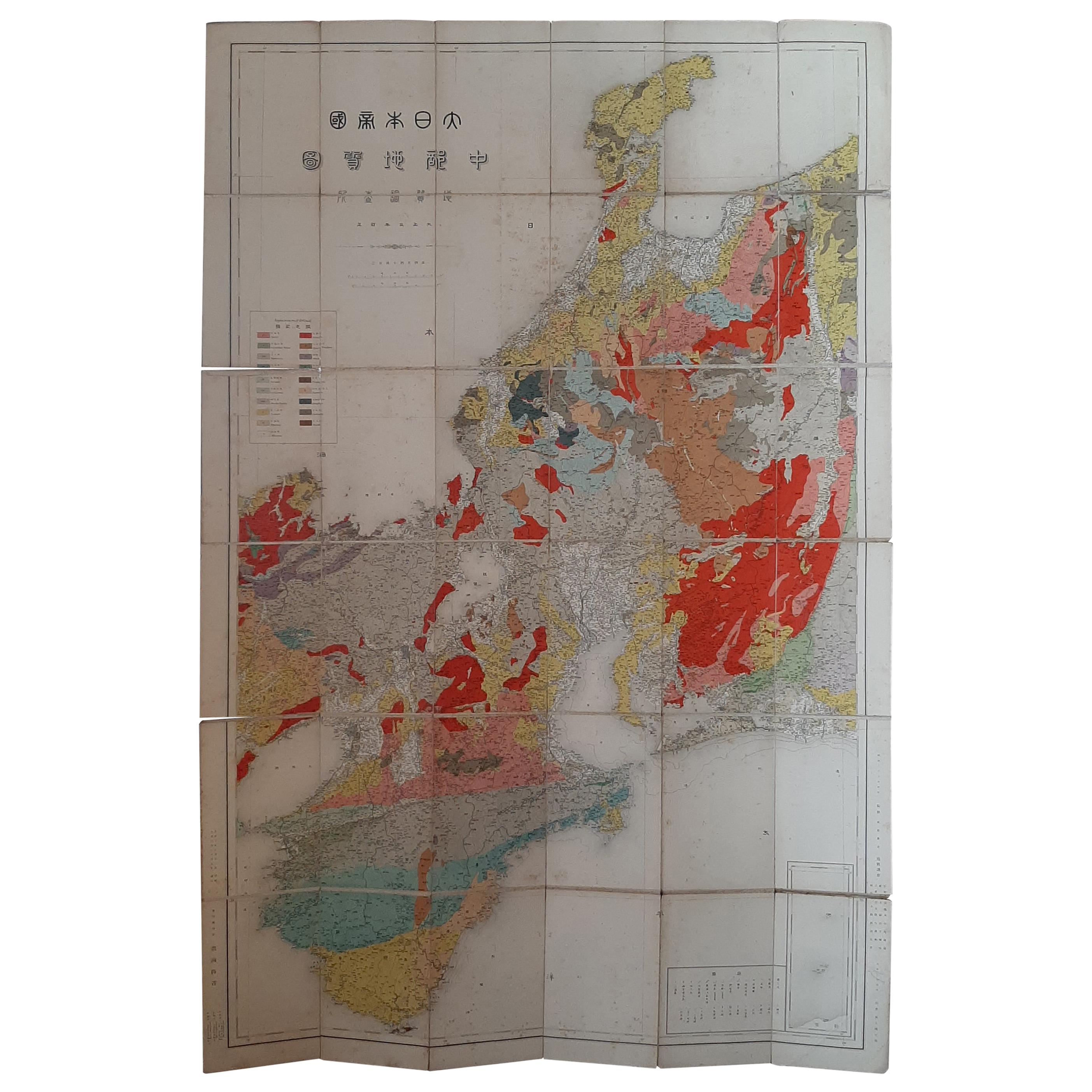
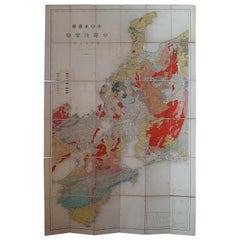
- Antique Map of the Region of Wakayama, Nara and Osaka 'Japan'Located in Langweer, NLGeological folding map of the area with Wakayama, Nara, Osaka, Mie, and Shiga in Japan, circa 1880: This map is a geological folding map, which means it was designed to be portable ...Category
Antique Late 19th Century Maps
MaterialsLinen, Paper
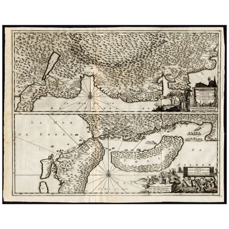
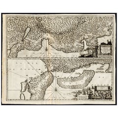
- Antique Map of the Region of Osaka and Hirado Island in Japan, 1725By Pieter Van Der AaLocated in Langweer, NLAntique map titled 'Description exacte et fidele des villes, bourgs et villages qui les Ambassadeurs de Hollande ont rencontrez dans leur voyage par terre de la ville Osacca jusqu'a ...Category
Antique 18th Century Maps
MaterialsPaper
- Attractive Hand-Tinted Antique Map of Japan, Published in 1752Located in Langweer, NLNice decorative hand tinted map of Japan with the title (in French): Carte de L'Empire du Japon Bellin, 1752 This antique map is engraved with very attractive title cartouche. ...Category
Antique 1750s Maps
MaterialsPaper
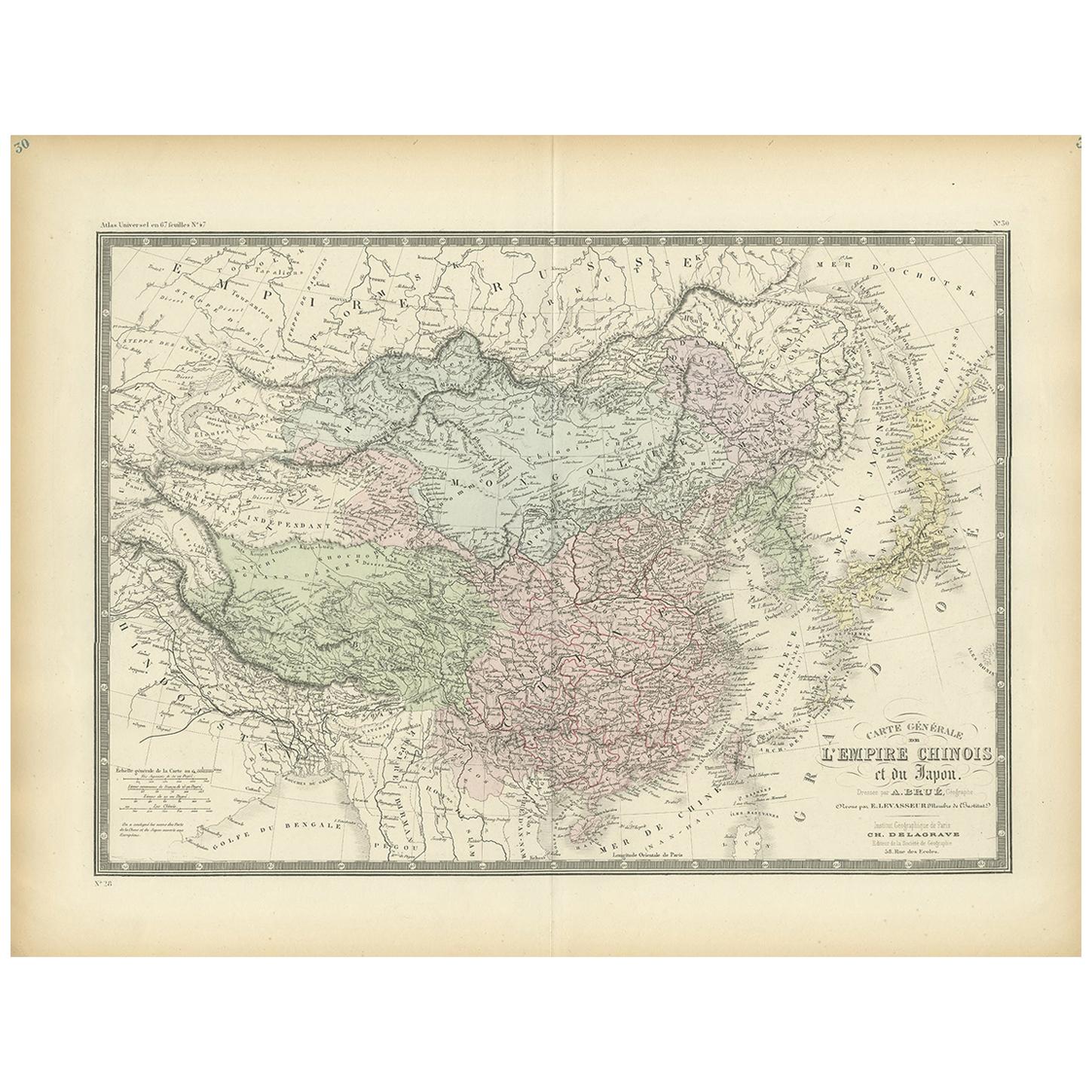
- Antique Map of the Chinese Empire and Japan, '1875'Located in Langweer, NLAntique map titled 'Carte générale de l'Empire Chinois et du Japon'. Large map of the Chinese Empire and Japan. This map originates from 'Atlas de Géographie Moderne Physique et Poli...Category
Antique Late 19th Century Maps
MaterialsPaper

You May Also Like
- Original Antique Map of Italy. C.1780Located in St Annes, LancashireGreat map of Italy Copper-plate engraving Published C.1780 Unframed.Category
Antique Early 1800s English Georgian Maps
MaterialsPaper

- Original Antique Map of Asia. C.1780Located in St Annes, LancashireGreat map of Asia Copper-plate engraving Published C.1780 Two small worm holes to right side of map Unframed.Category
Antique Early 1800s English Georgian Maps
MaterialsPaper

- Original Antique Map of India. C.1780Located in St Annes, LancashireGreat map of India Copper-plate engraving Published C.1780 Three small worm holes to right side of map and one bottom left corner Unframed.Category
Antique Early 1800s English Georgian Maps
MaterialsPaper

- Original Antique Map of The World by Thomas Clerk, 1817Located in St Annes, LancashireGreat map of The Eastern and Western Hemispheres On 2 sheets Copper-plate engraving Drawn and engraved by Thomas Clerk, Edinburgh. Published by Mackenzie And Dent, 1817 ...Category
Antique 1810s English Maps
MaterialsPaper
- Original Antique Map of The Netherlands, Engraved by Barlow, Dated 1807Located in St Annes, LancashireGreat map of Netherlands Copper-plate engraving by Barlow Published by Brightly & Kinnersly, Bungay, Suffolk. Dated 1807 Unframed.Category
Antique Early 1800s English Maps
MaterialsPaper
- Original Antique Map of Italy. Arrowsmith. 1820Located in St Annes, LancashireGreat map of Italy Drawn under the direction of Arrowsmith Copper-plate engraving Published by Longman, Hurst, Rees, Orme and Brown, 1820 Unframed.Category
Antique 1820s English Maps
MaterialsPaper


Recently Viewed
View AllMore Ways To Browse
Antique Empire De
Center Island
Antique Bay
Antique Center Islands
Maps Of Long Island
Long Island Map
Map Of Long Island
Cart Cover
Japanese Empire
La Marine Antique
Antique Style Trolley
Used Furniture Depot
Map Cabinet
Long Island Cabinet
Japanned Cabinet 18th Century
Antique Japanese Maps
Antique Japanese Map
18th Century French Child Furniture