Items Similar to Original Antique Map of Pennsylvania Showing Interesting Statistics Etc, 1825

Want more images or videos?
Request additional images or videos from the seller
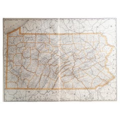
Original Antique Map of Pennsylvania Showing Interesting Statistics Etc, 1825
About the Item
Attractive map of Pennsylvania with bordercoloring of the county and showing the various towns, roads, rivers, bridges, and a host of other details.
The map is surrounded by French text describing the statistics of the state, its population, governors, religion, education, commerce, climate topography and more. This map comes from the French edition of Carey & Lea's American Atlas. The French edition is a superior work, using better paper and a superior engraving technique.
Condition: Good to very good. Strong and clean paper. Original colouring. In the top margins a few faint stains due to handling. Study image carefully.
- Dimensions:Height: 12 in (30.48 cm)Width: 17 in (43.18 cm)Depth: 0.002 in (0.06 mm)
- Materials and Techniques:
- Period:
- Date of Manufacture:1825
- Condition:
- Seller Location:Langweer, NL
- Reference Number:
About the Seller
5.0
Platinum Seller
These expertly vetted sellers are 1stDibs' most experienced sellers and are rated highest by our customers.
Established in 2009
1stDibs seller since 2017
1,949 sales on 1stDibs
Typical response time: <1 hour
- ShippingRetrieving quote...Ships From: Langweer, Netherlands
- Return PolicyA return for this item may be initiated within 14 days of delivery.
More From This SellerView All
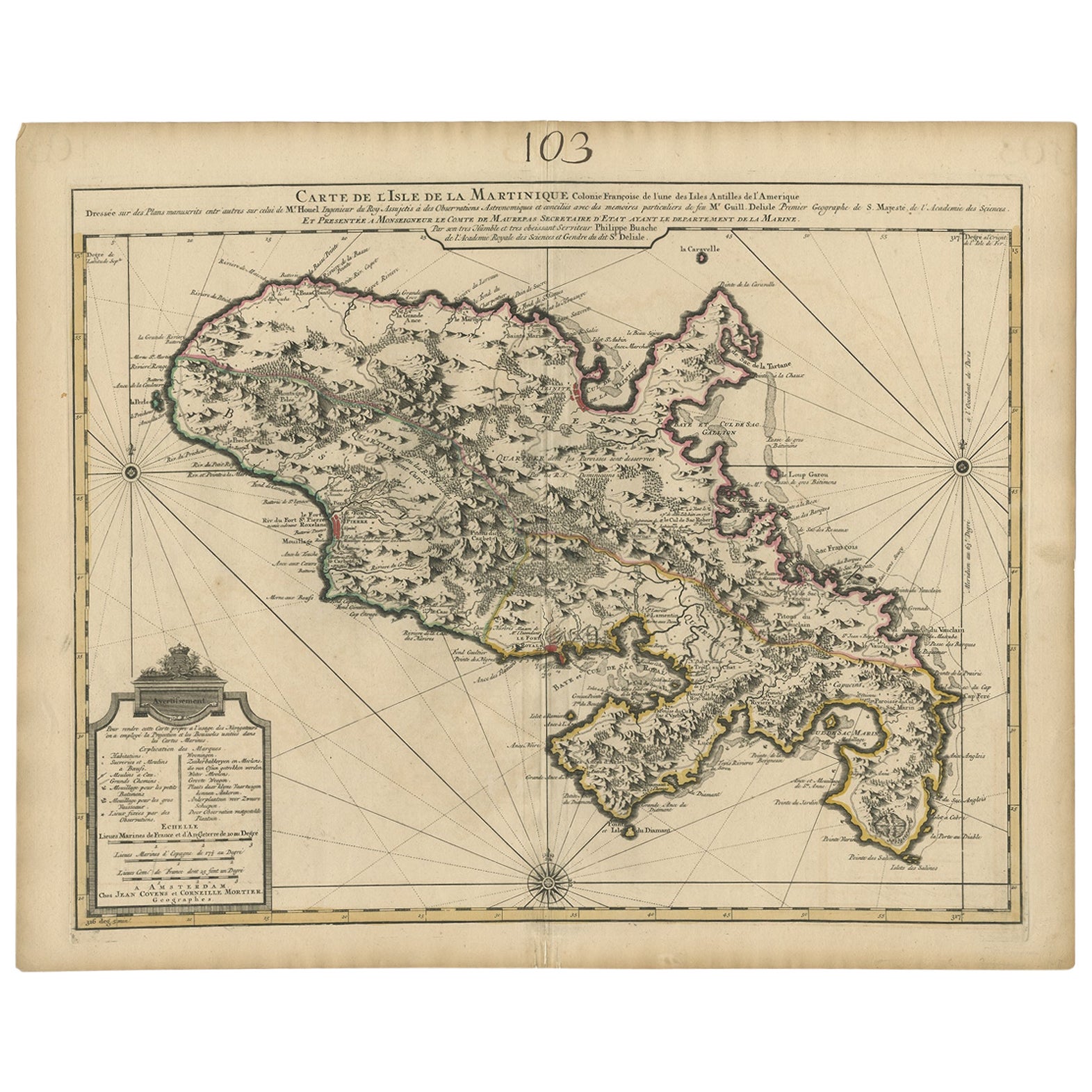
- Antique Map of Martinique, Showing Roads, Houses, Sugar Plantations, etc. c.1750Located in Langweer, NLAntique map titled 'Carte de l'Isle de la Martinique'. Detailed map of Martinique. Shows hilly terrain, forests, roads, houses, and even the sugar plantations. The island was to ...Category
Antique 18th Century Maps
MaterialsPaper
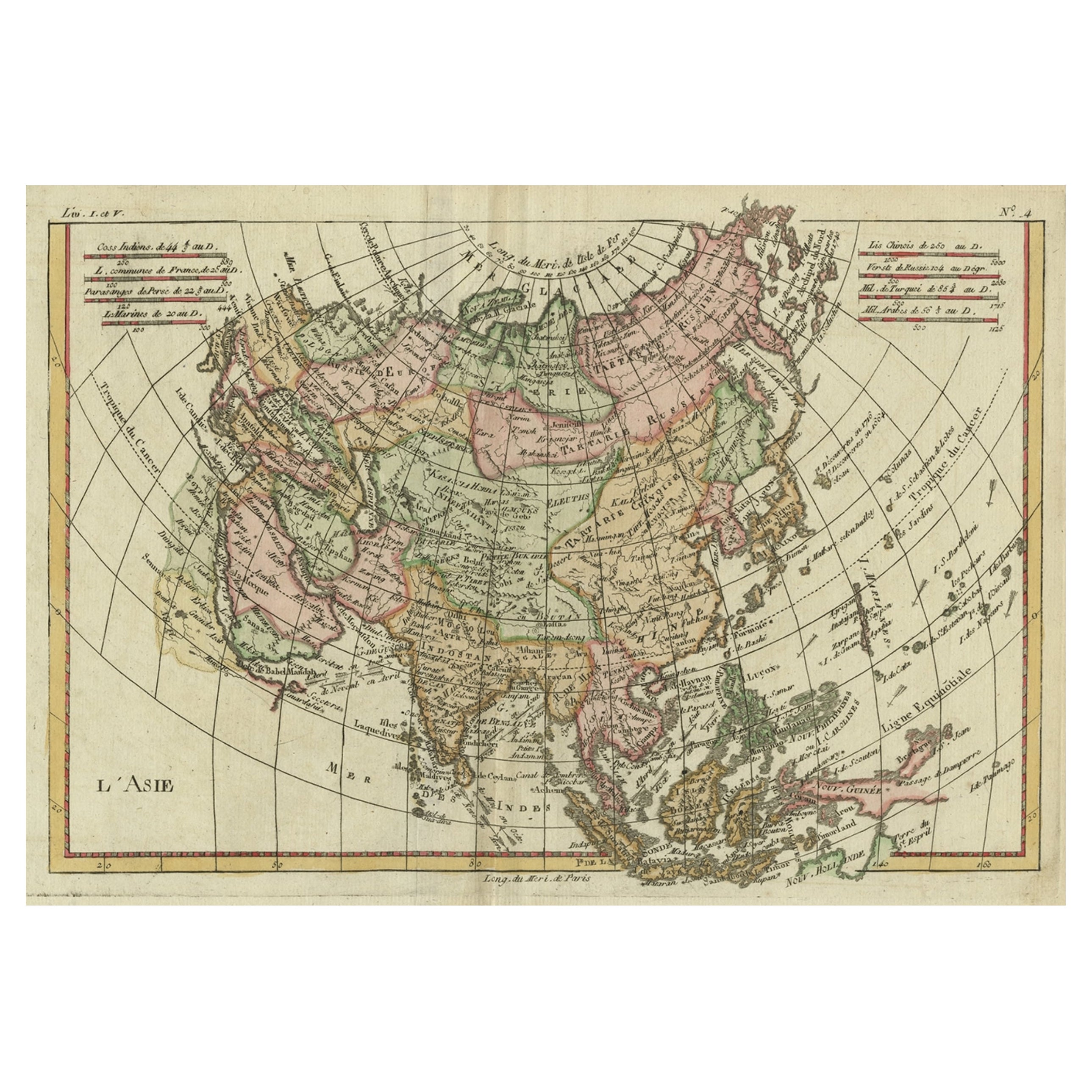
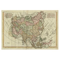
- Antique Map of Asia, Showing Tradewinds, Silke Route Cities Etc, c.1780Located in Langweer, NLAntique map titled 'L'Asie.' Map of Asia. Offers considerable detail considering the size, showing the tradewinds in the Pacific and Indian Oceans as well as numerous Silk Route citi...Category
Antique 18th Century Maps
MaterialsPaper
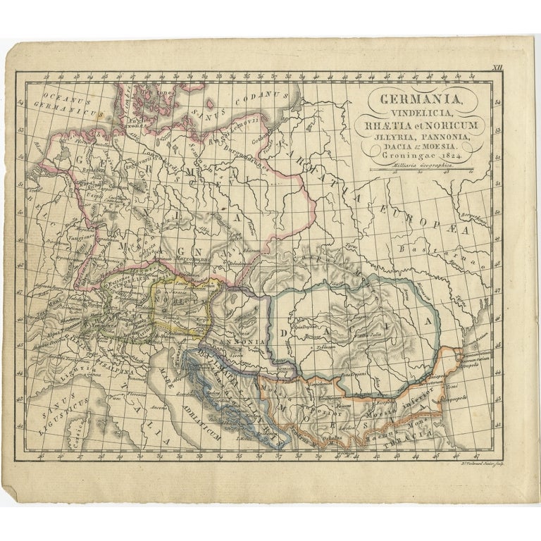
- Antique Map of Germany in Roman Times, Showing Roman Provinces, 1825Located in Langweer, NLAntique map titled 'Germania, Vindelicia, Rhaetia et Noricum Jllyria, Pannonia, Dacie & Moesia'. Old map of Germany and surroundings originating from 'Atlas der Oude Wereld'. Artists...Category
Antique 19th Century Maps
MaterialsPaper
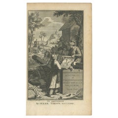
- Antique Frontispiece by Tirion, Showing a Map of Africa, an Elephant Etc, 1731Located in Langweer, NLAntique frontispiece of the 3rd volume of 'Hedendaagsche historie of tegenwoordige staat van allen volkeren (..)' by Thomas Salmon. This volume describes Peg...Category
Antique 18th Century Prints
MaterialsPaper
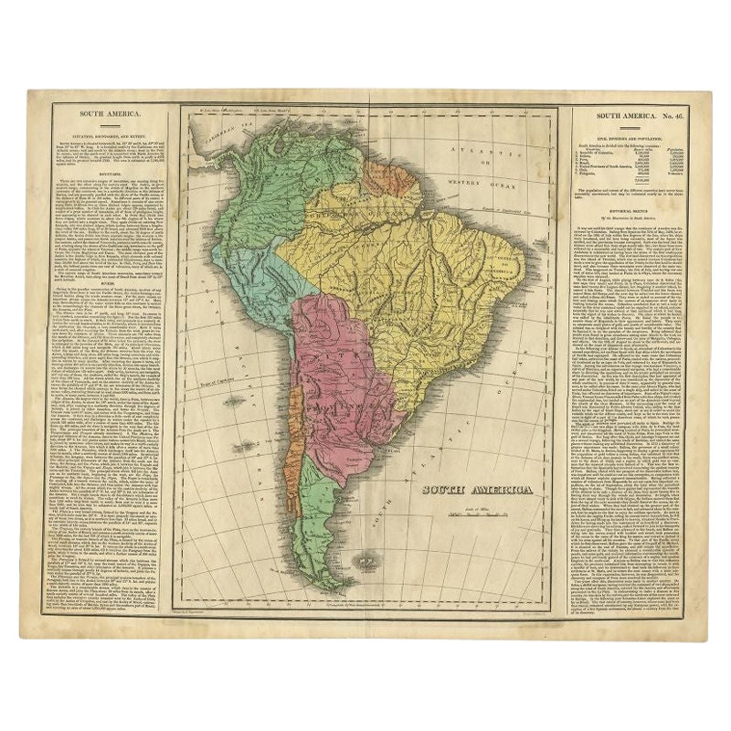
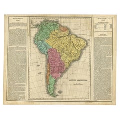
- Interesting Original Antique Map of South America, 1822Located in Langweer, NLAntique map titled 'South America'. Map of South America with attractive topography, surrounded on three sides by text on the history, geography, and economy of the continent. Sh...Category
Antique 19th Century Maps
MaterialsPaper
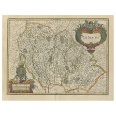
- Antique Map of the French Province Maine, Showing Le Mans, Alencon Etc., Ca1640Located in Langweer, NLAntique map titled 'Le Maine'. Old map of the province of Maine, France. It shows the cities of Le Mans, Alencon and others. This map originates from a composite atlas. Artis...Category
Antique 1640s Maps
MaterialsPaper

You May Also Like
- Large Original Antique Map of Pennsylvania, USA, 1894By Rand McNally & Co.Located in St Annes, LancashireFabulous map of Pennsylvania Original color. By Rand, McNally & Co. Published, 1894. Unframed. Free shipping.Category
Antique 1890s American Maps
MaterialsPaper
- Original Antique Map of the American State of Pennsylvania, 1889Located in St Annes, LancashireGreat map of Pennsylvania Drawn and Engraved by W. & A.K. Johnston Published By A & C Black, Edinburgh. Original colour Unframed. Repair to a minor tear on bottom edge.Category
Antique 1880s Scottish Victorian Maps
MaterialsPaper
- Antique 18th Century Map of the Province of Pensilvania 'Pennsylvania State'Located in Philadelphia, PAA fine antique of the colony of Pennsylvania. Noted at the top of the sheet as a 'Map of the province of Pensilvania'. This undated and anonymous map is thought to be from the Gentleman's Magazine, London, circa 1775, although the general appearance could date it to the 1760's. The southern boundary reflects the Mason-Dixon survey (1768), the western boundary is placed just west of Pittsburgh, and the northern boundary is not marked. The map has a number of reference points that likely refer to companion text and appear to be connected to boundaries. The western and southern boundaries are marked Q, R, S, for example. A diagonal line runs from the Susquehanna R to the Lake Erie P. A broken line marked by many letters A, B, N, O, etc., appears in the east. There are no latitude or longitude markings, blank verso. Framed in a shaped contemporary gilt wooden frame and matted under a cream colored matte. Bearing an old Graham Arader Gallery...Category
Antique 18th Century British American Colonial Maps
MaterialsPaper
- Original Antique Map of Italy. C.1780Located in St Annes, LancashireGreat map of Italy Copper-plate engraving Published C.1780 Unframed.Category
Antique Early 1800s English Georgian Maps
MaterialsPaper

- Original Antique Map of Asia. C.1780Located in St Annes, LancashireGreat map of Asia Copper-plate engraving Published C.1780 Two small worm holes to right side of map Unframed.Category
Antique Early 1800s English Georgian Maps
MaterialsPaper

- Original Antique Map of India. C.1780Located in St Annes, LancashireGreat map of India Copper-plate engraving Published C.1780 Three small worm holes to right side of map and one bottom left corner Unframed.Category
Antique Early 1800s English Georgian Maps
MaterialsPaper


Recently Viewed
View AllMore Ways To Browse
Interesting Antique
Antique Etc
Antique Governor
Antique Pennsylvania Furniture
Pennsylvania Antiques
Antique State Maps
1825 American
French Map Of America
Antique Town Maps
French County
Map Of Pennsylvania
Antique Road Maps
Antique Road Map
Used Lea Furniture
Antique Pennsylvania Map
Pennsylvania Antique Map
Antique Maps Of Pennsylvania
Space Map