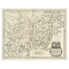
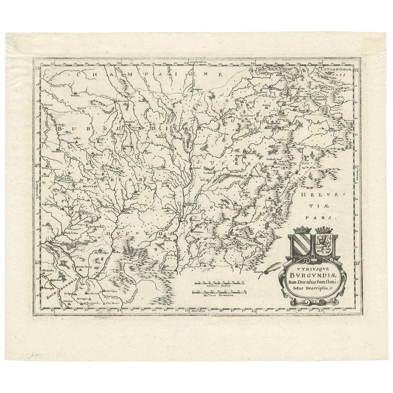
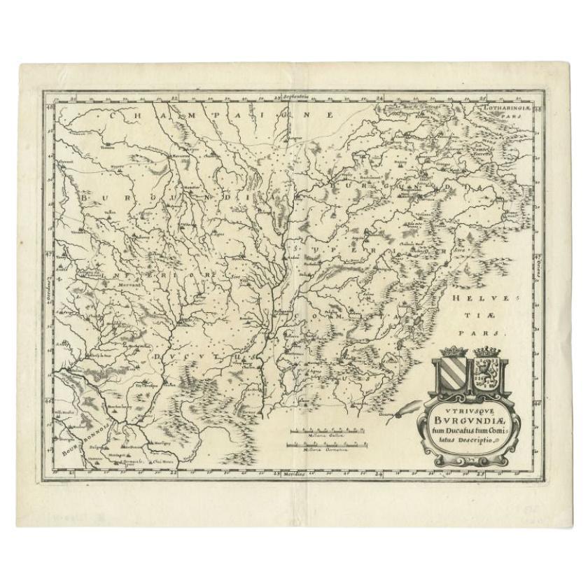
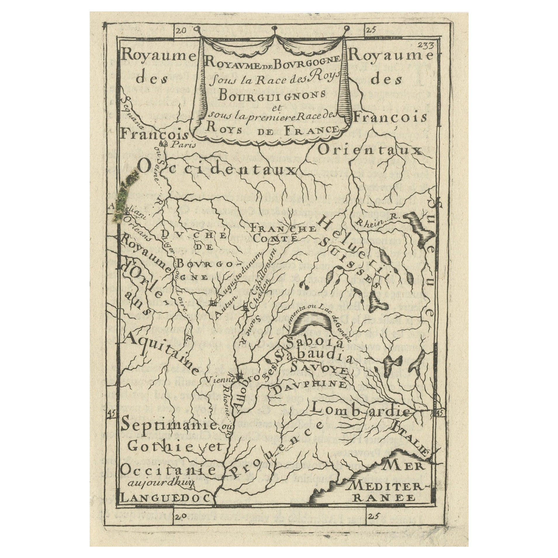
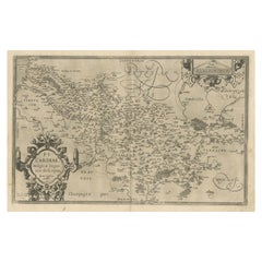
Original Copper Engraved Antique Map of the Burgundy Region of France, 1646
View Similar Items


Want more images or videos?
Request additional images or videos from the seller
1 of 6
Original Copper Engraved Antique Map of the Burgundy Region of France, 1646
About the Item
- Dimensions:Height: 12.01 in (30.5 cm)Width: 14.38 in (36.5 cm)Depth: 0 in (0.02 mm)
- Materials and Techniques:
- Period:1640-1649
- Date of Manufacture:1646
- Condition:
- Seller Location:Langweer, NL
- Reference Number:Seller: BG-12390-4 1stDibs: LU3054326653202
About the Seller
5.0
Platinum Seller
These expertly vetted sellers are 1stDibs' most experienced sellers and are rated highest by our customers.
Established in 2009
1stDibs seller since 2017
1,960 sales on 1stDibs
More From This SellerView All
- Antique Map of the Burgundy Region by Merian '1646'Located in Langweer, NLAntique map titled 'Utriusque Burgundiae tum Ducatus tum Comitatus descriptio'. Old map of the Burgundy (Bourgogne) region of France. This map originates from 'Neuwe Archontologia co...Category
Antique Mid-17th Century Maps
MaterialsPaper
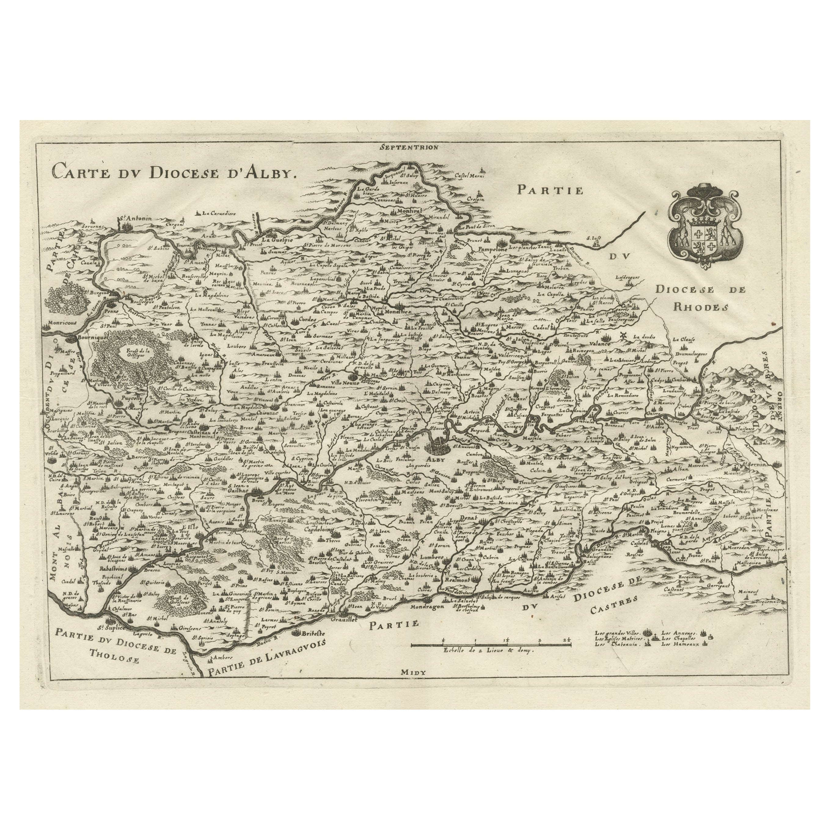
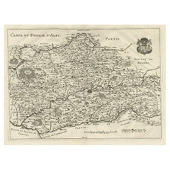
- Original Old Copper Engraved Map of the Region of Albi, Southern France, 1663Located in Langweer, NLAntique map titled 'Carte du Diocese d'Alby'. Original antique map of the region of Albi in Southern France. This map originates from 'Topographia Galliae dat is eene algemeene e...Category
Antique 1660s Maps
MaterialsPaper
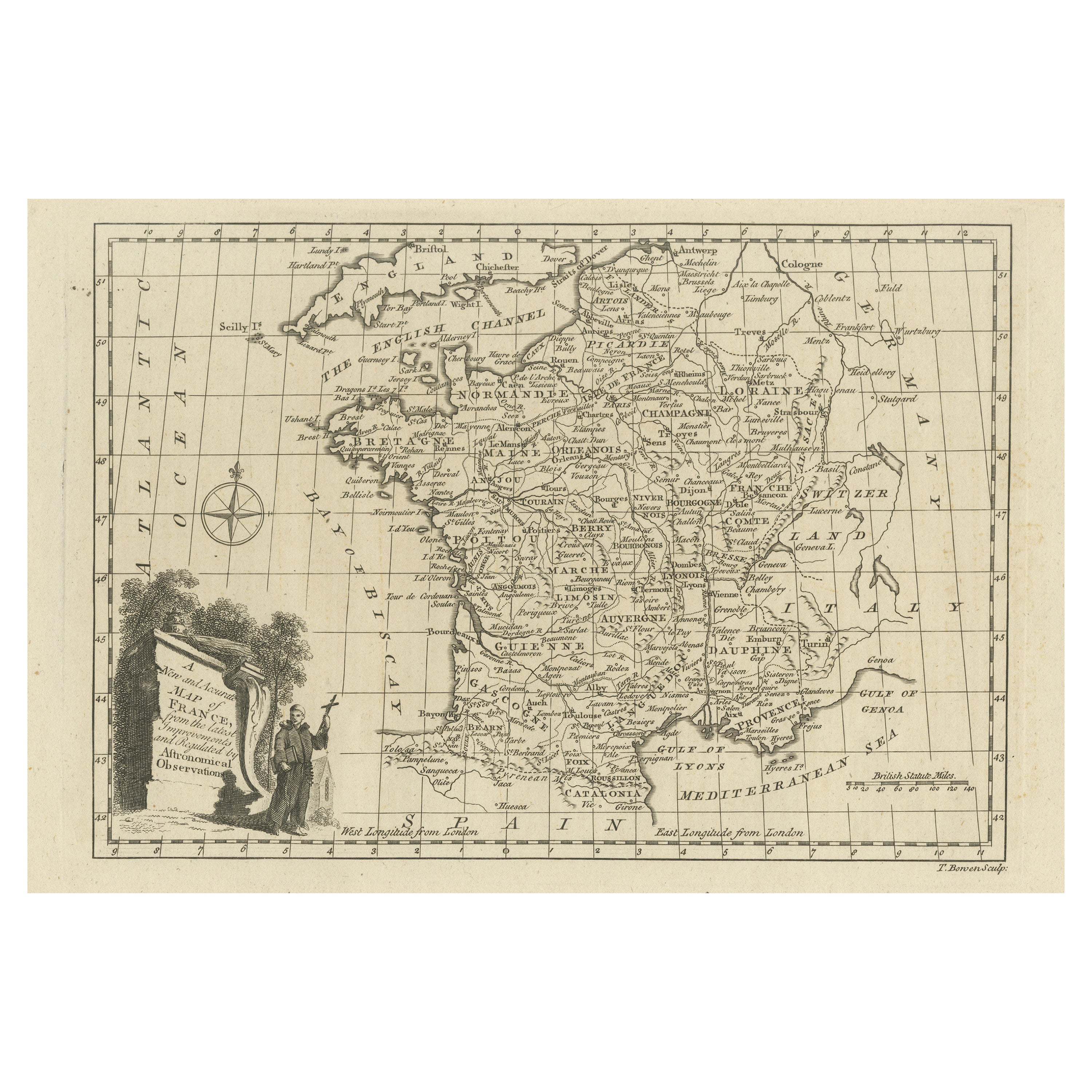
- Original Copper Engraved Map of FranceLocated in Langweer, NLAntique map titled 'New and Accurate Map of France from the latest improvements'. Original copper engraved map of France. Engraved by T. Bowen, published circa 1771.Category
Antique Late 18th Century Maps
MaterialsPaper
- Antique Map of the Burgundy Region by Merian, 1646Located in Langweer, NLAntique map titled 'Utriusque Burgundiae tum Ducatus tum Comitatus descriptio'. Old map of the Burgundy region of France. This map originates from 'Neuwe Archontologia cosmica'. Arti...Category
Antique 17th Century Maps
MaterialsPaper
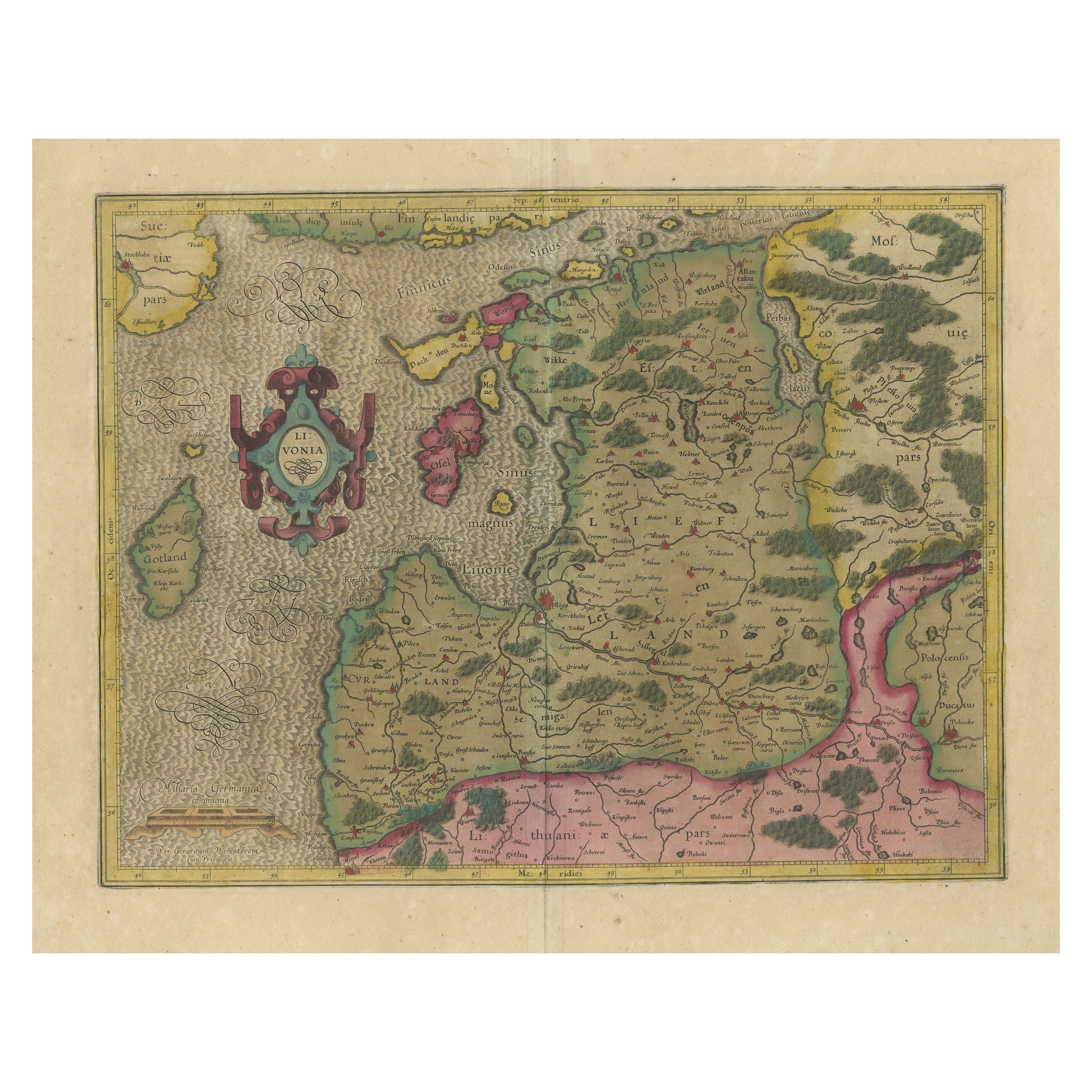
- Original Antique Map of the Northern Baltic RegionLocated in Langweer, NLTitle: "Livonia: Antique Map of the Northern Baltic Region" Description: This antique map, titled "Livonia," is a detailed representation of the northern Baltic region. Centered on ...Category
Antique Early 17th Century Maps
MaterialsPaper
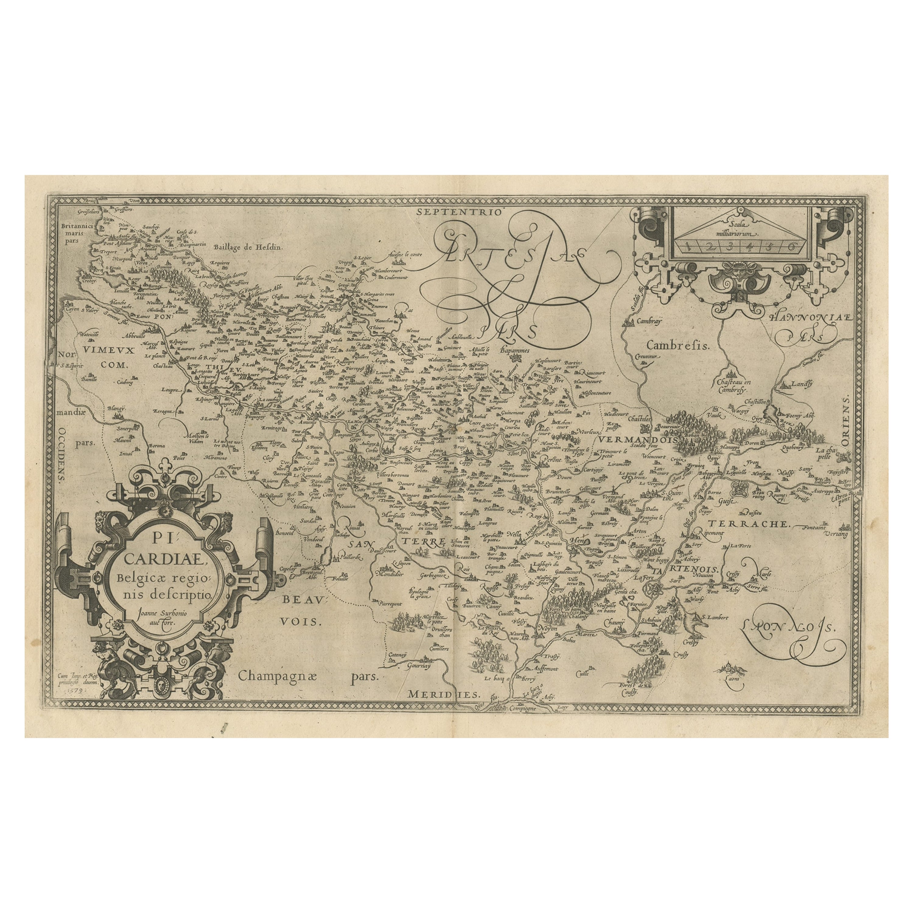
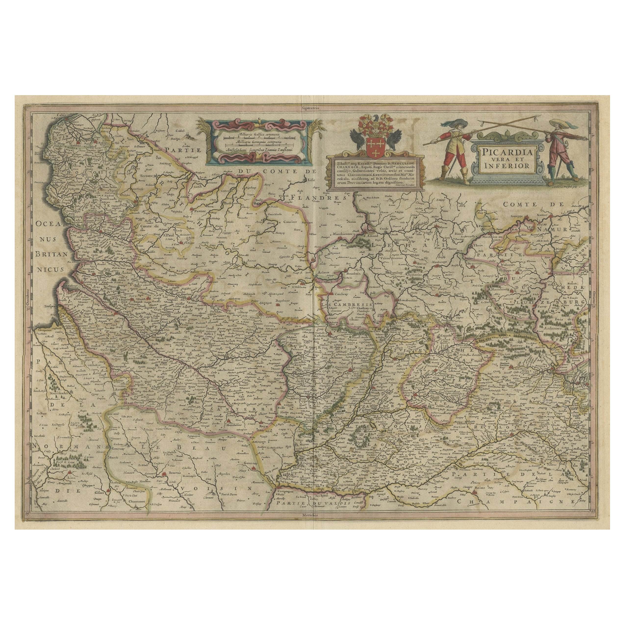
- Original Antique Map of the Region of Picardy, France, ca.1602Located in Langweer, NLAntique map titled 'Picardiae Belgicae regionis descriptio'. Original antique map of the region of Picardy, France. Superb example of the decorative style of Ortelius and filled ...Category
Antique Early 1600s Maps
MaterialsPaper


You May Also LikeView All
- Original Antique Map of Sweden, Engraved by Barlow, 1806Located in St Annes, LancashireGreat map of Sweden Copper-plate engraving by Barlow Published by Brightly & Kinnersly, Bungay, Suffolk. 1806 Unframed.Category
Antique Early 1800s English Maps
MaterialsPaper
- Original Antique Map of Switzerland, Engraved By Barlow, Dated 1807Located in St Annes, LancashireGreat map of Switzerland Copper-plate engraving by Barlow Published by Brightly & Kinnersly, Bungay, Suffolk. Dated 1807 Unframed.Category
Antique Early 1800s English Maps
MaterialsPaper
- Original Antique Map of Spain and Portugal, Engraved By Barlow, 1806Located in St Annes, LancashireGreat map of Spain And Portugal Copper-plate engraving by Barlow Published by Brightly & Kinnersly, Bungay, Suffolk. 1806 Unframed.Category
Antique Early 1800s English Maps
MaterialsPaper
- Original Antique Map of France, Arrowsmith, 1820Located in St Annes, LancashireGreat map of France Drawn under the direction of Arrowsmith. Copper-plate engraving. Published by Longman, Hurst, Rees, Orme and Brown, 1820 Unframed.Category
Antique 1820s English Maps
MaterialsPaper

- The Normandy Region of France: A 17th C. Hand-colored Map by Sanson and JaillotBy Nicolas SansonLocated in Alamo, CAThis large hand-colored map entitled "Le Duché et Gouvernement de Normandie divisée en Haute et Basse Normandie en divers Pays; et par evêchez, avec le Gouvernement General du Havre ...Category
Antique 1690s French Maps
MaterialsPaper
- Original Antique Map of Italy. C.1780Located in St Annes, LancashireGreat map of Italy Copper-plate engraving Published C.1780 Unframed.Category
Antique Early 1800s English Georgian Maps
MaterialsPaper


Recently Viewed
View AllMore Ways To Browse
Maria Magdalena
Antique Map Burgundy
Devonia Antique
J Thayer
Map Of Antigua
Nicolas De Fer
Antiques From Guatemala
Sumba Map
Used Furniture Cabo San Lucas
Antique Maps Washington Dc
Antique Map Tennessee
Heinrich Kiepert On Sale
Georgetown Map
Large Original Antique Map Of Philadelphia
Tanzania Antique Map
Abraham Ortelius On Sale
William Wyld
Antique Chesapeake Bay Map