Items Similar to Print of Maps of Islands of the South Pacific, Incl. Pitcairn & Dusky Bay, 1788
Want more images or videos?
Request additional images or videos from the seller
1 of 5
Print of Maps of Islands of the South Pacific, Incl. Pitcairn & Dusky Bay, 1788
About the Item
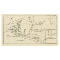
Antique map titled 'Esquisse de la Bay Dusky, Dans La Nouvelle Zeelande / I. Pitcairn / Isles de Wallis / I Turtle / I des Cocos and Traitres / Palmerston I. / I. Suavage / I. D'Hervey/ Havre Pickersgill / I de Pasques.'
Detailed set of maps of the islands of the South Pacific, with a large compass rose and inset of Dusky Bay on New Zealand. This map originates from 'Atlas encyclopedique: contenant la géographie ancienne' by Rigobert Bonne.
Artists and Engravers: Rigobert Bonne (1727-1795 ) was one of the most important cartographers of the late 18th century. In 1773 he succeeded Jacques Bellin as Royal Cartographer to France in the office of the Hydrographer at the Depôt de la Marine. Working in his official capacity Bonne compiled some of the most detailed and accurate maps of the period. Bonne's work represents an important step in the evolution of the cartographic ideology away from the decorative work of the 17th and early 18th century towards a more detail oriented and practical aesthetic. With regard to the rendering of terrain Bonne maps bear many stylistic similarities to those of his predecessor, Bellin. However, Bonne maps generally abandon such common 18th century decorative features such as hand coloring, elaborate decorative cartouches, and compass roses. While mostly focusing on coastal regions, the work of Bonne is highly regarded for its detail, historical importance, and overall aesthetic appeal.
Condition: Good, given age. Irregular edges as issued with an occasinal small tear. A few spots in the margins. Original middle fold as issued. General age-related toning and/or occasional minor defects from handling. Please study image carefully.
- Dimensions:Height: 12.21 in (31 cm)Width: 18.31 in (46.5 cm)Depth: 0 in (0.02 mm)
- Materials and Techniques:
- Period:1780-1789
- Date of Manufacture:1788
- Condition:Condition: Good, given age. Irregular edges as issued with an occasinal small tear. A few spots in the margins. Original middle fold as issued. General age-related toning and/or occasional minor defects from handling. Please study image carefully.
- Seller Location:Langweer, NL
- Reference Number:
About the Seller
5.0
Platinum Seller
These expertly vetted sellers are 1stDibs' most experienced sellers and are rated highest by our customers.
Established in 2009
1stDibs seller since 2017
1,957 sales on 1stDibs
Typical response time: <1 hour
- ShippingRetrieving quote...Ships From: Langweer, Netherlands
- Return PolicyA return for this item may be initiated within 14 days of delivery.
More From This SellerView All
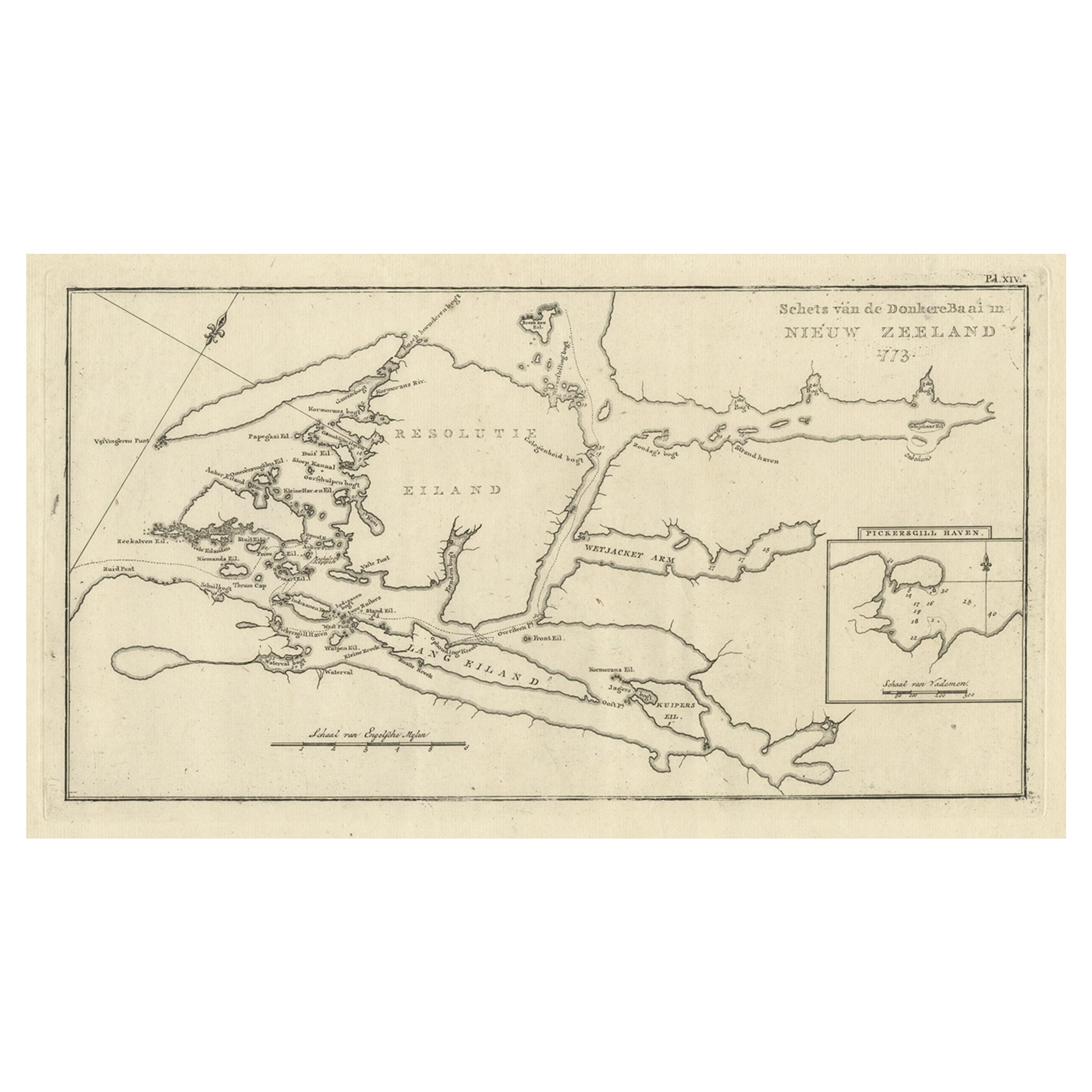
- Antique Map of the Dusky Bay or Dusky Sound of New Zealand by Captain Cook, 1803Located in Langweer, NLAntique map New Zealand titled 'Schets van de Donkere Baai in Nieuw Zeeland 1773'. Antique map of the Dusky Bay/Dusky Sound of New Zealand....Category
Antique Early 1800s Maps
MaterialsPaper
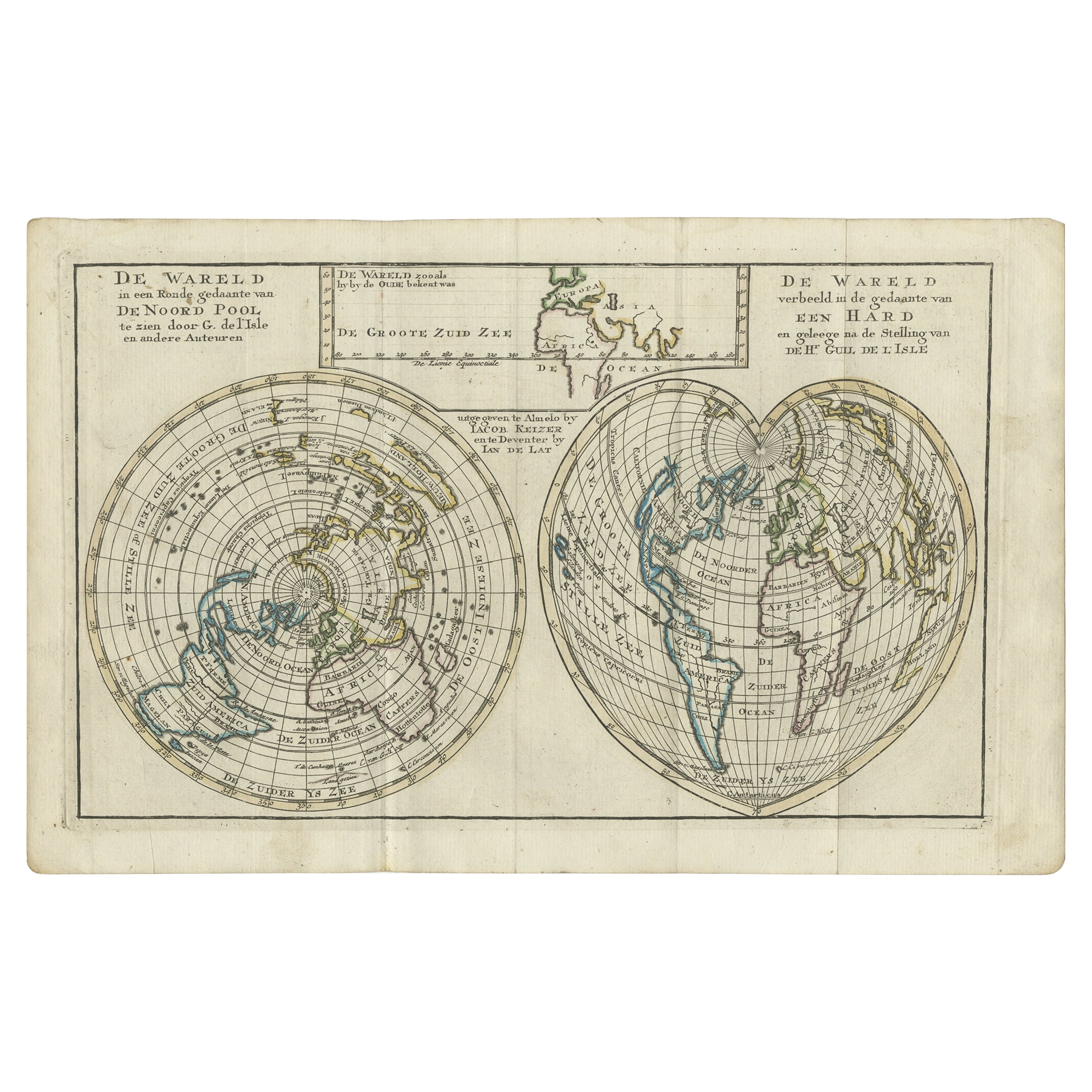
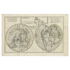
- Antique Map of the World with California as an Island, 1788Located in Langweer, NLDescription: Antique map titled 'De wareld in een ronde gedaante van de Noord Pool te zien - De Wareld verbeeld in de gedaante van een hard'. This interesting composition contains three world maps on the sheet. At left is a northern projection showing all the landmasses. At right is a cordiform projection (heart-shaped). At top is a map of the world as known to the ancients. Both the polar and cordiform projections show California as an island...Category
Antique 1780s Maps
MaterialsPaper
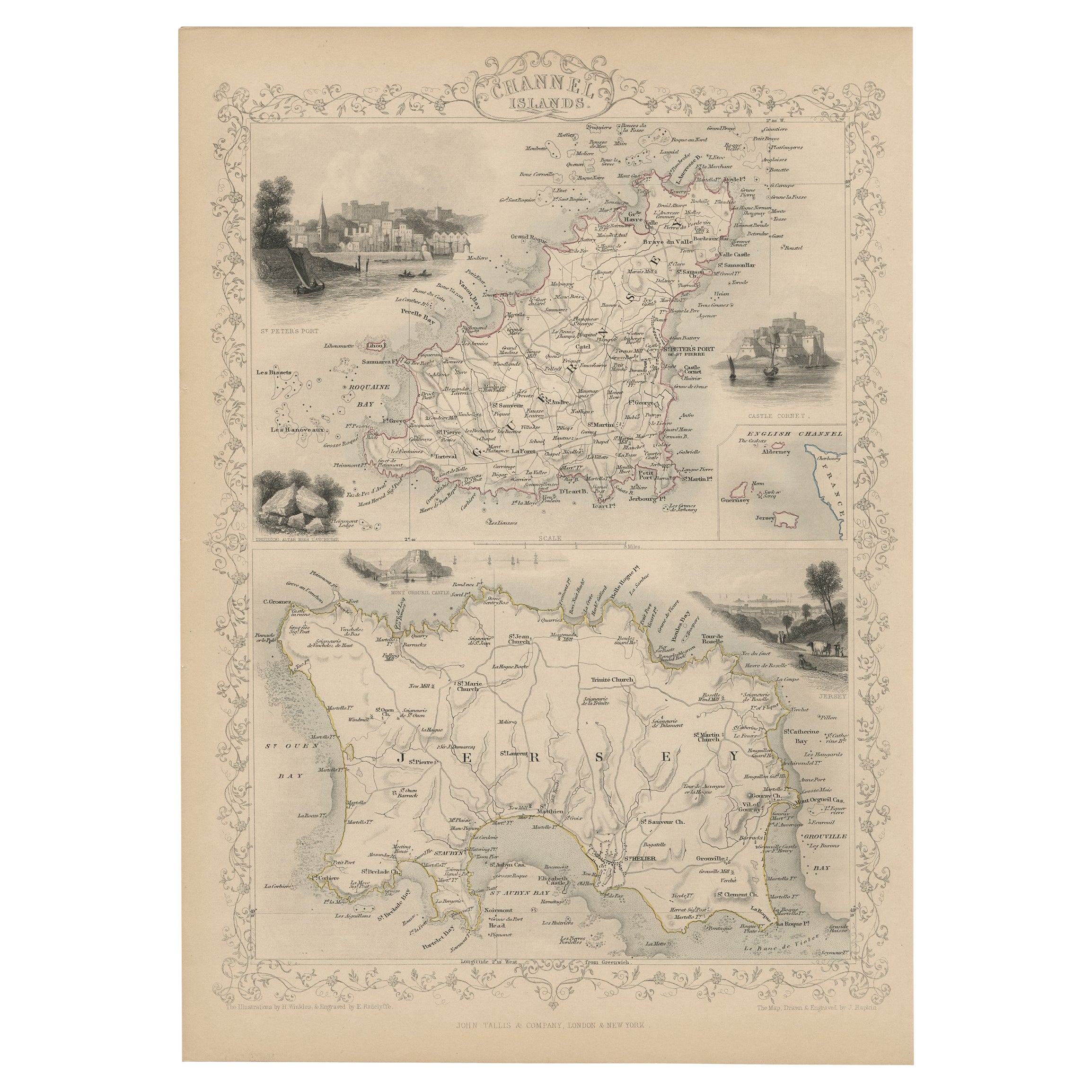
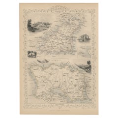
- Original Antique Map of the Channel Islands, Incl. Decorative Vignettes, 1851Located in Langweer, NLAntique map titled ‘Channel Islands’. Includes decorative vignettes titled St. Peters Port, Castle Cornet, Druidical altar near Lancresse, Mont Orgueil Castle and Jersey. Originates from 'The Illustrated Atlas, And Modern History Of The World Geographical, Political, Commercial & Statistical, Edited By R. Montgomery Martin'. Published; John Tallis London, New York, Edinburgh & Dublin. 1851. Drawn and Engraved by J. Rapkin. Artists and engravers: John Tallis (1817-1876) was a British map...Category
Antique 1850s Maps
MaterialsPaper
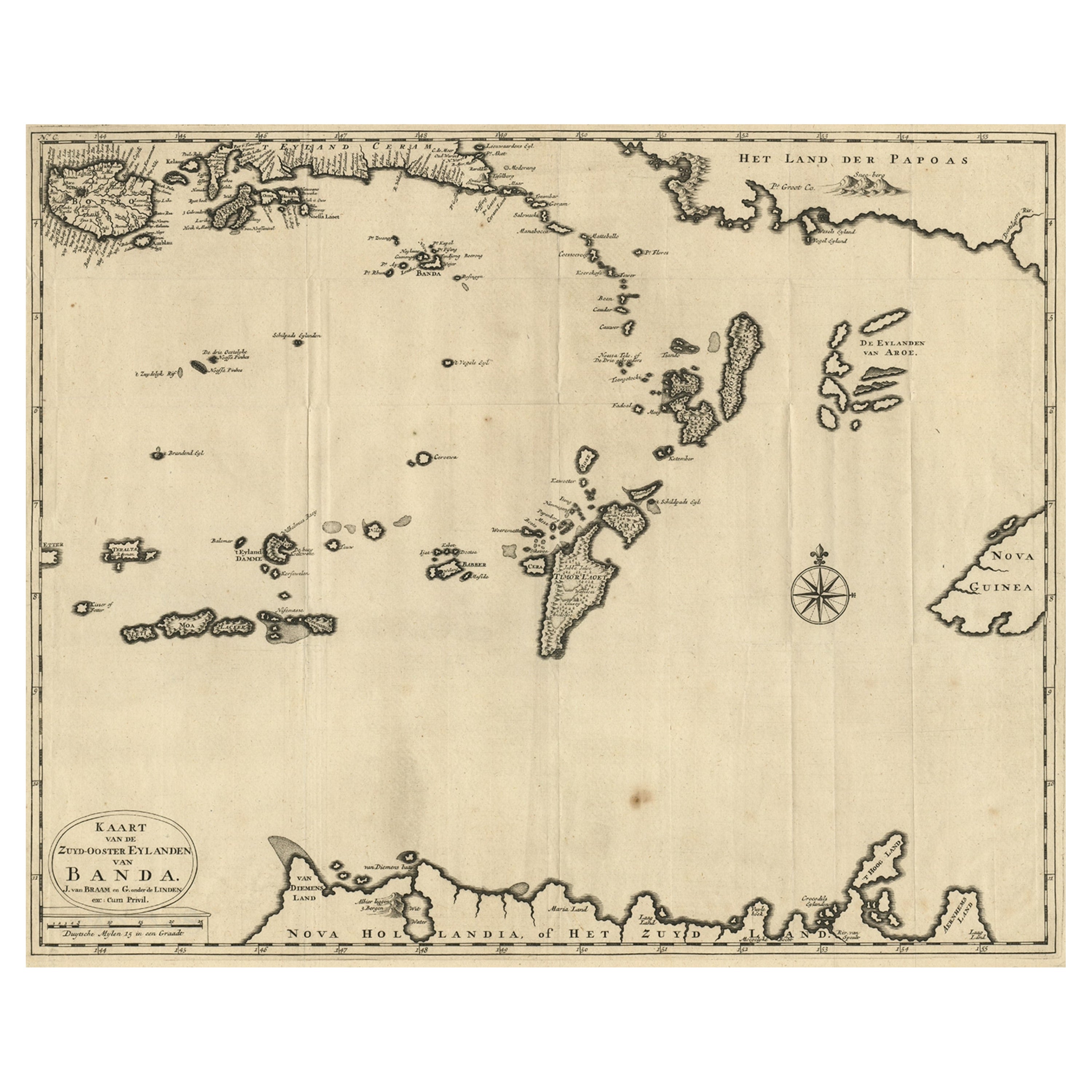
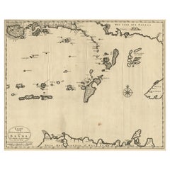
- Map of the Southeastern Part of the Banda Islands, Incl Northern Australia, 1726Located in Langweer, NLAntique map titled 'Kaart van de Zuyd-Ooster Eylanden van Banda.' Map of the southeastern part of the Banda islands. This map originates from 'Oud en Nieuw Oost-Indiën' by Franço...Category
Antique 1720s Maps
MaterialsPaper
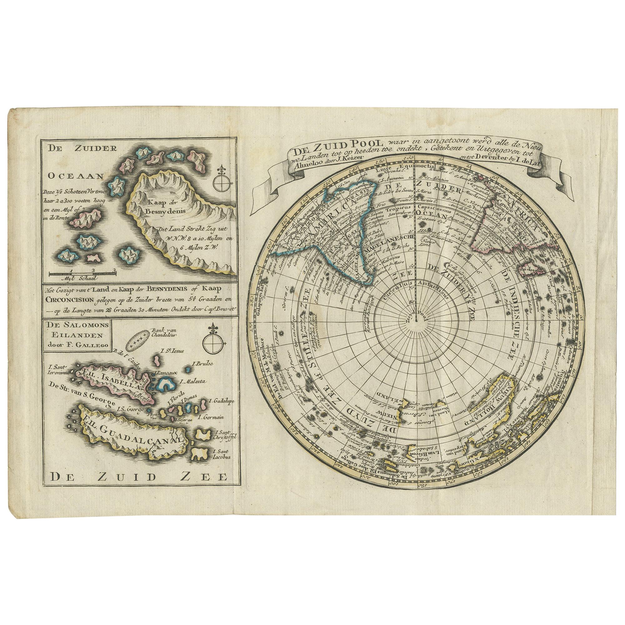
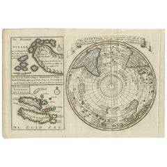
- Antique Map of the South Pole by Keizer & de Lat, 1788Located in Langweer, NLAntique map titled 'De Zuid Pool, waar in aangetoont werd alle de Nieuwe Landen (..)'. Original antique map of the South Pole including two small inset maps...Category
Antique Late 18th Century Maps
MaterialsPaper
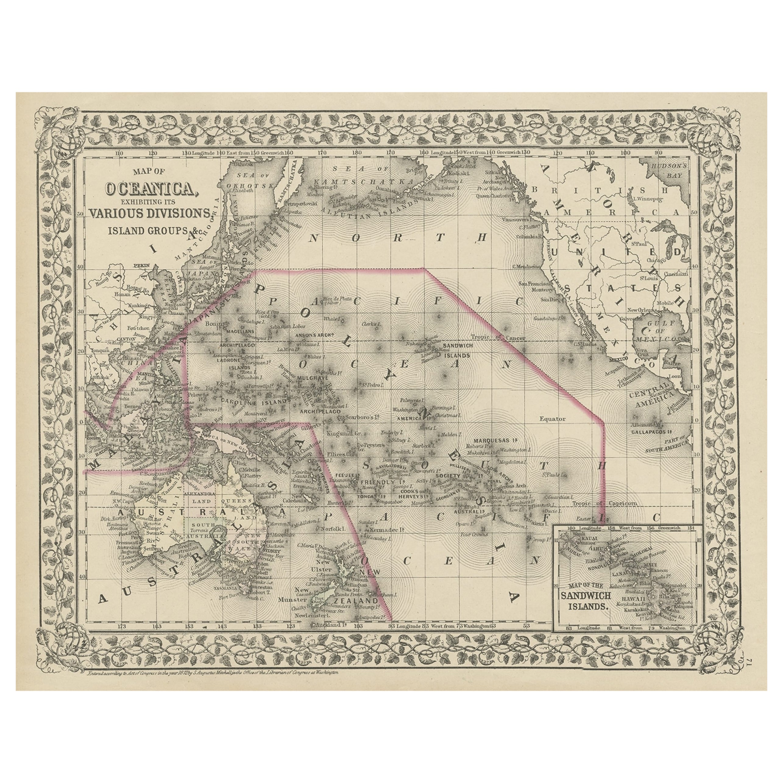
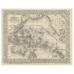
- Old Map of the Pacific, Incl Australia, Polynesia, Melanesia and Malaysia, 1872Located in Langweer, NLAntique map Oceania titled 'Map of Oceanica exhibiting its various divisions, island groups & c'. Map of the Pacific, including Australia, Polynes...Category
Antique 1870s Maps
MaterialsPaper
You May Also Like
- Original Antique Map of South America. C.1780Located in St Annes, LancashireGreat map of South America Copper-plate engraving Published C.1780 Two small worm holes to left side of map Unframed.Category
Antique Early 1800s English Georgian Maps
MaterialsPaper
- Original Antique Map of South Africa, Arrowsmith, 1820Located in St Annes, LancashireGreat map of South Africa. Drawn under the direction of Arrowsmith. Copper-plate engraving. Published by Longman, Hurst, Rees, Orme and Br...Category
Antique 1820s English Maps
MaterialsPaper
- Original Antique Map of South America, circa 1830Located in St Annes, LancashireGreat map of South America Copper plate engraving Published by Butterworth, Livesey & Co., circa 1830 Unframed.Category
Antique Early 1800s English Other Maps
MaterialsPaper
- Hand-Colored 18th Century Homann Map of Denmark and Islands in the Baltic SeaBy Johann Baptist HomannLocated in Alamo, CAAn 18th century copper plate hand-colored map entitled "Insulae Danicae in Mari Balthico Sitae utpote Zeelandia, Fionia, Langelandia, Lalandia, Falstria, Fembria Mona" created by Joh...Category
Antique Early 18th Century German Maps
MaterialsPaper
- Map of the Republic of GenoaLocated in New York, NYFramed antique hand-coloured map of the Republic of Genoa including the duchies of Mantua, Modena, and Parma. Europe, late 18th century. Dimension: 25...Category
Antique Late 18th Century European Maps
- Original Antique Map of South East Asia, Arrowsmith, 1820Located in St Annes, LancashireGreat map of South East Asia Drawn under the direction of Arrowsmith Copper-plate engraving Published by Longman, Hurst, Rees, Orme and Brown, 1820 Unframed.Category
Antique 1820s English Maps
MaterialsPaper


Recently Viewed
View AllMore Ways To Browse
French Antique Island
Bay Antique Furniture
Pacific Islands
Antique Bay
Large Antique Prints Set
Compass Rose
Map Of South Of France
Map Of The Pacific
Small Compasses
Small Compass
La Marine Antique
Antique Compass Rose
Antique Rose Compass
Compass Rose Antique
Folding Step
Map Of Orient
Used Furniture Depot
Orient Map