Items Similar to Rare Early Hand-Colored Woodcut of the City of Haarlem, the Netherlands, ca.1580

Want more images or videos?
Request additional images or videos from the seller
Rare Early Hand-Colored Woodcut of the City of Haarlem, the Netherlands, ca.1580
About the Item
Antique map titled 'Warhaffte contrastehung der Statt Harlem'.
Early woodcut of the city of Haarlem, the Netherlands. This map originates from 'Cosmographia' by S. Münster.
Artists and Engravers: The author of this work is Sebastian Munster, a German cartographer, cosmographer and Christian scholar. He is best known for Cosmographia, the earliest German description of the world (in 6 parts. He was also the author of Horologiographia, Organum Uranicum and Rudimenta Mathematica. The woodcuts in this publication were made by a group of artists, among which Hans Holbein, Conrad Schnitt, David Kandel and Hans Rudolf Manuel Deutsch.
Condition: Good, general age-related toning. Text and portrait on verso. Please study image carefully.
- Dimensions:Height: 12.6 in (32 cm)Width: 8.27 in (21 cm)Depth: 0 in (0.02 mm)
- Materials and Techniques:
- Period:
- Date of Manufacture:circa 1580
- Condition:Wear consistent with age and use.
- Seller Location:Langweer, NL
- Reference Number:
About the Seller
5.0
Platinum Seller
These expertly vetted sellers are 1stDibs' most experienced sellers and are rated highest by our customers.
Established in 2009
1stDibs seller since 2017
1,950 sales on 1stDibs
Typical response time: <1 hour
- ShippingRetrieving quote...Ships From: Langweer, Netherlands
- Return PolicyA return for this item may be initiated within 14 days of delivery.
More From This SellerView All
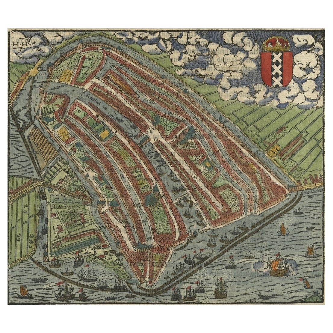
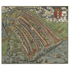
- Old Original Hand-Colored Engraving of a Bird's-eye Plan of Amsterdam, ca.1580Located in Langweer, NLDescription: Antique print, untitled. Bird's-eye plan of Amsterdam portrayed on a sheet of German text. Remarkably detailed for its size, hundreds of individual buildings and hou...Category
Antique 16th Century Maps
MaterialsPaper
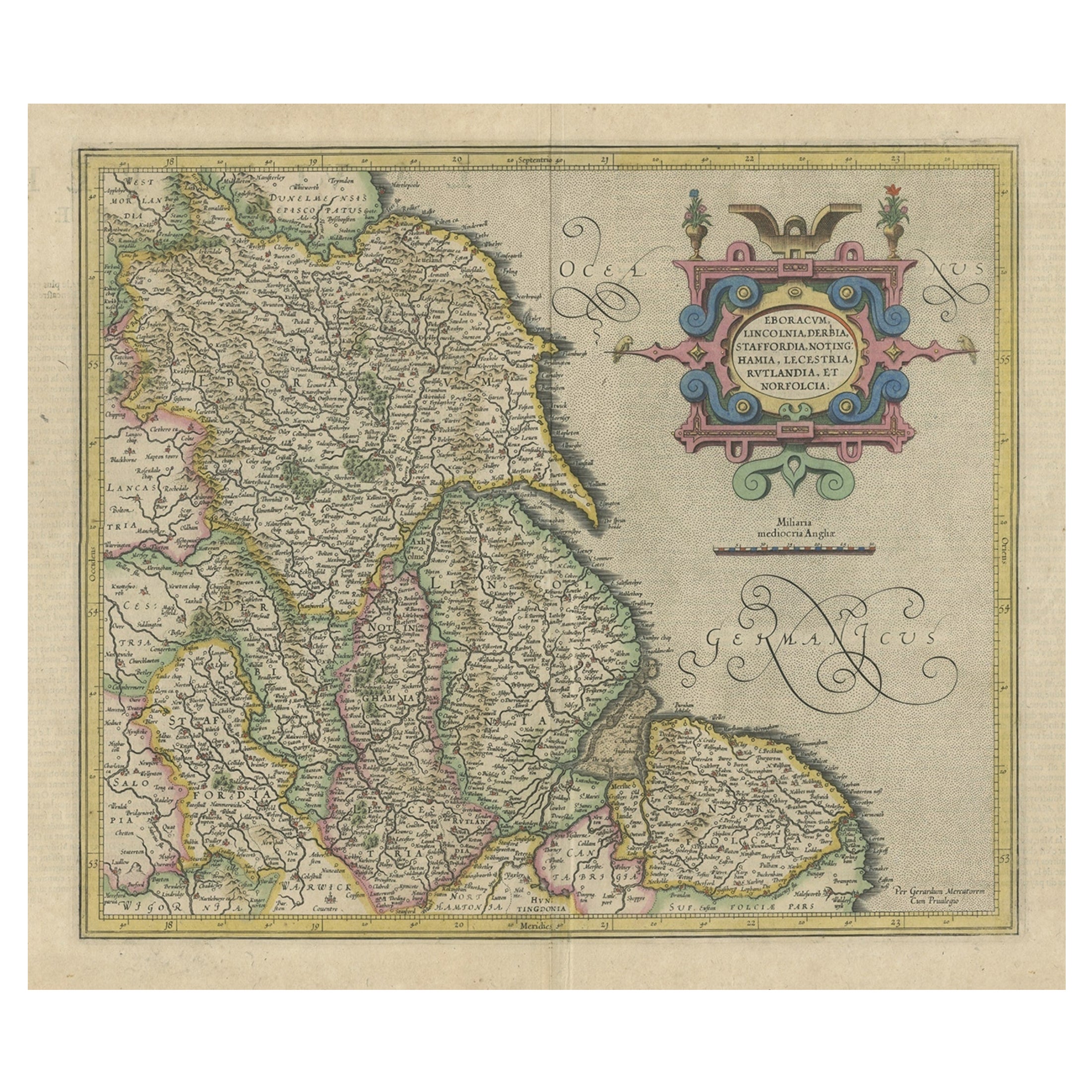
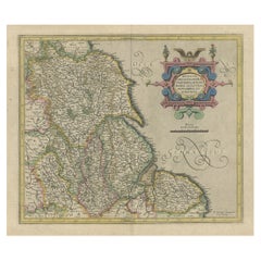
- Decorative Early Hand-Colored Map of the Northeast of England, ca.1620Located in Langweer, NLAntique map titled 'Eboracum, Lincolnia, Derbia, Staffordia, Notinghamia, Lecestria, Rutlandia et Norfolcia'. Decorative early map of the northeast of England, comprising the cou...Category
Antique 1620s Maps
MaterialsPaper
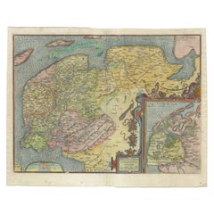
- Old Antique Map of the Province of Friesland, the Netherlands, c.1580Located in Langweer, NLAntique map titled 'Frisia Occidentalis'. Old map of the province of Friesland, the Netherlands. This map is also known as the 'Pauwenkaart' ('peacock map'), referring to the peacock next to the inset map. Based on a manuscript map...Category
Antique 16th Century Maps
MaterialsPaper
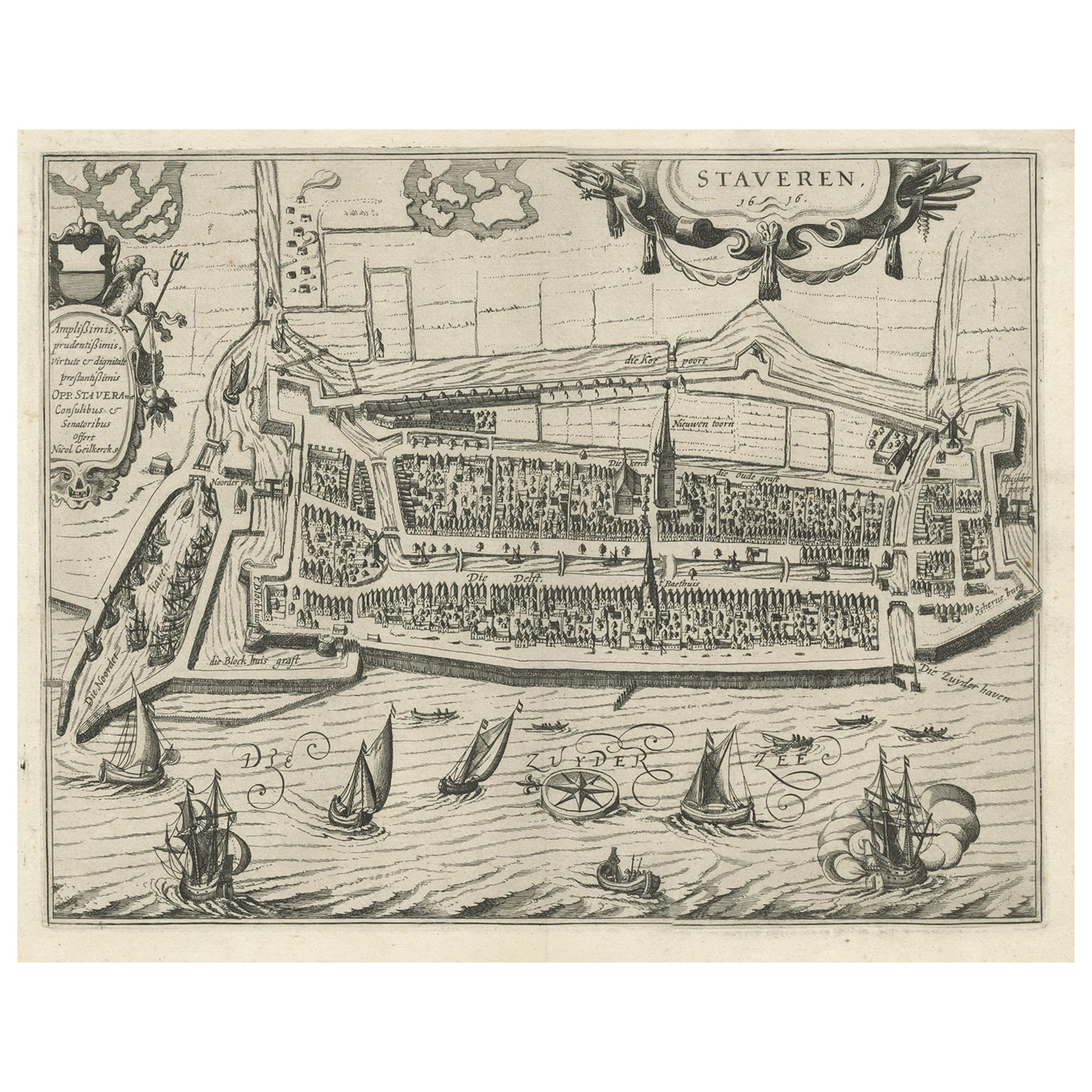
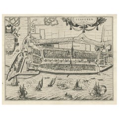
- Rare Old Map of the City of Stavoren, Friesland, the Netherlands, 1616Located in Langweer, NLAntique map titled 'Staveren'. Old map of the city of Stavoren, Friesland. This map originates from 'Rerum Frisicarum Historia' by U. Emmius. Artists and Engravers: Nicolaes ...Category
Antique 1610s Maps
MaterialsPaper
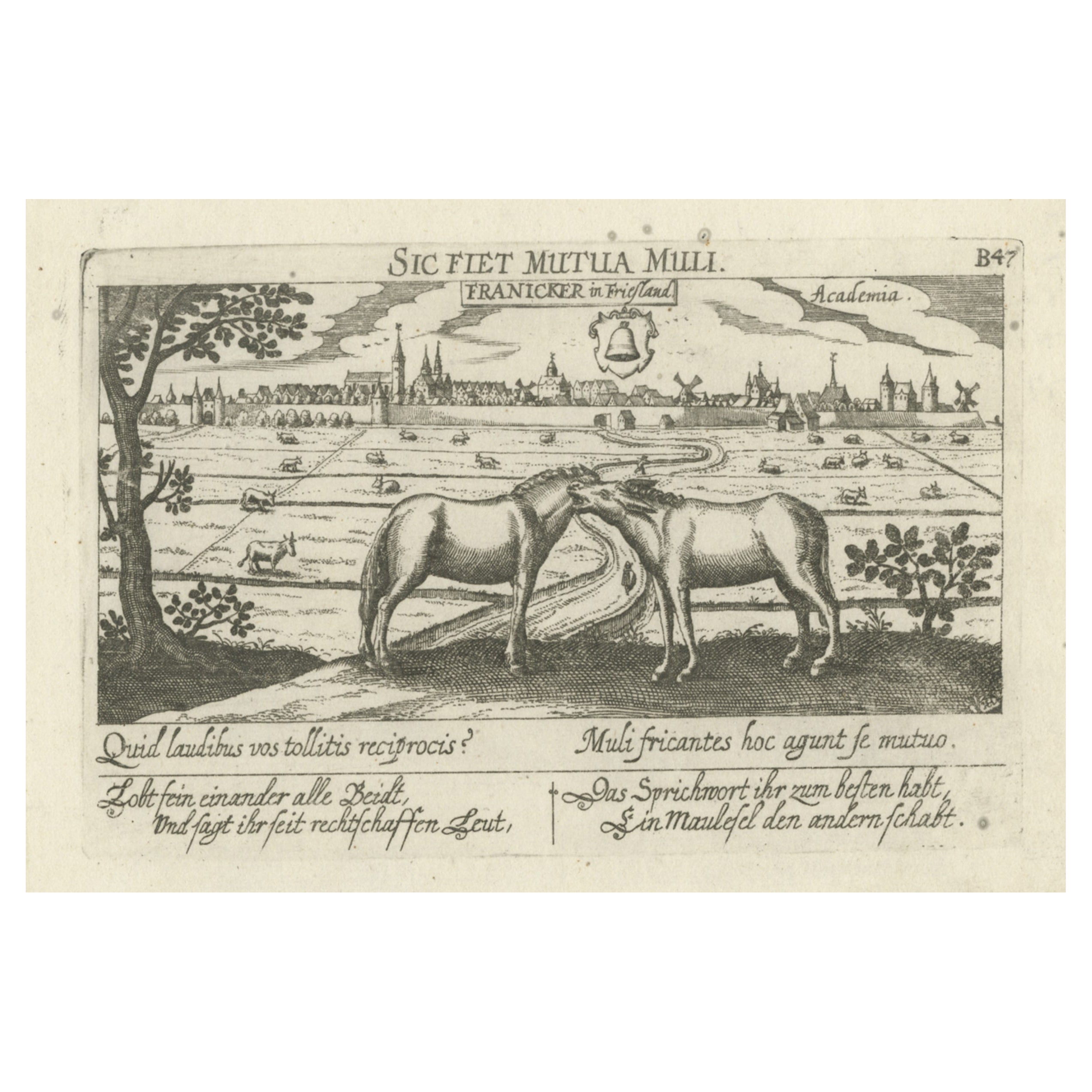
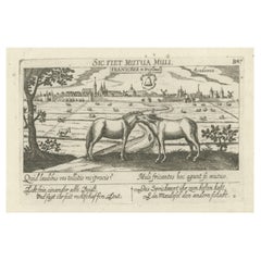
- Rare Antique Print of the University City of Franeker, the Netherlands, 1678Located in Langweer, NLAntique print titled 'Franicker in Friesland, Academia' View of the city of Franeker, Friesland, the Netherlands. Edition: 1678. This delicate engraving originates from 'Thesauri Phi...Category
Antique 17th Century Prints
MaterialsPaper
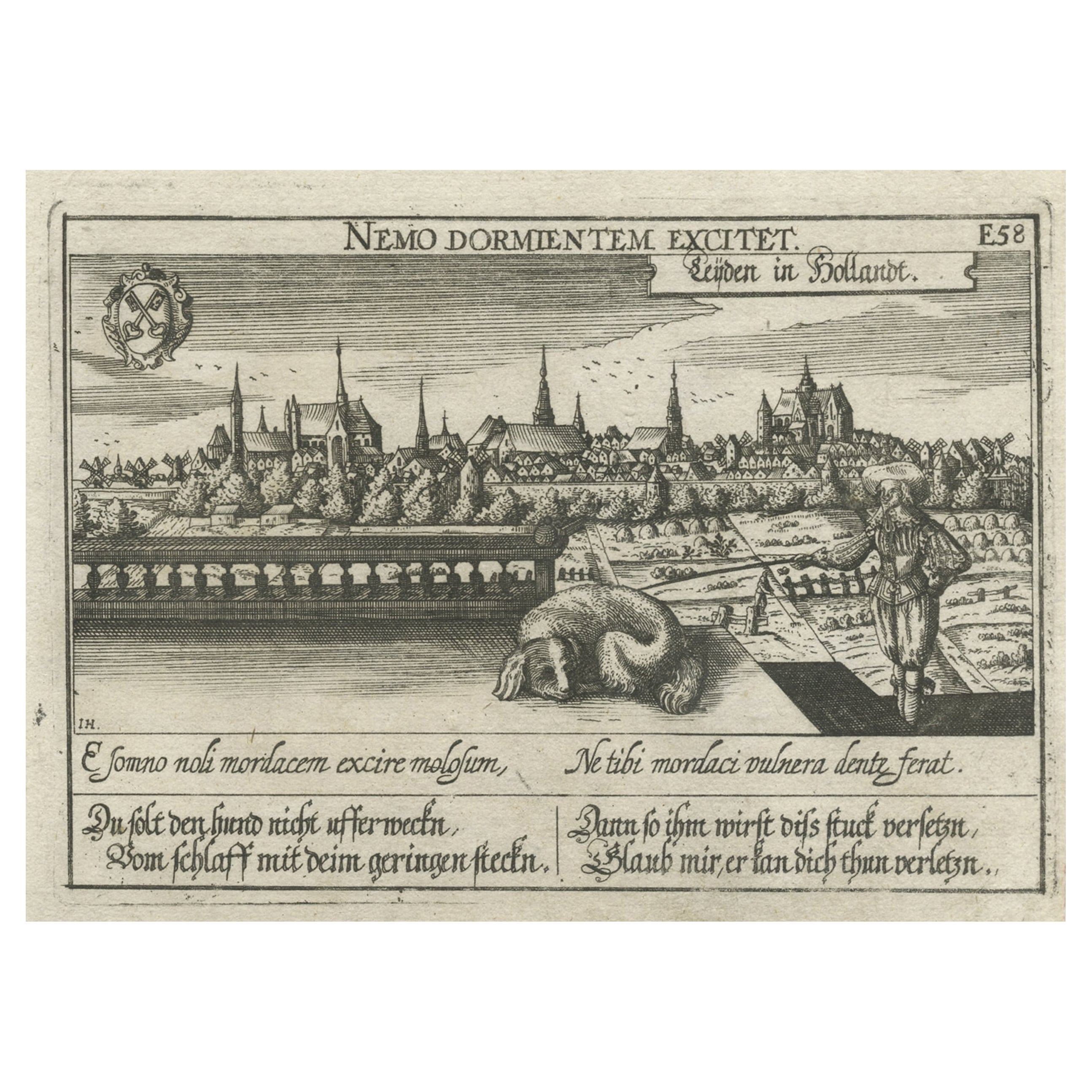
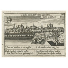
- Rare Antique Engraving of the University City of Leiden, The Netherlands, c.1625Located in Langweer, NLAntique print titled 'Leijden in Hollandt'. Old print of the city of Leiden, the Netherlands. This print originates from 'Thesaurus philopoliticus oder Politisches Schatzkästlein'. T...Category
Antique 17th Century Prints
MaterialsPaper
You May Also Like
- City View of Nuremberg, Germany: An 18th Century Hand-Colored Map by M. SeutterBy Matthew SeutterLocated in Alamo, CAAn 18th century hand-colored city view of Nuremburg, Germany entitled "Geometrischer Grundris der des Heiligen Römischen Reichs Freyen Stadt Nürnberg" by Matthaus Seutter from his "A...Category
Antique Mid-18th Century German Maps
MaterialsPaper
- Lithographic print on paper, depicting the atlas of the hand, France 1850 ca.Located in Milan, ITAn anatomical lithographic print on paper, depicting the anatomical atlas of the hand. Black lacquered fir wood frame with golden ramin wood batting. N. H. Ja...Category
Antique Mid-19th Century French Prints
MaterialsGlass, Wood, Paper
- Dutch Map and City Plan of La Roche-sur-Foron, France, 17th Century Hand ColoredBy Coenraet DeckerLocated in Alamo, CA"Rupes Allobrogum vulgo La Roche" by Dutch engraver Coenraet Decker (1650-1685) is from the atlas Theatrum Statuum Regiae Celestudinis Sabaudiae Ducis, published in 1682. This richly...Category
Antique Late 17th Century Dutch Maps
MaterialsPaper
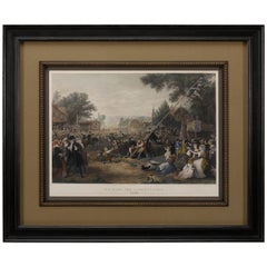
- "Raising the Liberty Pole" Hand-Colored Antique Print, 1875Located in Colorado Springs, COThis nineteenth-century engraving shows a liberty pole being raised in a town square in 1776, while a sign bearing the face of King George III is removed in the background. The rioto...Category
Antique 1870s American Historical Memorabilia
MaterialsPaper
- Hand-Colored 18th Century Homann Map of the Danube, Italy, Greece, CroatiaBy Johann Baptist HomannLocated in Alamo, CA"Fluviorum in Europa principis Danubii" is a hand colored map of the region about the Danube river created by Johann Baptist Homann (1663-1724) in his 'Atlas Novus Terrarum', publish...Category
Antique Early 18th Century German Maps
MaterialsPaper
- Germany West of the Rhine: A Hand-colored 18th Century Map by de WitBy Frederick de WitLocated in Alamo, CAThis original 18th century hand-colored map of the county of Moers, Germany entitled "Illustrissimo Celsissmo Principi GUILIELMO HENRICO D.G. Arausionum Principi Domino suo Clementis...Category
Antique Early 18th Century Dutch Maps
MaterialsPaper


Recently Viewed
View AllMore Ways To Browse
16th Century Hand Colored Map
Harlem Furniture
Harlem Artists
David Deutsch
Sebastian Munster
Antique Map Munster
Antique Furniture East London
Antique Eastern European Furniture
Antique House Plans
Antique Metal Window
Antique Metal Windows
Antique Furniture Rollers
Antiques Compasses
India Map
Antique Maps Book
Antique Map Book
Antique Italian Map
Antique Italy Map