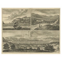
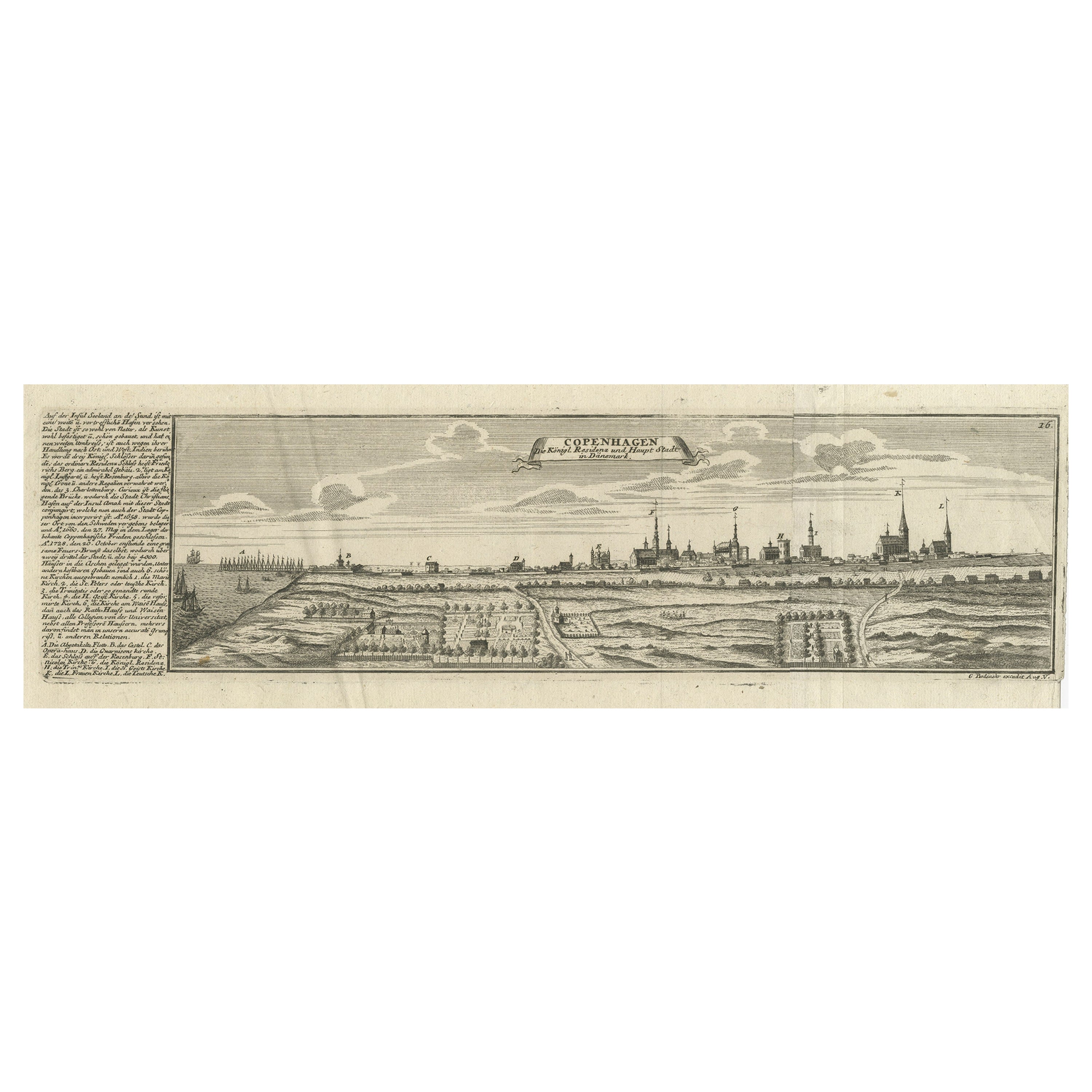
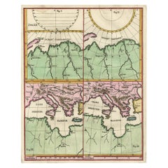
Rare Original Engraving with a View of the Bosphorus and the Black Sea, ca.1700
View Similar Items
Want more images or videos?
Request additional images or videos from the seller
1 of 6
Rare Original Engraving with a View of the Bosphorus and the Black Sea, ca.1700
About the Item
- Dimensions:Height: 12.8 in (32.5 cm)Width: 15.56 in (39.5 cm)Depth: 0 in (0.02 mm)
- Materials and Techniques:
- Period:1700-1709
- Date of Manufacture:circa 1700
- Condition:Condition: Good. General age-related toning. Please study image carefully.
- Seller Location:Langweer, NL
- Reference Number:Seller: BGI-004671stDibs: LU3054327517972
About the Seller
5.0
Platinum Seller
These expertly vetted sellers are 1stDibs' most experienced sellers and are rated highest by our customers.
Established in 2009
1stDibs seller since 2017
1,960 sales on 1stDibs
More From This SellerView All
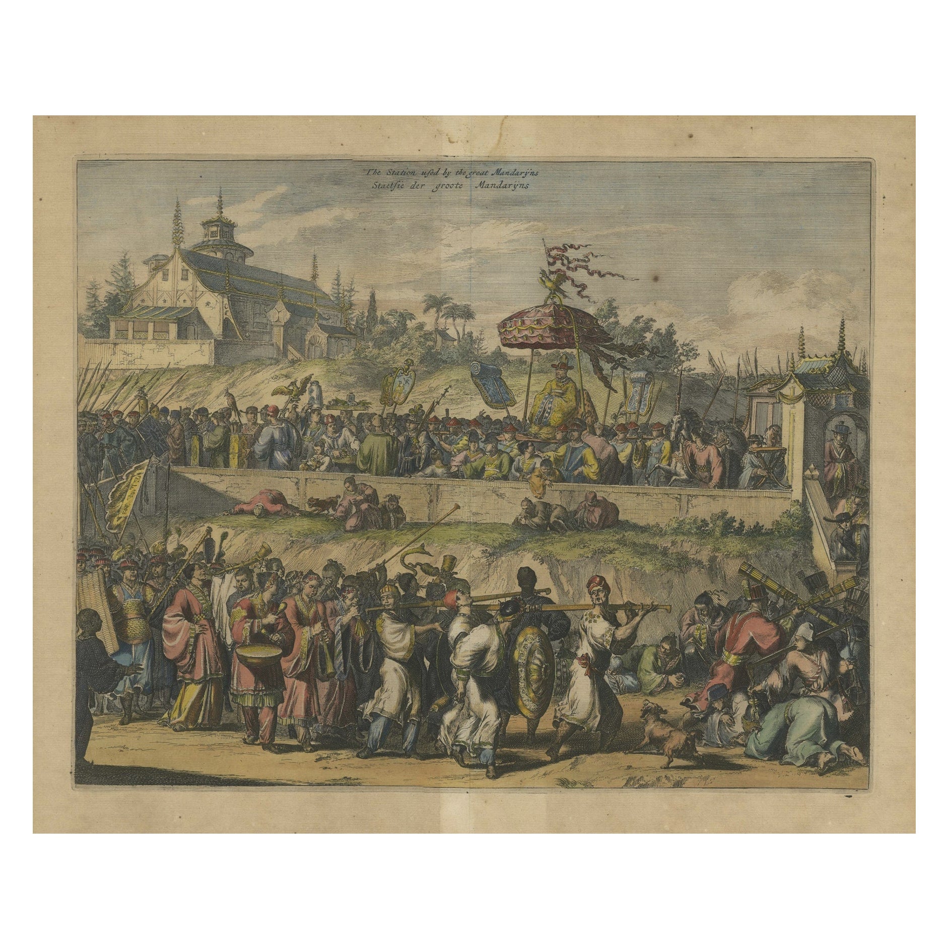
- Original Copper Engraving with View of the Palace and Chinese Emperor, ca.1700Located in Langweer, NLTitle: "The Station used by the great Mandaryns Staetsie der groote Mandarijns / The Station used by the great Mandaryns Staetsie der groote Mandarijns. 1665. The richly illustrat...Category
Antique Early 1700s Prints
MaterialsPaper
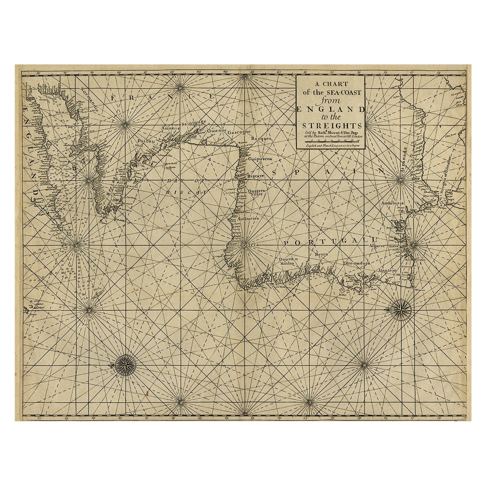
- Original Antique Sea Chart of the Coastline from England to Gibraltar, ca.1700Located in Langweer, NLAntique map titled 'A Chart of the Sea-Coast from England to the Streights.' Original antique map showing the European coastline from the South of England (and North of France) to ...Category
Antique Early 1700s Maps
MaterialsPaper
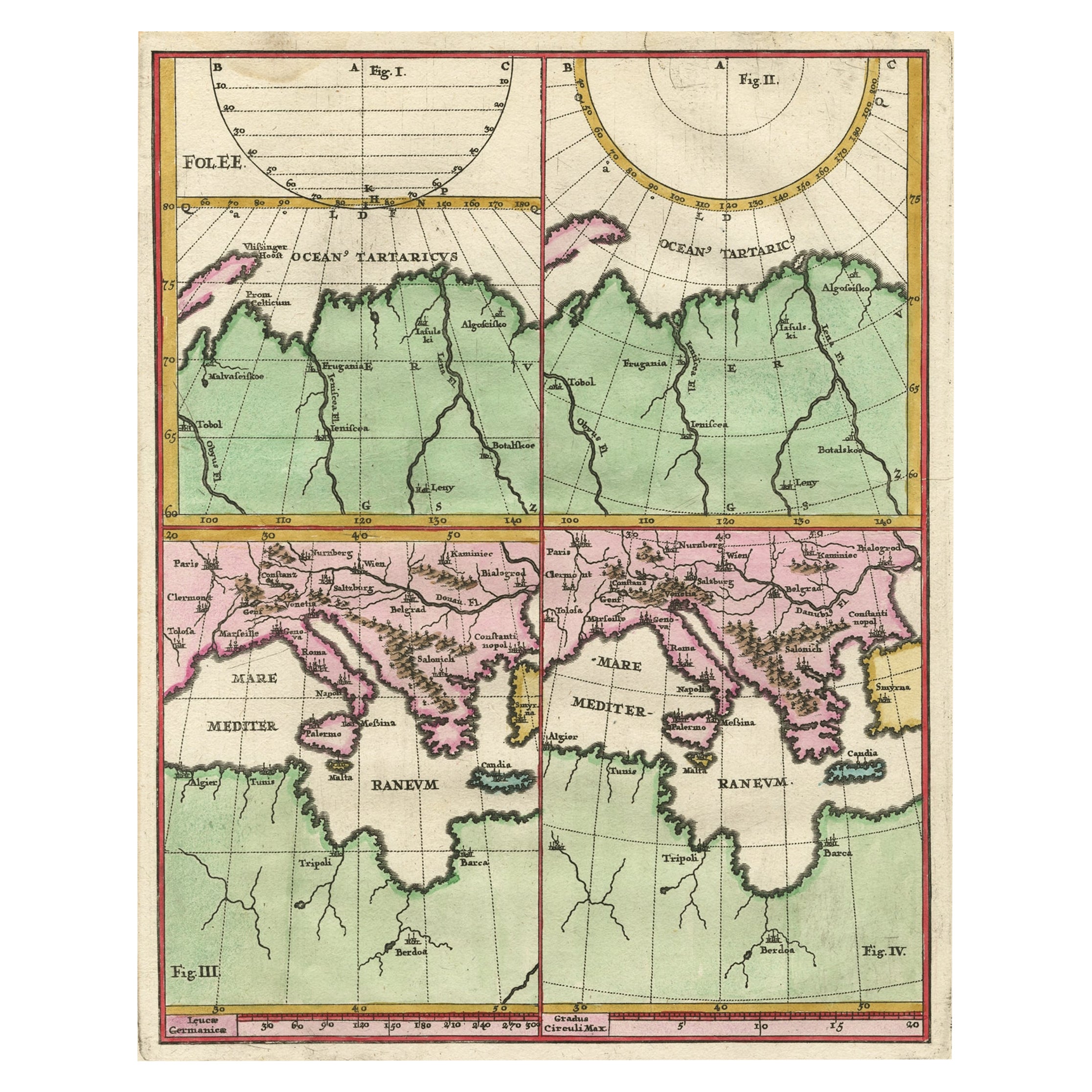
- Curious Map of the Laptev Sea 'Arctic Ocean' and the Mediterranean, ca.1700Located in Langweer, NLAntique map, untitled. Map of the Laptev Sea (Arctic Ocean) and the Mediterranean, printed for Scherer's 'Atlas Novus' (1702-1710). Scherer's 'Atlas Novus' forms an important mil...Category
Antique Early 1700s Maps
MaterialsPaper
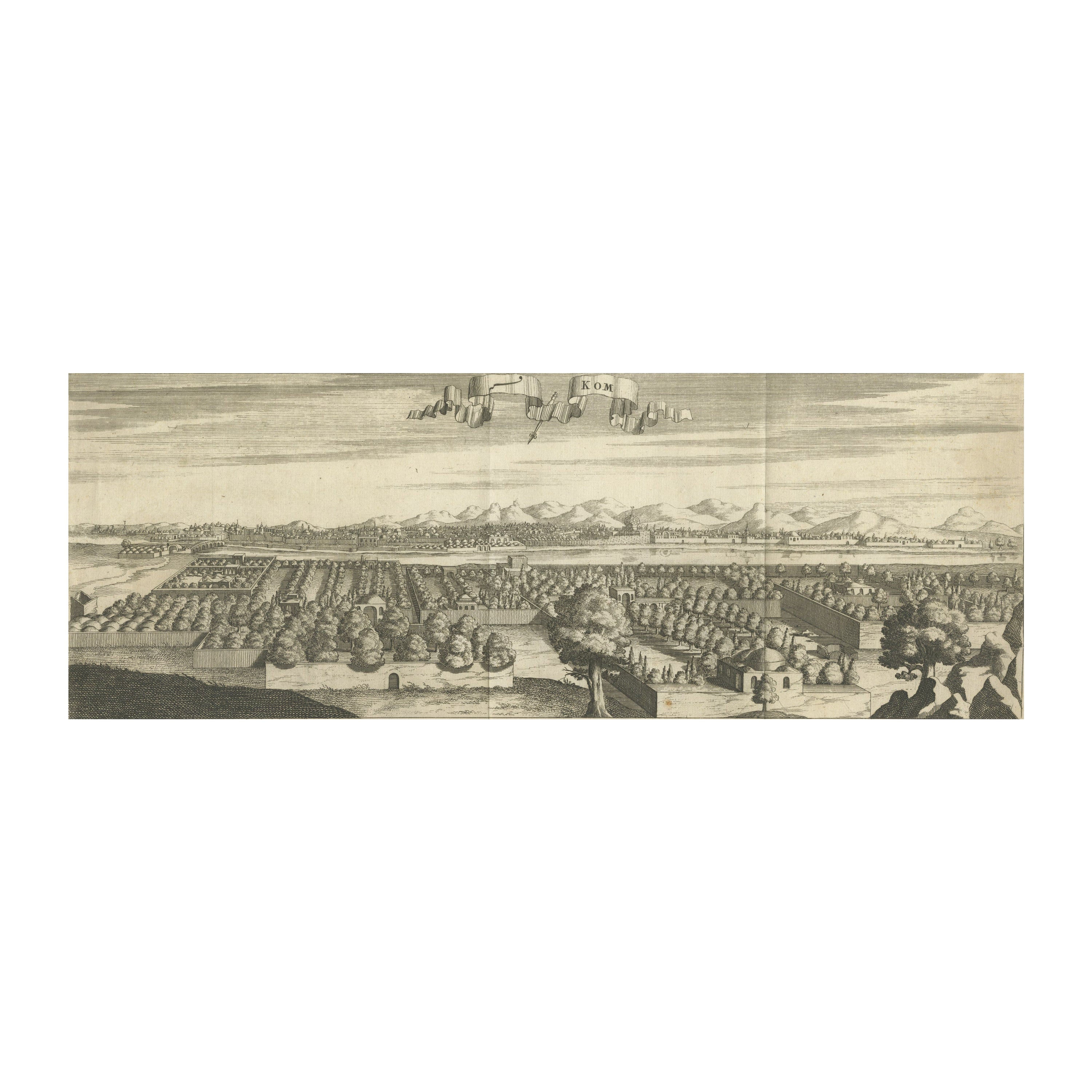
- Rare Engraving with a View of the City of Kom in EgyptLocated in Langweer, NLThis is an original antique print of the city of Kom in Egypt.Category
Antique Late 18th Century Prints
MaterialsPaper
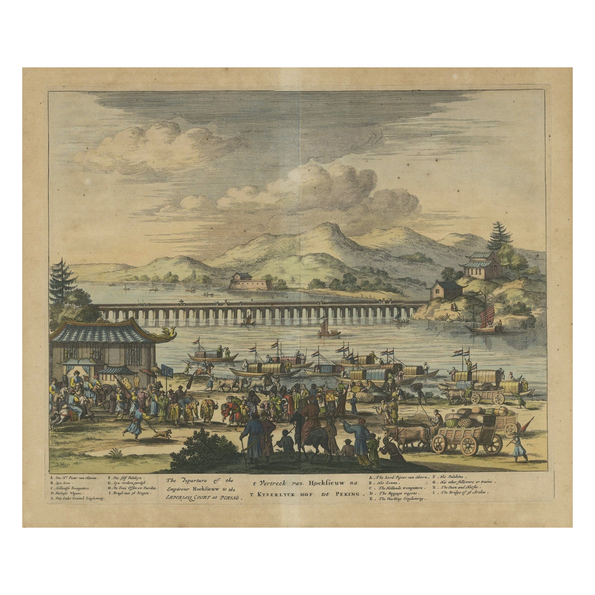
- Original Copper Engraving Depicting Dutch Merchants visting China, ca.1700Located in Langweer, NLTitle: 'The departure of the Empirour Hockflieuw to the Emprial Court at Peking' with further description in Dutch. The Dutch man Pieter van Hoorn, his son...Category
Antique Early 1700s Prints
MaterialsPaper
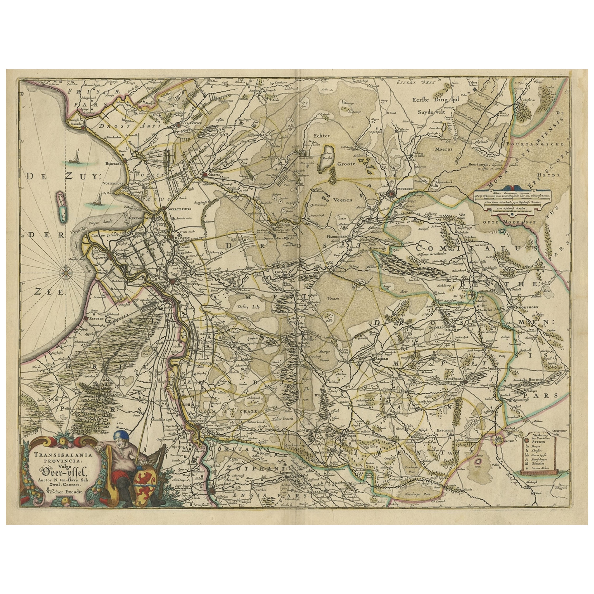
- Attractive Original Map of the Province of Overijssel, the Netherlands, Ca.1700Located in Langweer, NLAntique print, titled: 'Transisalania Provincia vulgo Over-yssel.' Attractive original handcoloured map of the province of Overijssel, The Netherlands. With beautiful title carto...Category
Antique Early 1700s Maps
MaterialsPaper
 $1,102 Sale Price20% Off


You May Also LikeView All
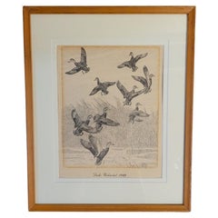
- Rare Lynn Bogue Hunt Engraving of Ducks Unlimited, 1940By Lynn Bogue HuntLocated in Dallas, TXPresenting a Rare Lynn Bogue Hunt engraving of ducks unlimited 1940. This piece cam from a wealthy estate in Dallas, TX with the mansion being built...Category
Mid-20th Century American Sporting Art Prints
MaterialsPaper
- “The Restaurant of the House of Representatives” Engraving by Harper's WeeklyLocated in Colorado Springs, COThis original wood engraving is titled “The Restaurant of the House of Representatives, Washington, DC.” It was published as a double-page image, in the August 12, 1893 issue of the famous 19th century newspaper Harper’s Weekly. The print was illustrated by Charles Stanley Reinhardt. The House Restaurant, a unique part of life in the Capitol, has been in the same location since the 1857 Capitol Expansion. Congressional members’ busy work schedule made the availability of food on site a necessity. But the restaurant also served as an informal meeting spot for members to continue conversations and deal making. This 1893 print illustrates the convivial atmosphere. Details including elegantly dressed tables...Category
Antique 1890s American Prints
MaterialsPaper
- 1876 "Gettysburg, The Repulse of Longstreet's Assault." EngravingLocated in Colorado Springs, COPresented here is an 1876 engraving of John B. Bachelder and James Walker’s Gettysburg. The Repulse of Longstreet’s Assault. The engraved scene depicts the decisive battle on the final day of the Battle of Gettysburg. Researched by the photographer and topographer John B. Bachelder and painted by James Walker, the original painting was created in 1870. This detailed engraving was done by H. B. Hall Jr. and published by James Drummond Ball. Otherwise called Pickett’s Charge, the battle occurred on July 3, 1863. Pickett’s corp commander, Lieutenant General James Longstreet was placed in charge of the attack despite his hesitations. Longstreet’s central role led to the title of the work, Repulse of Longstreet’s Assault. In an attempt to gain control of an important supply route, nine Confederate brigades charged across three-quarters of a mile of open ground against cannon fire to take Cemetery Ridge from the defending Union Army. Despite their overwhelming numbers, the Confederate forces were repelled with considerable casualties marking not only a decisive victory for the Union, but also the beginning of the slow defeat of Lee’s Army. The furthest the charging forces advanced before being repulsed would forever be known as the “High Water Mark of the Confederacy.” The Confederate army never recovered from the losses at Gettysburg and it effectively ended Lee’s campaign into Pennsylvania. The engraving gives the perspective from the Union rear, one that encompasses most of the battlefield, from Big Round Top on the left to the northern reaches of Cemetery Ridge on the right. The Confederate lines at Seminary Ridge are in the far distance, partially obscured by bursting shells. The image centers on the main Confederate assault, in the vicinity of what today are known as "The Copse" and "The Bloody Angle." The composition has elemen...Category
Antique 1870s American Prints
MaterialsPaper
- Hand-Colored 18th Century Homann Map of the Black Sea, Turkey and Asia MinorBy Johann Baptist HomannLocated in Alamo, CAAn attractive original early 18th century hand-colored map of the Black Sea and Turkey entitled "Carte de L'Asie Minevre ou de la Natolie et du Pont Evxin Tiree des Voyages et des Ob...Category
Antique Early 18th Century German Maps
MaterialsPaper
- Set of Twelve Colored Engravings of the Defeat of the Spanish Armada by J. PineLocated in Essex, MABy John Pine considered the foremost heraldic and decorative engraver of his generation. Depicting the defeat of the Spanish by the English Fleet in 1588. These are after a set of tapestries that hung in the House of Commons...Category
Antique 1740s English Prints
MaterialsPaper
- Vintage "View of the Center of Paris Taken from the Air" Lithograph MapLocated in San Diego, CAA very stylish "View of the Center of Paris Taken from the Air" lithograph map published by the Paris Ministry of Tourism, circa early 1950s. The piece measures 27" x 43" and shows...Category
20th Century French Mid-Century Modern Prints
MaterialsPaper
 $680 Sale Price20% Off


Recently Viewed
View AllMore Ways To Browse
Bosphorus Antique
Antique Battle Maps
Antique Long Island Map
Antique Map Long Island
Antique Maps Of Long Island
Rome Antique Map
Sea Chart Map
Antique Map Of Switzerland
Antique Map Switzerland
Ships Log
17th Century Scottish Furniture
17th Century Italy Map
17th Century Scottish
Antique Malaysia
Malaysian Antique
Map Tapestry
World Map Copper
18th Century Globe Of The World