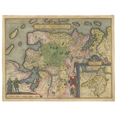
Items Similar to Rare Sea Chart of the East Frisian Islands or Watten and the North Sea, c.1700


Want more images or videos?
Request additional images or videos from the seller
1 of 5
Rare Sea Chart of the East Frisian Islands or Watten and the North Sea, c.1700
About the Item
Description: Antique map titled 'Paskaarte van de rievier de Elve streckende van Oldenbroek tot Hamburgh.'
Rare and interesting chart of the East Frisian Islands (or Watten) and the North Sea. Above the Elbe river from Oldenbroek to Hamburg. Beautiful large cartouche with scale below. Also another cartouche with key and a compass rose. Source unknown, to be determined.
Artists and Engravers: Johannes van Keulen (1654, Deventer - 1715, Amsterdam) was a 17th-century Dutch cartographer.
Condition: Very good, given age. Original middle fold as issued. General age-related toning and /or occasional minor defects from handling. Please study image carefully.
- Dimensions:Height: 20.95 in (53.2 cm)Width: 24.73 in (62.8 cm)Depth: 0 in (0.02 mm)
- Materials and Techniques:
- Period:1700-1709
- Date of Manufacture:circa 1700
- Condition:
- Seller Location:Langweer, NL
- Reference Number:
About the Seller
5.0
Platinum Seller
These expertly vetted sellers are 1stDibs' most experienced sellers and are rated highest by our customers.
Established in 2009
1stDibs seller since 2017
1,940 sales on 1stDibs
Typical response time: <1 hour
- ShippingRetrieving quote...Ships From: Langweer, Netherlands
- Return PolicyA return for this item may be initiated within 14 days of delivery.
More From This SellerView All
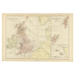
- Large Sea Chart of the British Islands, 1918Located in Langweer, NLAntique map titled 'The British Islands'. Large sea chart of the British Islands. It shows Ireland, Scotland, England, the Shetland Islands and part of Fra...Category
Vintage 1910s Maps
MaterialsPaper
- Large Chart of the island and sea of Java, IndonesiaLocated in Langweer, NLAntique map titled 'Carte Esférica de la Isla Y Mar de Java'. Large chart of the island and sea of Java, Indonesia. Beautiful nautical chart, published 1863 in Spain.Category
Antique Mid-19th Century Maps
MaterialsPaper
- Antique Chart of the Banda Islands or The Spice Islands, Indonesia, 1726Located in Langweer, NLAntique map titled 'Nieuwe Caart der Eylanden van Banda'. Beautiful chart of the Banda Islands including Banda Api, Banda Neira, Banda Besar, Pulau Hatta (Rosengain), Pulau Ai an...Category
Antique 1720s Maps
MaterialsPaper
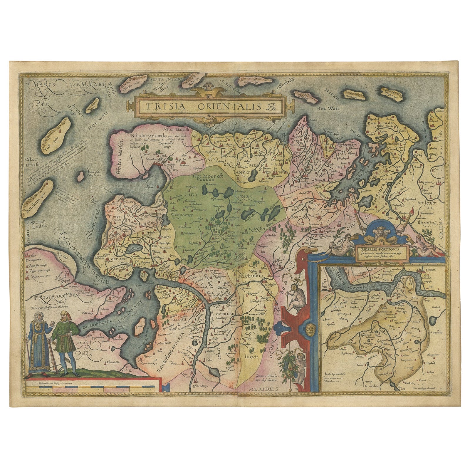
- Map of East Frisian Islands & Northwestern Tip of Germany, Ostfriesland, c.1595Located in Langweer, NLAntique map titled 'Frisia Orientalis'. Beautiful map of east Frisian islands and the northwestern tip of Germany, Ostfriesland. With people in local costumes. Ornamented inset of the Eems estuary. Based on a manuscript map...Category
Antique 16th Century Maps
MaterialsPaper
- Antique Sea Chart of the Shetland Islands, Scotland, ca.1745Located in Langweer, NLAntique map of Scotland titled 'Nieuwe Paskaard van Hitland met de daar omleggende eylanden na de nieuwe aftekening gemaakt by den Lofwaarden en onvermoeyden Hit en Zeeman Ian Bruyst...Category
Antique 1740s Maps
MaterialsPaper
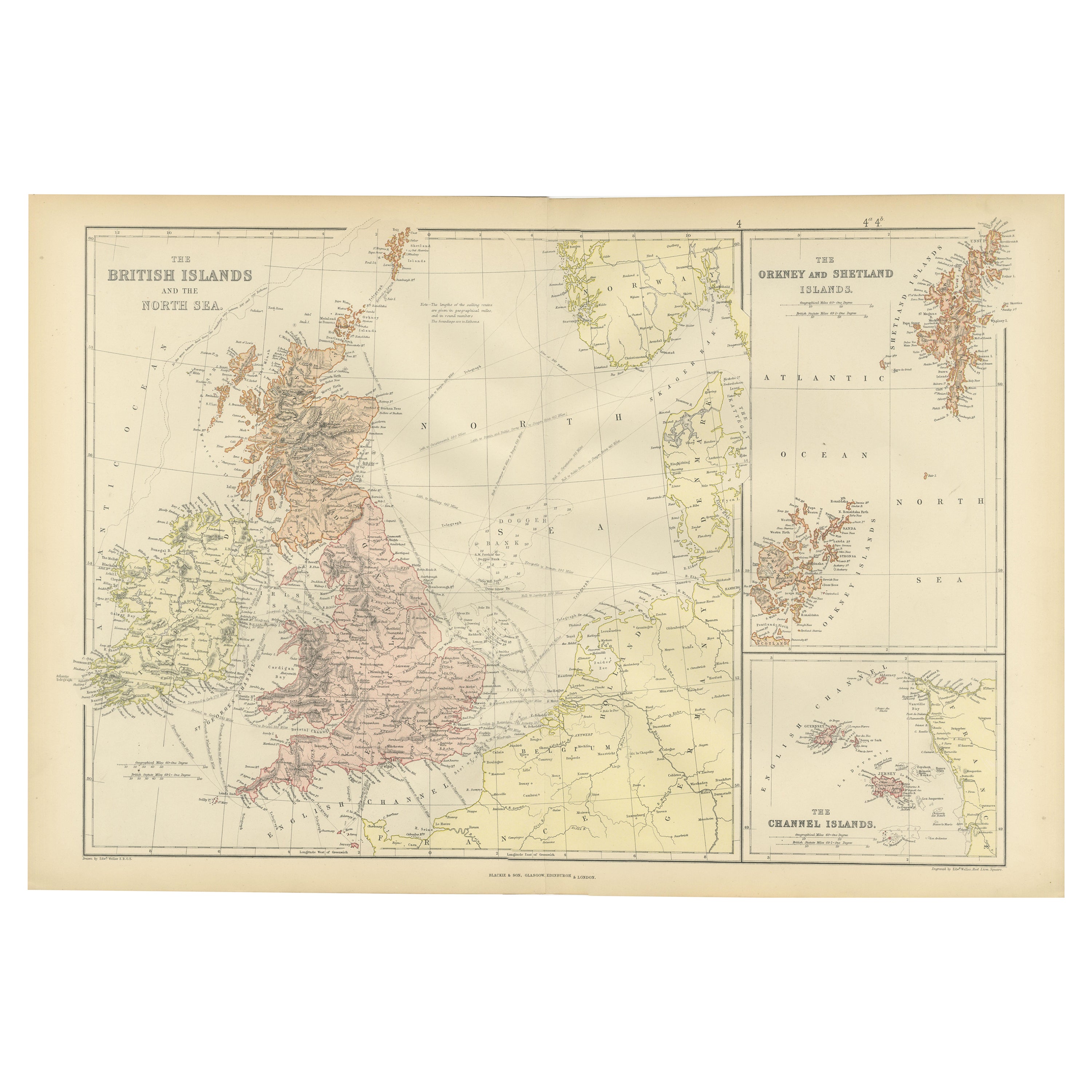
- Colorful Detailed Antique Map of The British Islands and `The North Sea, 1882Located in Langweer, NLDiscover 'The British Islands and The North Sea' Map with Insets of Orkney, Shetland, and Channel Islands! This captivating original antique map offers a detailed view of the British...Category
Antique 1880s Maps
MaterialsPaper


You May Also Like
- 1865 Chart of the Islands of MadeiraLocated in Norwell, MARare James Imray chart from 1865 titled "Chart of the Islands of Madeira, Porto Santo and Dezerea" drawn from the survey made by Captain Ate Vidal Royal Navy, London. Published by Ja...Category
Antique 1860s European Maps
MaterialsPaper
- Chart of Boston's North ShoreLocated in Norwell, MARarely found restrike of an 1804 chart by Nathanael Bowditch of the Harbors of Salem, Marblehead, Beverly, and Manchester. Showing the Islands of Great Misery, Satan, Cuney, Winter,...Category
Vintage 1980s North American Maps
MaterialsPaper
- University Chart “Black Map of North AmericaLocated in Chillerton, Isle of WightUniversity Chart “Black Map of North America W&A K Johnston’s Charts of Physical Maps By G W Bacon, This is a Black Physical map of North A...Category
Early 20th Century Industrial Maps
MaterialsLinen
- Long Island Chart from 1828Located in Norwell, MARare original chart of Long Island Sound by E + G Blunt of New York, 179 Water St. "Surveyed in the years 1828, 29 & 30" Exceedingly rare and early chart, titled Long Island Sound fr...Category
Antique 1830s Nautical Objects
MaterialsPaper
- Original Imray & Son Chart of North Atlantic, 1876Located in Norwell, MANautical chart of the North Atlantic showing the Eastern United States coast, Caribbean Islands, South America (Venezuela and ), British Possessions (Canada - Gulf of Lawrence, Newfo...Category
Antique 1870s Nautical Objects
MaterialsPaper
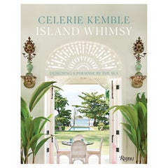
- Island Whimsy Designing a Paradise by the SeaBy Rizzoli International PublicationsLocated in New York, NYAuthor Celerie Kemble A house by the sea should be a house of dreams. Where windows and doors are thrown open to the ocean, and gusts of cool, salty air turn us all into kids again--buoyant and joyful. Spending childhood days on the beach and in the magical, romantic chaos of her family's rambling house internationally renowned interior designer Celerie Kemble has a deep-rooted connection to the sun and surf. However, in the summer of 2004, Kemble laid eyes on a wild swath of jungle in the Dominican Republic next to minty-blue water and an endless stretch of golden sand, she fell madly in love. Over many years, she designed a home away from home there, an island retreat--a clubhouse and a grouping of family homes and guesthouses--suffused with light and air, full of indoor and outdoor rooms for relaxation. In her latest book, Island Whimsy, Kemble recounts the deeply personal and creative journey of designing Playa Grande and bringing this labor of love to life. The chapters of this book are organized around the different ways Kemble sought to braid her family's story into the larger landscape of Playa Grande and to provide inspiration, joy, and respite to all who come. "Fantasy" looks at the way she used whimsical, dreamlike elements--from the latticework cabanas by the pool to the lamb statues...Category
21st Century and Contemporary North American Books
MaterialsPaper


Recently Viewed
View AllMore Ways To Browse
1700 Antique Furniture
Middle East Furniture
Toner Chart
Collecting Antique Keys
Keys Collectible Antique
Middle East Antiques
Large Scale Map
Antique Maps And Charts
Compass Rose
Rare Compass
Compass Rose Antique
Antique Compass Rose
Antique Rose Compass
17th Map Large
Large Antique Compass
Antique Sea Charts
Antique Sea Chart
Sea Chart