Items Similar to Set of 11 Antique Maps of Japan Originating from a Japanese Atlas, 1906

Want more images or videos?
Request additional images or videos from the seller
1 of 12
Set of 11 Antique Maps of Japan Originating from a Japanese Atlas, 1906
About the Item
Set of 11 antique maps depicting various regions of Japan. These maps originate from a Japanese atlas, dated 1906. All text is in Japanese.
- Dimensions:Height: 12.01 in (30.5 cm)Width: 8.67 in (22 cm)Depth: 0.02 in (0.5 mm)
- Sold As:Set of 11
- Materials and Techniques:
- Period:
- Date of Manufacture:1906
- Condition:All maps have different measurements. The last two are still joined together on the verso. Original folding lines, the maps shows some wear and minor defects. General age-related toning, please study images carefully.
- Seller Location:Langweer, NL
- Reference Number:
About the Seller
5.0
Platinum Seller
These expertly vetted sellers are 1stDibs' most experienced sellers and are rated highest by our customers.
Established in 2009
1stDibs seller since 2017
1,947 sales on 1stDibs
Typical response time: <1 hour
- ShippingRetrieving quote...Ships From: Langweer, Netherlands
- Return PolicyA return for this item may be initiated within 14 days of delivery.
More From This SellerView All
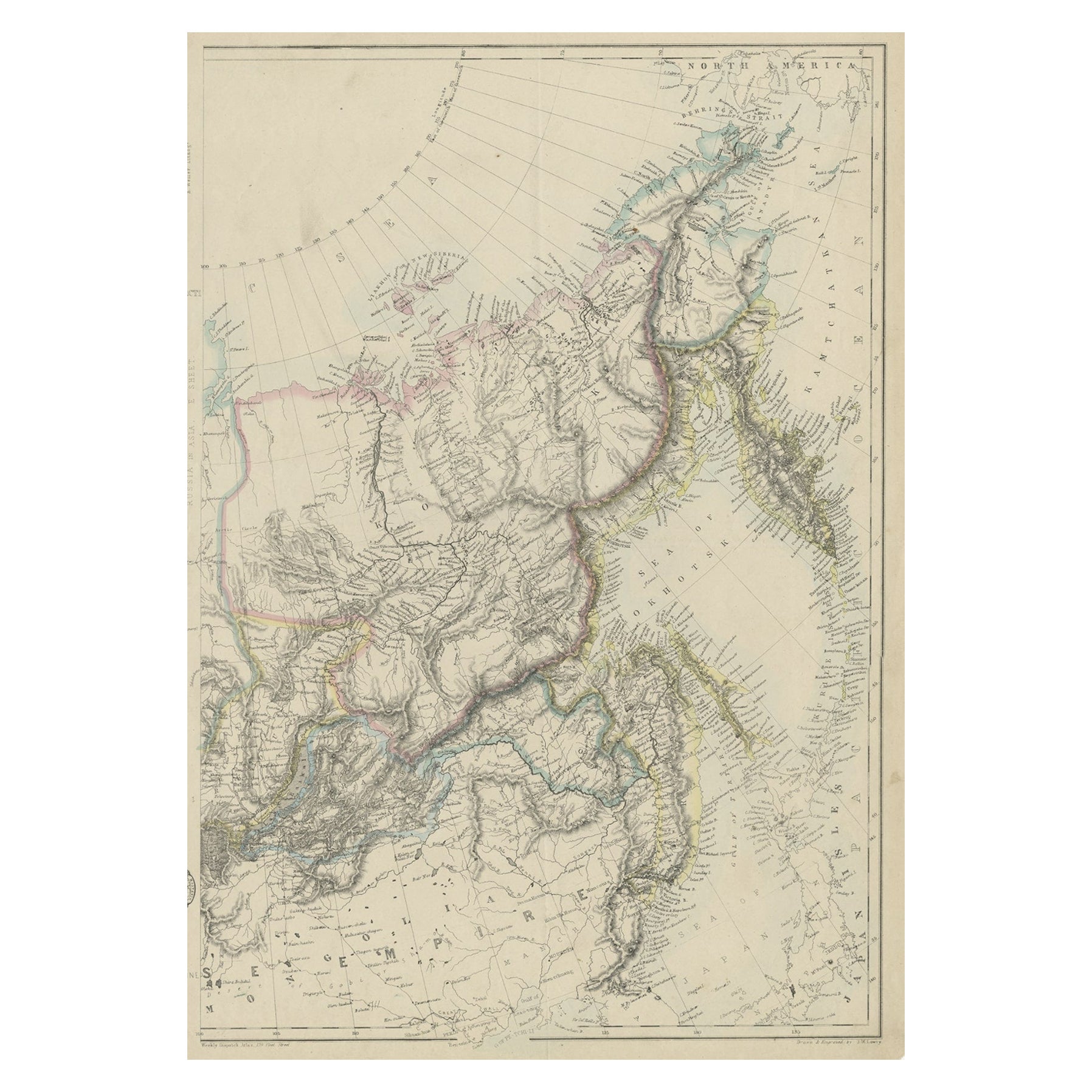
- Old Map of Russia Originating from the 'Weekly Dispatch Atlas', ca.1865Located in Langweer, NLAntique map titled 'Russia in Asia, E Sheet'. Old map of Russia originating from the 'Weekly Dispatch Atlas'. Artists and Engravers: Engraved by J.W. Lowry.Category
Antique 1860s Maps
MaterialsPaper
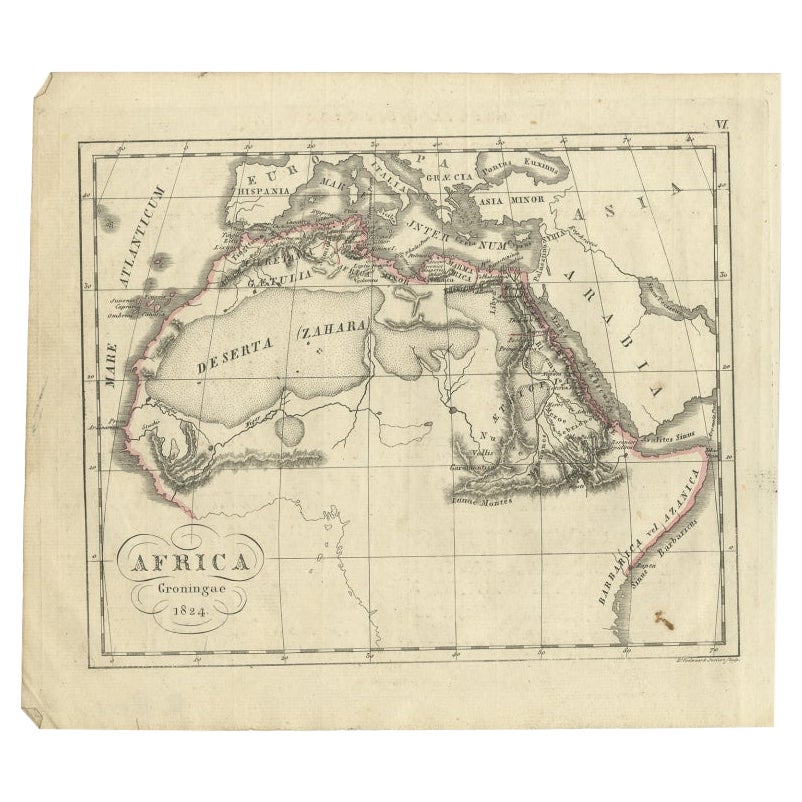
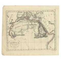
- Antique Map of Northern Africa from a Rare Dutch Atlas, 1825Located in Langweer, NLAntique map titled 'Africa'. Old map of the African continent originating from 'Atlas der Oude Wereld'. Artists and Engravers: Published by C. Ph. Funke and W. van Boekeren, Gron...Category
Antique 19th Century Maps
MaterialsPaper
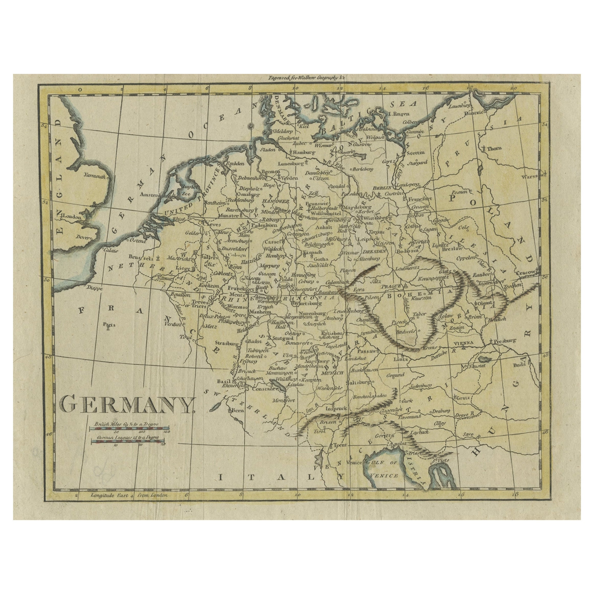
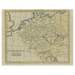
- Antique Map of Germany from an Old English Atlas, c.1802Located in Langweer, NLAntique map titled 'Germany'. Antique map of Germany engraved for 'Atlas to Walker's Geography'. Artists and Engravers: Engraved by W. Darton. Artist: Engraved by W. Darton. Co...Category
Antique 19th Century Maps
MaterialsPaper
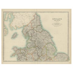
- Original Antique Map of England and Wales from the 1909 Royal AtlasLocated in Langweer, NLThe antique map titled 'England and Wales' is a historical cartographic representation of these two nations. This original antique map of England...Category
Early 20th Century Maps
MaterialsPaper
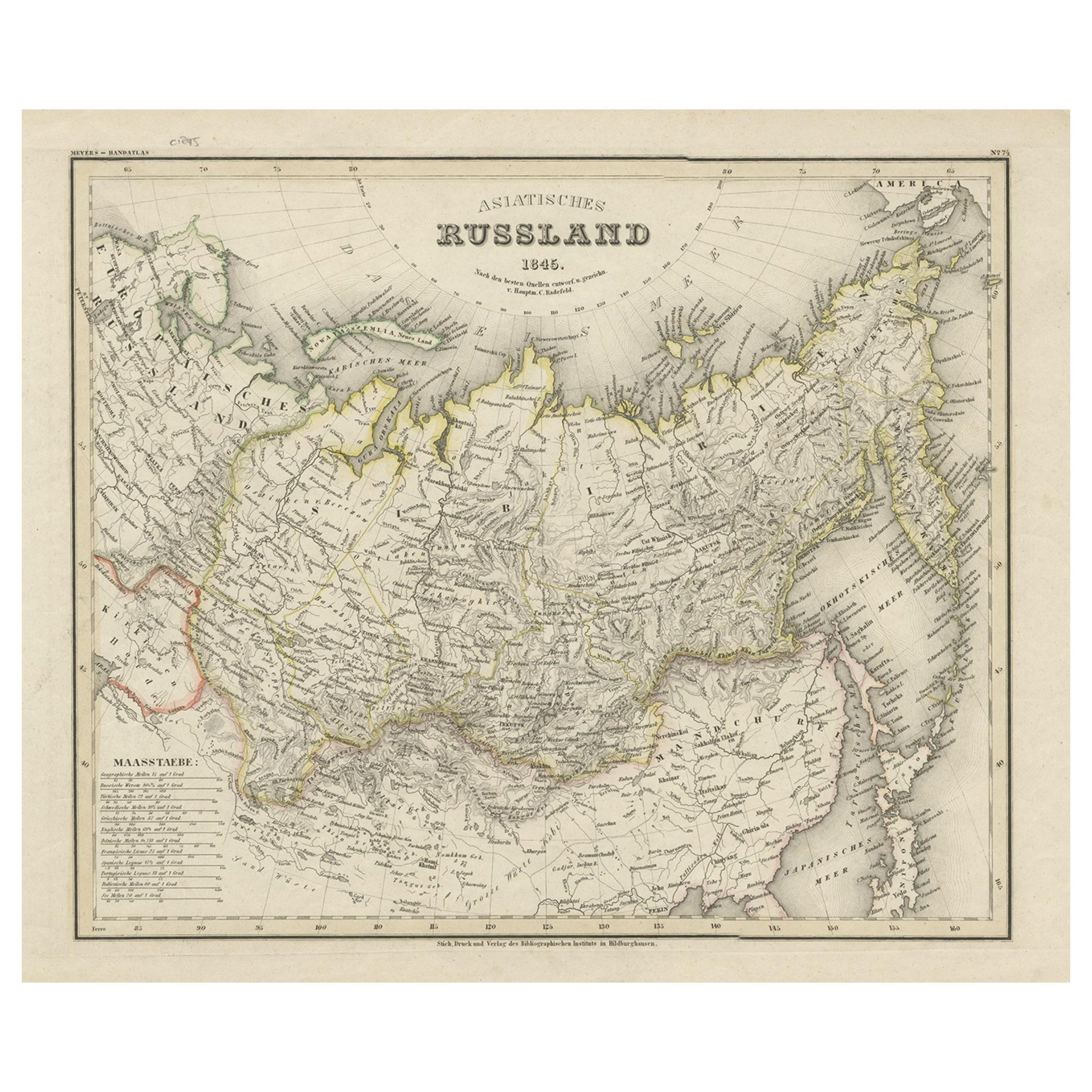
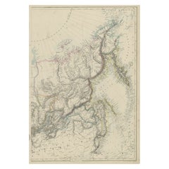
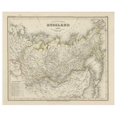
- Antique Map of Russia in Asia from An Old German Atlas, 1845By MeyerLocated in Langweer, NLAntique map titled 'Asiatisches Russland'. This map depicts Russia in Asia and originates from 'Meyers Handatlas'. Artists and Engravers: Engraved and published by 'Bibliographis...Category
Antique 19th Century Maps
MaterialsPaper
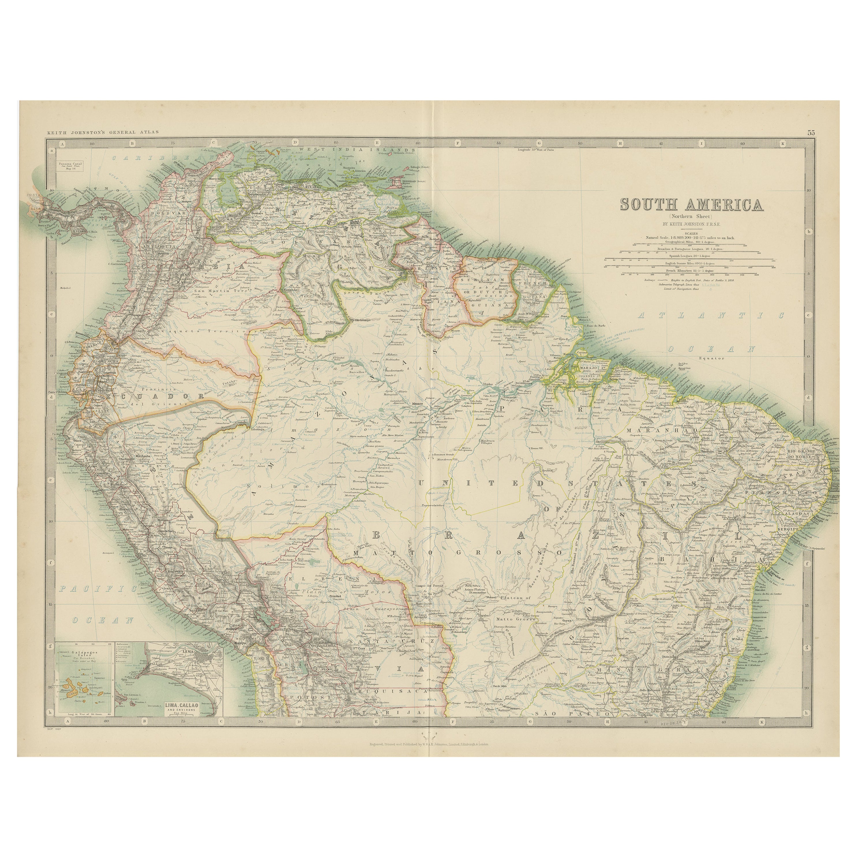
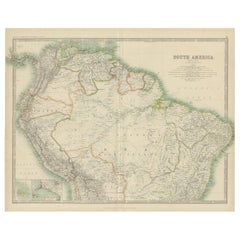
- Exploring South America's North: Antique Map from the Royal Atlas of 1909Located in Langweer, NLThe antique map titled 'South America, Northern Sheet' is a historical cartographic representation of the northern part of South America. This original antique map features inset map...Category
Early 20th Century Maps
MaterialsPaper
You May Also Like
- Antique Map of Principality of MonacoBy Antonio Vallardi EditoreLocated in Alessandria, PiemonteST/619 - "Old Geographical Atlas of Italy - Topographic map of ex-Principality of Monaco" - ediz Vallardi - Milano - A somewhat special edition ---Category
Antique Late 19th Century Italian Other Prints
MaterialsPaper
- Original Antique Map of Italy. C.1780Located in St Annes, LancashireGreat map of Italy Copper-plate engraving Published C.1780 Unframed.Category
Antique Early 1800s English Georgian Maps
MaterialsPaper

- Original Antique Map of Asia. C.1780Located in St Annes, LancashireGreat map of Asia Copper-plate engraving Published C.1780 Two small worm holes to right side of map Unframed.Category
Antique Early 1800s English Georgian Maps
MaterialsPaper

- Original Antique Map of India. C.1780Located in St Annes, LancashireGreat map of India Copper-plate engraving Published C.1780 Three small worm holes to right side of map and one bottom left corner Unframed.Category
Antique Early 1800s English Georgian Maps
MaterialsPaper

- Original Antique Map of Italy. Arrowsmith. 1820Located in St Annes, LancashireGreat map of Italy Drawn under the direction of Arrowsmith Copper-plate engraving Published by Longman, Hurst, Rees, Orme and Brown, 1820 Unframed.Category
Antique 1820s English Maps
MaterialsPaper
- Original Antique Map of Ireland- Kerry. C.1840Located in St Annes, LancashireGreat map of Kerry Steel engraving Drawn under the direction of A.Adlard Published by How and Parsons, C.1840 Unframed.Category
Antique 1840s English Maps
MaterialsPaper


Recently Viewed
View AllMore Ways To Browse
Japanese Vintage Collectibles
Vintage Japanese Japanese Collectables
Map Set
Japan Antiques Collectables
Set Of Maps
Japan Maps
Map Japan
Map Of Japan
Antique Map Set
Set Of Antique Maps
Antique Map Japan
Vintage Japanese Map
Original Antique World Map
Map Of United States
Antique German Collectible
Authentic Antique Maps
The United States Map
Map France