Items Similar to Set of 4 Antique Geographical Maps French-German War 1870-71


Want more images or videos?
Request additional images or videos from the seller
1 of 14
Set of 4 Antique Geographical Maps French-German War 1870-71
About the Item
Elegant late 19th century set of four antique geographical maps relating to the positioning of the armies in the Franco-German War 1870-71.
Author: Historical Section of the Great General Staff.
Publisher: Lith Institut Wilh Greve
In good general condition, with yellowing of the paper, equipped with a recently manufactured wooden cone.
- Dimensions:Height: 31.5 in (80 cm)Width: 36.62 in (93 cm)Depth: 1.58 in (4 cm)
- Sold As:Set of 4
- Materials and Techniques:
- Place of Origin:
- Period:
- Date of Manufacture:circa 1890
- Condition:Wear consistent with age and use. with yellowing of the paper.
- Seller Location:Casale Monferrato, IT
- Reference Number:1stDibs: LU3616338463262
About the Seller
5.0
Platinum Seller
These expertly vetted sellers are 1stDibs' most experienced sellers and are rated highest by our customers.
Established in 2012
1stDibs seller since 2018
149 sales on 1stDibs
Typical response time: <1 hour
- ShippingRetrieving quote...Ships From: Casale Monferrato, Italy
- Return PolicyA return for this item may be initiated within 7 days of delivery.
More From This SellerView All
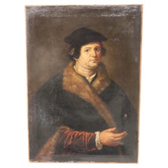
- 18th Century Antique Oil Painting on Canvas Portrait of a GentlemanLocated in Casale Monferrato, ITBeautiful antique oil painting on canvas portrait of a gentleman. Excellent pictorial quality great attention to detail. English school ...Category
Antique 1780s Dutch Paintings
MaterialsCanvas
- 17th Century Italian Antique Oil Painting on Canvas Portrait of a GentlemanLocated in Casale Monferrato, ITBeautiful antique oil painting on canvas portrait of a gentleman with book.. Excellent pictorial quality great attention to detail. Flemish school school of the 17th century. Not signed. Sold with rare 17th century antique wooden frame...Category
Antique 1660s Dutch Paintings
MaterialsCanvas
- 18th Century Antique Oil Painting on Canvas Oval Portrait of a GentlemanLocated in Casale Monferrato, ITBeautiful antique oil painting on canvas portrait of a gentleman. Excellent pictorial quality great attention to detail. English school ...Category
Antique 1780s Dutch Paintings
MaterialsCanvas
- 17th Century Antique Oil Painting on Canvas Portrait of a Gentleman with FurLocated in Casale Monferrato, ITBeautiful antique oil painting on canvas portrait of a gentleman with fur. Excellent pictorial quality great attention to detail. Flemis...Category
Antique 1660s Dutch Paintings
MaterialsCanvas
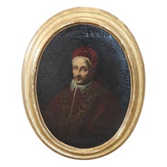
- 17th Century Italian Antique Oil Painting on Canvas Portrait of Pope Clemente IXLocated in Casale Monferrato, ITBeautiful antique Italian oil painting on canvas. Excellent pictorial quality great attention to detail. Italian school of the 17th century. Not signed. A beautiful religious painting, oval portrait of Pope Clemente IX. Sold with oval antique frame...Category
Antique 1660s Italian Paintings
MaterialsCanvas
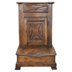
- 18th Century Italian Rare Antique Walnut KneelerLocated in Casale Monferrato, ITRare antique Italian kneeler, Mid-18th century. Made of solid walnut with delicate decoration carved in the wood on the front of the door. In the part dedicated to the knees there is...Category
Antique Mid-18th Century Italian Religious Items
MaterialsWalnut


You May Also Like
- Geographical Antique Map of Principality of MonacoBy Bruno SantiniLocated in Alessandria, PiemonteST/609 - Interesting antique color map of Monaco Principality in French language : "Carte qui contient le Principauté de Piémont, le Monferrat et la comté de...Category
Antique Late 18th Century Italian Other Maps
MaterialsPaper
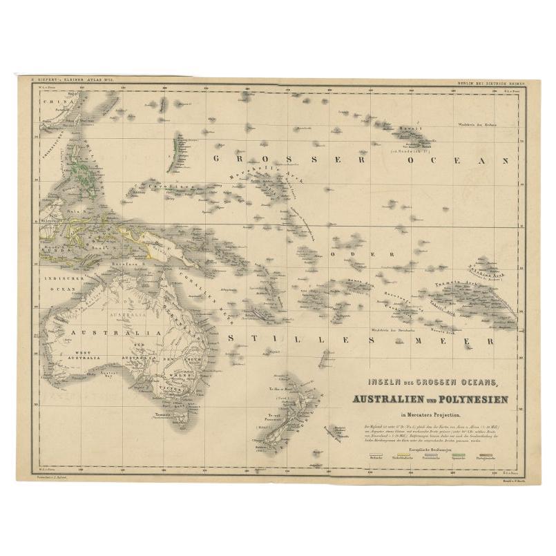
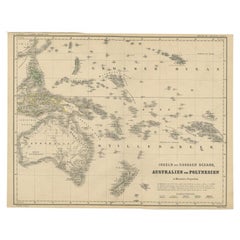
- German Antique Map of Australia and Polynesia, c.1870Located in Langweer, NLAntique map titled 'Inseln des Grossen Oceans, Australien und Polynesien'. Old map of Australia and Polynesia. This map originates from 'H. Kiepert's Kleiner Atlas der Neueren Geogra...Category
Antique 19th Century Maps
MaterialsPaper
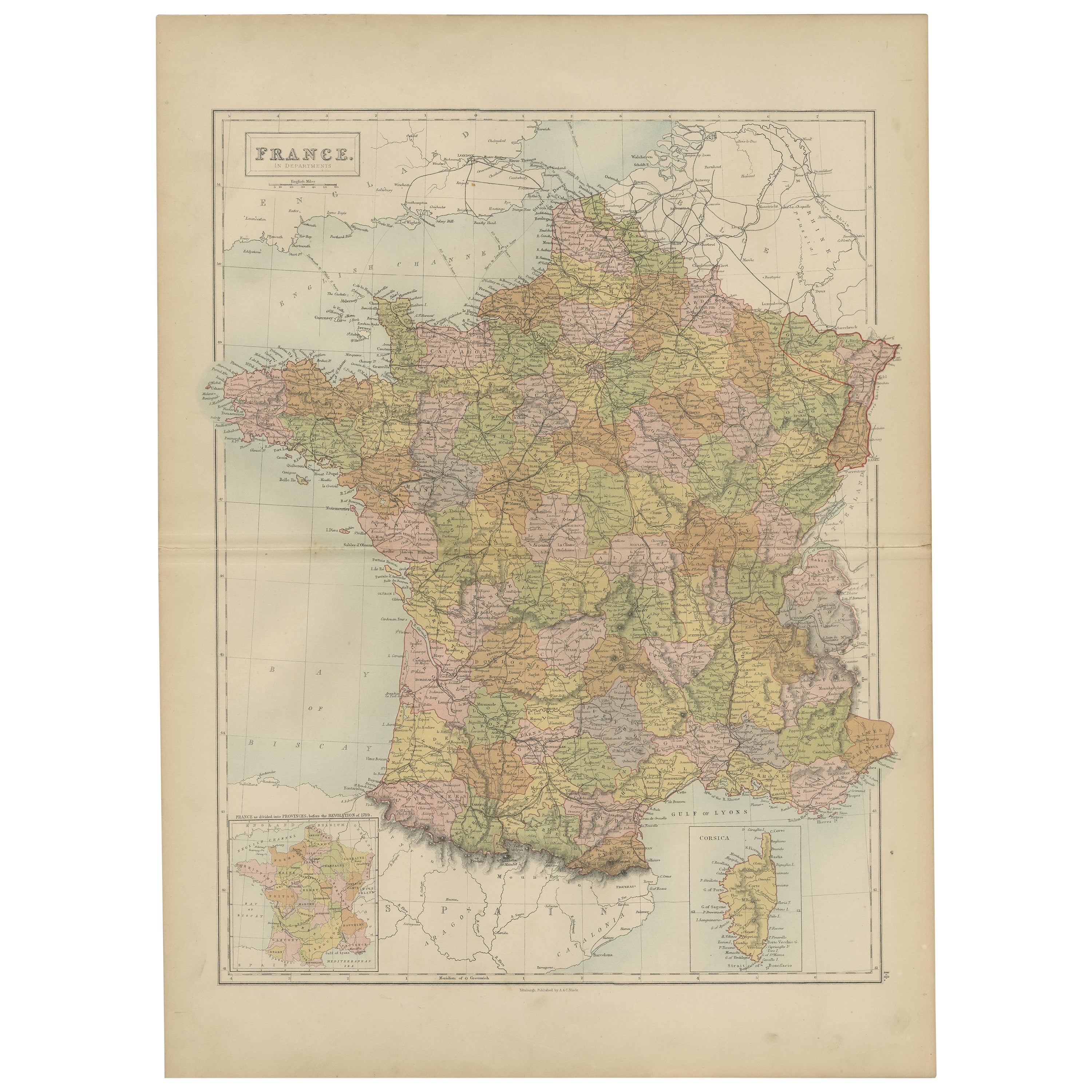
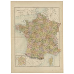
- Antique Map of France by A & C. Black, 1870Located in Langweer, NLAntique map titled 'France'. Original antique map of France with inset map of France as divided into provinces, before the revolution of 1789 and map of Corsica...Category
Antique Late 19th Century Maps
MaterialsPaper
- Antique Map of Asia from a German School Atlas, c.1870Located in Langweer, NLAntique map titled 'Asien'. Old map of the Asian continent. This map originates from 'H. Kiepert's Kleiner Atlas der Neueren Geographie für Schule und Haus'. Artists and Engravers:...Category
Antique 19th Century Maps
MaterialsPaper
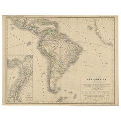
- Antique German Map of South America by Kiepert, c.1870Located in Langweer, NLAntique map titled 'Süd-America'. Old map of South America. This map originates from 'H. Kiepert's Kleiner Atlas der Neueren Geographie für Schule und Haus'. Artists and Engravers: K...Category
Antique 19th Century Maps
MaterialsPaper
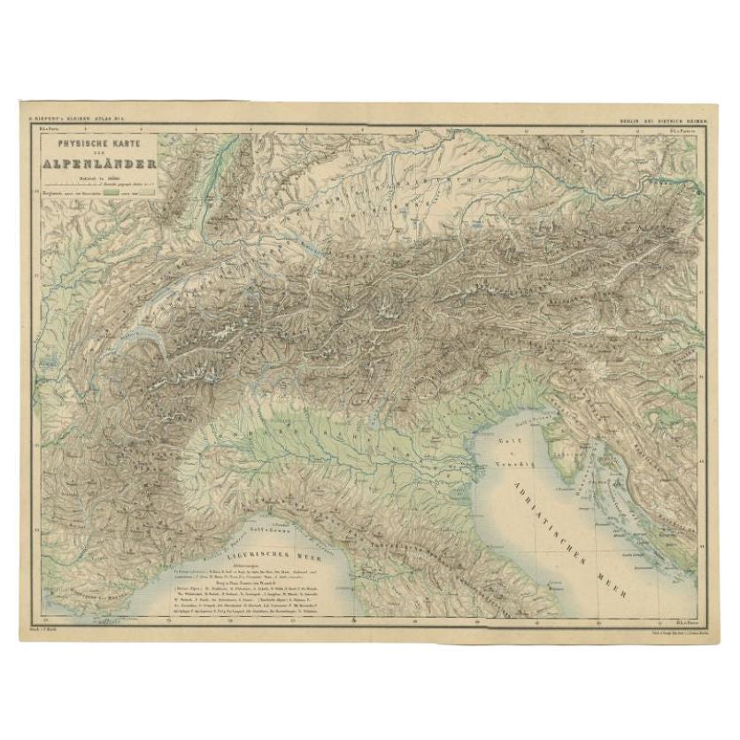
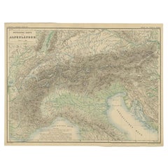
- Antique Map of the Alpine Countries, Published in Germany, c.1870Located in Langweer, NLAntique map titled 'Physische Karte der Alpenländer'. Old map of the Alpine countries. This map originates from 'H. Kiepert's Kleiner Atlas der Neueren Geographie für Schule und Haus...Category
Antique 19th Century Maps
MaterialsPaper


Recently Viewed
View AllMore Ways To Browse
Map Of Iraq
Map Antique Map Of Armenia
Antique Original Maps Of Africa
Carte Terre Plate
Marne Map
Devon Map
Jeffery Brown
Native American Tribes Map
Staffordshire Antique Map
Staffordshire Map
Tam Austria
Vintage Schoolroom
Wyoming Map
1890 Map Of Illinois
E H Fletcher
Edens Whale
F V Hayden
Giovanni Maria Cassini On Sale