Items Similar to Striking Antique Map Centered on the Malay Peninsula


Want more images or videos?
Request additional images or videos from the seller
1 of 7
Striking Antique Map Centered on the Malay Peninsula
About the Item
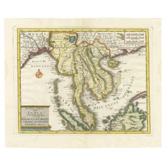
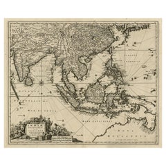
Antique map titled 'D'Indiaanze Landschappen Zeen en Eylanden, van Couchin af tot in de Moluccos (...)'. Striking map of the region from the Philippines and Formosa to India and the Maldives, centered on the Malay Peninsula. The map was used to illustrate the Dutch Translation of the Account of Nuno da Cunha in the region. Nuno da Cunha was a governor of the Portuguese possessions in India from 1528 to 1538. He was the son of the famous Portuguese navigator, admiral and ambassador to Pope Leo X, Tristão da Cunha, and Tristão's wife Antónia Pais. Nuno da Cunha fought in battles at Oja and Brava, and at the capture of Panane, under the viceroy Francisco de Almeida. Named by João III ninth governor of Portuguese possessions in India, he served from April 1528 to 1538. On his passage to Goa, he subdued the pirates at Mombassa who had been harassing the coast of Mozambique. Nuno's brothers Pero Vaz da Cunha and Simão da Cunha were expected to serve under him as second and third in command, a form of nepotism that was expected in the Portuguese Estado da Índia. However, they died on the voyage, and Nuno was forced to rely upon local networks of clientage in Goa during his long rule. In 1529, Nuno sent an expedition that sacked and burned the city of Damão on the Arabian Sea at the mouth of the Damão River, about 100 miles north of Mumbai in the Muslim state of Gujarat. Forces under his control captured Baxay (now Vasai, often mistaken for Basra in Iraq) from the Muslim ruler of Gujarat, Bahadur Shah, on January 20, 1533. The next year, renamed Bassein, the city became the capital of the Portuguese province of the North, and the great citadel of black basalt, still standing, was begun. (It was completed in 1548). Forced to return to Portugal as a result of court intrigues, he was shipwrecked at the Cape of Good Hope and drowned.
Published by P. van der Aa, 1706.
- Creator:Pieter Van Der Aa (Artist)
- Dimensions:Height: 6.89 in (17.5 cm)Width: 9.45 in (24 cm)Depth: 0.02 in (0.5 mm)
- Materials and Techniques:
- Period:
- Date of Manufacture:1706
- Condition:Wear consistent with age and use. General age-related toning, later hand coloring. Original folding lines blank verso. Minor wear and foxing. Please study images carefully.
- Seller Location:Langweer, NL
- Reference Number:

Pieter Van Der Aa
Pieter van der Aa began his career at Leiden in 1683 as a Latin trade publisher, publishing classical texts about medicine and science. He was a Dutch publisher of maps and atlases active in the late 17th and early 18th centuries. During his long and impressive career, Van der Aa produced thousands of maps, including a vast 28 volume atlas containing no less than 3,000 maps.
About the Seller
5.0
Platinum Seller
These expertly vetted sellers are 1stDibs' most experienced sellers and are rated highest by our customers.
Established in 2009
1stDibs seller since 2017
1,940 sales on 1stDibs
Typical response time: <1 hour
- ShippingRetrieving quote...Ships From: Langweer, Netherlands
- Return PolicyA return for this item may be initiated within 14 days of delivery.
More From This SellerView All
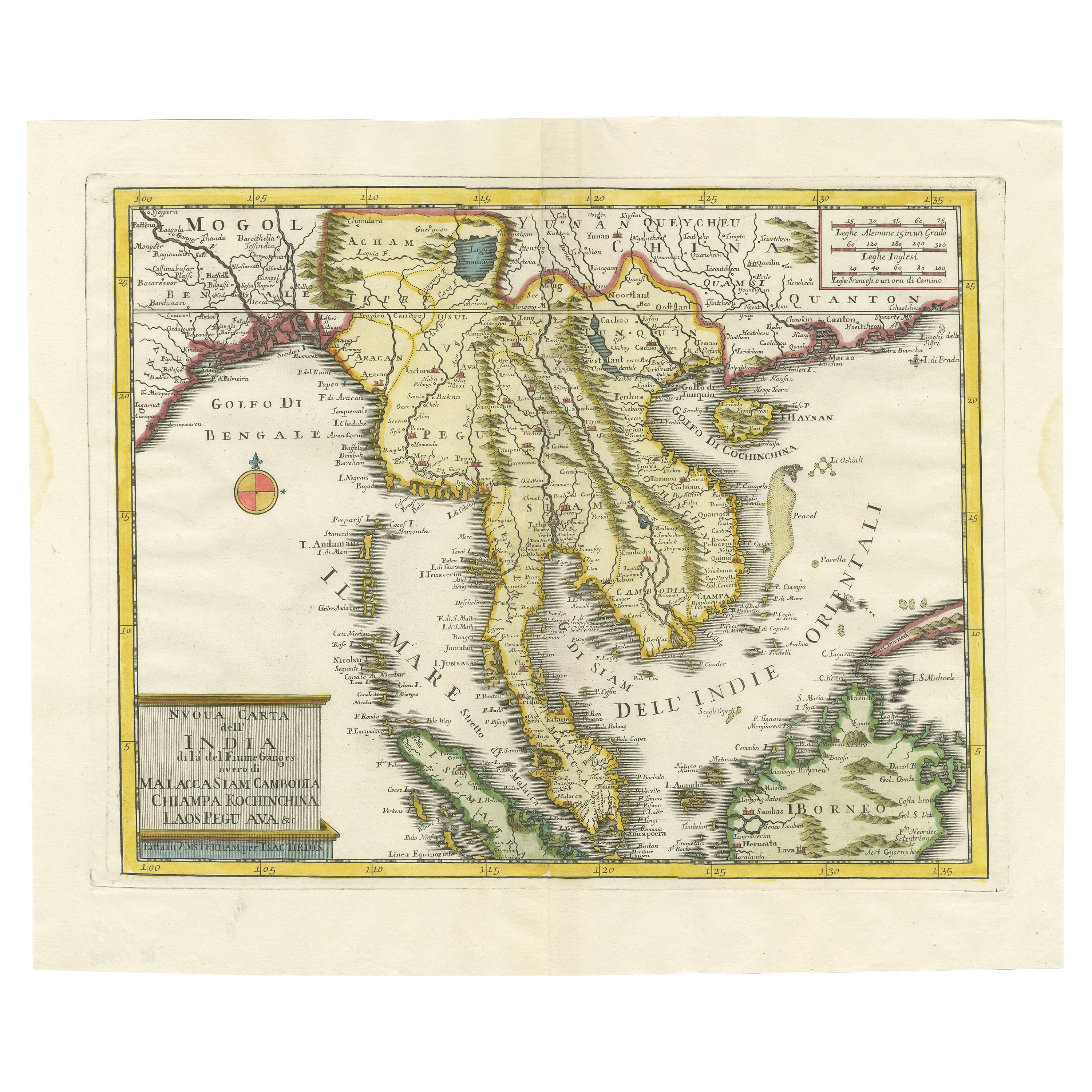
- Antique Map of the Region Centered on the Malay Peninsula by Tirion 'c.1760'Located in Langweer, NLAntique map titled 'Nuova Carta dell' India (..)'. Decorative map of the region centered on the Malay Peninsula and extending from the Straits of Singapore, Malacca and Borneo in the South to China in the east and the Bay of Bengal...Category
Antique Mid-18th Century Maps
MaterialsPaper
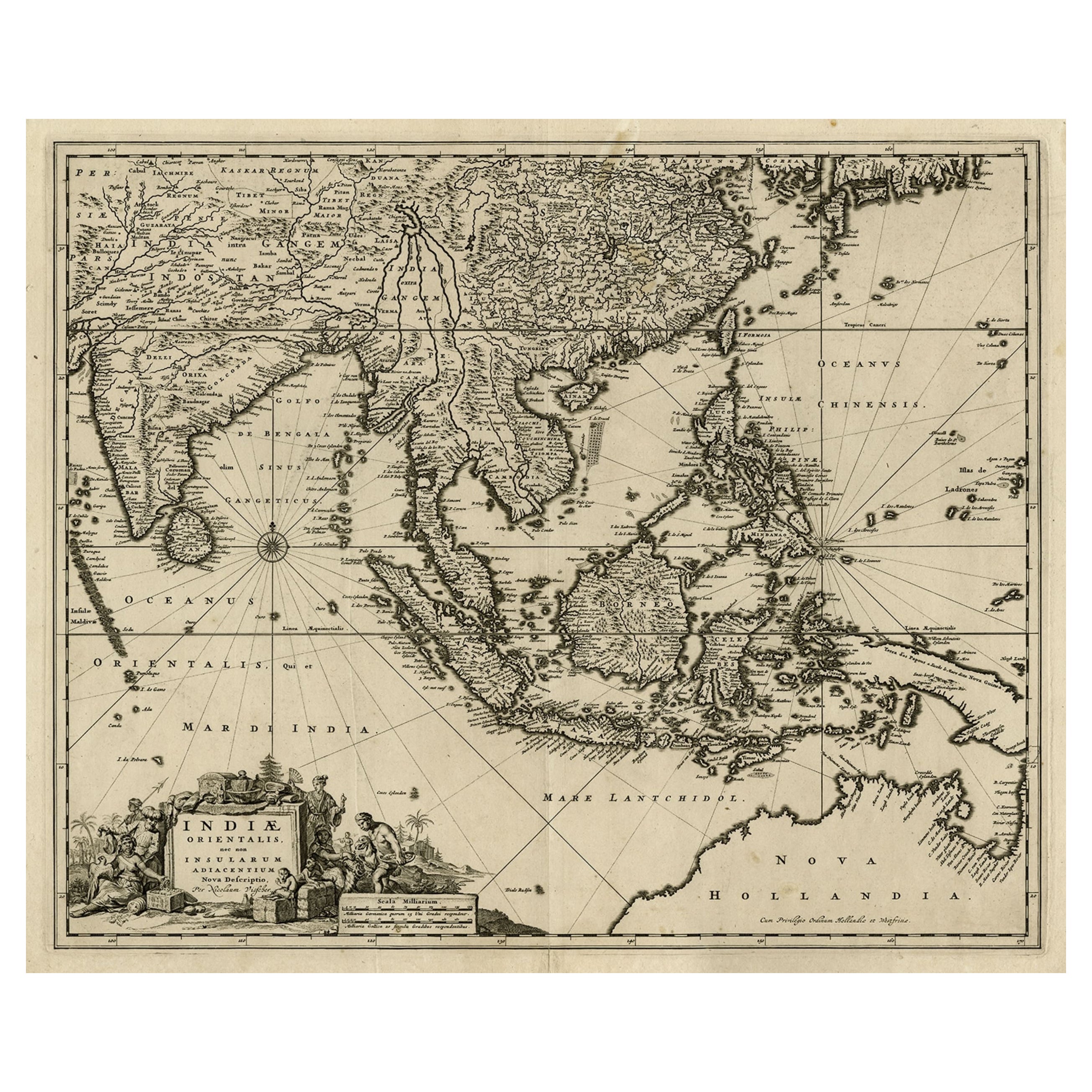
- Antique Map of the Strait of Malacca, Malay Peninsula & Dutch Indies, c.1670Located in Langweer, NLAntique map titled 'Indiae Orientalis, nec non Insularum Adiacentium Nova Descriptio.' Map of Southeast Asia. The map centers on the Strait of Malacca and Malay Peninsula. It ext...Category
Antique 1670s Maps
MaterialsPaper
- Antique Map of the Sunda Islands Sumatra, Java, Malay Peninsula & Borneo (1739)By Isaak TirionLocated in Langweer, NLAntique map titled 'Nieuwe kaart van de Sundasche Eilanden als Borneo, Sumatra en Groot Iava & c'. Detailed map of the Sunda Islands, Southeast Asia, extending from the tip of Cambod...Category
Antique Mid-18th Century Maps
MaterialsPaper
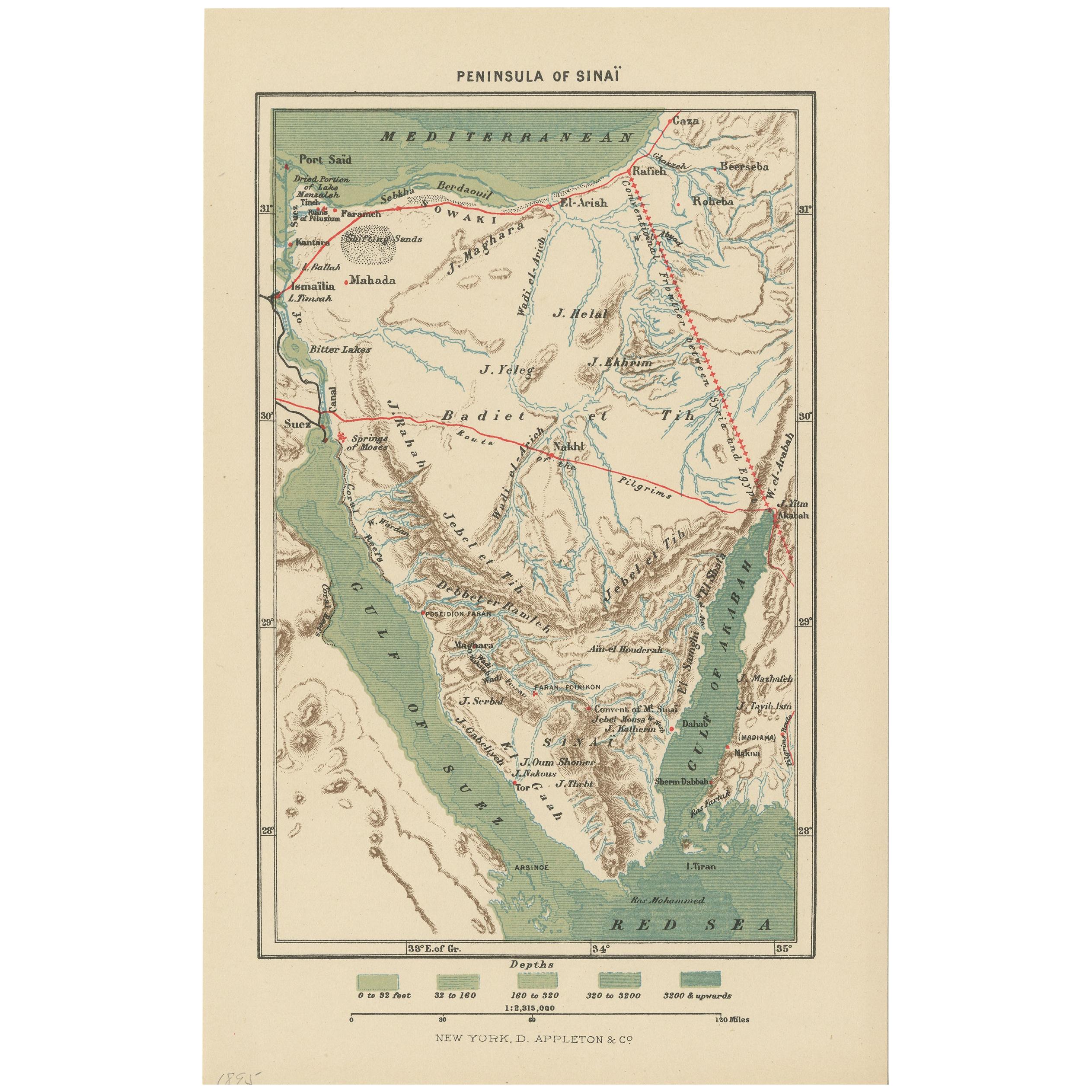
- Antique Map of the Sinai Peninsula, '1895'Located in Langweer, NLAntique map titled 'Peninsula of Sinaï'. Lithographed map of the Sinai Peninsula, a peninsula in Egypt, and the only part of the country located in Asia. It is situated between the M...Category
Antique Late 19th Century Maps
MaterialsPaper
- Antique Map of the Arabian Peninsula by Bonne 'c.1780'Located in Langweer, NLAntique map titled 'Carte de l'Arabie, du Golfe Persique, et de la Mer Rouge (..)'. Original antique map of the Arabian Peninsula, including the horn...Category
Antique Late 18th Century Maps
MaterialsPaper
- Antique Map of the Arabian Peninsula by Franceschini, '1739'Located in Langweer, NLAntique map titled 'Conventus et Residentiae'. Rare map of the Arabian Peninsula. This map originates from 'Provinciarum et Conventum Fratrum Discalc...Category
Antique Mid-18th Century Maps
MaterialsPaper


You May Also Like
- Vintage "View of the Center of Paris Taken from the Air" Lithograph MapLocated in San Diego, CAA very stylish "View of the Center of Paris Taken from the Air" lithograph map published by the Paris Ministry of Tourism, circa early 1950s. The piece measures 27" x 43" and shows...Category
20th Century French Mid-Century Modern Prints
MaterialsPaper
- Original Antique Map of The World by Thomas Clerk, 1817Located in St Annes, LancashireGreat map of The Eastern and Western Hemispheres On 2 sheets Copper-plate engraving Drawn and engraved by Thomas Clerk, Edinburgh. Published by Mackenzie And Dent, 1817 ...Category
Antique 1810s English Maps
MaterialsPaper
- Original Antique Map of The Netherlands, Sherwood, Neely & Jones, Dated 1809Located in St Annes, LancashireGreat map of The Netherlands Copper-plate engraving by Cooper Published by Sherwood, Neely & Jones. Dated 1809 Unframed.Category
Antique Early 1800s English Maps
MaterialsPaper
- Original Antique Map of The Netherlands, Engraved by Barlow, Dated 1807Located in St Annes, LancashireGreat map of Netherlands Copper-plate engraving by Barlow Published by Brightly & Kinnersly, Bungay, Suffolk. Dated 1807 Unframed.Category
Antique Early 1800s English Maps
MaterialsPaper
- Map of the Republic of GenoaLocated in New York, NYFramed antique hand-coloured map of the Republic of Genoa including the duchies of Mantua, Modena, and Parma. Europe, late 18th century. Dimension: 25...Category
Antique Late 18th Century European Maps
- Map "Estuary- Mouth of the Thames"Located in Alessandria, PiemonteST/426 - Antique French Map of the estuary of the Thames, map dated 1769 - "Mape of the entrance of the Thames. Designed by filing of Navy cards fo...Category
Antique Mid-18th Century French Other Prints
MaterialsPaper


