Spanish Colonial Maps

SPANISH COLONIAL STYLE

After the conquest of Mexico in 1521 and the Philippines in 1565, Spain dictated a global culture. The colonization of territories in the Americas, Western Europe, Africa, Oceania and the Pacific imposed the values of Spain, including Catholicism, while the extraction of resources reinforced the empire’s wealth and power. Unlike many styles that came out of European colonialism, such as British Colonial, Spanish Colonial furniture and architecture frequently mixed local heritage with the artistic traditions of Spain.

Spanish Colonial furniture was informed by the shifting styles of Europe as well as Indigenous culture. There were Inca tapestries depicting Spanish coats of arms and Baroque chairs adorned with tropical flora. The butaca, a low easy chair popular in the Caribbean, was inspired by Rococo’s curving forms and the shape of precolonial seating. In New Mexico, Pueblo artisans carved chests with patterns reminiscent of Anasazi art.

Even within the homes of the wealthy, furniture was usually restricted to necessities like benches, desks, cupboards and chests. These were often ornately designed and especially important for storing prized goods like textiles. Spanish Colonial houses were built with adobe and clay and tended to be minimally decorated, so the style’s heavily carved wooden furniture pieces stood out against a home’s white stucco walls.

The Spanish Colonial period mostly came to an end after the territories achieved independence from Spain. However, its aesthetics continued to influence Southwestern style and Spanish Colonial Revival style after Spanish Colonial style was used extensively at San Diego’s 1915 Panama-California Exposition.

Find a collection of antique Spanish Colonial chairs, tables, bedroom furniture and other furniture on 1stDibs.

3
to
3
3
3
3
54
34
16
11
9
5
5
4
4
3
1
1
1
2
1
3
3
3
1
2
1
1
1
1
Style: Spanish Colonial
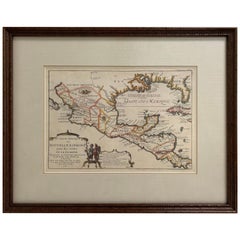
1705 Golfe de Mexico and Florida Framed Map
Located in Stamford, CT
Framed map of Mexico & Florida circa 1705, Paris. Small map with Mexico and the Gulf Coast. Inset text indicating Panama, Acapulco, Mexico City and the Mississippi. Extends North to ...
Category

Early 1700s French Antique Spanish Colonial Maps

Materials

Glass, Wood, Paper

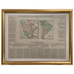
Framed 1820s Hand Colored Map of the United States
Located in Stamford, CT
Framed 1820s hand colored map photos of North America and South America. As found framed in giltwood frame.
Category

1820s American Antique Spanish Colonial Maps

Materials

Giltwood, Paper, Glass

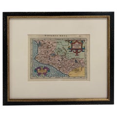
Framed Mercator Hondius Hispania Nova Atlas Minor Map
Located in Stamford, CT
Framed colored example of this decorative and important minature map. Newly framed in brown wood frame with gold trim. Mercator Hondius “Atlas Minor” pu...
Category

17th Century Dutch Antique Spanish Colonial Maps

Materials

Glass, Wood, Paper

Related Items
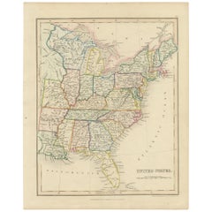
Original Antique Hand-colored Map of the United States, circa 1845
Located in Langweer, NL
Antique map titled 'United States'. Old map of the United States, includes the last part of the North West Territory (present day Wisconsin and part of Minnesota). It also marks Ft. Crawford at the confluence of the Mississippi River and the Ouisconsin River (present day Wisconsin River). Published by Orr & Company; Amen Corner...
Category

Mid-19th Century Antique Spanish Colonial Maps

Materials

Paper

Antique Map of The United States of North America, 1882
Located in Langweer, NL
This is a historical map titled "The United States of North America, Central Part" from the 1882 Blackie Atlas. It depicts the continental United States with a high level of detail, ...
Category

1880s Antique Spanish Colonial Maps

Materials

Paper

Antique Map of The United States of North America, 1882
Free Shipping
H 14.97 in W 22.45 in D 0 in
Old Decorative Pictorial Map of the United States, circa 1953
Located in Langweer, NL
Antique map titled 'A Pictorial Map of the United States of America Showing Principal Regional Resources, Products, and Natural Features'. This information-packed map was create by the General Drafting Company for the New Jersey Bell Telephone Company. The main map features over 700 drawings in full color including points of interest, natural resources, and agricultural products. At bottom are inset maps showing railroad lines, air routes, telephone lines, as well as a pictorial map of New Jersey...
Category

20th Century Spanish Colonial Maps

Materials

Paper

Antique Map of the United States of America by Lapie '1842'
Located in Langweer, NL
Antique map titled 'Carte des États-Unis d'Amérique'. Map of the United States of America (USA). This map originates from 'Atlas universel...
Category

Mid-19th Century Antique Spanish Colonial Maps

Materials

Paper

Antique Detailed World Map Drawn on Mercator's Projection, 1700
Located in Langweer, NL
Antique world map titled 'Carte generale du monde, ou description du monde terrestre & Aquatique - Generale Waereld kaart, of beschryving van de land en water waereld'. This is Pierr...
Category

17th Century Antique Spanish Colonial Maps

Materials

Paper

Antique Map with Hand Coloring of the United States and the Caribbean
Located in Langweer, NL
Antique map titled 'Verein-Staaten von Nord-America, Mexico, Yucatan u.a.'. Very detailed map of the United States of America showing the Caribbean. With an inset map of the surround...
Category

Late 19th Century Antique Spanish Colonial Maps

Materials

Paper

Antique Map of Mexico by Ortelius, circa 1602
Located in Langweer, NL
Antique map titled 'Hispaniae Novae Sivae Magnae Recens Et Vera Descriptio 1579'. Map of western New Spain, showing the recently-created Spanish settlements, many rivers, and large l...
Category

Early 17th Century Belgian Antique Spanish Colonial Maps

Materials

Paper

Antique Map of Mexico by Ortelius, circa 1602
H 16.93 in W 20.87 in D 0.02 in
Antique Map of the World on Mercator's Projection, 1788
Located in Langweer, NL
Antique map titled 'Kaart van de Geheele Wereld (..)'. Uncommon small world map on Mercator's projection. Nice detail of the islands throughout the wor...
Category

Late 18th Century Antique Spanish Colonial Maps

Materials

Paper

Antique Map of the World, Mercator Projection, by Wyld, '1845'
Located in Langweer, NL
Antique map titled 'The World'. Original antique world map, on Mercator's projection. This map originates from 'An Atlas of the World, Compr...
Category

Mid-19th Century Antique Spanish Colonial Maps

Materials

Paper

Antique Map of the United States by Titus '1871'
Located in Langweer, NL
Antique map titled 'The United States of America'. Original antique map of the United States. This map originates from 'Atlas of Prebl...
Category

Late 19th Century Antique Spanish Colonial Maps

Materials

Paper

Antique Map of the Coal Fields of the United States by Walker '1874'
Located in Langweer, NL
Antique map titled 'Map of the coal fields of the United States, compiled from state reports and data specially furnished by Prof. W.B. Rogers, E.T. Cox, A.H. Worthen, S.S. Lyon, Ric...
Category

Late 19th Century Antique Spanish Colonial Maps

Materials

Paper

Antique Map of the United States by Balbi '1847'
Located in Langweer, NL
Antique map titled 'Etats-Unis'. Original antique map of the United States. This map originates from 'Abrégé de Géographie (..)' by Ad...
Category

Mid-19th Century Antique Spanish Colonial Maps

Materials

Paper

Spanish Colonial maps for sale on 1stDibs.

Find a broad range of unique Spanish Colonial maps for sale on 1stDibs. Many of these items were first offered in the 19th Century, but contemporary artisans have continued to produce works inspired by this style. If you’re looking to add vintage maps created in this style to your space, the works available on 1stDibs include more furniture and collectibles and other home furnishings, frequently crafted with glass, paper and other materials. If you’re shopping for used Spanish Colonial maps made in a specific country, there are Europe, France, and Netherlands pieces for sale on 1stDibs. It’s true that these talented designers have at times inspired knockoffs, but our experienced specialists have partnered with only top vetted sellers to offer authentic pieces that come with a buyer protection guarantee. Prices for maps differ depending upon multiple factors, including designer, materials, construction methods, condition and provenance. On 1stDibs, the price for these items starts at $1,250 and tops out at $1,950 while the average work can sell for $1,450.

Recently Viewed

View All