Items Similar to Territories of Antiquity: The Northern Division of Syria, A Detailed 1882 Map
Want more images or videos?
Request additional images or videos from the seller
1 of 6
Territories of Antiquity: The Northern Division of Syria, A Detailed 1882 Map
About the Item
This 19th-century map from the atlas published by Blackie and Son in 1882 is titled "SYRIA (NORTH DIVISION)" and covers the northern part of Syria, capturing its geographical and administrative divisions during the late Ottoman period. The map's scope extends from the Mediterranean Sea in the west, stretching eastward into the expanse of the Syrian Desert, and from the region's northern boundaries down to its central parts.
Color-coded boundaries distinguish the various districts, with topographical features such as mountain ranges and valleys depicted using hachures. The map meticulously charts cities, towns, and villages, and denotes major rivers and bodies of water, reflecting the detailed cartographic practices of the era. The coastline along the Mediterranean is clearly outlined, with ports and coastal cities highlighted, signifying their historical importance as hubs of maritime trade and cultural exchange.
A key feature of the map is the inclusion of historical and biblical references, such as the route of the Apostle Paul’s journey, which underscores the region's rich historical and religious significance. It also indicates caravan routes, which were vital for commerce and communication across the vast desert regions.
The map reflects a time of imperial influence and exploration, where such maps were crucial for navigation, administration, and understanding the complexities of the region's landscape and political territories. It is a window into the past, illustrating how the region was perceived and documented by Western cartographers in the Victorian era. The precision and detail in this map serve as a testament to the advanced state of geographical knowledge and cartographic skill during the 19th century.
- Dimensions:Height: 14.97 in (38 cm)Width: 11.03 in (28 cm)Depth: 0 in (0.02 mm)
- Materials and Techniques:
- Period:
- Date of Manufacture:1882
- Condition:Good condition. Study the image carefully.
- Seller Location:Langweer, NL
- Reference Number:
About the Seller
5.0
Platinum Seller
These expertly vetted sellers are 1stDibs' most experienced sellers and are rated highest by our customers.
Established in 2009
1stDibs seller since 2017
1,946 sales on 1stDibs
Typical response time: <1 hour
- ShippingRetrieving quote...Ships From: Langweer, Netherlands
- Return PolicyA return for this item may be initiated within 14 days of delivery.
More From This SellerView All
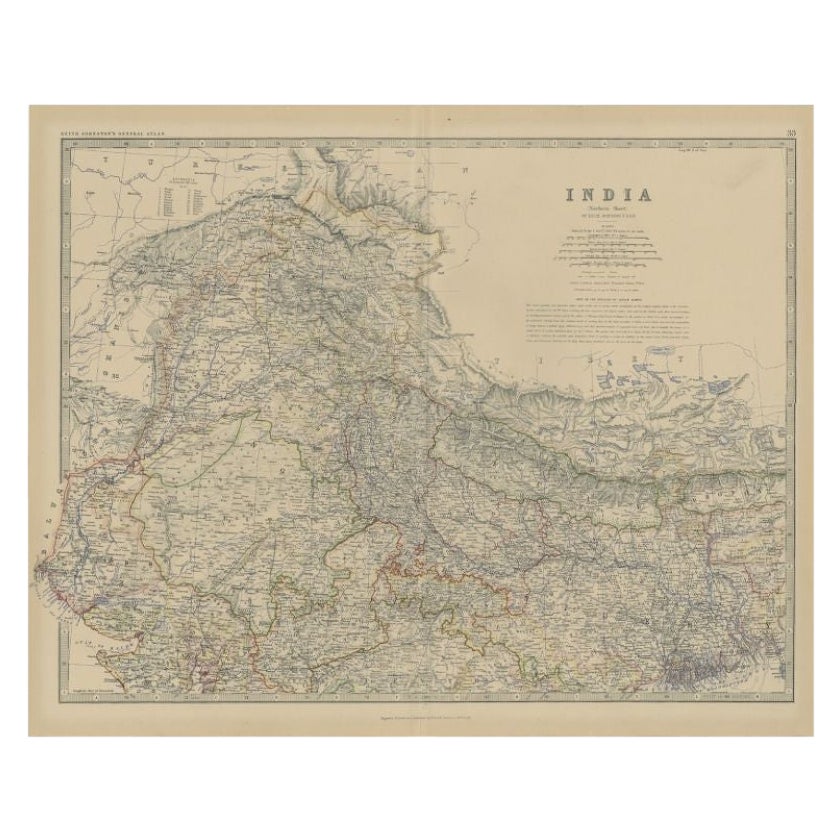
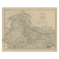
- Antique Map of Northern India by Johnston, 1882Located in Langweer, NLAntique map titled 'India (Northern Sheet)'. Old map of Northern India. This map originates from 'The Royal Atlas of Modern Geography, Exhibiting, in a Series of Entirely Original an...Category
Antique 19th Century Maps
MaterialsPaper
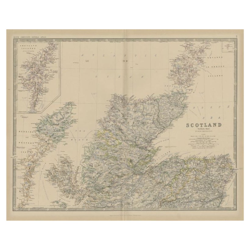
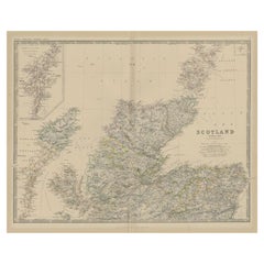
- Antique Map of Northern Scotland by Johnston, 1882Located in Langweer, NLAntique map titled 'Scotland'. Old map of Northern Scotland. This map originates from 'The Royal Atlas of Modern Geography, Exhibiting, in a Series of Entirely Original and Authentic...Category
Antique 19th Century Maps
MaterialsPaper
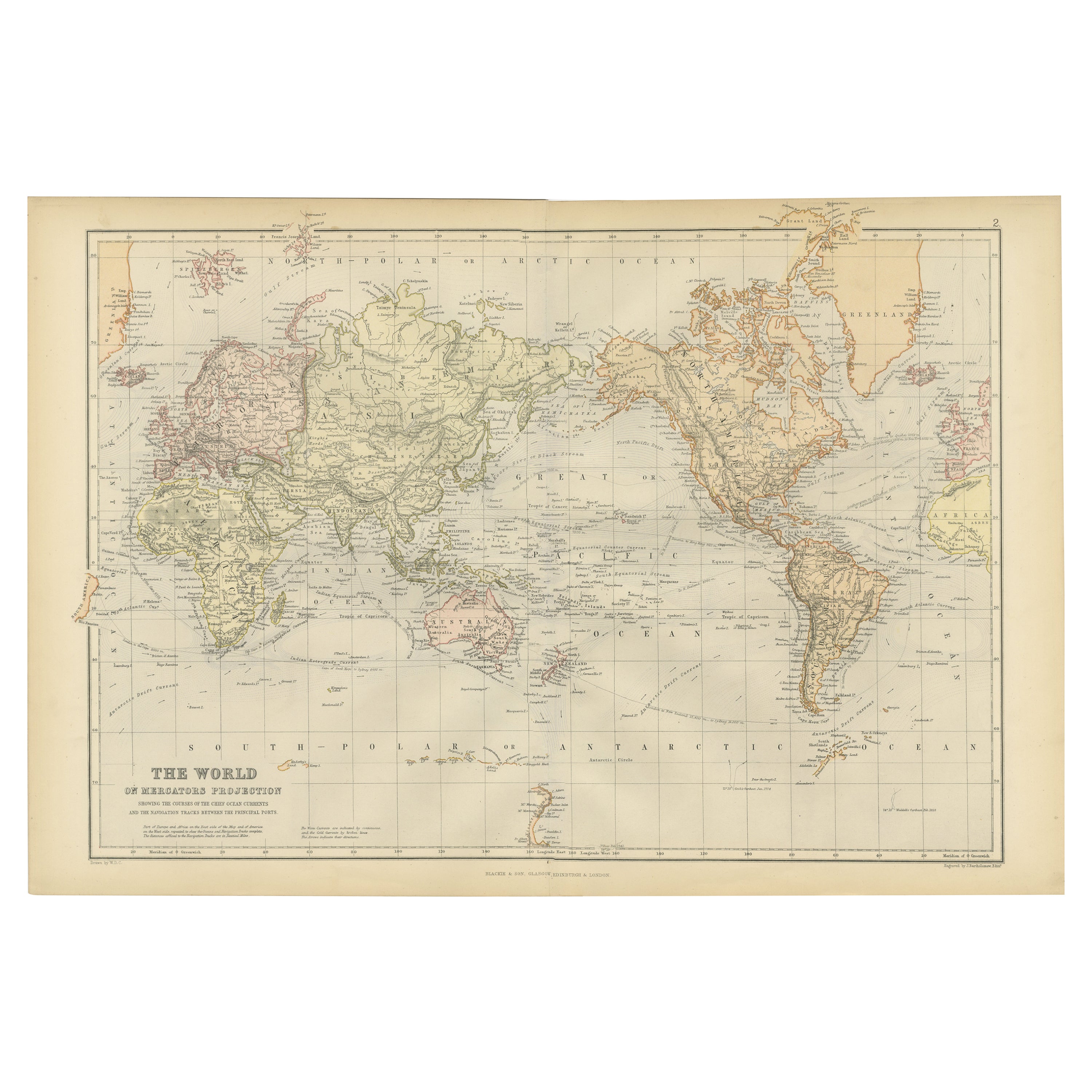
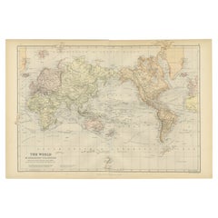
- Colorful Detailed Antique Map of The World on Mercators Projection, 1882Located in Langweer, NLThe 'World of Mercator's Projection' is a map with a stunning portrayal of global geography and maritime navigation from an era steeped in exploration and discovery. With meticulous detail and precision, this map showcases the world's continents on Mercator's famous projection, capturing the essence of a bygone era's cartographic expertise. Illustrating the courses of chief ocean currents and key navigation tracks between major ports, this map doesn't just depict landmasses but also reveals the vital maritime routes that shaped global trade and exploration. Each line and curve represents the pathways of ancient voyages and modern seafaring, connecting distant shores and continents. Crafted with the precision characteristic of Mercator's projection, this map offers a unique perspective on how sailors and explorers navigated the world's vast oceans. It stands as a testament to the artistry and scientific ingenuity of cartographers of that time, showcasing their commitment to accurate representation amid the challenges of mapping a spherical world on a flat surface. This map isn't just a historical document; it's a captivating piece of cartographic art...Category
Antique 1880s Maps
MaterialsPaper
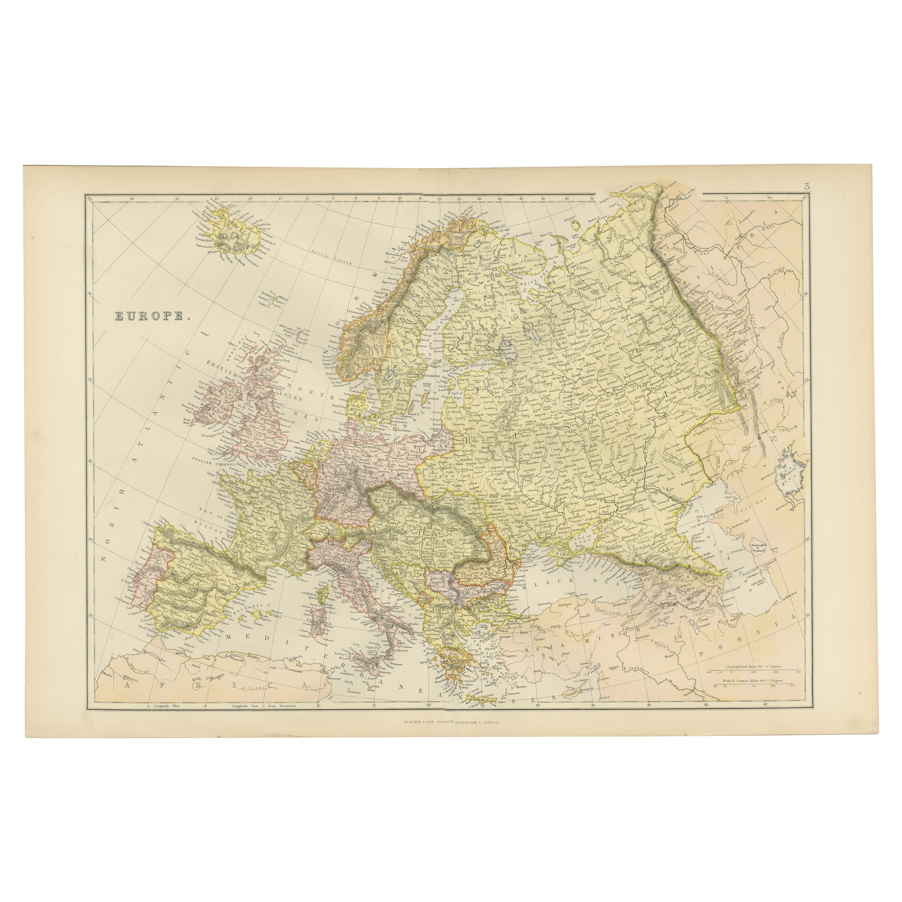
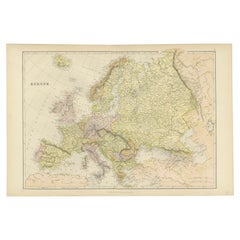
- Colorful Detailed Antique Map of Europe, Published in 1882Located in Langweer, NL"The Antique Map of Europe from 'The Comprehensive Atlas and Geography of the World,' published in 1882 by Blackie & Son, is a testament to meticulous cartography and scholarly preci...Category
Antique 1880s Maps
MaterialsPaper
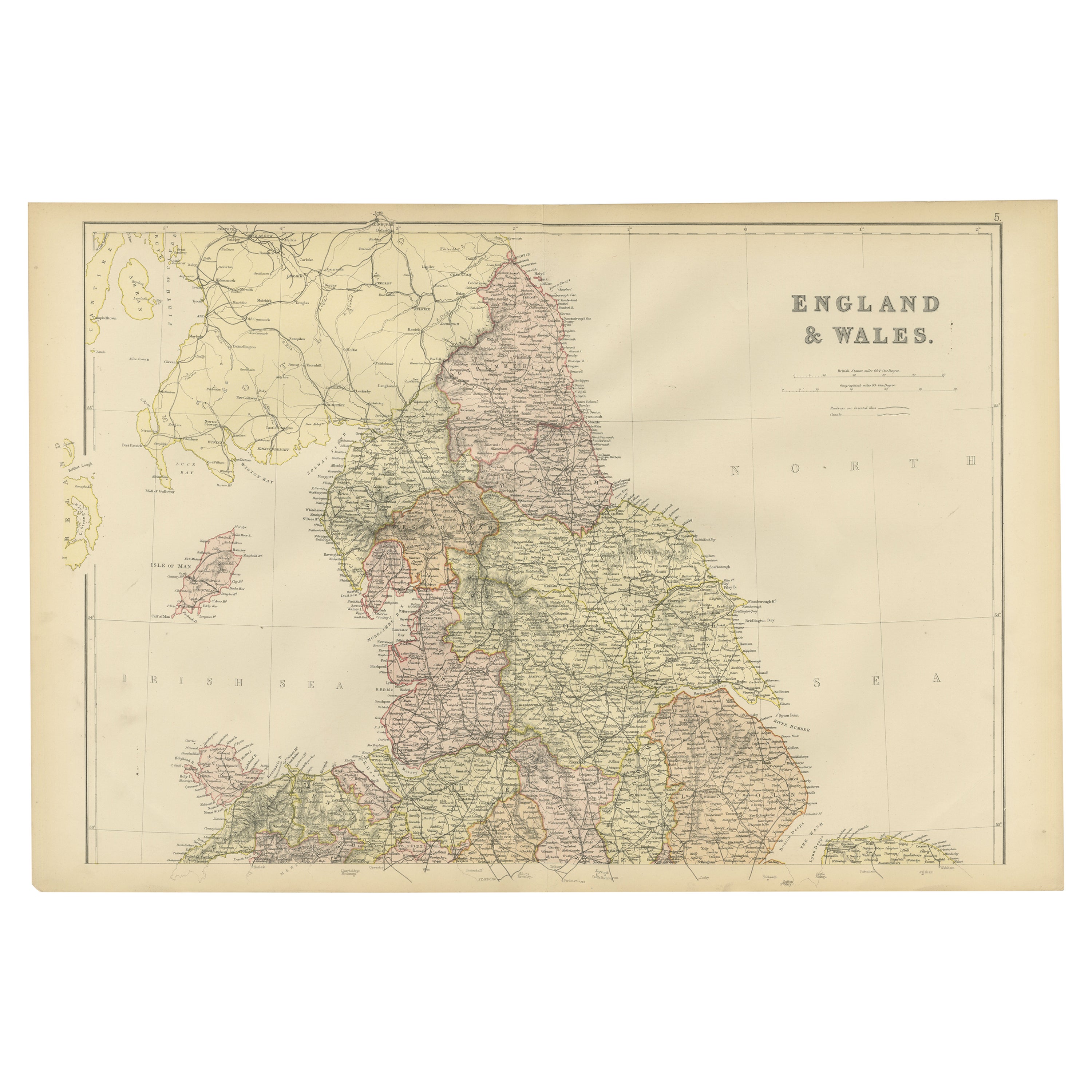
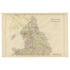
- Colorful Detailed Antique Map of England and Wales, 1882Located in Langweer, NLExplore the Historic Splendor of 'England and Wales' with this Antique Map! Part of a distinguished collection, this map presents a captivating view of the enchanting landscapes, cit...Category
Antique 1880s Maps
MaterialsPaper
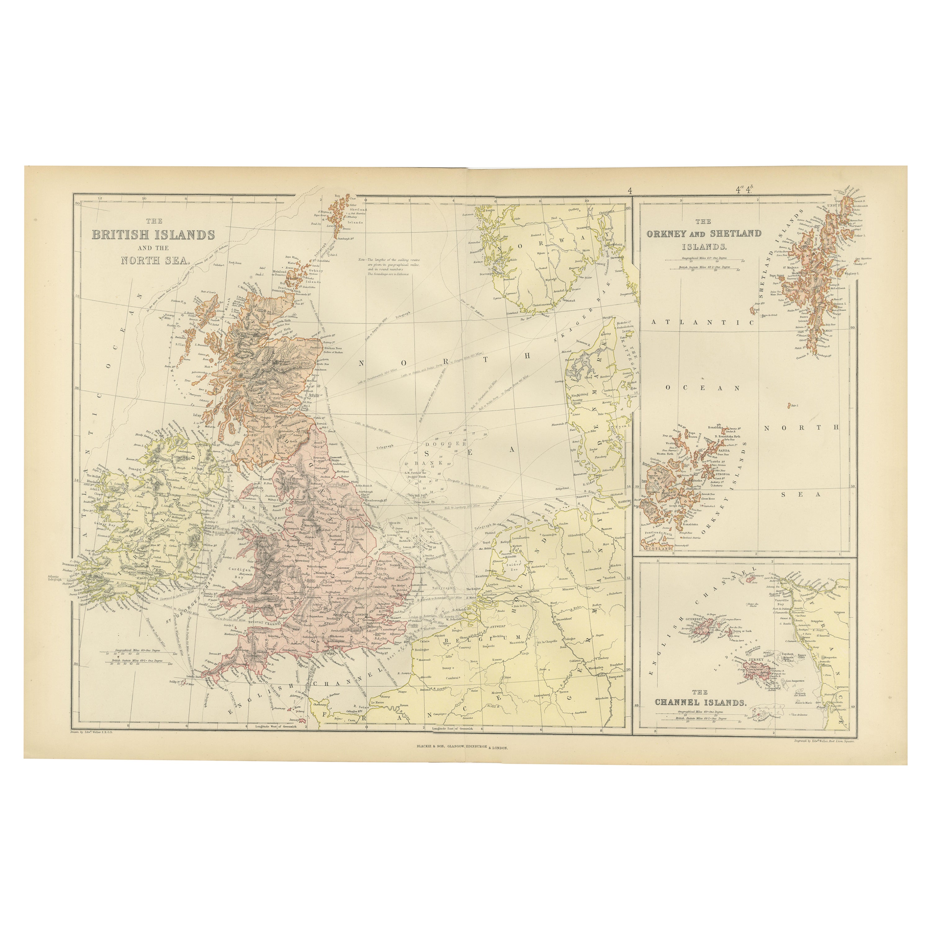
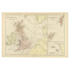
- Colorful Detailed Antique Map of The British Islands and `The North Sea, 1882Located in Langweer, NLDiscover 'The British Islands and The North Sea' Map with Insets of Orkney, Shetland, and Channel Islands! This captivating original antique map offers a detailed view of the British...Category
Antique 1880s Maps
MaterialsPaper
You May Also Like
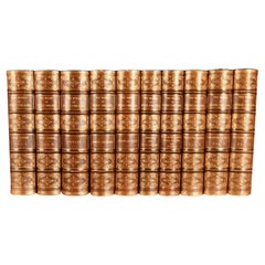
- 1882 The Works of Henry Fielding, Esq.By Henry FieldingLocated in Bath, GBA limited edition ten-volume set of the works of Henry Fielding, edited with a biography by Leslie Stephen. A ten-volume set in half morocco bindings. All edges gilt. No. 92 of a t...Category
Antique 1880s British Books
MaterialsPaper
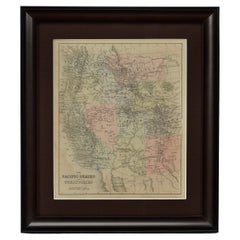
- 1889 "The Pacific States and Territories"Located in Colorado Springs, COPresented is an uncommon 1889 map of the western United States, titled “The Pacific States and Territories.” The vertical map depicts the Western states at the time: Washington, Oregon, California, Montana, Idaho, Wyoming, Utah, Colorado, Arizona, and New Mexico. They are bordered by British America to the north, Lower California, Mexico and Texas to the south, and North Dakota, South Dakota, Nebraska and Texas to the east. The map provides a fascinating look at the western states of the United States, just before the turn of the century. In addition to excellent topographical detail of mountain ranges, the map identifies towns and cities, rivers, lakes, deserts and valleys. Crisscrossing across the states, railroad routes are identified with hatched blacklines. Death Valley, Yosemite, Yellowstone National Park, as well as the key mining towns, like Virginia City...Category
Antique 1880s American Maps
MaterialsPaper
- Vintage World Map Mirror Based on the Original by Johnson 1882 Military CampaignLocated in GBWe are delighted to offer for sale this lovely Antique style pictorial plan map of the globe based on the original by Johnson in 1882 This is a very interesting and decorative pie...Category
20th Century English Campaign Maps
MaterialsMirror
- 1635 Willem Blaeu Map of Northern France"Comitatvs Bellovacvm" Ric.a08Located in Norton, MA1635 Willem Blaeu map of northern France, entitled. "Comitatvs Bellovacvm Vernacule Beavvais," Colored Ric.a008 “COMITATVS BELLOVACVM…” Amsterdam: W...Category
Antique 17th Century Unknown Maps
MaterialsPaper
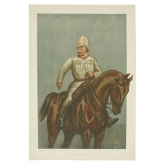
- Vanity Fair, Military Print, the Cavalry DivisionBy Godfrey Douglas GilesLocated in Oxfordshire, GBVanity fair military print 'the Cavalry Division' after G.D.G. A chromolithograph military print published 12th July, 1900, by Vincent Brooks, Day & S...Category
20th Century British Sporting Art Prints
MaterialsPaper
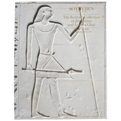
- Sotheby's: The Breitbart Collection of Antiquities & Ancient Glass, 6/1990Located in valatie, NYSotheby's: The Breitbart Collection of Antiquities & Ancient Glass, 6/1990. 145 lots, Ancient Glass; Egyptian, Western Asiatic, and classical antiquities...Category
1990s American Books
MaterialsPaper


Recently Viewed
View AllMore Ways To Browse
Engraved Cross
Collectors And Curiosities
Minature Map
Anguilla Map
James Calvert Smith
Winkler Prins
A Plan City And Castle Of Batavia
Malacca Strait Map
John Speed Isle Of Wight Maps
Antique Map Of Shanghai
Heinrich Kiepert On Sale
Old Teak Petite Artisan
Antique Maps Of Amsterdam
Antique Map Coats Of Arms
Albania Antique Map
Framed Map India
Maps Balkans
Paraguay Antique Map