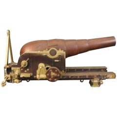
United States Naval Gun, 1866
View Similar Items


Want more images or videos?
Request additional images or videos from the seller
1 of 6
United States Naval Gun, 1866
About the Item
- Dimensions:Height: 22 in (55.88 cm)Width: 44 in (111.76 cm)Depth: 23 in (58.42 cm)
- Period:
- Date of Manufacture:1866
- Condition:
- Seller Location:Norwell, MA
- Reference Number:Seller: 91600281stDibs: LU174127301393
About the Seller
5.0
Vetted Seller
These experienced sellers undergo a comprehensive evaluation by our team of in-house experts.
Established in 1967
1stDibs seller since 2015
346 sales on 1stDibs
Typical response time: 2 hours
More From This SellerView All
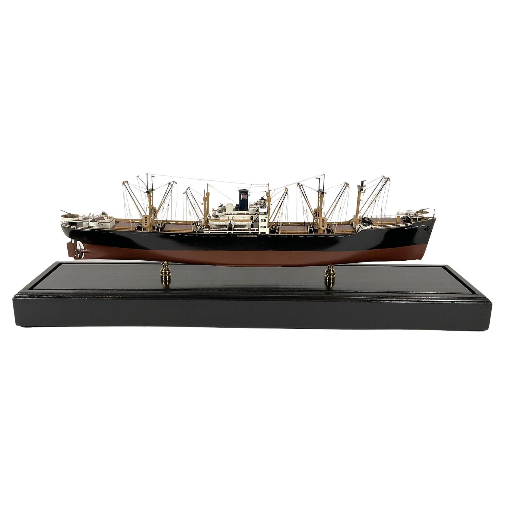
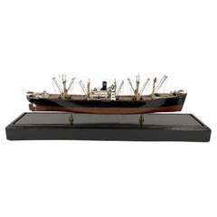
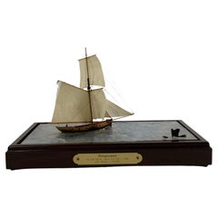
- Model of the American Merchant Ship “United States Victory”Located in Norwell, MAProfessionally built model of the American merchant ship “United States Victory”. The model has masts, booms, hatches, super structure, bitts, cleats, ri...Category
Vintage 1940s North American Models and Miniatures
MaterialsWood
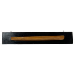
- Naval Architect's Half Model of a SpeedboatLocated in Norwell, MAQuality architect's half model of a double ended competition speedboat. The hull is marked with the lines of the vessel. Possibly a C.W. Mower design. Mounted to a wood backboard. Ci...Category
Vintage 1930s North American Models and Miniatures
MaterialsWood
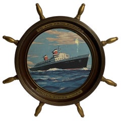
- United States Lines Framed PosterLocated in Norwell, MAUnites States lines promotional poster set into a ships wheel frame. With printed panels that read "To and from Europe", and United States Lines. Weight: 8 lbs. Overall Dimensions: ...Category
Early 2000s North American Posters
MaterialsWood
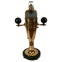
- United State Navy Ships Binnacle CompassLocated in Norwell, MAImmense three-hundred-pound ships binnacle compass with highly polished and lacquered finish. With maker’s plate from Lionel Corp. With the rarely fou...Category
Vintage 1940s North American Nautical Objects
MaterialsBrass
- Diorama Showing Ten Gun Royal Navy Vessel "Entreprenante"Located in Norwell, MAClear water diorama showing the Ten Gun Royal Navy Cutter, Entreprenante Circa 1790. The model is built to a scale of one sixteenth inch equals one foot. The vessel appears to be sai...Category
Antique Early 18th Century English Models and Miniatures
MaterialsWood
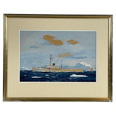
- United States Coast Guard Cutter George W. Campbell WPG 32Located in Norwell, MAWorden Wood original gouache of the US Coast Guard cutter George W. Campbell (WPG 32). Very colorful work showing a seaplane on deck, launches, mast, signal flags, weapon, etc. Icebe...Category
Vintage 1940s North American Paintings
MaterialsCanvas
You May Also Like
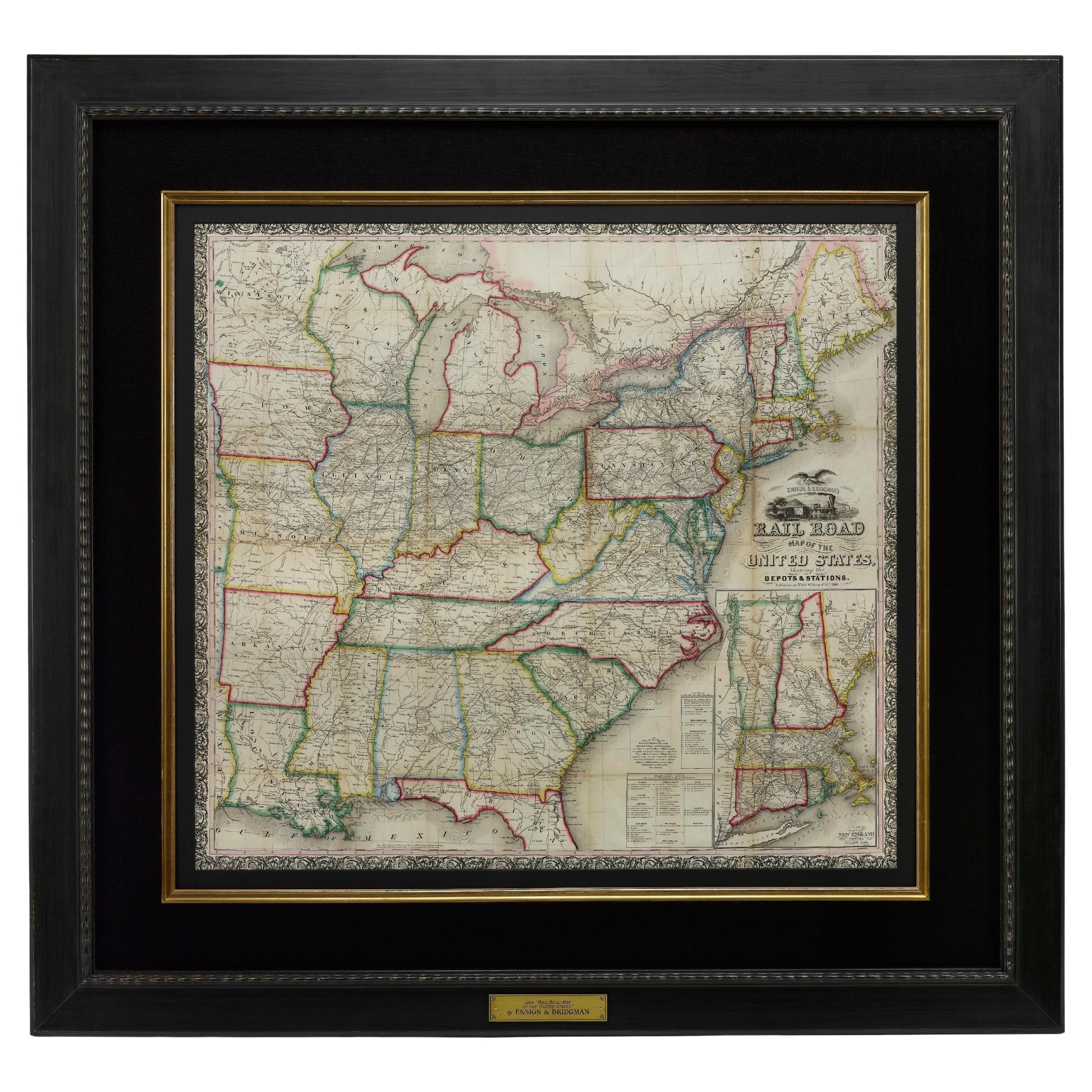
- 1866 Ensign & Bridgman's Rail Road Map of the United StatesLocated in Colorado Springs, COPresented is an 1866 issue of “Ensign & Bridgeman’s Rail Road Map of the United States, showing Depots & Stations.” First published in 1856, this is the third edition, following anot...Category
Antique 1860s American Late Victorian Maps
MaterialsPaper
- S.S. United States ThermometerLocated in Hanover, MAVintage SS United States Thermometer by the British Rototherm Co. Ltd. London, England About 4.75" high and 5.25" wide. This table/desk top thermometer is in a leather clad wood case...Category
Vintage 1950s British Mid-Century Modern Nautical Objects
MaterialsLeather
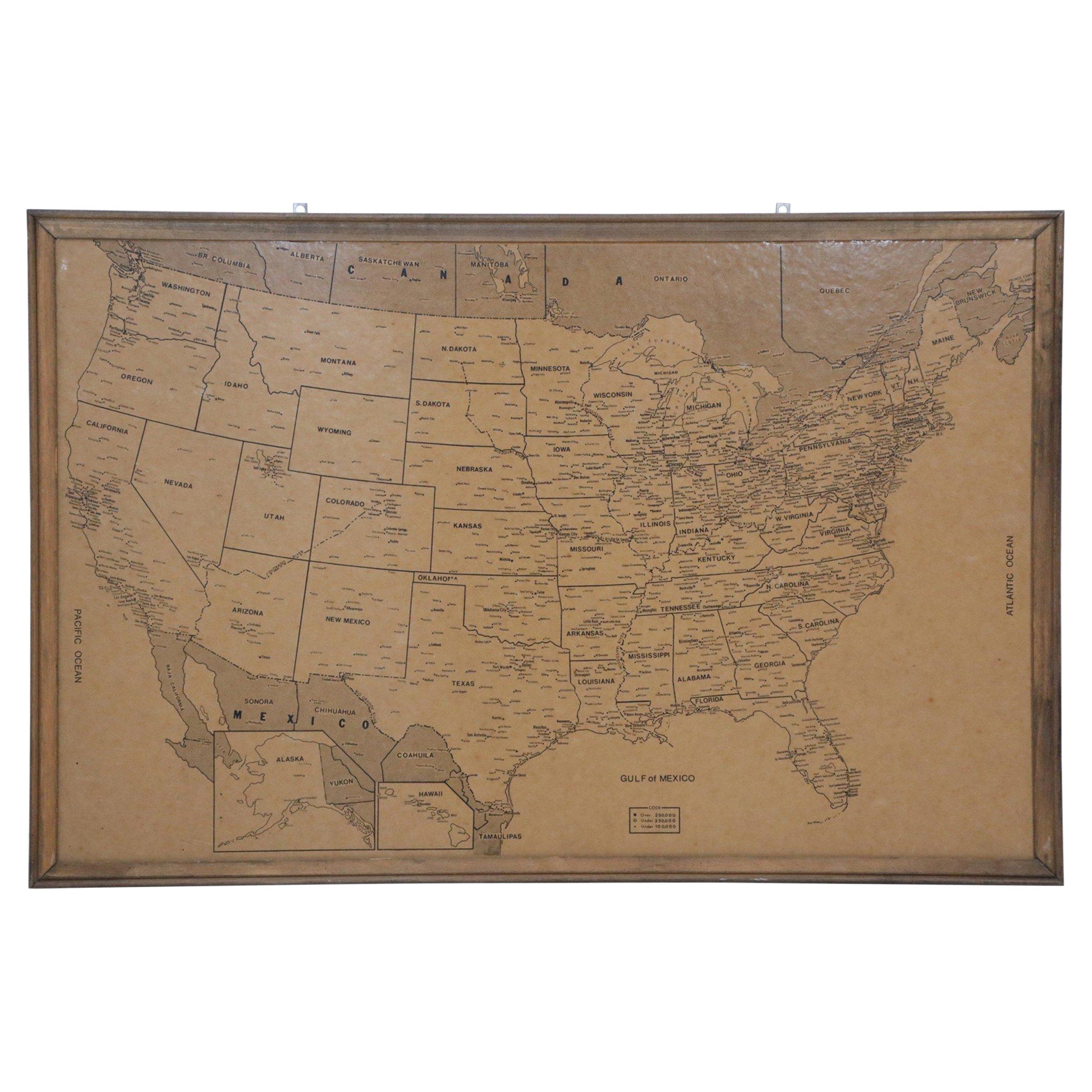
- Vintage Framed United States MapLocated in New York, NYVintage aged paper map of the United States mounted on particle board and framed in a simple wooden frame.Category
20th Century American Mid-Century Modern Maps
MaterialsWood, Paper
- Small Map of the United StatesLocated in Langweer, NLAntique map titled 'Amérique septe. Physique'. Small map of the United States. lithographed by C. Callewaert brothers in Brussels circa 1870.Category
Antique Mid-19th Century Maps
MaterialsPaper
- 1830 Mexico and United States Framed MapLocated in Stamford, CTMap of North America published circa 1830. Map shows United States into Canada. Mexico extending into the upper California territory. Texas appears in name but prior to the period of...Category
Antique 1830s American American Classical Maps
MaterialsGlass, Wood, Paper
- Antique Map Colton's United States of AmericaLocated in Langweer, NLAntique map titled 'Colton's United States of America'. Show railroads, canals, state capitals, major cities and towns, military posts, historic trails, Pony Express and U.S. mail routes; Dakota [Territory] extending deep into Nebraska, and Idaho [Territory] encompassing [modern day] Montana and Wyoming; Indian Territory...Category
Antique Mid-19th Century Maps
MaterialsPaper