Items Similar to Antique Technical Drawing Set, German, Architect, Cartography, Wichmann


Want more images or videos?
Request additional images or videos from the seller
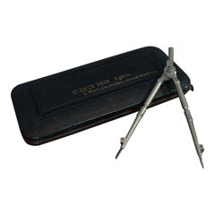
Antique Technical Drawing Set, German, Architect, Cartography, Wichmann
About the Item
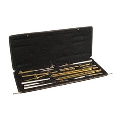
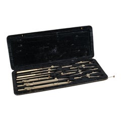
This is an antique technical drawing set. A German, architect's or cartographer's instrument case by Wichmann, dating to the early 20th century, circa 1920.
Quality, 14-piece instrument set
Displays a desirable aged patina
Silver nickel tools with fine detail and light tones
Presented within a leather textured carry case — some wear commensurate with age
Each instrument housed within a dark navy blue velour lined compartment
Includes a bow compass, pair of combination compasses and a ruling pen
Case bears the Wichmann Reißzeug name and '908 S' set number to the upper corner
Wichmann name engraved to each combination compass
This is a quality antique technical drawing set with a comprehensive 14-piece selection of precision instruments. Delivered read for the desk or within a collection.
Dimensions:
Max width 28cm (11")
Max depth 11.5cm (4.5")
Max height 2.5cm (1')
We offer a 100% satisfaction guarantee with all of our antiques.
- Dimensions:Height: 0.99 in (2.5 cm)Width: 11.03 in (28 cm)Depth: 4.53 in (11.5 cm)
- Style:Edwardian (Of the Period)
- Materials and Techniques:
- Place of Origin:
- Period:
- Date of Manufacture:circa 1920
- Condition:Wear consistent with age and use. Presented in very good antique condition.
- Seller Location:Hele, Devon, GB
- Reference Number:
About the Seller
5.0
Platinum Seller
These expertly vetted sellers are 1stDibs' most experienced sellers and are rated highest by our customers.
Established in 2005
1stDibs seller since 2017
851 sales on 1stDibs
Typical response time: 2 hours
- ShippingRetrieving quote...Ships From: Hele, Devon, United Kingdom
- Return PolicyA return for this item may be initiated within 14 days of delivery.
More From This SellerView All
- Vintage Technical Drawing Set, German, Architect, Cartographer, Riefler, 1930Located in Hele, Devon, GBThis is a vintage technical drawing set. A German, silver nickel architect or cartographer's instrument set by Riefler of Munich, dating ...Category
Early 20th Century German Art Deco Scientific Instruments
MaterialsNickel
- Antique Drawing Instrument Set, German, Cartographer, Technical, RichterLocated in Hele, Devon, GBThis is an antique drawing instrument set. A German, brass cartographer's or architect's technical drawing set, by Richter, dating to the E...Category
Early 20th Century German More Desk Accessories
MaterialsNickel
- Antique Technical Drawing Set, German, Cartographer's Instruments, Riefler, 1920Located in Hele, Devon, GBThis is an antique technical drawing set. A German, silver nickel set of cartographer's instruments by Riefler, dating to the early 20th ...Category
Early 20th Century German More Desk Accessories
MaterialsNickel
- Quality Antique Drawing Instrument Set, German, Architect, Cartographer, RieflerLocated in Hele, Devon, GBThis is a quality antique drawing instrument set. A German, architect's or cartographer's tool case by Riefler, dating to the Edwardian per...Category
Early 20th Century German More Desk Accessories
MaterialsNickel
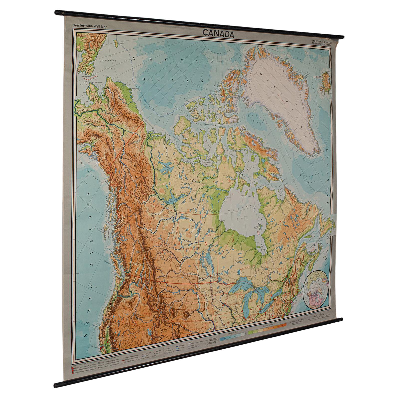
- Very Large Vintage Map of Canada, German, Education, Institution, CartographyLocated in Hele, Devon, GBThis is a very large vintage map of Canada. A German, quality printed educational or institution map, dating to the mid 20th century, circa 1965....Category
Mid-20th Century German Maps
MaterialsPaper
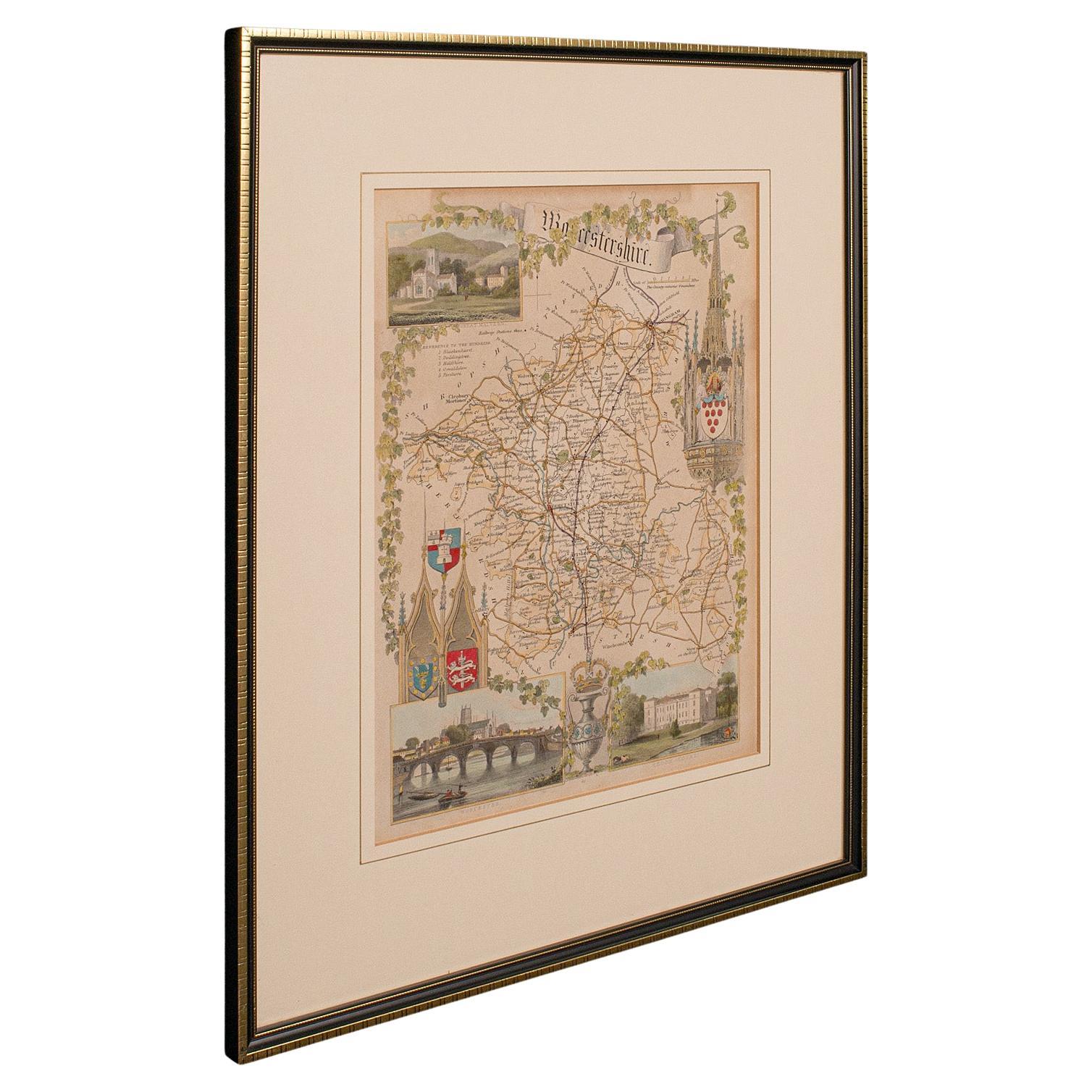
- Antique Lithography Map, Buckinghamshire, English, Framed Cartography, VictorianLocated in Hele, Devon, GBThis is an antique lithography map of Buckinghamshire. An English, framed atlas engraving of cartographic interest, dating to the mid 19th century and later. Superb lithography of B...Category
Antique Mid-19th Century British Victorian Maps
MaterialsWood, Paper


You May Also Like
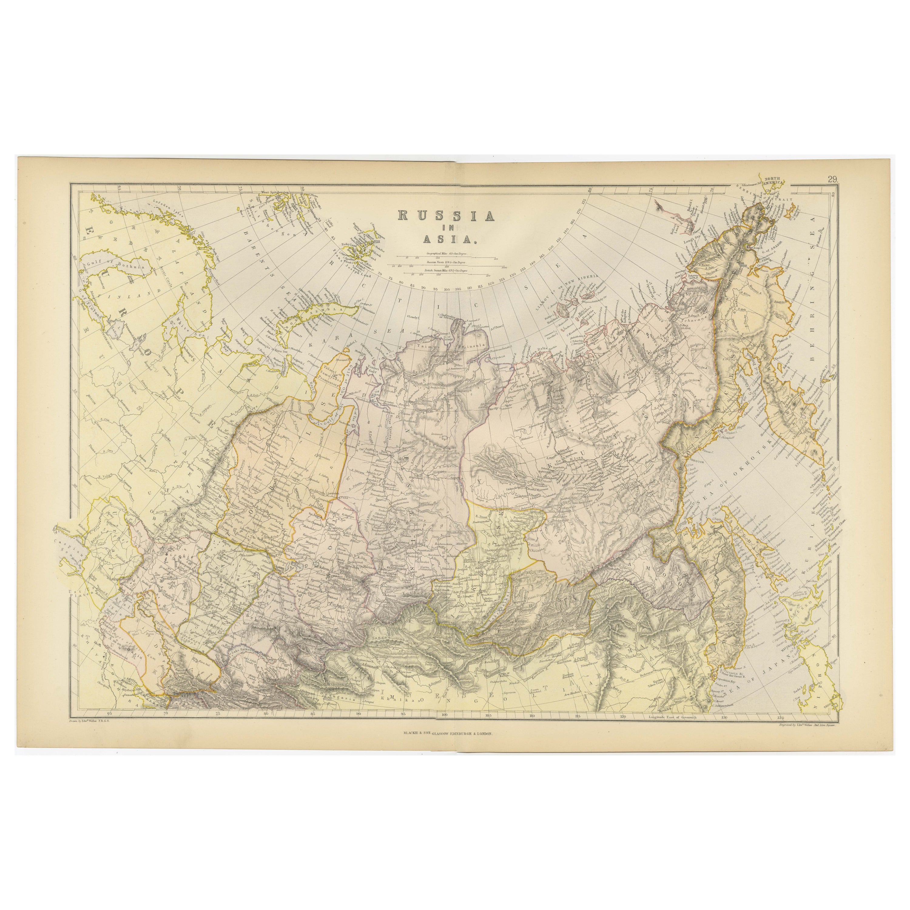
- Detailed Antique Cartography of Asian Russia, 1882Located in Langweer, NLThis exquisite map, hailing from the year 1882, is a remarkable historical cartographic artifact, which was included as part of the prestigious 'Comprehensive Atlas and Geography of ...Category
Antique 1880s Maps
MaterialsPaper
- Vintage Cartographic Collection Set of India Explored - W. G. Blackie's 1859Located in Langweer, NLAntique map titled 'India'. Original antique map of India with inset maps of Pegu, the Tenasserim Provinces, straits settlements. This map originate...Category
Antique Mid-19th Century Maps
MaterialsPaper
- Cartographic Tapestry: Antique Map of Asia Minor, circa 1640Located in Langweer, NLTitle: "Historical Tapestry: Antique Map of Asia Minor, circa 1640" Description: This authentic antique map, created by Willem Blaeu and published in Amsterdam circa 1640, is a capt...Category
Antique Mid-17th Century Maps
MaterialsPaper
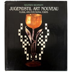
- Jugendstil Art Nouveau: Floral and Functional Forms, by Siegfried Wichmann, 1stLocated in valatie, NYJugendstil Art Nouveau: Floral and Functional Forms, by Siegfried Wichmann. New York Graphic Society, Little, Brown and Company, Boston, 1984. !st Ed hardcover with dust jacket. With...Category
Vintage 1980s American Books
MaterialsPaper
- Cartographic Elegance of the Mughal Dominion in a Hand-Colored Antique Map, 1705Located in Langweer, NLThis original antique map titled “'T Ryk van den Grooten Mogol” by Nicolas Sanson from 1705 is an interesting historical artifact. It depicts the extent of the Mughal Empire in North...Category
Antique Early 1700s Maps
MaterialsPaper
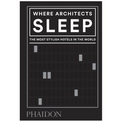
- Where Architects SleepLocated in New York City, NYIn the tradition of the bestselling Where Chefs Eat: the definitive global hotel guide by the real experts who know - architects No one appreciates a building quite like an archit...Category
21st Century and Contemporary Chinese Books
MaterialsPaper

Recently Viewed
View AllMore Ways To Browse
Name Engraved
Technical Antiques
Black Bear Leather
Compass Set
Dark Antique Desk
Nickel Display Case
Antique Architect Desk
Antique Architects Desk
German Silver Bear
Antique Nickel Light
Desk Set Corners
Antique Engraved Leather
German Nickel Silver
Bear Bows
Used Bear Bows
Antique Bow Light
Antique Tools And Instruments
Antique Drawing Desk