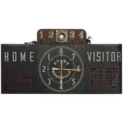
Antique American Light Up Scoreboard Evans-Nashville
View Similar Items


1 of 2
Antique American Light Up Scoreboard Evans-Nashville
About the Item
- Dimensions:Height: 28.75 in (73.03 cm)Width: 54 in (137.16 cm)Depth: 5.25 in (13.34 cm)
- Materials and Techniques:
- Place of Origin:
- Period:
- Date of Manufacture:Early 20th Century
- Condition:Wear consistent with age and use.
- Seller Location:Chicago, IL
- Reference Number:1stDibs: LU92477860473
You May Also LikeView All
- Antique Map of North America by Dufour 'circa 1834'Located in Langweer, NLAntique map titled 'Amérique Septentrionale'. Uncommon map of North America. Published by or after A.H. Dufour, circa 1834. Source unknown, to be determined.Category
Antique Mid-19th Century Maps
MaterialsPaper
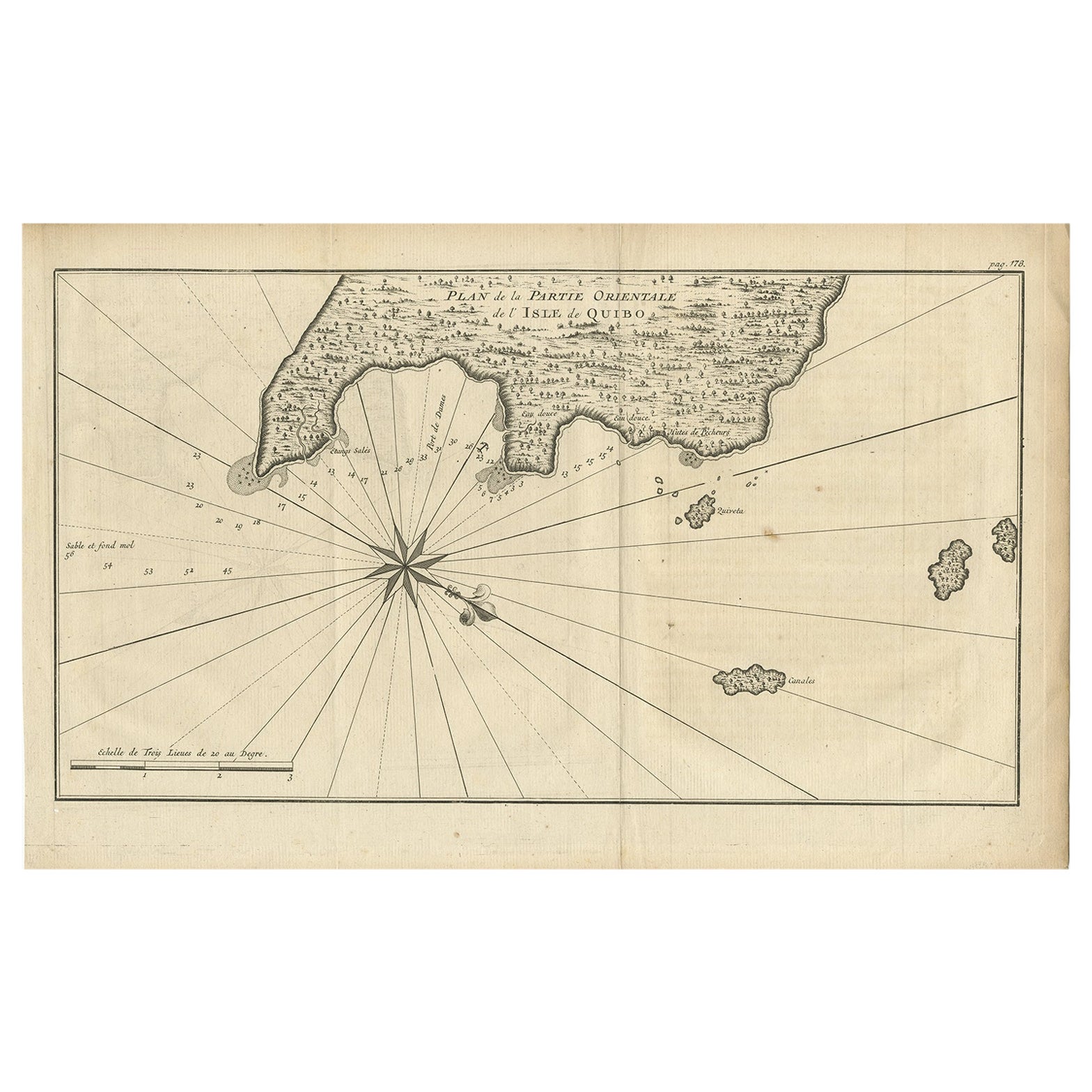
- Antique Map of Coiba Island, Panama, South America, C.1740Located in Langweer, NLAntique map titled 'Plan de la partie orientale de l'Isle de Quibo'. Map of the eastside of Coiba Island (Quibo), Panama, showing the shoreline around Port de Dames indicating soft s...Category
Antique 18th Century Maps
MaterialsPaper
- Antique Map of South America by Wyld, circa 1850By J. WyldLocated in Langweer, NLBeautiful folding map of South America titled 'Colombia Prima or South America Drawn from the Large Map in Eight Sheets by Louis Stanislas D ' Arcy Delarochette'. Three insets in the...Category
Antique Mid-19th Century British Maps
MaterialsPaper

- Original Antique Map of the American State of Pennsylvania, 1889Located in St Annes, LancashireGreat map of Pennsylvania Drawn and Engraved by W. & A.K. Johnston Published By A & C Black, Edinburgh. Original colour Unframed. Repair to a minor tear on bottom edge.Category
Antique 1880s Scottish Victorian Maps
MaterialsPaper
- Original Antique Map of the American State of Nevada, 1889Located in St Annes, LancashireGreat map of Nevada Drawn and Engraved by W. & A.K. Johnston Published By A & C Black, Edinburgh. Original colour Unframed.Category
Antique 1880s Scottish Victorian Maps
MaterialsPaper
- Original Antique Map of the American State of Oregon, 1889Located in St Annes, LancashireGreat map of Oregon Drawn and Engraved by W. & A.K. Johnston Published By A & C Black, Edinburgh. Original colour Unframed.Category
Antique 1880s Scottish Victorian Maps
MaterialsPaper


Recently Viewed
View AllMore Ways To Browse
Antique Furniture Nashville
Antique Scoreboard
Bsa Motorcycles
Surfboard Channel
Vintage Cane Fishing Rods
Quasar Khanh On Sale
Seve Ballesteros
Used Jetboard
Vintage Hardy Perfect Fly Reel
Hardy Neroda
Golf Augusta
Retro Fly Reel
Antique Foot Scraper
Lawn Bowling
Skull Walking Stick
Antique Ski Equipment
Sumatra Amber
Trophy Oar