Items Similar to 1750 Schaffhausen, Seutter, Large and Detailed Map Switzerland


Want more images or videos?
Request additional images or videos from the seller
1750 Schaffhausen, Seutter, Large and Detailed Map Switzerland
About the Item
Sandrart Joachim, von (1606-1688)
Effigies antiquae Romae. redacta a Pyrrho Ligorio Romano, per XIIII Regiones, in quas Urbem divisit Imp. Caesar August.
Nuremberg, Germany, published 1679.
Dimensions
Height: 14.57 in. (37 cm)
Width: 17.17 in. (43.6 cm)
Reference: Caldana I, 37.
The plan is base upon Pirro Ligorio's monumental plan of 1553, illustrating Rome at the time of Augustus Ceasar.
Beautiful detailed birds-eye-view of ancient Rome. In his time Joachim von Sandrart (1606-1688) was the most famous artist in Germany. He trained in engraving and painting and travelled extensively in Italy and England and was accompanied by Peter Paul Rubens on a tour of Holland.
Sometimes referred to as the “German Vasari,” Joachim von Sandrart, born in Frankfurt, trained first as a printmaker, notably in Nuremberg, and in Prague with Aegidius Sadeler. After a long and successful career in the foremost artistic circles in England, Italy, and the Netherlands, he returned to Germany and painted for Emperor Ferdinand III, for which he was ennobled in 1673. In the latter part of his life, Sandrart settled in Nuremberg and turned to publishing projects and teaching. His most important publication, the Academia todesca, better known as the Teutsche Academie, was the first comprehensive treatise on the history of art written in German.
Excellent condition on fine laid paper.
- Creator:Matthew Seutter (Artist)
- Dimensions:Height: 14.57 in (37 cm)Width: 16.93 in (43 cm)Depth: 0.04 in (1 mm)
- Style:Baroque (Of the Period)
- Materials and Techniques:
- Place of Origin:
- Period:1670-1679
- Date of Manufacture:1679
- Condition:Wear consistent with age and use.
- Seller Location:Norwich, GB
- Reference Number:1stDibs: LU7031234705412
About the Seller
No Reviews Yet
Vetted Seller
These experienced sellers undergo a comprehensive evaluation by our team of in-house experts.
Established in 1992
1stDibs seller since 2022
9 sales on 1stDibs
- ShippingRetrieving quote...Ships From: Norwich, United Kingdom
- Return PolicyA return for this item may be initiated within 14 days of delivery.
More From This SellerView All
- Merian, Stein am Rhein, large double folio, SwitzerlandLocated in Norwich, GBMatthäus Merian, engraved by M.I.I. Ringle “STEIN AM RHEIN - STENIUM AD RHENUM” View of the municipal town of Stein am Rhein and the castle Hohenklingen, at that time in the Ca...Category
Antique 17th Century German Prints
MaterialsPaper
- Hardesty, Sectional & Township Map of Ohio, Very LargeLocated in Norwich, GBRand, McNally & Co.'s New Sectional And Township Map of Ohio 24.8 x 24.3 inches folding into 6 sections. Colour printed in part. Chicago, 1880. Scale: 1:633,600 Fine early large scale map...Category
Antique 1880s American Prints
MaterialsPaper
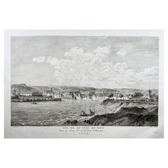
- Basel, Bale, Switzerland, Large Copper Engraving of the CityBy Beat Fidel ZurlaubenLocated in Norwich, GBView of the City of Basle, taken from above the Fortre?s of Huningue. Copper Engraving by Jean-Bapti?te Liénard after a Drawing by Nicolas Pérignon. Published 1780. Nicolas...Category
Antique 1780s Swiss Georgian Prints
MaterialsPaper
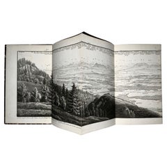
- H. Keller, Switzerland, Aquatint Panorama Bernese Oberland Hand ColBy Henry George KellerLocated in Norwich, GBEXQUISITE PANORAMA OF THE SWISS ALPS Heinrich Keller Aussicht vom Weissenstein auf dem Jura, Cant. Solothurn gezeichnet und hrsg. von Heinrich Keller, gestochen von J. J. Scheurmann [Gezeichnet nach der Natur im Wirthshaus auf dem Weissenstein von H(einrich). Keller 1817, vermehrt und berichtigt Zürich 1822. 19,5 x 192 cm. Zurich, Keller & Füssli, (1822). Fan-folded, partly hand coloured (grey tones) aquatint in contemporary boards. Slipcase folder with engraved map and title to upper boards. Two added elements to include the view of Solothurn. Fine details of the alps from Säntis, Altmann, Ober Albis, Toggenburg to Hasenmatt and Stahelfluh with, in The Valley, all the villages from Aarwangen to the lake of Biel and Neuenburg passing by Solothurn. on the rear back cover there is a view of the Weissenstein in the Jura near Solothurn. Very good condition. Double page manuscript leaf...Category
Antique 1820s Swiss Biedermeier Prints
MaterialsPaper
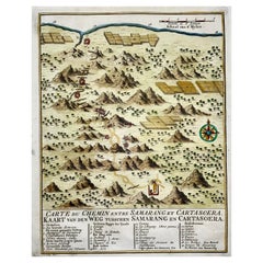
- Map of Indonesia, Semarang, Kartasoera, Soerabaya by SchleyBy Jakob van der SchleyLocated in Norwich, GB'Carte du Chemin entre Samarang et Cartasoera, kaart van den weg tusschen Samarang en Cartasoera' Map of the Road between Semarang and Kartasura by Van Schley. Published 1763. ...Category
Antique 1760s Indonesian Georgian Prints
MaterialsPaper
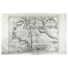
- Bellin, map, Hudson Bay, Canada, James Bay, LabradorLocated in Norwich, GB“Carte de la Baye de Hudson” Map of the Hudson Bay area of Northern Canada. Shows Hudson Bay, James Bay, Labrador (previously called New Brittany by the Fr...Category
Antique 1880s American Prints
MaterialsPaper
You May Also Like
- Antique Map of Northern Germany by M. Seutter, circa 1730By Matthew SeutterLocated in Langweer, NLAntique map titled 'Saxoniae Inferioris Circulus'. Old map of the northern part of Germany by M. Seutter. Covering the area of Lower Saxony, Mecklenburg-Vorpommern and Schleswig-Hols...Category
Antique Mid-18th Century Maps
MaterialsPaper
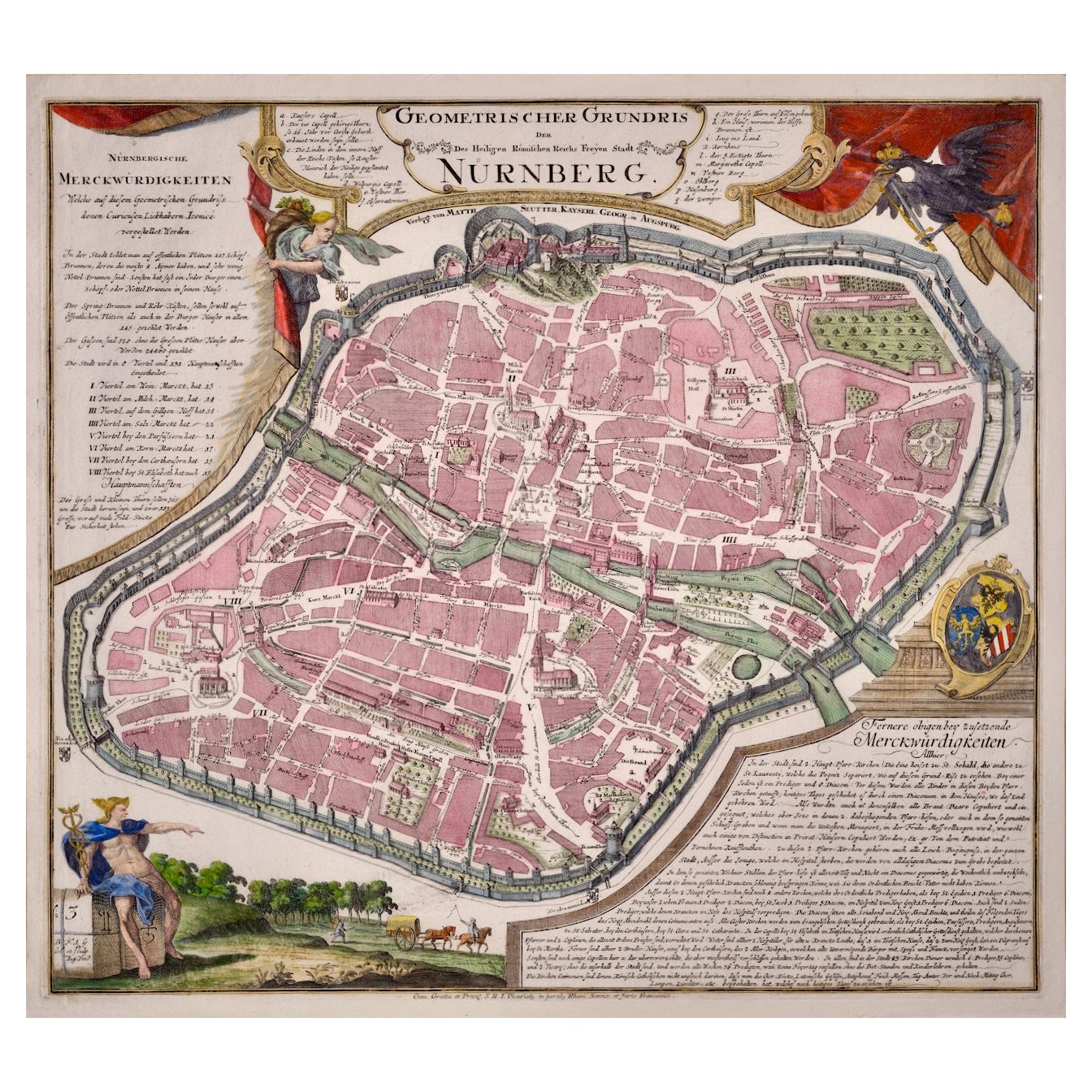
- City View of Nuremberg, Germany: An 18th Century Hand-Colored Map by M. SeutterBy Matthew SeutterLocated in Alamo, CAAn 18th century hand-colored city view of Nuremburg, Germany entitled "Geometrischer Grundris der des Heiligen Römischen Reichs Freyen Stadt Nürnberg" by Matthaus Seutter from his "A...Category
Antique Mid-18th Century German Maps
MaterialsPaper
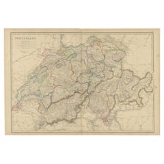
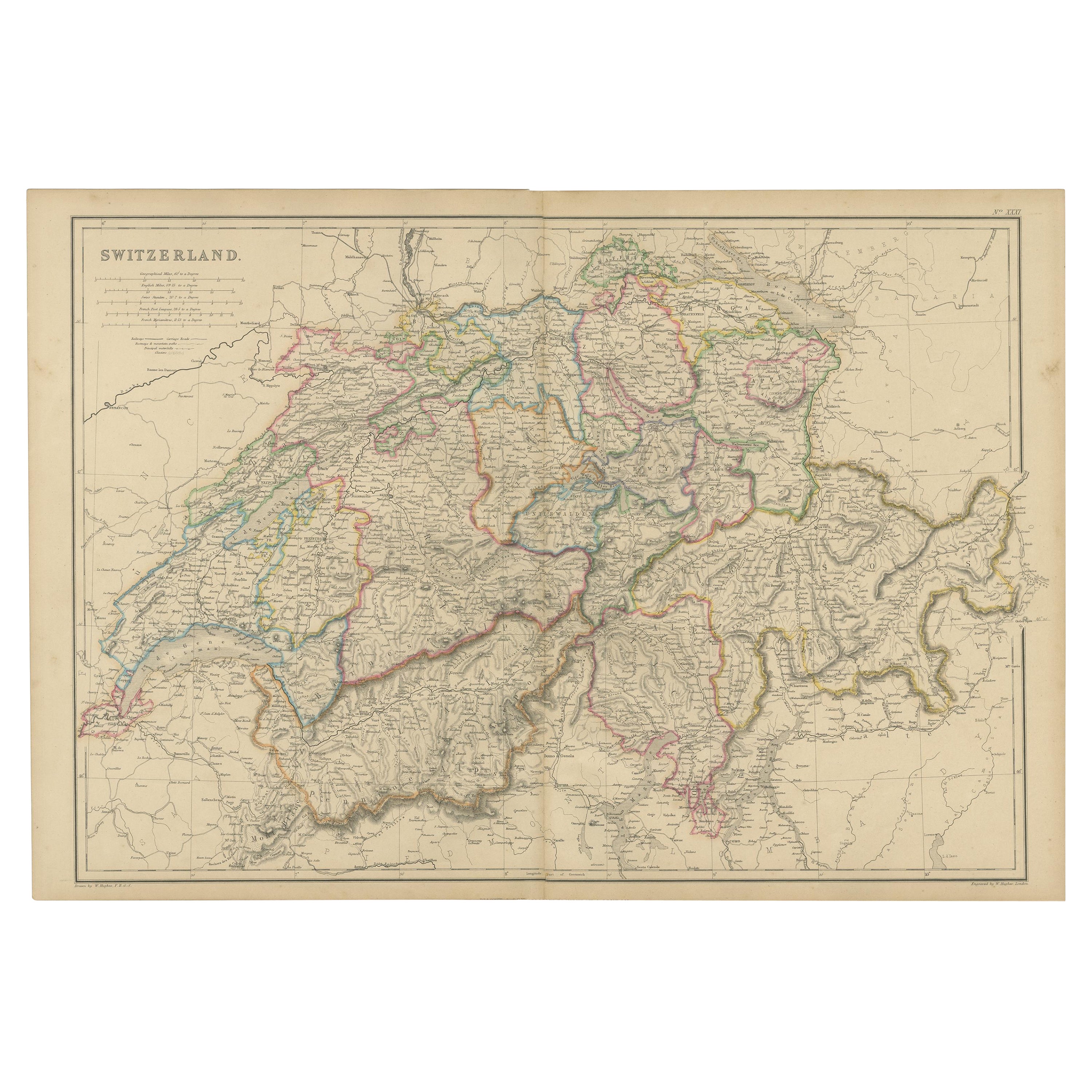
- 1859 Antique Swiss Panorama: Blackie's Detailed Map of SwitzerlandLocated in Langweer, NLThe "Antique Map of Switzerland" is a distinguished piece from 'The Imperial Atlas of Modern Geography', published in 1859 by the renowned cartographer W. G. Blackie. This map presen...Category
Antique Mid-19th Century Maps
MaterialsPaper
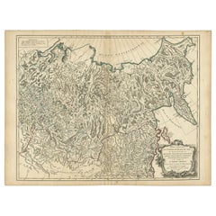
- Detailed Original Antique Map of the Russian Empire in Asia, 1750Located in Langweer, NLAntique map titled 'Partie Orientale de l'Empire de Russie en Asie (..)'. Detailed map of the Russian Empire in Asia. Artists and Engravers: Gilles Robert de Vaugondy (1688-1766) was the head of a leading family of geographers in eighteenth century France. Gilles got his start when he jointly inherited the shop of Pierre-Moullart Sanson, grandson of the famous geographer Nicholas Sanson. The inheritance included the business, its stock of plates, and a roller press...Category
Antique 1750s Maps
MaterialsPaper
- Antique Map of Greece by Seutter or Lotter, 'c.1740'Located in Langweer, NLAntique map titled 'Graecia pars Septentrionalis'. Original antique map of Greece, uncommon. Signed cum Gratia et Privil. S.R.I. Vicariatus (..)'. Published by Seutter or Lotter, cir...Category
Antique Mid-18th Century Maps
MaterialsPaper
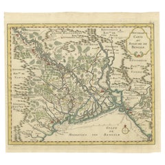
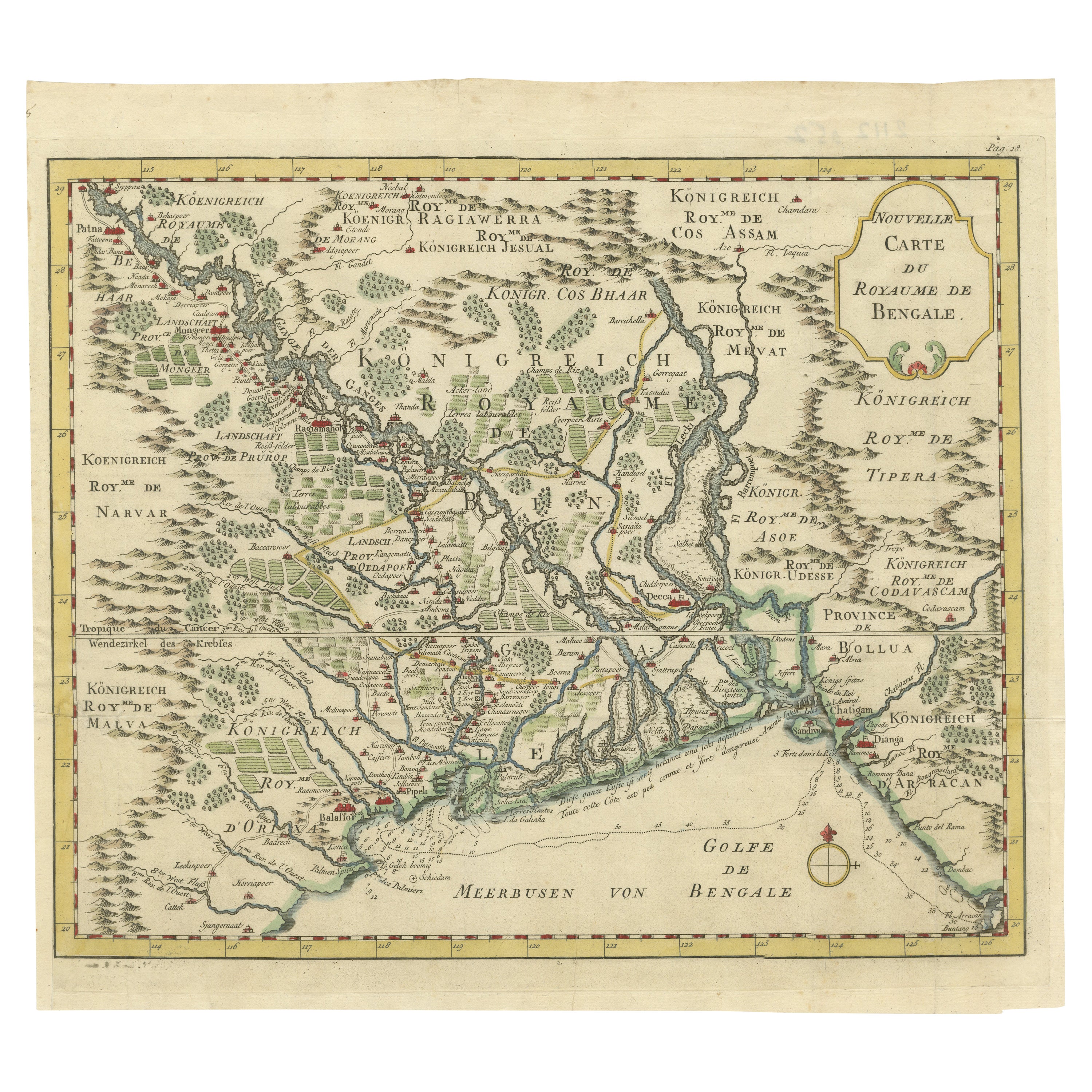
- Detailed Regional Map of the Gulf of Bengal and the Lower Ganges River, ca.1750Located in Langweer, NLTitle of this original and rare antique map: Nouvelle Carte Du Royaume De Bengale Mapmaker: Jacques-Nicolas Bellin (1703-1772). He was among the most important mapmakers of the eighteenth century. In 1721, at only the age of 18, he was appointed Hydrographer to the French Navy. In August 1741, he became the first Ingénieur de la Marine of the Dépôt des cartes...Category
Antique 1750s Maps
MaterialsPaper