Items Similar to Antique Colored Engraving of Madras 'Chennai' and Fort St. George in India, 1751
Want more images or videos?
Request additional images or videos from the seller
1 of 6
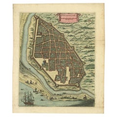
Antique Colored Engraving of Madras 'Chennai' and Fort St. George in India, 1751
About the Item
Antique print titled 'Plan de Madras et du Fort St. Georges'. Plan of the city of Madras (or Chennai), the capital of the state of Tamil Nadu, India. Also shows a plan of Fort St. George, the first English (later British) fortress in India, founded in 1644. The construction of the fort provided the impetus for further settlements and trading activity, in what was originally an uninhabited land. Made by Bellin for 'l'Histoire Generale des Voyages', by Antoine François Prévost (the Abbé Prévost).
Artists and Engravers: Jacques-Nicolas Bellin (1703 - 1772) was one of the most important cartographers of the 18th century. With a career spanning some 50 years, Bellin is best understood as geographe de cabinet and transitional mapmaker spanning the gap between 18th and early 19th century cartographic styles. His long career as Hydrographer and Ingénieur Hydrographe at the French Dépôt des cartes et plans de la Marine resulted in hundreds of high quality nautical charts of practically everywhere in the world. A true child of the Enlightenment Era, Bellin's work focuses on function and accuracy tending in the process to be less decorative than the earlier 17th and 18th century cartographic work. Unlike many of his contemporaries, Bellin was always careful to cite his references and his scholarly corpus consists of over 1400 articles on geography prepared for Diderot's Encyclopedie. Bellin, despite his extraordinary success, may not have enjoyed his work, which is described as "long, unpleasant, and hard." In addition to numerous maps and charts published during his lifetime, many of Bellin's maps were updated (or not) and published posthumously. He was succeeded as Ingénieur Hydrographe by his student, also a prolific and influential cartographer, Rigobert Bonne.
Condition: Good, general age-related toning and minor wear. Original folding lines, blank verso. Please study image carefully.
Date: 1751
Overall size: 43 x 28 cm.
Image size: 31 x 19 cm.
Antique prints have long been appreciated for both their aesthetic and investment value. They were the product of engraved, etched or lithographed plates. These plates were handmade out of wood or metal, which required an incredible level of skill, patience and craftsmanship. Whether you have a house with Victorian furniture or more contemporary decor an old engraving can enhance your living space. We offer a wide range of authentic antique prints for any budget.
- Creator:Jacques-Nicolas Bellin (Artist)
- Dimensions:Height: 11.03 in (28 cm)Width: 16.93 in (43 cm)Depth: 0 in (0.01 mm)
- Materials and Techniques:
- Period:
- Date of Manufacture:1751
- Condition:Condition: Good, general age-related toning and minor wear. Original folding lines, blank verso. Please study image carefully.
- Seller Location:Langweer, NL
- Reference Number:

Jacques-Nicolas Bellin
Jacques Nicolas Bellin (1703 –1772) was a French hydrographer (official cartographer) and a geographer. While still a teenager he became the chief cartographer to the French Navy and later to the king of France. Bellin created a large number of maps for Antoine François Prévost's (L'Abbe Prevost) 'Histoire Generale des Voyages', which was a 25 volume publication focused on 17th and 18th century exploration.It was published in French, Dutch and German. He also contributed maps and articles to the 35-volume Encyclopédie edited by Denis Diderot and Jean le Rond d'Alembert. He was part of the group called Philosophes, which included many of the great intellectuals of the Age of Enlightenment, including Voltaire, Rousseau and Montesquieu. Bellin died at Versailles in 1772.
About the Seller
5.0
Platinum Seller
These expertly vetted sellers are 1stDibs' most experienced sellers and are rated highest by our customers.
Established in 2009
1stDibs seller since 2017
1,938 sales on 1stDibs
Typical response time: <1 hour
- ShippingRetrieving quote...Ships From: Langweer, Netherlands
- Return PolicyA return for this item may be initiated within 14 days of delivery.
More From This SellerView All
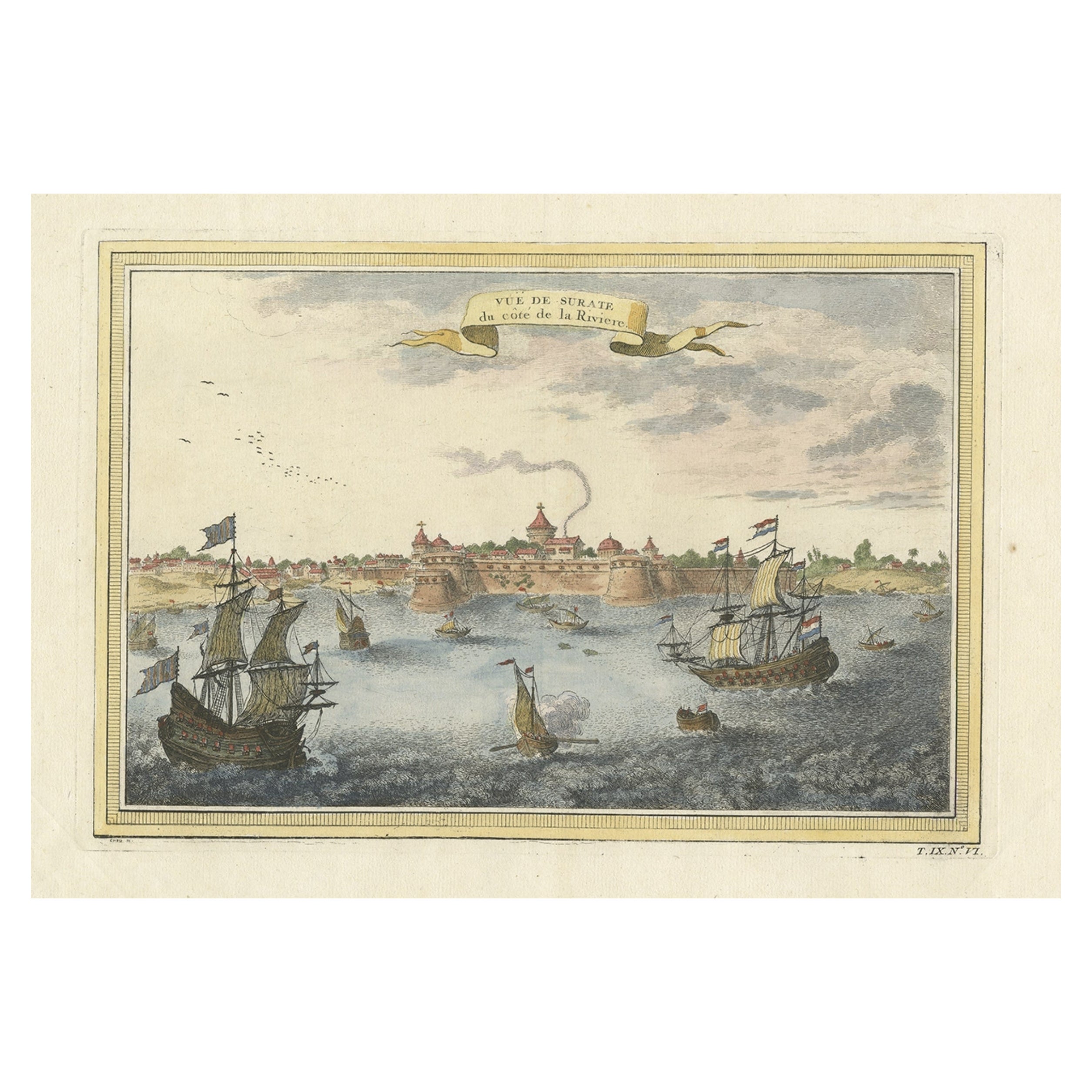
- Nicely Colored Antique Print of Surat in India, 1751Located in Langweer, NLAntique print titled 'Vuë de Surate du côté de la Riviere'. View of Surat, a city in the state of Gujarat, India. This print originates from 'Histoire générale des voyages' by A. Pré...Category
Antique 18th Century Prints
MaterialsPaper
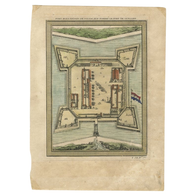
- Fort Hollandois De Paliacate Nommé Le Fort De Gueldre, Bellin, 1751Located in Langweer, NLAntique print, titled: ?Fort Hollandois de Paliacate nommé le Fort de Gueldre?. Published for Antonine de Prevost d' Exile's Histoire generale des voyages. Artists and Engravers: Jac...Category
Antique 18th Century Prints
MaterialsPaper
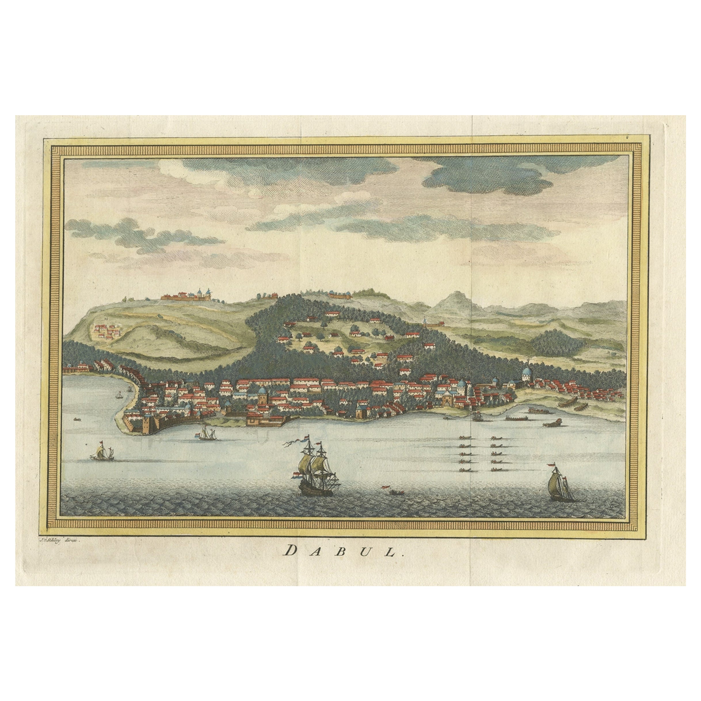
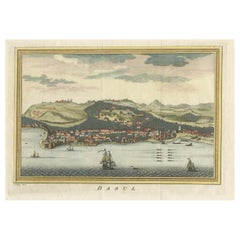
- Antique Handcolored Engraving of Dabhol or Dabul in India, '1757'Located in Langweer, NLAntique print titled 'Dabul'. Old print of the port city Dabhol in India. In the 15th and 16th centuries, Dabul was an opulent Muslim trade center. Around 1660 it was annexed to the ...Category
Antique 18th Century Prints
MaterialsPaper
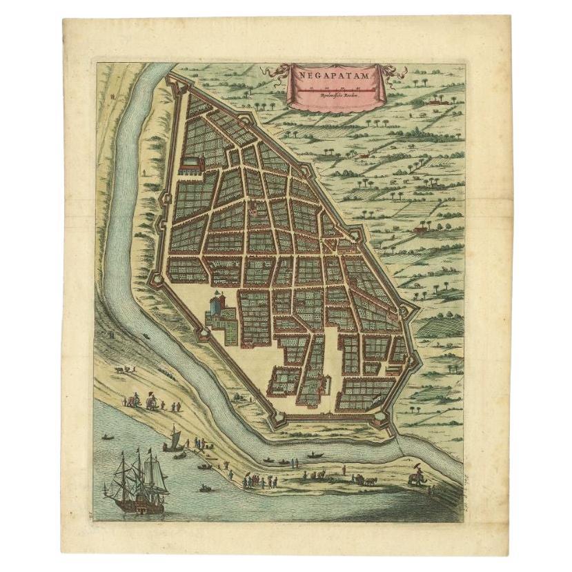
- Attractive Hand-Colored Antique Plan of Nagapattinam in India, 1744Located in Langweer, NLAntique map titled 'Negapatam.' Attractive bird's-eye view of Nagapattinam, India from Churchill's 'A Collection of Voyages and Travels, some now first printed from original manuscri...Category
Antique 18th Century Maps
MaterialsPaper
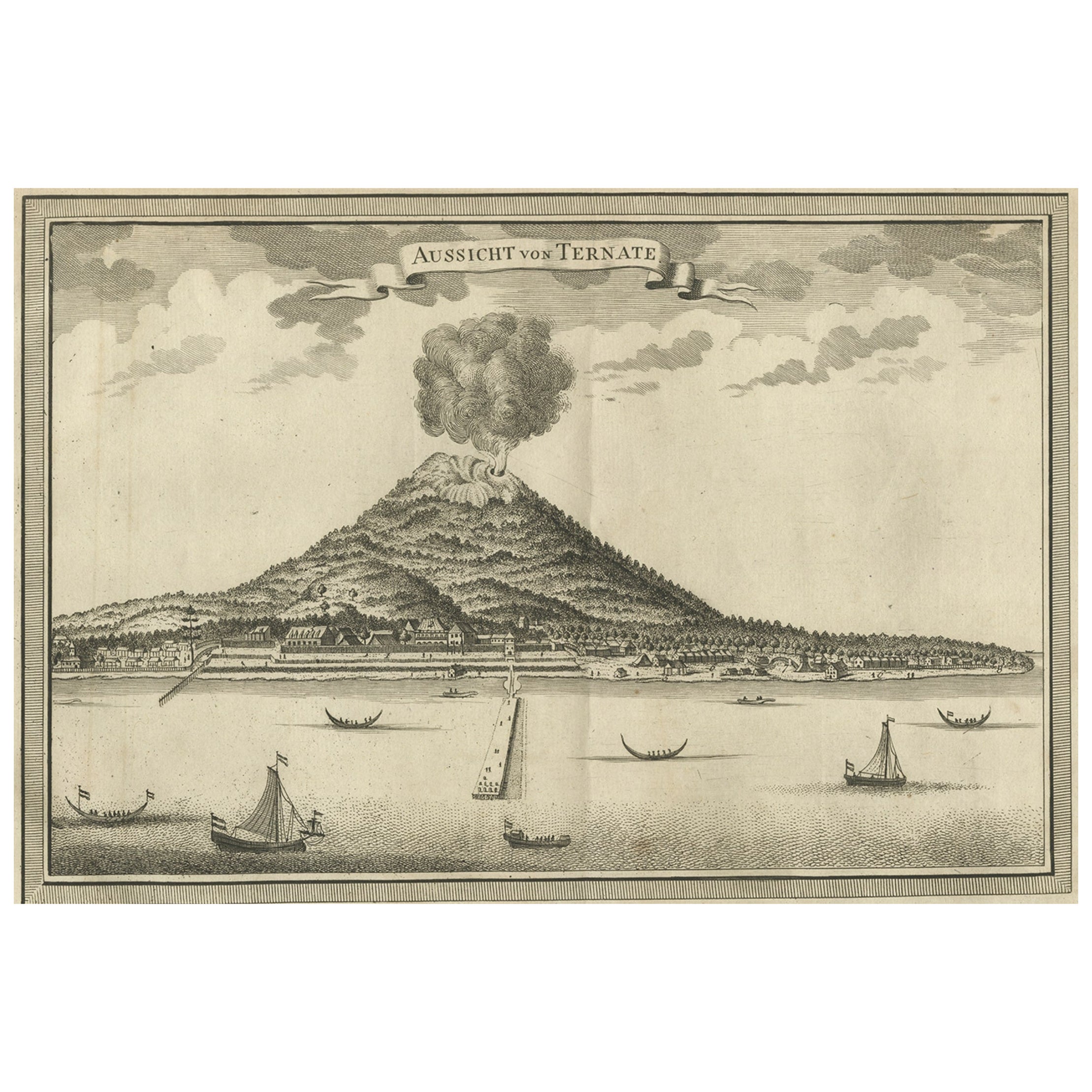
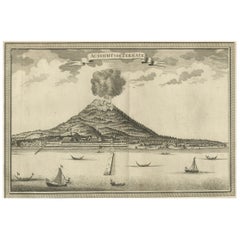
- Antique Print of a Volcano in Ternate in Indonesia, 1751Located in Langweer, NLAntique print titled 'Aussischt von Ternate'. View of the island of Ternate with erupting volcano Gamalama and vessels in the foreground. Ternate was the seat of the Governor General...Category
Antique 18th Century Prints
MaterialsPaper
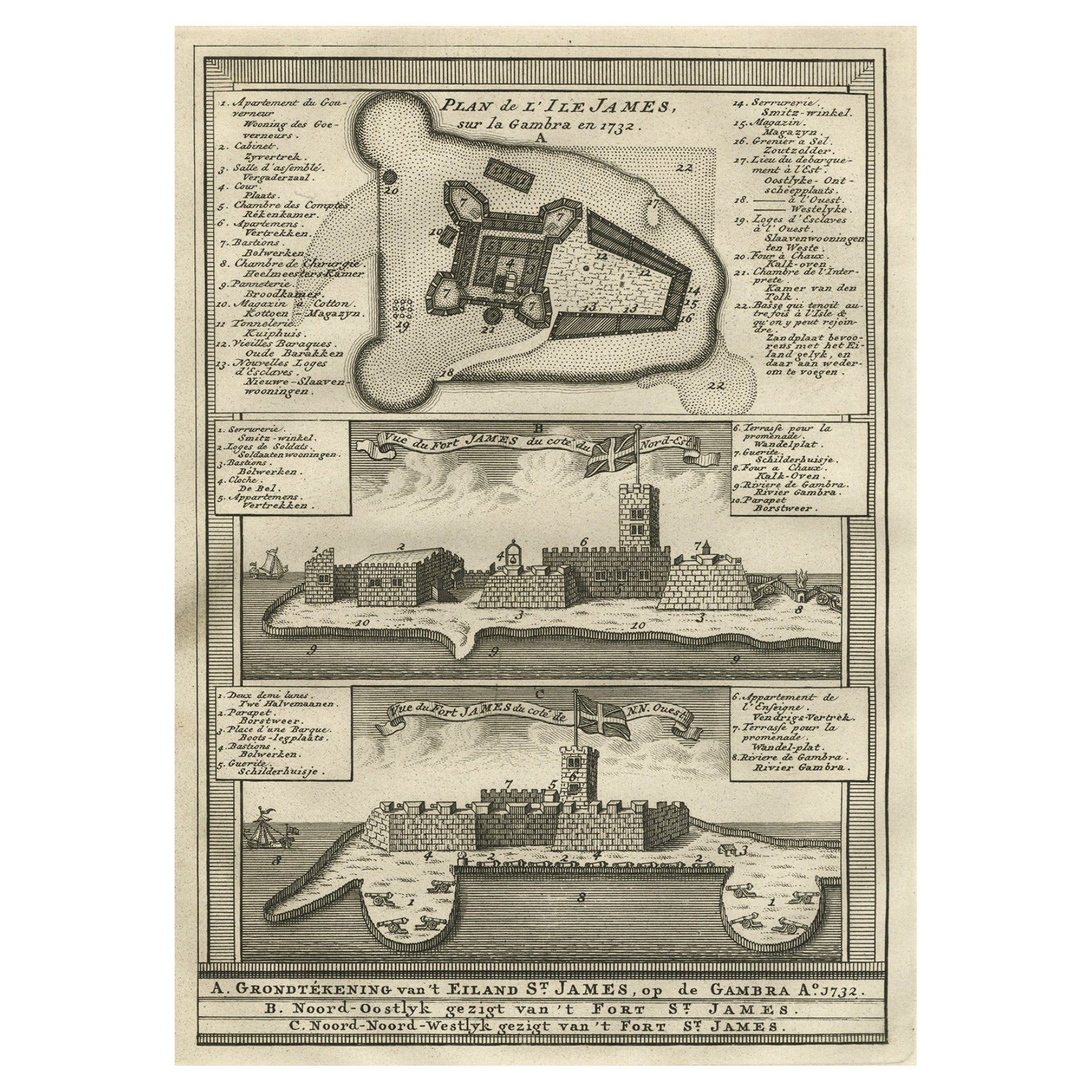
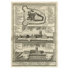
- Old Copperplate Engraving of Fort St. James on the Gambra River, Africa, c.1760Located in Langweer, NLPlan de l’Isle James sur la Gambra en 1732 (…). Copperplate engraving/etching on Hand laid (Verge) paper. Sheet size: 19,7 x 26,7 cm. Image size: 13,8 x 19,8 cm. From vol. 3 o...Category
Antique 1760s Maps
MaterialsPaper

You May Also Like
- St. Christophe 'St. Kitts' Island: An 18th Century Hand-colored Map by BellinBy Jacques-Nicolas BellinLocated in Alamo, CAJacques Bellin's copper-plate map of the Caribbean island of Saint Kitts entitled "Carte De De l'Isle St. Christophe Pour servir á l'Histoire Genle. des V...Category
Antique Mid-18th Century French Maps
MaterialsPaper
- Captain Cook's Exploration of Tahiti 18th C. Hand-Colored Map by BellinBy Jacques-Nicolas BellinLocated in Alamo, CAThis beautiful 18th century hand-colored copper plate engraved map is entitled "Carte de l'Isle de Taiti, par le Lieutenant J. Cook" was created by Jacques Nicolas Bellin and publish...Category
Antique Mid-18th Century French Maps
MaterialsPaper
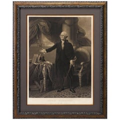
- George Washington by Henry Sadd, Antique Engraving, circa 1844Located in Colorado Springs, COThis is an 1844 engraving of President George Washington. The print was issued by G. Stuart in Albion, New York and engraved by H. S. Sadd. This standing portrait shows President George Washington in front of neoclassical columns. In his right hand, he holds a dress sword...Category
Antique 1840s American Prints
MaterialsPaper
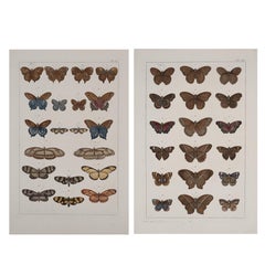
- Antique Albertus Seba Pair 18th Century Hand-Colored Engravings ButterflyBy Albertus Seba 1Located in Washington, DCRare pair of original hand-colored prints from Sir Albertus Seba's cabinet of natural curiosities. Prints come from published volumes in Amste...Category
Antique Mid-18th Century Dutch Prints
MaterialsPaper
- Original Antique Map of India. C.1780Located in St Annes, LancashireGreat map of India Copper-plate engraving Published C.1780 Three small worm holes to right side of map and one bottom left corner Unframed.Category
Antique Early 1800s English Georgian Maps
MaterialsPaper

- 18th century Set Hand Colored Nautical EngravingsBy M. OgierLocated in Savannah, GASigned M. Ogier (Fecit:by), this set of four hand colored engravings is part of a larger edition of plates. These plates are numbered PL 16, 347, 365 and 386. The subject is probably...Category
Antique 18th Century Unknown Elizabethan Prints
MaterialsGlass, Wood, Paper


Recently Viewed
View AllMore Ways To Browse
St George 19th
17th And 18th Century English Furniture
English What Not
India 17th Century
English 17th Century Cabinet
17th Cabinet English
Antique Wood Cart
Antique Style Wall Cabinet
Antique English Cabinet Plate Plate
Antique English Cabinet Plate
English Trolley Cart
British India Antique
Antique French Wall Cabinet
Antique Wood Trolley
19th Century Corpus
Antique Style Trolley
Antique English Wall Cabinet
Antique Print Cabinet