Items Similar to Antique Distance Table Between the Main Cities of Europe by Keizer & De Lat 1788


Want more images or videos?
Request additional images or videos from the seller
1 of 5
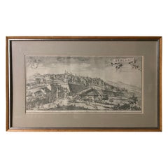
Antique Distance Table Between the Main Cities of Europe by Keizer & De Lat 1788
About the Item
Antique print titled 'Nieuwe Steede-Wyser (..)'. Original antique distance table between the main cities of Europe. This print originates from 'Nieuwe Natuur- Geschied- en Handelkundige Zak- en Reisatlas' by Gerrit Brender à Brandis.
Artists and Engravers: Published by J. Keizer and I. de Lat, 1788.
Condition: General age-related toning. Original folding lines. Original/contemporary hand coloring, blank verso. Minor wear, please study image carefully.
Date: 1788
Overall size: 26.5 x 20.5 cm.
Image size: 21.5 x 18.5 cm.
We also offer thousands of antique prints covering fields of interest as diverse as architecture, natural history, religion, ethnology and many more. Antique prints have long been appreciated for both their aesthetic and investment value. They were the product of engraved, etched or lithographed plates. These plates were handmade out of wood or metal, which required an incredible level of skill, patience and craftsmanship. Whether you have a house with Victorian furniture or more contemporary decor an old engraving can enhance your living space.
- Dimensions:Height: 8.08 in (20.5 cm)Width: 10.44 in (26.5 cm)Depth: 0 in (0.01 mm)
- Materials and Techniques:
- Period:
- Date of Manufacture:1788
- Condition:
- Seller Location:Langweer, NL
- Reference Number:
About the Seller
5.0
Platinum Seller
These expertly vetted sellers are 1stDibs' most experienced sellers and are rated highest by our customers.
Established in 2009
1stDibs seller since 2017
1,957 sales on 1stDibs
Typical response time: <1 hour
- ShippingRetrieving quote...Ships From: Langweer, Netherlands
- Return PolicyA return for this item may be initiated within 14 days of delivery.
More From This SellerView All
- Antique Map of Europe by Keizer & de Lat, 1788Located in Langweer, NLAntique map titled 'Kaartje van Europa (..)'. Uncommon original antique map of Europe. This map originates from 'Nieuwe Natuur- Geschied- en Handelkundige Zak- en Reisatlas' by Gerri...Category
Antique Late 18th Century Maps
MaterialsPaper
- Antique Map of Switzerland by Keizer & de Lat, 1788Located in Langweer, NLAntique map titled 'La Suisse (..)'. Uncommon original antique map of Switzerland. This map originates from 'Nieuwe Natuur- Geschied- en Handelkundige Zak- en Reisatlas' by Gerrit Br...Category
Antique Late 18th Century Maps
MaterialsPaper
- Antique Map of Greece by Keizer & de Lat, 1788Located in Langweer, NLAntique map titled 't Zuider Deel van Turks Europe genaamt Griekenland (..)'. Uncommon original antique map of Greece. This map originates from 'Nieuwe Natuur- Geschied- en Handelkun...Category
Antique Late 18th Century Maps
MaterialsPaper
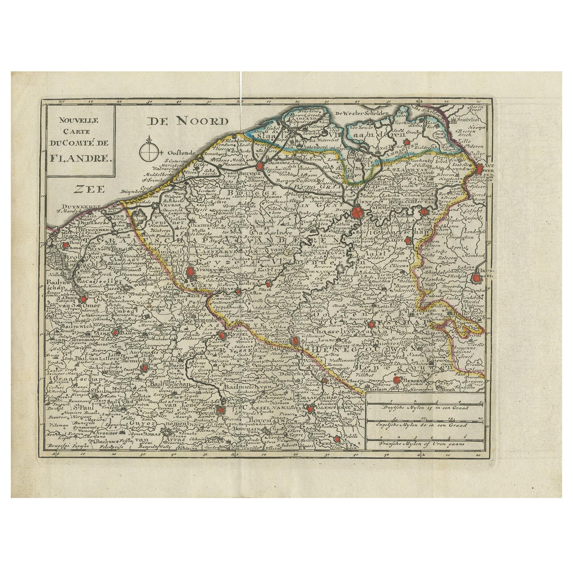
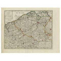
- Antique Map of Flanders by Keizer & de Lat, 1788Located in Langweer, NLAntique map titled 'Nouvelle Carte du Comté de Flandre'. Uncommon original antique map of Flanders, Belgium. This map originates from 'Nieuwe Natuur- Geschied- en Handelkundige Zak- ...Category
Antique Late 18th Century Maps
MaterialsPaper
- Antique Map of Italy by Keizer & de Lat, 1788Located in Langweer, NLAntique map titled 'Kaart van Italie (..)'. Uncommon original antique map of Italy. This map originates from 'Nieuwe Natuur- Geschied- en Handelk...Category
Antique Late 18th Century Maps
MaterialsPaper
- Antique Map of Africa by Keizer & de Lat, 1788Located in Langweer, NLAntique map titled 'Kaartje van Africa (..)'. Uncommon original antique map of Africa. This map originates from 'Nieuwe Natuur- Geschied- en Handelkundige Zak- en Reisatlas' by Gerri...Category
Antique Late 18th Century Maps
MaterialsPaper


You May Also Like
- "Amsterdam" by Dick de Herder, 1947: Photographic Journey of a Historic CityBy Dick de HerderLocated in Barcelona, BarcelonaImmerse yourself in the iconic city of Amsterdam with this vintage book by Dick de Herder, published in 1947. Titled "Amsterdam," the book features 68 photographic impressions, showc...Category
Vintage 1940s Dutch Mid-Century Modern Prints
MaterialsPaper
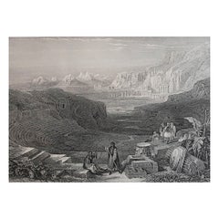
- Original Antique Print of The Ancient City of Palmyra, Syria, circa 1840Located in St Annes, LancashireWonderful image of Palmyra, Syria Fine mezzotint engraving Published by Thomas Kelly, London, circa 1840 Unframed.Category
Antique 1840s English Greco Roman Prints
MaterialsPaper
- Original Antique Print of the Ancient City of Petra After David Roberts c 1850Located in St Annes, LancashireWonderful image of Petra, Jordan Fine steel engraving after David Roberts Published circa 1850 The measurement given is the paper size Unframed.Category
Antique 1850s English Greco Roman Prints
MaterialsPaper
- 19th C Engraving of the City of Bergamo, ItalyLocated in Sheffield, MAA fine engraving of the ancient City of Bergamo depicting its architecture and historical places of interest. Nicely matted and framed. Search term: art, painting. lithograph.Category
Antique Late 19th Century Italian Prints
MaterialsPaper
- Original Antique Map / City Plan of Brussels by Tallis, circa 1850Located in St Annes, LancashireGreat map of Brussels. Steel engraving. Published by London Printing & Publishing Co. (Formerly Tallis), C.1850 Free shipping.Category
Antique 1850s English Maps
MaterialsPaper
- Original Antique Map of Europe, Arrowsmith, 1820Located in St Annes, LancashireGreat map of Europe Drawn under the direction of Arrowsmith. Copper-plate engraving. Published by Longman, Hurst, Rees, Orme and Brown, 1820 ...Category
Antique 1820s English Maps
MaterialsPaper


Recently Viewed
View AllMore Ways To Browse
Wall Foldable Table
Wall Folding Table
Victorian 18th Table
Green Tapestry
Ralph By Ralph Lauren
Green Kitchen Cabinets
Large Wooden Cabinet
Antique Brass Door Lock
Mid Century Cabinet Gold
Painted Wooden Cabinet
Pair Of Cabinets With Glass Doors
Miss Vintage
Pair French Side Cabinets
Antique Kitchen Cabinet Painted
Antique Large Display Cabinet
Tapestry Wall Hanging
Lacquer Display Cases
Make Up Cabinet