Items Similar to Antique Original Engraving of Chinese Vessels in the 18th Century, 1765

Want more images or videos?
Request additional images or videos from the seller
1 of 5
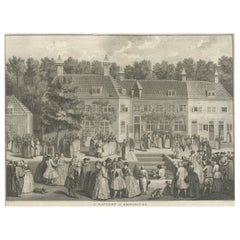
Antique Original Engraving of Chinese Vessels in the 18th Century, 1765
About the Item
Description: Plate no.34: 'Vaisseaux chinois.' (Chinese vessels.) This original auhentic plate originates from: 'Reize rondom de werreld, Gedaan in de jaaren 1740 tot 1744, door den Heere George Anson …', 3rd. Ed., published in Leiden and Amsterdam in 1765, translated into Dutch from the 1748 first English ed. by Richard Walter. (A voyage round the world ... by George Anson ...)
Great Britain was at war with Spain in 1740. Admiral of the Fleet George Anson, 1st Baron Anson PC, FRS, RN (1697 -1762) was a British admiral and a wealthy aristocrat, noted for his circumnavigation of the globe and his role overseeing the Royal Navy during the Seven Years' War. Anson commanded the small British squadron sent at the beginning of the war with Spain to harass the Spaniards on the west coast of South America and cut off their supplies of wealth from the Pacific. Disasters and hardships plagued the expedition; most of the ships were lost around Cape Horn, and on the Chilean coast, and of a crew of 960, less than 350 survived.
Eventually the Centurion alone was left, but Anson persevered and succeeded in capturing a gold-laden Spanish galleon near Manila. The prize he earned as a result settled his fortune for life. This is the official account of his voyage of circumnavigation, compiled from Anson's journals by Richard Walter, chaplain on board the Centurion, and revised by Benjamin Robins.
Artists and Engravers: No engraver or cartographer indicated on this plate. Engravers in the originating work include Jacob Folkema (Dutch 1692-1767), Jakob van der Schley (Dutch 1715-1779) and Frans de Bakker (Dutch 1720-?, fl 1736-1767).
Condition: General age related toning and ocassional light soiling. Original fold lines as issued. Ocassional very small tears in paper edges. Light ghosting from text pages of originating work. Blank verso. Please study image carefully.
- Dimensions:Height: 10.04 in (25.5 cm)Width: 16.07 in (40.8 cm)Depth: 0 in (0.02 mm)
- Materials and Techniques:
- Period:1760-1769
- Date of Manufacture:1765
- Condition:Condition: General age related toning and ocassional light soiling. Original fold lines as issued. Ocassional very small tears in paper edges. Light ghosting from text pages of originating work. Blank verso. Please study image carefully.
- Seller Location:Langweer, NL
- Reference Number:Seller: PCT-43830 1stDibs: LU3054326678452
About the Seller
5.0
Platinum Seller
These expertly vetted sellers are 1stDibs' most experienced sellers and are rated highest by our customers.
Established in 2009
1stDibs seller since 2017
1,947 sales on 1stDibs
Typical response time: <1 hour
- ShippingRetrieving quote...Ships From: Langweer, Netherlands
- Return PolicyA return for this item may be initiated within 14 days of delivery.
Auctions on 1stDibs
Our timed auctions are an opportunity to bid on extraordinary design. We do not charge a Buyer's Premium and shipping is facilitated by 1stDibs and/or the seller. Plus, all auction purchases are covered by our comprehensive Buyer Protection. Learn More
More From This SellerView All
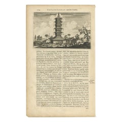
- Original Antique Engraving of the Quangguamiau Pagoda in China, 1665Located in Langweer, NLAntique print titled 'Pagoda Quangguamiau'. Old print depicting the 'Quangguamiau' pagoda, China. This print originates from 'Het gezantschap der Nee^rlandtsche Oost-Indische Compagn...Category
Antique 17th Century Prints
MaterialsPaper
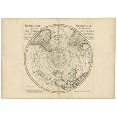
- 18th Century Antique Engraving of the Southern Hemisphere by G. de L'IsleBy Guillaume De L'IsleLocated in Langweer, NLAntique map titled 'Hemisphere Meridional pour voir plus distinctement Les Terres Australes'. Hemispherical map of the southern hemisphere centered on ...Category
Antique Late 18th Century Maps
MaterialsPaper
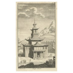
- Original Antique Engraving of a Chinese Temple, 1736Located in Langweer, NLAntique print titled 'Temple Chinois'. Old print depicting a temple in China. Source unknown, to be determined. Artists and Engravers: Made after J.C. Philips. Condition: Very ...Category
Antique 18th Century Prints
MaterialsPaper
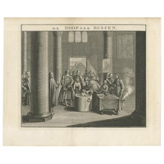
- Mid-18th Century Engraving Depicting The Baptism of Russians, 1735Located in Langweer, NLDescription: Antique print titled 'De Doop der Russen' (Dutch for 'Baptism of the Russians') Old print depicting the baptism of Russians. This print originates from 'Hedendaegsch...Category
Antique 1730s Prints
MaterialsPaper
- Original Antique Engraving of Various Chinese Gods, 1726Located in Langweer, NLAntique print titled 'Onbekende Goden - Onbekende Goden'. Copper engraving of various Chinese Gods in Batavia, Indonesia. This print originates from 'Oud ...Category
Antique 18th Century Prints
MaterialsPaper
- Original Antique Engraving of the Baptism of Christians in The Netherlands, 17Located in Langweer, NLAntique print titled 'Le Baptême de Rhinsbourg'. This print depicts the baptism of Christians in Katwijk-Rijnsburg in The Netherlands. Source unknown, to be determined. Artists an...Category
Antique 18th Century Prints
MaterialsPaper
You May Also Like
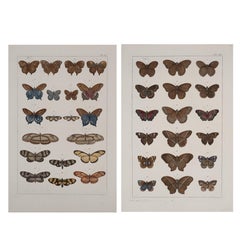
- Antique Albertus Seba Pair 18th Century Hand-Colored Engravings ButterflyBy Albertus Seba 1Located in Washington, DCRare pair of original hand-colored prints from Sir Albertus Seba's cabinet of natural curiosities. Prints come from published volumes in Amste...Category
Antique Mid-18th Century Dutch Prints
MaterialsPaper
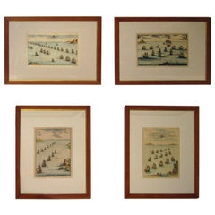
- 18th century Set Hand Colored Nautical EngravingsBy M. OgierLocated in Savannah, GASigned M. Ogier (Fecit:by), this set of four hand colored engravings is part of a larger edition of plates. These plates are numbered PL 16, 347, 365 and 386. The subject is probably...Category
Antique 18th Century Unknown Elizabethan Prints
MaterialsGlass, Wood, Paper
- Antique 18th Century Map of the Province of Pensilvania 'Pennsylvania State'Located in Philadelphia, PAA fine antique of the colony of Pennsylvania. Noted at the top of the sheet as a 'Map of the province of Pensilvania'. This undated and anonymous map is thought to be from the Gentleman's Magazine, London, circa 1775, although the general appearance could date it to the 1760's. The southern boundary reflects the Mason-Dixon survey (1768), the western boundary is placed just west of Pittsburgh, and the northern boundary is not marked. The map has a number of reference points that likely refer to companion text and appear to be connected to boundaries. The western and southern boundaries are marked Q, R, S, for example. A diagonal line runs from the Susquehanna R to the Lake Erie P. A broken line marked by many letters A, B, N, O, etc., appears in the east. There are no latitude or longitude markings, blank verso. Framed in a shaped contemporary gilt wooden frame and matted under a cream colored matte. Bearing an old Graham Arader Gallery...Category
Antique 18th Century British American Colonial Maps
MaterialsPaper
- Hand-Colored 18th Century Homann Map of Denmark and Islands in the Baltic SeaBy Johann Baptist HomannLocated in Alamo, CAAn 18th century copper plate hand-colored map entitled "Insulae Danicae in Mari Balthico Sitae utpote Zeelandia, Fionia, Langelandia, Lalandia, Falstria, Fembria Mona" created by Joh...Category
Antique Early 18th Century German Maps
MaterialsPaper
- Hand-Colored 18th Century Homann Map of the Danube, Italy, Greece, CroatiaBy Johann Baptist HomannLocated in Alamo, CA"Fluviorum in Europa principis Danubii" is a hand colored map of the region about the Danube river created by Johann Baptist Homann (1663-1724) in his 'Atlas Novus Terrarum', publish...Category
Antique Early 18th Century German Maps
MaterialsPaper
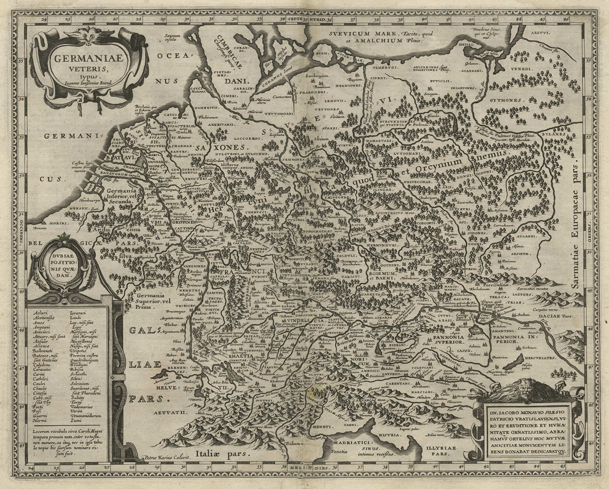
- Germany West of the Rhine: A Hand-colored 18th Century Map by de WitBy Frederick de WitLocated in Alamo, CAThis original 18th century hand-colored map of the county of Moers, Germany entitled "Illustrissimo Celsissmo Principi GUILIELMO HENRICO D.G. Arausionum Principi Domino suo Clementis...Category
Antique Early 18th Century Dutch Maps
MaterialsPaper