Items Similar to Antique Plan of the Siege of the Castle of Cardona in 1714


Want more images or videos?
Request additional images or videos from the seller
1 of 6
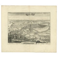
Antique Plan of the Siege of the Castle of Cardona in 1714
About the Item
Antique print titled 'Plan of Cardona a strong city and castle of Catalonia, upon the river Cardoner as besieged by the French and defended by the Allies'. A plan of the siege of the Castle of Cardona in 1714, towards the end of the War of the Spanish Succession, after the Treaty of Utrecht had removed Britain from the hostilities. Built by Wilfred the Hairy in 886, the French bombardment destroyed much of the walls. The fall of Cardona and Barcelona soon after ended Catalan hopes for independence from Spain.
Nicholas Tindal (1687-1774), at one time Chaplain to Greenwich Hospital, first published a translation of Frenchman Paul de Rapin's 'History of England' in 1727, running to thirteen volumes; in 1732 it was enlarged with his own notes and maps. This map was published in 'A summary of Mr Rapin de Thoyras's History of England, and Mr Tindal's Continuation, from the Invasion of Julius Caesar, to the End of the Reign of King George I. Illustrated With Medals, Plans of Battles, Towns, and Sieges', 1751.
- Dimensions:Height: 15.67 in (39.8 cm)Width: 18.9 in (48 cm)Depth: 0.02 in (0.5 mm)
- Materials and Techniques:
- Period:
- Date of Manufacture:1751
- Condition:Age-related toning. Original folding line. Shows some wear, soiling and staining. Blank verso. Please study image carefully.
- Seller Location:Langweer, NL
- Reference Number:
About the Seller
5.0
Platinum Seller
These expertly vetted sellers are 1stDibs' most experienced sellers and are rated highest by our customers.
Established in 2009
1stDibs seller since 2017
1,946 sales on 1stDibs
Typical response time: <1 hour
- ShippingRetrieving quote...Ships From: Langweer, Netherlands
- Return PolicyA return for this item may be initiated within 14 days of delivery.
More From This SellerView All
- Antique Print of the Siege of Alkmaar in the Netherlands, 1681By Coenraet DeckerLocated in Langweer, NLAntique print titled 'Het Beleg van Alkmaar'. Old print depicting the Siege of Alkmaar, the Netherlands. This print originates from 'Hugo de Groot, Nederlandtsche Jaerboeken en Histo...Category
Antique 17th Century Prints
MaterialsPaper
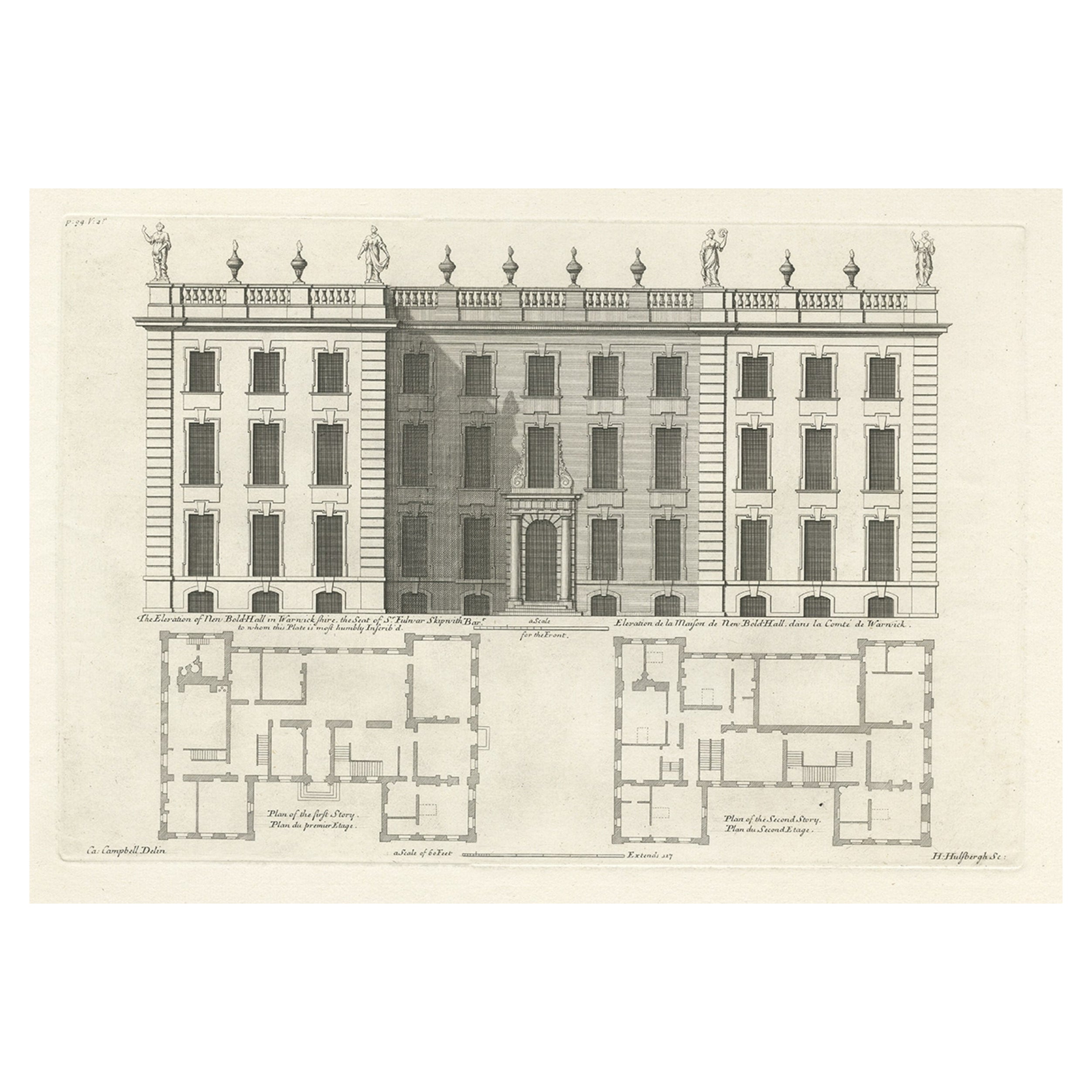
- Antique Print of the Bold Hall in Warwickshire in England, 1714Located in Langweer, NLAntique print titled 'The Elevation of Nen Bold-Hall in Warwickshire (..)'. View of the Bold Hall in Warwickshire, England. This print originates from 'Vitruvius Britannicus' by ...Category
Antique 18th Century Prints
MaterialsPaper
- Antique Print of the Siege of Grave, 1730Located in Langweer, NLAntique print titled 'De Stadt Grave, door den Prins van Parma, in den jaar 1586, belegert'. This print depicts the siege of Grave by the Count of Parma. Originates from 'Geschiedenissen der Vereenigde Nederlanden (..)' by Jean le Clerc...Category
Antique 18th Century Prints
MaterialsPaper
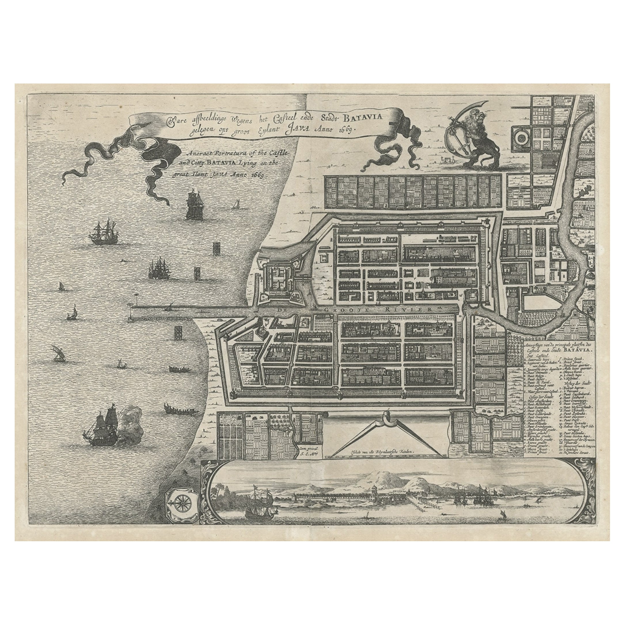
- Antique Plan of the Castle & City of Batavia 'Jakarta' on Java, Indonesia, c1669Located in Langweer, NLAntique map Batavia titled 'Ware Affbeeldinge wegens het Casteel ende Stadt Batavia'. Antique print of the castle and city of Batavia on the Island of Java'. Rare edition with En...Category
Antique 1660s Maps
MaterialsPaper
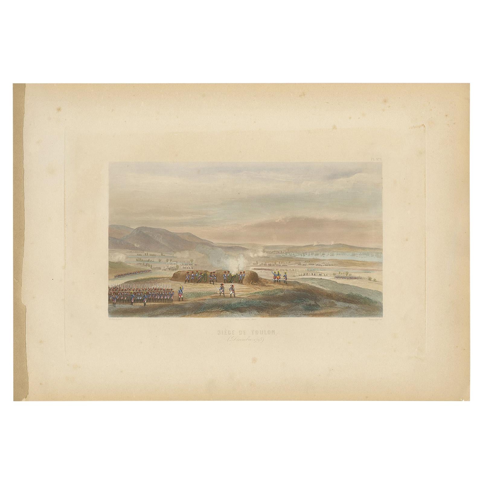
- Antique Print of the Siege of Toulon 'circa 1860'Located in Langweer, NLAntique print titled 'Siège de Toulon'. Steel engraving of the Siege of Toulon (1793). This print originates from 'Album de Vingt Batailles de la Révolution e...Category
Antique Mid-19th Century Prints
MaterialsPaper
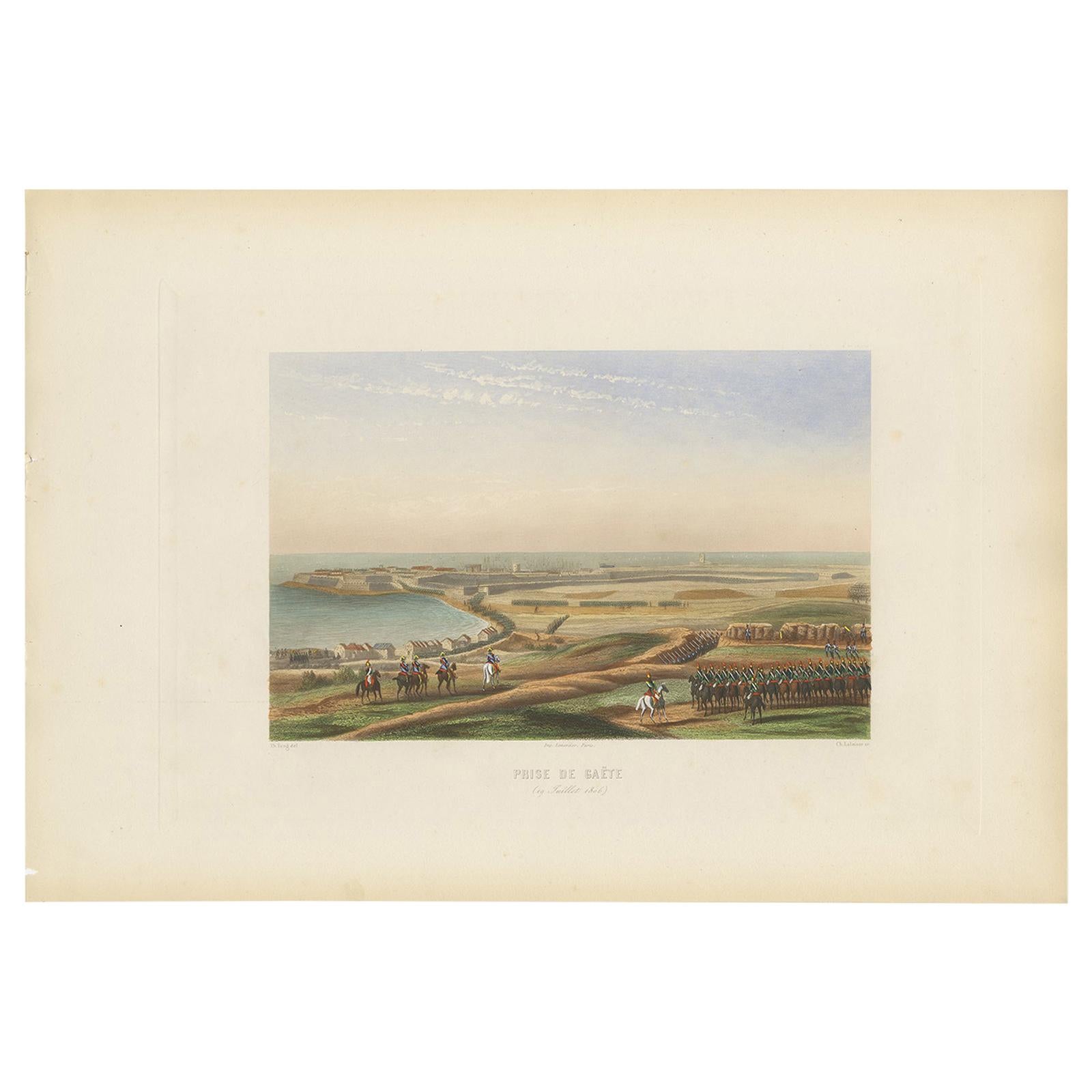
- Antique Print of the Siege of Gaeta 'circa 1860'Located in Langweer, NLAntique print titled 'Prise de Gaëte'. Steel engraving of the Siege of Gaeta (1806). This print originates from 'Album de Vingt Batailles de la Révolution et ...Category
Antique Mid-19th Century Prints
MaterialsPaper


You May Also Like
- Cabin Plan Blueprint of the Yacht “Spirit”Located in Norwell, MAOriginal blueprint of the yacht Spirit from naval architect John G. Alden of Boston. This is for Project 581, the yacht was built by Hodgdon Brothers of East...Category
Vintage 1930s North American Prints
MaterialsPaper
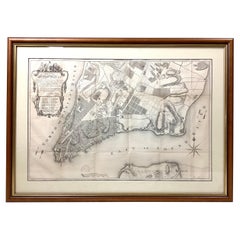
- Old Framed Map of a Plan of the City of New York as Surveyed in 1767Located in Lambertville, NJOld framed map of a plan of the City of New York as surveyed in 1767. Published by the Common Council and lithographed by George Hayward circa 1800. Repro...Category
Antique Late 19th Century American Prints
MaterialsWood, Paper
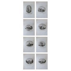
- Set of 8 Antique Prints of Scottish Castles, circa 1770Located in St Annes, LancashireGlorious set of 8 prints of mainly Scottish Castles. 2 from the English borders. Copper-plate engravings mainly after drawings by Moses Griffiths. ...Category
Antique 1770s English Georgian Prints
MaterialsPaper
- Original Antique Map / City Plan of Brussels by Tallis, circa 1850Located in St Annes, LancashireGreat map of Brussels. Steel engraving. Published by London Printing & Publishing Co. (Formerly Tallis), C.1850 Free shipping.Category
Antique 1850s English Maps
MaterialsPaper
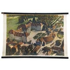
- Prince's Castle of the 18th Century Vintage Mural Rollable Wall ChartLocated in Berghuelen, DEThe vintage pull-down wall chart shows an imposing princely castle from the 18th century. Published by der Neue Schulmann, Stuttgart. Colorful print on paper reinforced with canvas. ...Category
Vintage 1970s German Country Prints
MaterialsCanvas, Wood, Paper
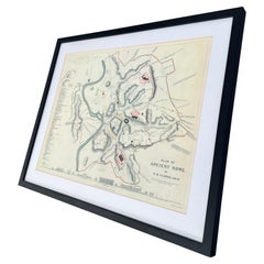
- Vintage Framed Print, Plan of Ancient RomeLocated in Seattle, WAVintage framed print. Plan of Ancient Rome. Dimensions. 27 W ; 22 H.Category
Vintage 1970s Mid-Century Modern Prints
MaterialsGlass, Wood