Items Similar to Antique Print of the Islands of Marken, New Ireland & Others, 1726

Want more images or videos?
Request additional images or videos from the seller
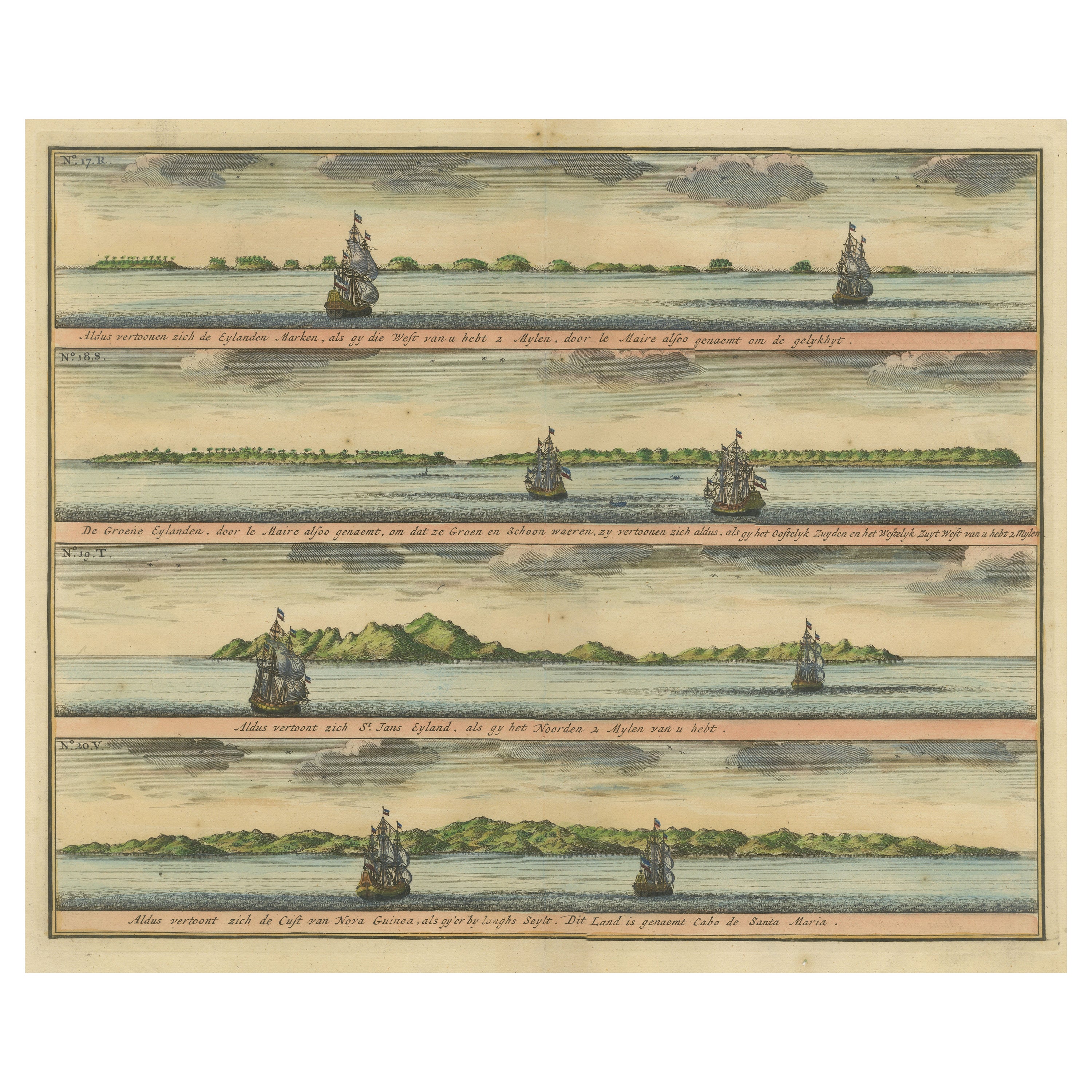
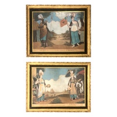
Antique Print of the Islands of Marken, New Ireland & Others, 1726
About the Item
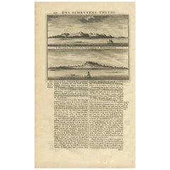
Antique print titled 'De Kust van Nova Guinea tot aan deze bogt (..)'. Four engravings on one sheet showing panoramic views of the islands of Marken, the Groene islands, Sint Jans island and New Ireland, on the same latitude as Cabo de Santa Maria. Abel Tasman, but also Willem Schouten and Isaac le Maire thought that these archipelagos were situated off the coast of New Guinea. But they were actually situated close to the island now known as New Ireland. Ontong Java is still known as such, the Groene eilanden are today known as the Green Islands, and Marken is now known as Takuu. This print originates from 'Oud en Nieuw Oost-Indiën' by F. Valentijn.
Artists and Engravers: François Valentijn (1666-1727), a missionary, worked at Amboina from 1684 to 1694 and 1705 to 1713 and travelled extensively in the VOC's lands.
Condition: Good, general age-related toning. Small worm hole, lower part folding line. Please study image carefully.
Date: 1726
Overall size: 40 x 34 cm.
Image size: 37 x 29 cm.
Whilst cartography holds a special place in our collection, we also offer thousands of antique prints covering fields of interest as diverse as architecture, natural history, religion, ethnology and many more. Antique prints have long been appreciated for both their aesthetic and investment value. They were the product of engraved, etched or lithographed plates. These plates were handmade out of wood or metal, which required an incredible level of skill, patience and craftsmanship. Whether you have a house with Victorian furniture or more contemporary decor an old engraving can enhance your living space. We offer a wide range of authentic antique prints for any budget.
- Dimensions:Height: 13.39 in (34 cm)Width: 15.75 in (40 cm)Depth: 0 in (0.01 mm)
- Materials and Techniques:
- Period:
- Date of Manufacture:1726
- Condition:Condition: Good, general age-related toning. Small worm hole, lower part folding line. Please study image carefully.
- Seller Location:Langweer, NL
- Reference Number:
About the Seller
5.0
Platinum Seller
These expertly vetted sellers are 1stDibs' most experienced sellers and are rated highest by our customers.
Established in 2009
1stDibs seller since 2017
1,950 sales on 1stDibs
Typical response time: <1 hour
- ShippingRetrieving quote...Ships From: Langweer, Netherlands
- Return PolicyA return for this item may be initiated within 14 days of delivery.
More From This SellerView All
- Colored Antique Print of the Islands of Marken, New Ireland and Other IslandsLocated in Langweer, NLAntique print titled 'De Kust van Nova Guinea tot aan deze bogt (..)'. Four engravings on one sheet showing panoramic views of the islands of Marken, the Groene islands, Sint Jans is...Category
Antique Mid-18th Century Prints
MaterialsPaper
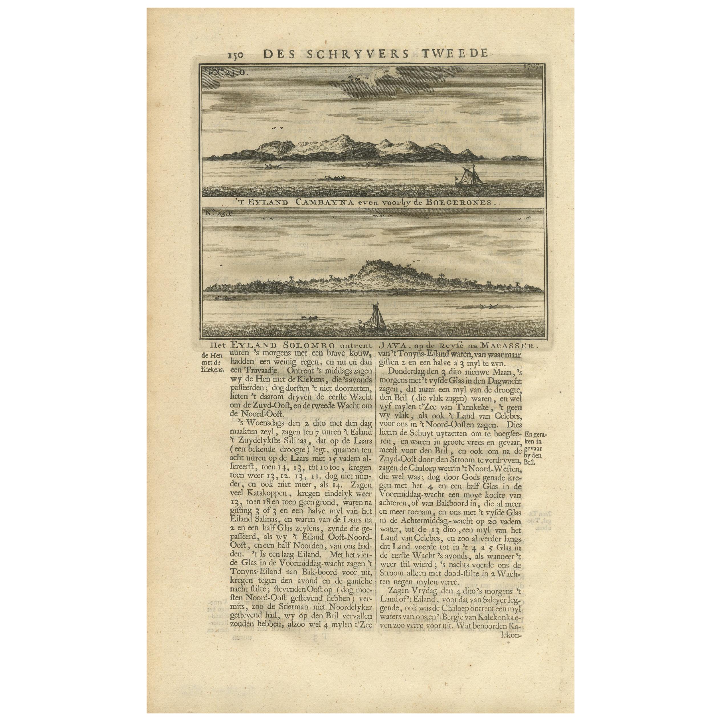
- Antique Print of the Islands Cambayna and Solombo by Valentijn, 1726By F. ValentijnLocated in Langweer, NLAntique print titled 't Eyland Cambayna even voorby de Boegerones / Het Eyland Solombo ontrent Java op de Reyse na Macasser'. This print depicts the Islands Cambayna and Solombo. Tex...Category
Antique Early 18th Century Dutch Prints
MaterialsPaper
- Antique Chart of the Banda Islands or The Spice Islands, Indonesia, 1726Located in Langweer, NLAntique map titled 'Nieuwe Caart der Eylanden van Banda'. Beautiful chart of the Banda Islands including Banda Api, Banda Neira, Banda Besar, Pulau Hatta (Rosengain), Pulau Ai an...Category
Antique 1720s Maps
MaterialsPaper
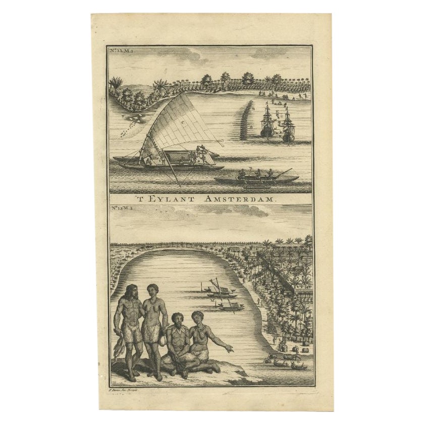
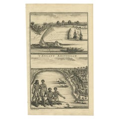
- Antique Print of Amsterdam Island in the Indian Ocean by Valentijn, 1726Located in Langweer, NLAntique print Indonesia titled 'T Eylant Amsterdam'. Two engravings on one sheet showing the native boats and peoples of Amsterdam Island in the Indian Ocean. Dutch (V.O.C.) sailing ...Category
Antique 18th Century Prints
MaterialsPaper
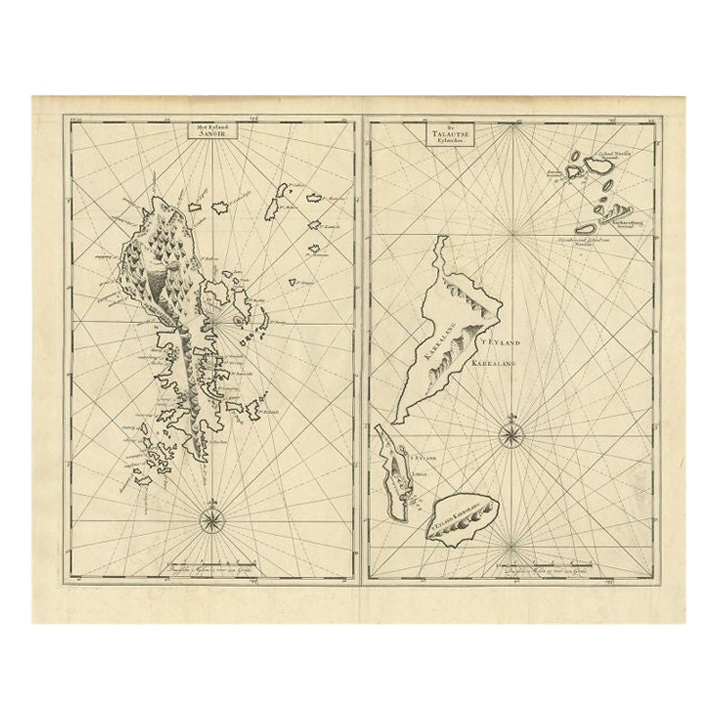
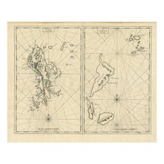
- Antique Map of Sangir Island and the Talaud Islands by Valentijn, 1726Located in Langweer, NLAntique map titled 'Het Eyland Sangir & De Talautse Eylanden'. Two maps on one sheet. To the left, a map of Sangir Island, Indonesia. To the right, a map of the Talaud Islands, Indon...Category
Antique 18th Century Maps
MaterialsPaper
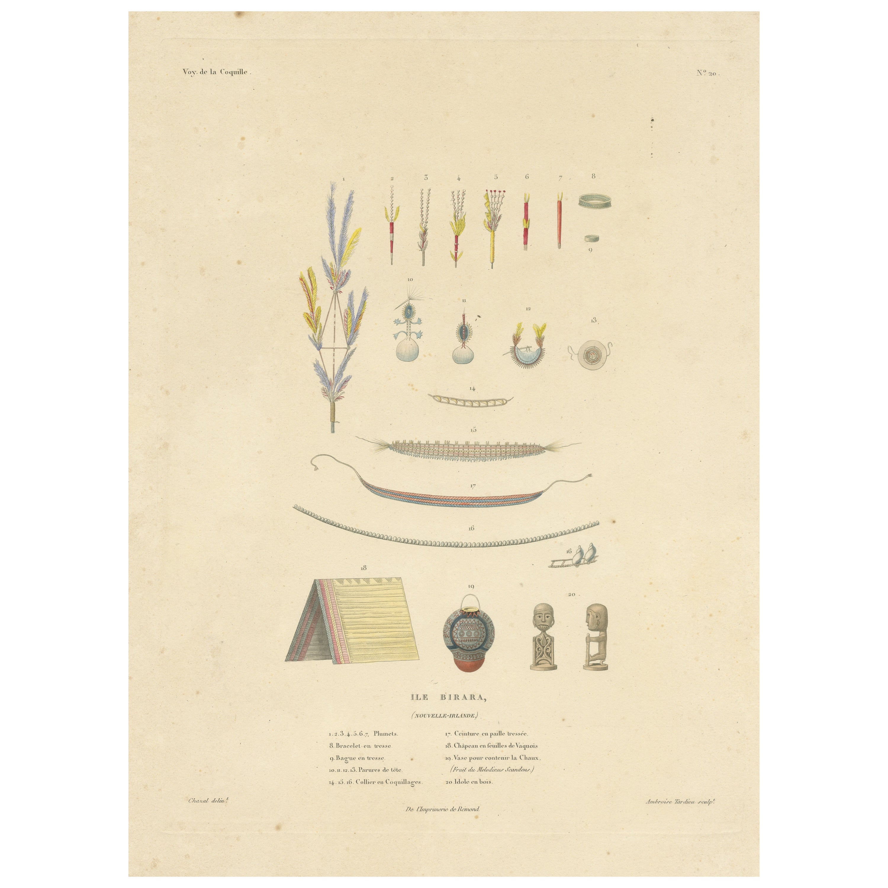
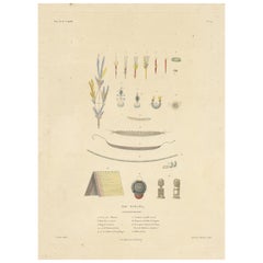
- Antique Print of Jewellery, Belts and other Items from Birara, New IrelandLocated in Langweer, NLAntique print titled 'Ile Birara, Nouvelle-Irlande'. Jewellery, belts and other items from Birara Islands, New Ireland. Illustrated are a feather ornament,...Category
Antique Mid-19th Century Prints
MaterialsPaper


You May Also Like
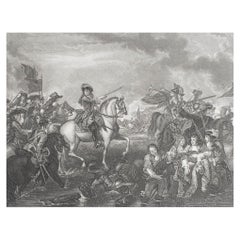
- Original Antique Print of The Battle of The Boyne, Ireland. C.1850Located in St Annes, LancashireGreat image of The Battle of The Boyne Fine steel engraving after Benjamin West With a highly decorative figural border Published by London printing & Publishing Co.C.1850 Unfram...Category
Antique 1850s English Prints
MaterialsPaper
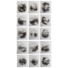
- Set of 15 Original Antique Prints of Ireland, C.1840Located in St Annes, LancashireGlorious set of 15 prints of Ireland Steel engravings after T.Creswick Published C.1840 Unframed. The measurement given is the paper size of one print.Category
Antique 1840s English Prints
MaterialsPaper
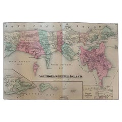
- Antique Map Long Island, Southold, Shelter Island, Orient, New YorkBy Beers Atlas Co.Located in Sag Harbor, NYAntique map of Long Island, Southold, Shelter Island, Orient, Great details, Names of homes, Roads and Businesses in 1870. Unframed. This is...Category
Antique Mid-19th Century American Early Victorian Prints
MaterialsPaper
- Antique Dutch Prints of the Four ContinentsLocated in Tampa, FLTwo prints of the four continents they are early 19th century, Dutch. In antique hand carved water gilded frames with original glass.Category
Antique Early 19th Century Prints
MaterialsPaper
- Original Antique Print of Albany, New York, circa 1840Located in St Annes, LancashireGreat print of Albany, New York Steel engraving by Daumerlang after Wall Published circa 1840 Unframed.Category
Antique 1840s German Other Prints
MaterialsPaper
- Original Antique Map of Ireland- Kerry. C.1840Located in St Annes, LancashireGreat map of Kerry Steel engraving Drawn under the direction of A.Adlard Published by How and Parsons, C.1840 Unframed.Category
Antique 1840s English Maps
MaterialsPaper

Recently Viewed
View AllMore Ways To Browse
Irish Decor
Antique Santa Plate
Nova Products
Oud Wood
Antique Victorian Santa
Modern Wall Sculpture Gold
Painted Commode Pair
Victorian Display Case
Antique Door Gold
Rustic Antique Door
Rustic Antique Doors
Antique Crescent
Large Wall Light Sculpture
Pair Painted Commodes
Art Deco Small Cabinets
Used Wooden French Doors
Sets Of Doors Interior
Small Art Deco Cabinet