Items Similar to Chessboard "Homaage á Marcel Duchamp" with the L.H.O.O.Q. Mustache by Arman

Want more images or videos?
Request additional images or videos from the seller
1 of 8
Chessboard "Homaage á Marcel Duchamp" with the L.H.O.O.Q. Mustache by Arman
About the Item
A shadow-box framed chessboard with the L.H.O.O.Q. mustache by Arman (1928-2005) entitled "Homaage á Marcel Duchamp".
A screen-print on Skivertex leather chessboard. Framed behind glass on fabric in a wooden shadow box frame.
Signed and numbered 61/100 lower left with felt tip pen.
Published by the Philadelphia Museum of Art in 1973.
Condition: Not observed outside the frame. There is some minor wear to the frame itself, a spot of foxing to the fabric the lower right section, and some very light cloudiness to the interior glass.
Frame size: circa 20 in. x 20 in.
Sight size: circa 16 in. x 16 in.
Items purchased from David Sterner Antiques must delight you. Purchases may be returned for any reason for a period of seven day.
- Creator:Arman (Artist)
- Dimensions:Height: 20 in (50.8 cm)Width: 20 in (50.8 cm)Depth: 1.25 in (3.18 cm)
- Style:Modern (Of the Period)
- Materials and Techniques:
- Place of Origin:
- Period:
- Date of Manufacture:1970s
- Condition:Wear consistent with age and use.
- Seller Location:Philadelphia, PA
- Reference Number:
About the Seller
5.0
Platinum Seller
These expertly vetted sellers are 1stDibs' most experienced sellers and are rated highest by our customers.
Established in 1996
1stDibs seller since 2015
405 sales on 1stDibs
Typical response time: 1 hour
- ShippingRetrieving quote...Ships From: Philadelphia, PA
- Return PolicyA return for this item may be initiated within 7 days of delivery.
More From This SellerView All
- New Map of North America from the Latest Discoveries, 1763Located in Philadelphia, PAA fine antique 18th century map of the North American seaboard. Entitled "A New Map of North America from the Latest Discoveries 1763". By the Cartographer/Engraver - John Spil...Category
Antique Mid-18th Century English Georgian Maps
MaterialsPaper
- Antique 18th Century Map of the Province of Pensilvania 'Pennsylvania State'Located in Philadelphia, PAA fine antique of the colony of Pennsylvania. Noted at the top of the sheet as a 'Map of the province of Pensilvania'. This undated and anonymous map is thought to be from the Gentleman's Magazine, London, circa 1775, although the general appearance could date it to the 1760's. The southern boundary reflects the Mason-Dixon survey (1768), the western boundary is placed just west of Pittsburgh, and the northern boundary is not marked. The map has a number of reference points that likely refer to companion text and appear to be connected to boundaries. The western and southern boundaries are marked Q, R, S, for example. A diagonal line runs from the Susquehanna R to the Lake Erie P. A broken line marked by many letters A, B, N, O, etc., appears in the east. There are no latitude or longitude markings, blank verso. Framed in a shaped contemporary gilt wooden frame and matted under a cream colored matte. Bearing an old Graham Arader Gallery...Category
Antique 18th Century British American Colonial Maps
MaterialsPaper
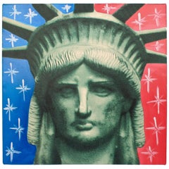
- Liberty Head, an Artist's Proof Screenprint on Canvas by Sak Steve KaufmanBy Steve KaufmanLocated in Philadelphia, PATitle: Liberty head. By: Steve Kaufman. Date: 1990s. A limited edition screen-print on canvas with hand embellishments (in oil). Depicting the head of of the statue of li...Category
1990s American Modern Paintings
MaterialsCanvas
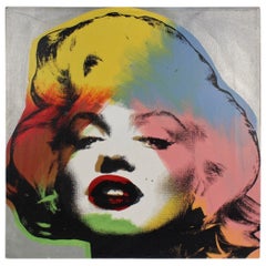
- Marilyn Monroe Silver, a Pop-Art Screen-Print by SAK Steve KaufmanBy Steve KaufmanLocated in Philadelphia, PATitle: Marilyn Monroe Silver By: Steve Kaufman. Date: 1990s. A limited edition screen-print on canvas with hand embellishments (in oil) depicting Marilyn Monroe. Sign...Category
1990s American Post-Modern Prints
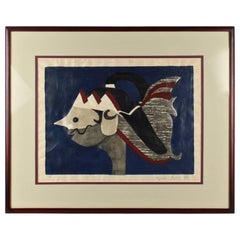
- Woodblock Print of a Javanese Puppet on Blue Ground by Kiyoshi Saito, 1950sBy Kiyoshi SaitōLocated in Philadelphia, PAA fine woodblock print of a Javanese puppet in profile. The imagery is a potent mixture of Saito's traditional Japanese sensibilities coupled with...Category
Mid-20th Century Japanese Mid-Century Modern Prints
MaterialsPaper
- Einstein State I, a Pop-Art Screen-Print of Albert Einstein by Sak Steve KaufmanBy Steve KaufmanLocated in Philadelphia, PATitle: Einstein State I (with embellishments). By: Steve Kaufman. Date: 1990s. A limited edition screen-print on canvas with hand embellishments (in oil). Depicting Alber...Category
Late 20th Century American Post-Modern Paintings


You May Also Like
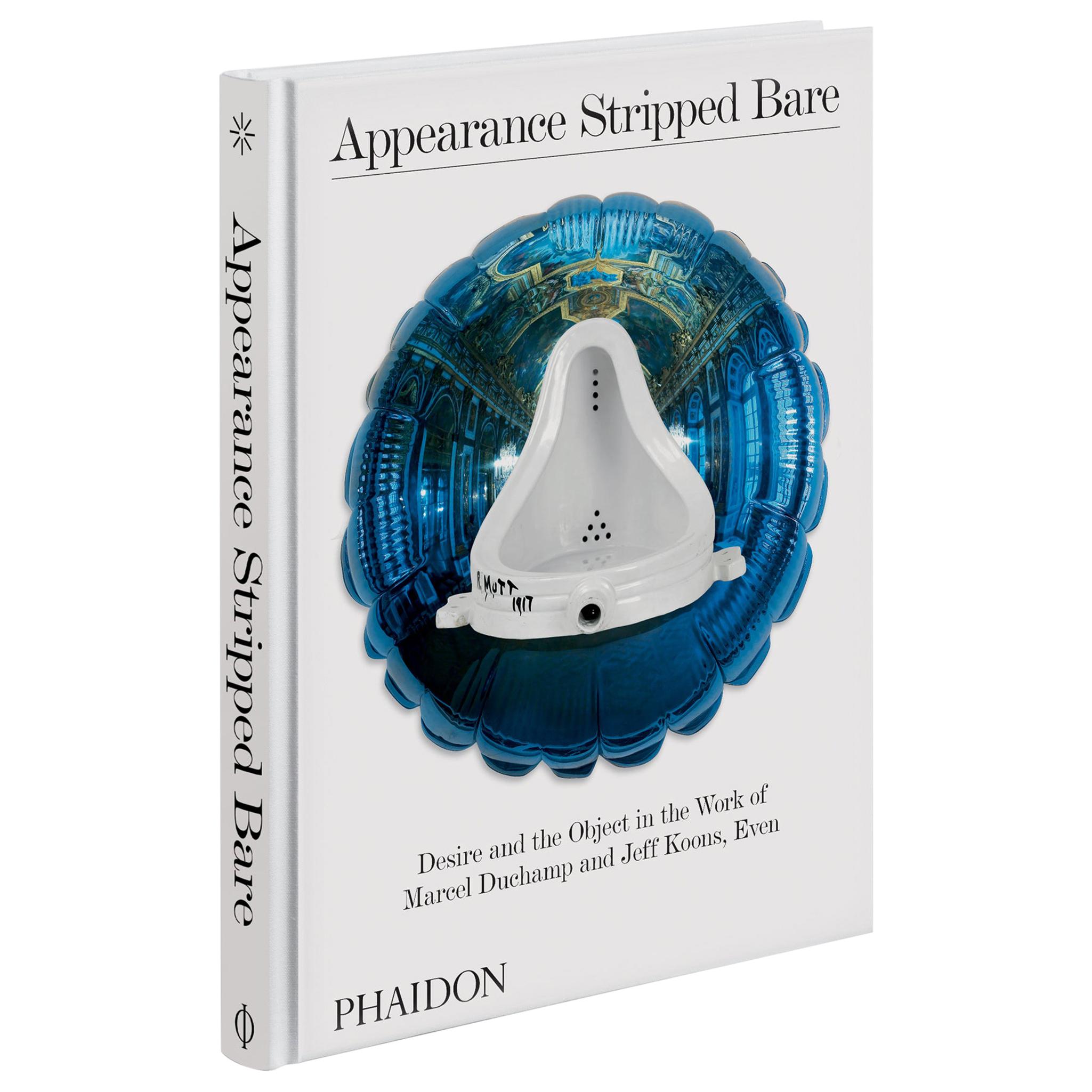
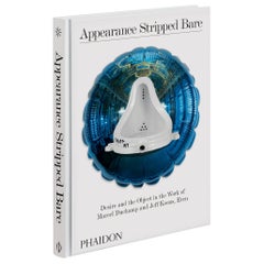
- Appearance Stripped Bare, Desire and the Object in the Work of Marcel DuchampLocated in New York City, NYThe first book to explore two of the biggest names in modern and contemporary art side by side, Marcel Duchamp and Jeff Koons In the first half of the 20th century, Marcel Duchamp re...Category
21st Century and Contemporary Books
MaterialsPaper
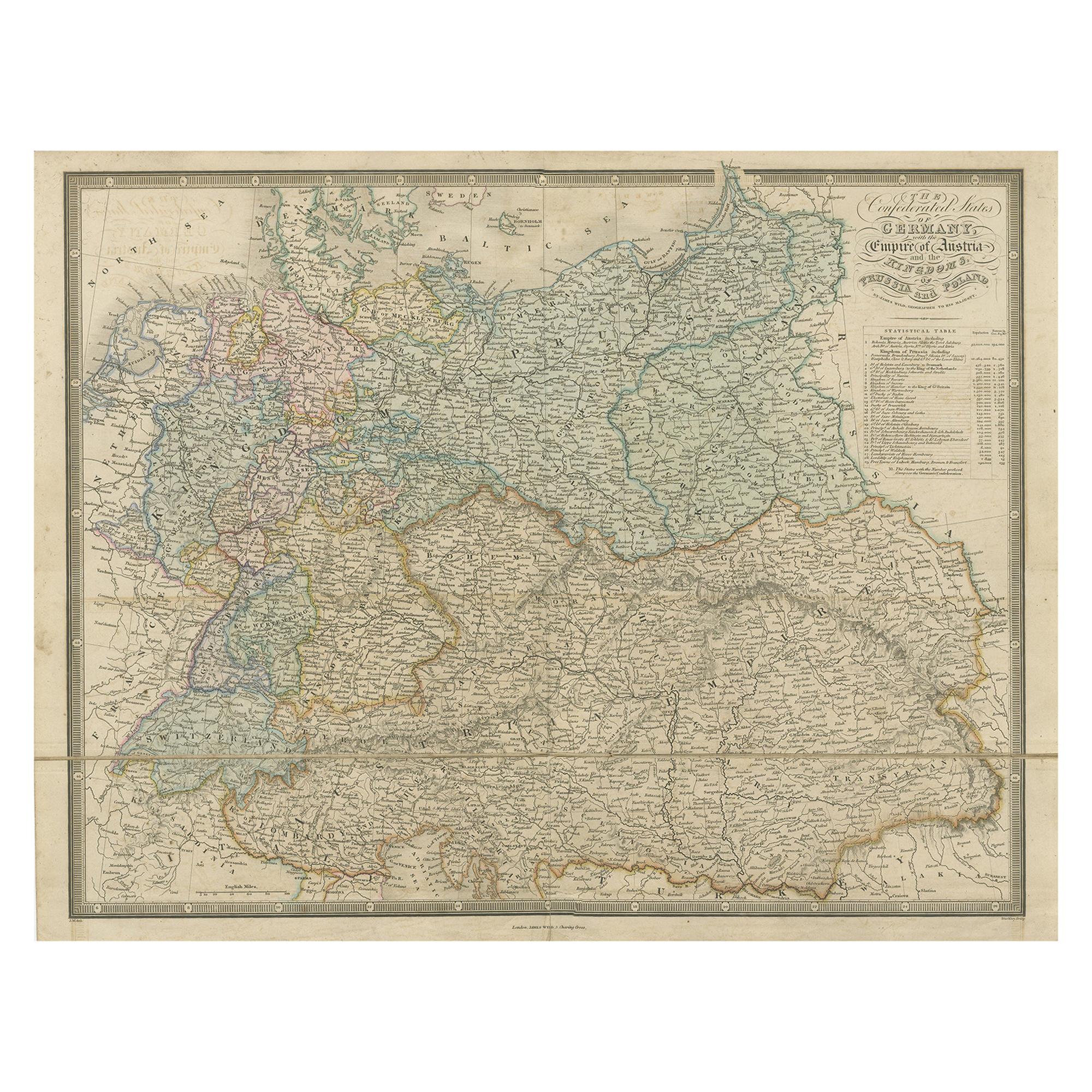
- Antique Map of Germany with the Empire of Austria by Wyld '1845'Located in Langweer, NLAntique map titled 'The Confederated States of Germany with the Empire of Austria, and The Kingdoms of Prussia and Poland'. Original antique map of ...Category
Antique Mid-19th Century Maps
MaterialsPaper
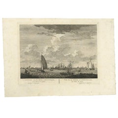
- Antique Print with a View of Amsterdam from the IJ Dock by H. SchoutenLocated in Langweer, NLThis rare authentic old antique print / plate originates from: 'Nieuwe atlas, van de voornaamste gebouwen en gezigten der stad Amsterdam, met derzelver beknopte beschryvingen.' (tran...Category
Antique Late 18th Century Prints
MaterialsPaper
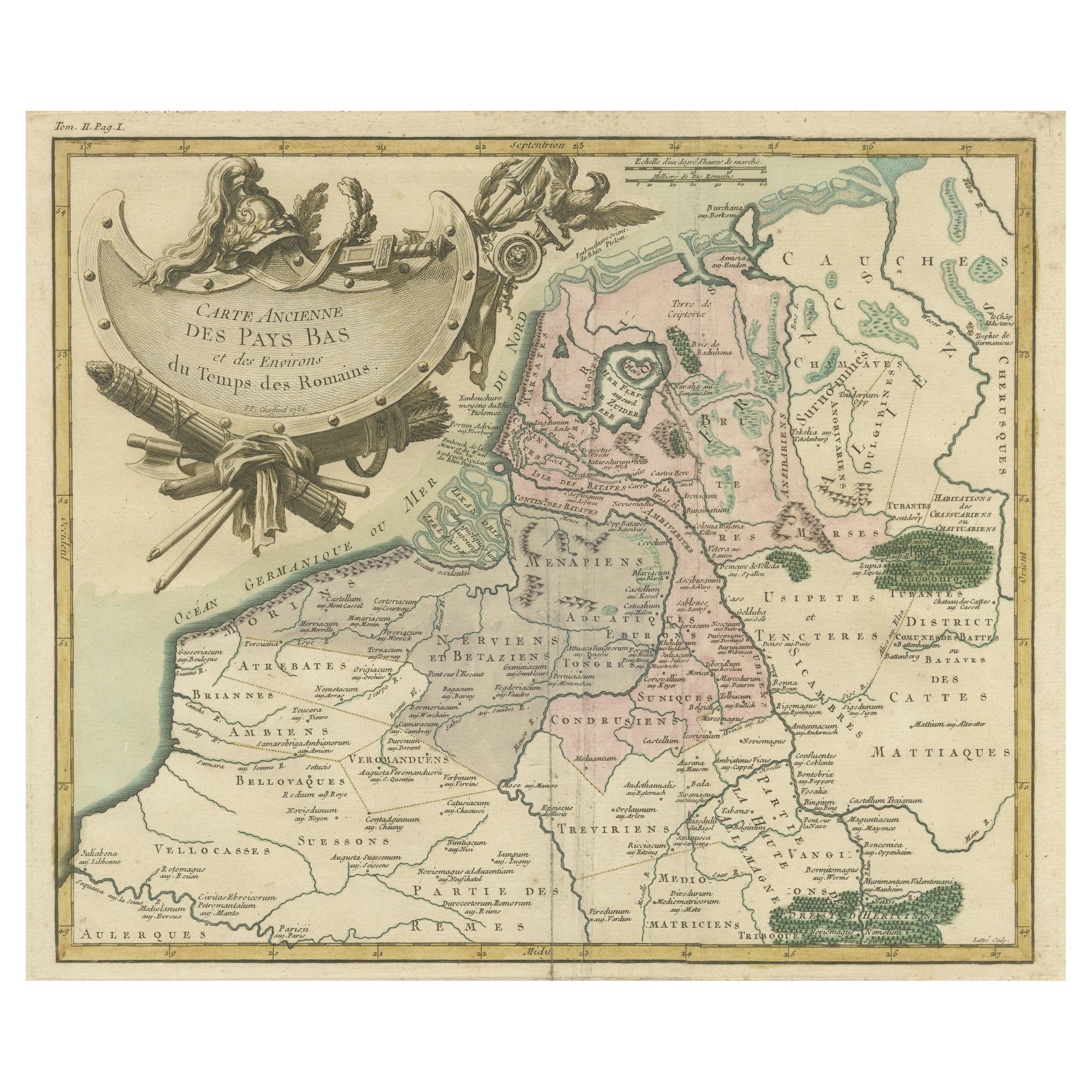
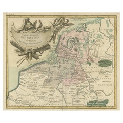
- Antique Map of the Netherlands in the time of the Domination by the Roman EmpireLocated in Langweer, NLOriginal antique map titled 'Carte Ancienne des Pays Bas et des Environs du Temps des Romains'. Copper engraved map of the Netherlands in the time of the domination by the Roman Empire. The map also includes portions of Belgium and Germany. With Renaissance title cartouche showing Roman armor...Category
Antique Mid-18th Century Maps
MaterialsPaper
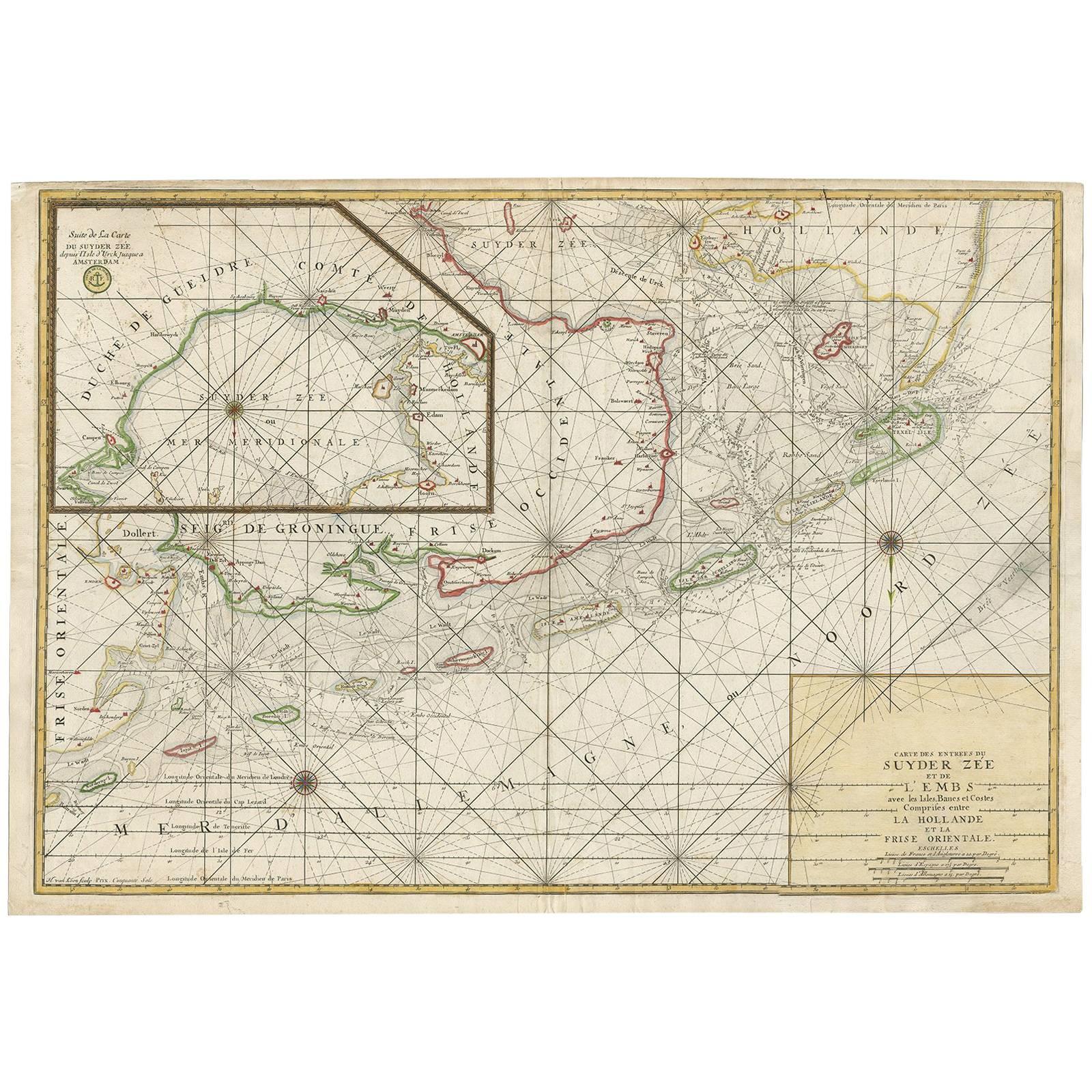
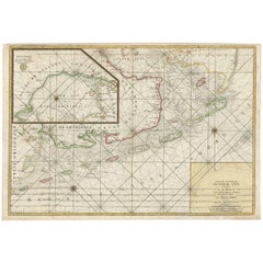
- Large Sea Chart of the Zuyder Zee & The Northsea with the Wadden Islands, 1773By H. van LoonLocated in Langweer, NLThe copper engraving by Herman van Loon, published by Pieter Mortier in 'Le Neptune François' in Amsterdam, is a remarkable piece within the realm of seventeenth-century cartography....Category
Antique Late 18th Century Maps
MaterialsPaper
- Antique Map of the World with Polar Projections by Keizer & de Lat, 1788Located in Langweer, NLAntique map titled 'Schuine Ronde Aard-Klooten (..)'. Interesting double hemisphere world map with polar projections. In North America, there is a...Category
Antique Late 18th Century Maps
MaterialsPaper


Recently Viewed
View AllMore Ways To Browse
Antique Wall Screens
Antique Glass Screens
Mustache Vintage
Antique Pen Box
Antique Wooden Wall Box
L Duchamp
Vintage Wooden Box Vintage 20wooden 20box Boxes
Vintage Wooden Shadow Box
Vintage Wooden Shadow Boxes
H L Stern
David Leather Box
Italian Wedding Designers
French Chest 19th Painted
Aged Black Wood Cabinet
Swing Doors
90 Clothes
Swing Door
Vanity Mirror In Wood