Items Similar to Copy of Walker Map Titled Boston & Surroundings


Want more images or videos?
Request additional images or videos from the seller
1 of 4
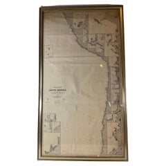
Copy of Walker Map Titled Boston & Surroundings
About the Item
Copy of a Walker map titled Boston & Surroundings. Shows Winchester to Dedham, with greater Boston in detail. Framed. Dimensions: 45" H x 31" L.
- Dimensions:Height: 45 in (114.3 cm)Width: 31 in (78.74 cm)Depth: 2 in (5.08 cm)
- Period:
- Date of Manufacture:Unknown
- Condition:
- Seller Location:Norwell, MA
- Reference Number:
About the Seller
5.0
Vetted Seller
These experienced sellers undergo a comprehensive evaluation by our team of in-house experts.
Established in 1967
1stDibs seller since 2015
346 sales on 1stDibs
Typical response time: 2 hours
- ShippingRetrieving quote...Ships From: Norwell, MA
- Return PolicyA return for this item may be initiated within 1 day of delivery.
More From This SellerView All
- Copy of 1901 Chart of Boston HarborLocated in Norwell, MALater copy after an original Boston Harbor chart by George Eldridge of Vineyard Haven and Boston. Detailed chart of Boston Harbor from the Neponset River in Quincy south down to Kimb...Category
Vintage 1910s North American Prints
MaterialsPaper
- 1891 Map of South Shore of BostonLocated in Norwell, MAOriginal 1891 map showing Cohasset, Scituate, Marshfield, Duxbury, Kingston, Norwell, Hanover, Hingham, Hull, Holbrook, Weymouth, Hanson, Pembroke, etc. Framed with glass. Circa 1891.Category
Antique 1890s North American Prints
MaterialsPaper
- Original 1891 Walker MapLocated in Norwell, MAOriginal 1891 map of Massachusetts by Walker. Towns include Cambridge, Boston, Dedham, Ashland, Brookline, Newton etc... burl wood frame. Measures...Category
Antique 19th Century Maps
- Map of Boston and Surrounding TownsLocated in Norwell, MALater copy of a nineteenth century map of Boston and surrounding towns. Showing parts of Quincy, Milton, Hyde Park, Winthrop and Revere. Showing all of B...Category
Antique 19th Century North American Maps
MaterialsPaper
- Chart of the East Coast of EnglandLocated in Norwell, MAChart of the East Coast of England, from Dungeness to Flamborough, including the entrances to the Thames River. Drawn by hydrographer J.W. Norie in 1841. Includes Kent, Essex and Suf...Category
Antique 1840s English Nautical Objects
MaterialsPaper
- Chart of West Coast of South America by James Imray and SonLocated in Norwell, MAChart of West Coast of South America compiled by James F. Imray and published in 1880. The chart captures the west coast from Valparaiso to Truxillo. Includes ...Category
Antique 1880s English Nautical Objects
MaterialsPaper


You May Also Like
- Antique Map of Belgium and Surroundings, 1692Located in Langweer, NLAntique map titled 'Provincie Meridionali de Paesi Bassi Intese sotto nome di Fiandra overo Li Paesi Bassi Cattolici con li confini di Francia di Allemagna et di Hollanda'. Uncommon map of Belgium...Category
Antique 17th Century Maps
MaterialsPaper
- Antique Map of Afghanistan and Surroundings, '1845'Located in Langweer, NLAntique map titled 'Map of Persia and Caubul'. Original antique map of Afghanistan and surroundings. This map originates from 'An Atlas of the World, Comprehending Separate Maps of...Category
Antique Mid-19th Century Maps
MaterialsPaper
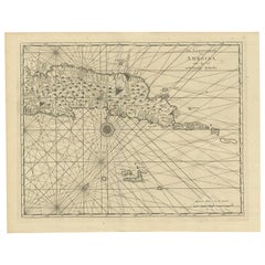
- Antique Map of Ambon and Surroundings by Valentijn '1726'By F. ValentijnLocated in Langweer, NLAntique map titled 'De landvoogdy van Amboina met de elf onderhoorige Eylanden'. Decorative map of the eastern tip of the islands of Ambon, Indonesia. This print originates from 'Oud...Category
Antique Early 18th Century Dutch Maps
MaterialsPaper
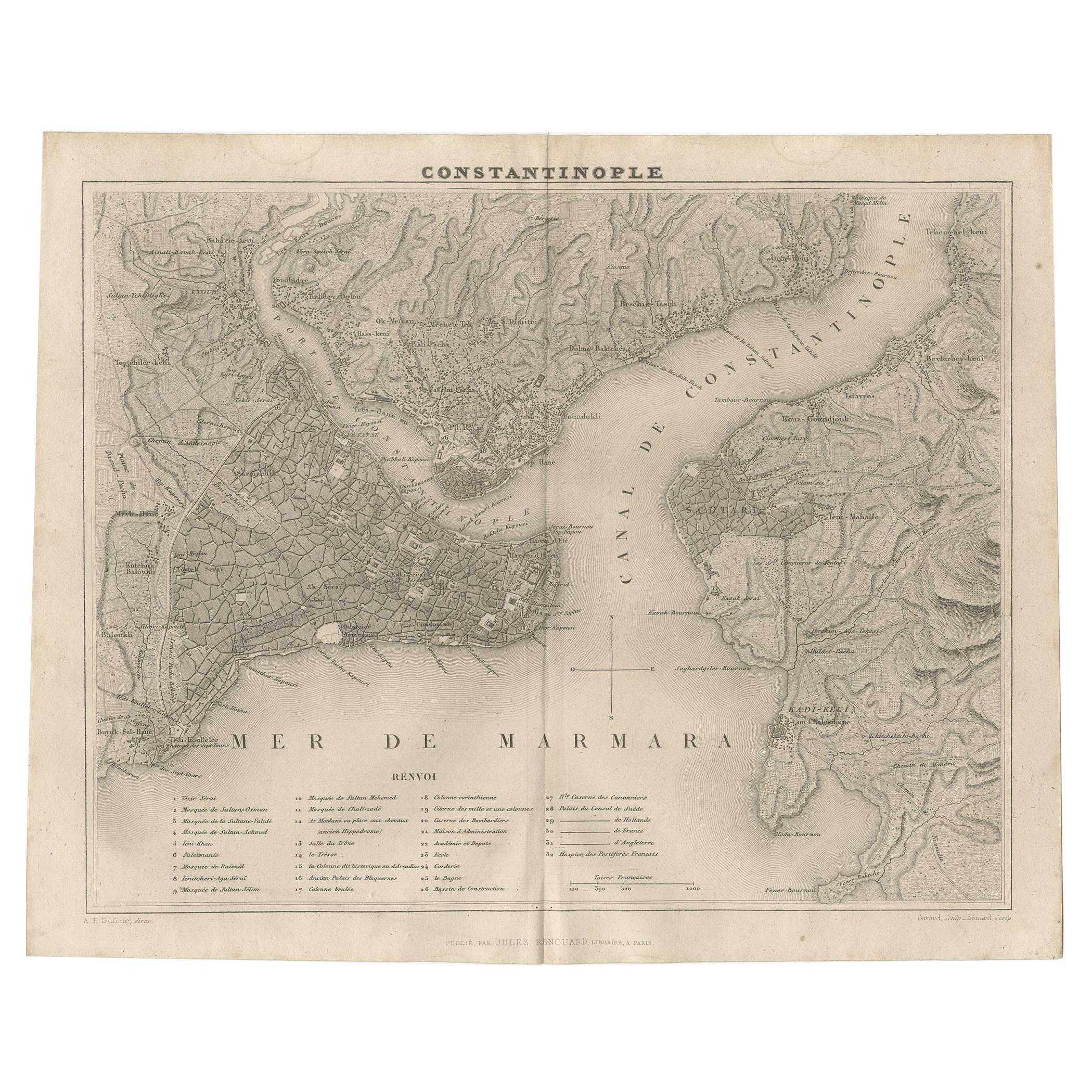
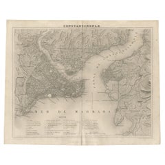
- Antique Map of Constantinople and Surroundings by Balbi '1847'Located in Langweer, NLAntique map titled 'Constantinople'. Original antique map of Constantinople and surroundings. This map originates from 'Abrégé de Géographie (..)...Category
Antique Mid-19th Century Maps
MaterialsPaper
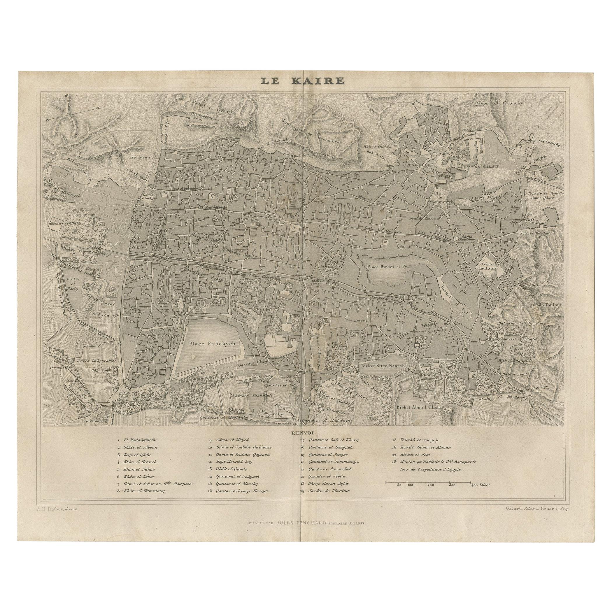
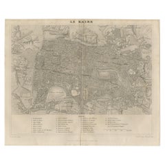
- Antique Map of Cairo and Surroundings by Balbi '1847'Located in Langweer, NLAntique map titled 'Le Kaire'. Original antique map of Cairo and surroundings, Egypt. This map originates from 'Abrégé de Géographie (..)' by Adrien Balbi. Published 1847.Category
Antique Mid-19th Century Maps
MaterialsPaper
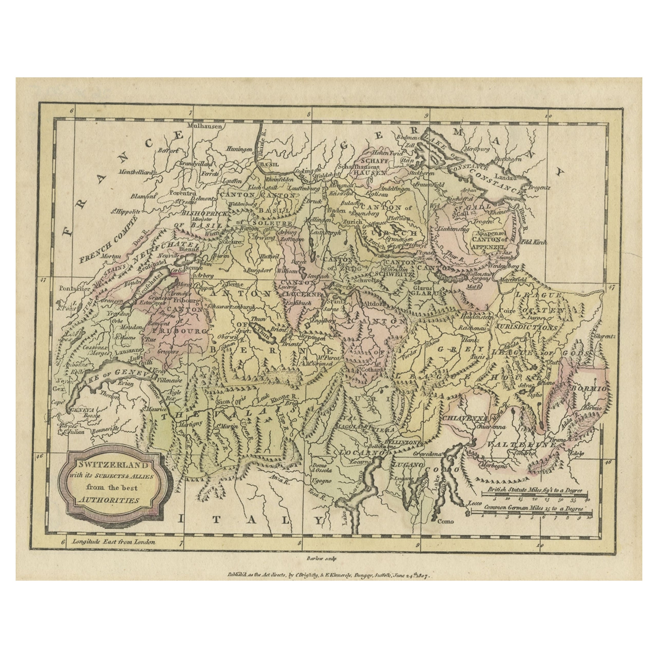
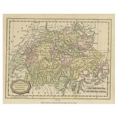
- Small Original Antique Map of Switzerland and Surroundings, 1807Located in Langweer, NLAntique map titled 'Switzerland with its subjects & allies from the best authorities'. Small map of Switzerland and surroundings. Originates from 'A general view of the world' by...Category
Antique Early 1800s Maps
MaterialsPaper


Recently Viewed
View AllMore Ways To Browse
Vintage Winchester
Boston Map Vintage
Boston Vintage Map
Vintage Map Of Boston
Frank Muller Used
Edwardian Antique Cabinets
1960s Desk Set
French Posters1920s
Greek Key Cabinet
Entry Cabinet Drawers
Lival Finland
Antique Swiss Chair
Plum Blossom
Thomas Sheraton
Table With Dry Bar
Industrial Metal Cabinet Retro
Le Corbusier Vintage Chair
Art Deco End And Dining Tables