

Want more images or videos?
Request additional images or videos from the seller
1 of 5
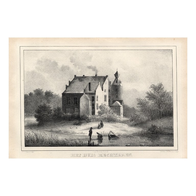
Het Huis Rechteren, Christ, 1846
About the Item
Het huis Rechteren.' (Rechteren Castle.) This Castle is situated in the province of Overijssel in Dalfsen. The castle was built in the 14th century by Herman van Voorst. Other well known occupants were the Van Heeckeren family who still occupy the last remaining castle from the middle ages of Overijssel. This delicate original old antique view originates from: 'Oud-Nederland in de uit vroegere dagen, overgeblevene Burgen en Kasteelen. Geschetst en afgebeeld, door Mr. C.P.E. Robide van de Aa.', published in Nijmegen by C.A. Vieweg, 1846. (Historic Netherlands and its remaining Castles.) Artists and Engravers: The author of this work is Christianus Petrus Eliza Robide van der Aa (1791-1851), a Dutch lawyer/judge and writer. Most of the Lithographs in this work by several lithographers are after Johannes Francisciscus Christ (1790-1845), a painter from Nijmegen.
Artist: The author of this work is Christianus Petrus Eliza Robide van der Aa (1791-1851), a Dutch lawyer/judge and writer. Most of the Lithographs in this work by several lithographers are after Johannes Francisciscus Christ (1790-1845), a painter from Nijmegen.
Condition: Good. General age related toning. Occasional light foxing, mostly in margins.
Date: 1846
Overall size: 8.9 x 5.5 inch
Image size: 6.3 x 4.3 inch
Antique prints have long been appreciated for both their aesthetic and investment value. They were the product of engraved, etched or lithographed plates. These plates were handmade out of wood or metal, which required an incredible level of skill, patience and craftsmanship. Whether you have a house with Victorian furniture or more contemporary decor an old engraving can enhance your living space. We offer a wide range of authentic antique prints for any budget.
- Dimensions:Height: 5.5 in (13.97 cm)Width: 8.9 in (22.61 cm)Depth: 0.001 in (0.03 mm)
- Materials and Techniques:
- Period:
- Date of Manufacture:1846
- Condition:
- Seller Location:Langweer, NL
- Reference Number:
About the Seller
5.0
Platinum Seller
These expertly vetted sellers are 1stDibs' most experienced sellers and are rated highest by our customers.
Established in 2009
1stDibs seller since 2017
1,922 sales on 1stDibs
Typical response time: <1 hour
- ShippingRetrieving quote...Ships From: Langweer, Netherlands
- Return PolicyA return for this item may be initiated within 14 days of delivery.
More From This SellerView All
- Fraeijlemaborg, Christ, 1846Located in Langweer, NLFraeijlemaborg.' (Fraeylema Castle.) This Castle is situated in the province of Groningen in Slochteren. It was built around 1500 and its first known occupant was Remmert Fraeylema. ...Category
Antique 19th Century Prints
MaterialsPaper
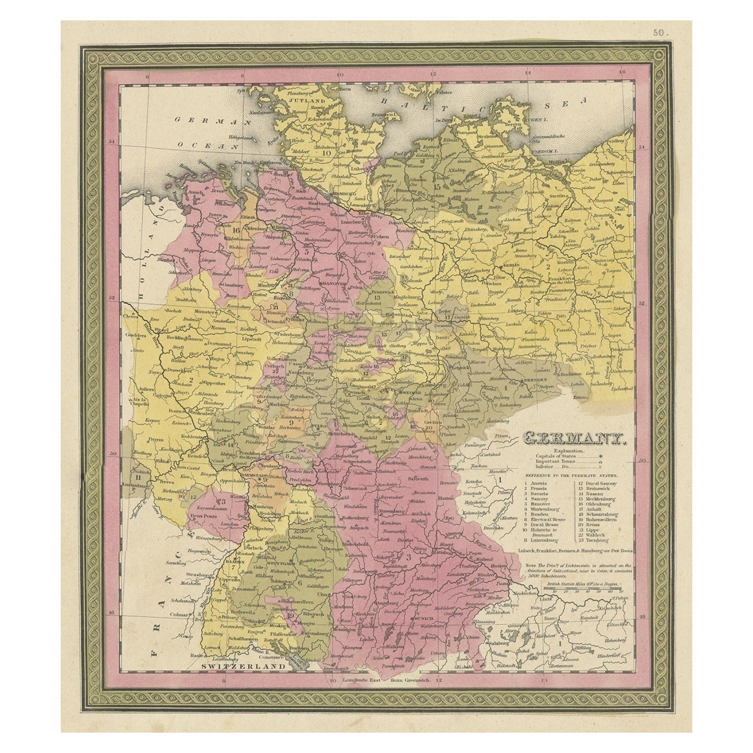
- Decorative Antique Map of Germany, 1846Located in Langweer, NLAntique map titled 'Germany'. Old map of Germany. This map originates from 'A New Universal Atlas Containing Maps of the various Empires, Kingdoms, ...Category
Antique 1840s Maps
MaterialsPaper
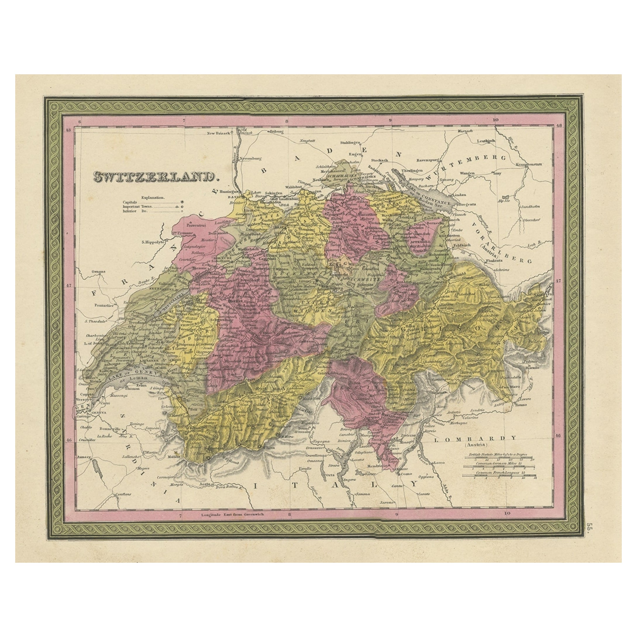
- Colourful Antique Map of Switzerland, 1846Located in Langweer, NLAntique map titled 'Switzerland'. Old map of Switzerland. This map originates from 'A New Universal Atlas Containing Maps of the various Empires...Category
Antique 1840s Maps
MaterialsPaper
- Liaukama-State, Van der Aa, 1846Located in Langweer, NLLiaukama-State.' (Liauckama Castle.) This Castle was situated in the province of Friesland in Sexbierum. The castle was demolished in 1824. Today there is a hotel and restaurant on t...Category
Antique 19th Century Prints
MaterialsPaper
- Orxma-State, Van der Aa, 1846Located in Langweer, NLOrxma-State.' (Orxma Castle.) This Castle was situated in the province of Friesland in Menaldum. The castle was demolished in 1831. Well known occupants were the Van Juckema family a...Category
Antique 19th Century Prints
MaterialsPaper
- Antique Map of Old European Russia, 1846Located in Langweer, NLAntique map titled 'Russia in Europe'. Old map of European Russia. This map originates from 'A New Universal Atlas Containing Maps of the various Em...Category
Antique 19th Century Maps
MaterialsPaper


You May Also Like
- Interieurs D'Aujourd'hui (Book)Located in North Yorkshire, GBThis is a herd covered folio with silvered lettering and the original pink ribbon ties. Dating from 1928 there is a 4 page introduction (French text) plus 40 loose plates which show ...Category
Vintage 1920s Books
MaterialsPaper
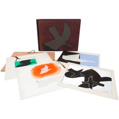
- 1957-1962, Rare Georges Braque 'Au Vent d'Arles' Archive Books and LithographsBy Georges BraqueLocated in Paris, FRExtremely rare set of Georges Braque archives maquettes books and lithographs created with the publisher 'Au Vent d'Arles', Paris. The set is composed with: - L'Ordre des Oiseaux (...Category
Vintage 1950s French Modern Books
MaterialsPaper
- St. Christophe 'St. Kitts' Island: An 18th Century Hand-colored Map by BellinBy Jacques-Nicolas BellinLocated in Alamo, CAJacques Bellin's copper-plate map of the Caribbean island of Saint Kitts entitled "Carte De De l'Isle St. Christophe Pour servir á l'Histoire Genle. des V...Category
Antique Mid-18th Century French Maps
MaterialsPaper
- West Coast of Africa, Guinea & Sierra Leone: An 18th Century Map by BellinBy Jacques-Nicolas BellinLocated in Alamo, CAJacques Bellin's copper-plate map entitled "Partie de la Coste de Guinee Dupuis la Riviere de Sierra Leona Jusquau Cap das Palmas", depicting the coast of Guinea and Sierra Leone in ...Category
Antique Mid-18th Century French Maps
MaterialsPaper
- Hand-Colored 18th Century Homann Map of the Black Sea, Turkey and Asia MinorBy Johann Baptist HomannLocated in Alamo, CAAn attractive original early 18th century hand-colored map of the Black Sea and Turkey entitled "Carte de L'Asie Minevre ou de la Natolie et du Pont Evxin Tiree des Voyages et des Ob...Category
Antique Early 18th Century German Maps
MaterialsPaper
- Hand-Colored 18th Century Homann Map of Denmark and Islands in the Baltic SeaBy Johann Baptist HomannLocated in Alamo, CAAn 18th century copper plate hand-colored map entitled "Insulae Danicae in Mari Balthico Sitae utpote Zeelandia, Fionia, Langelandia, Lalandia, Falstria, Fembria Mona" created by Joh...Category
Antique Early 18th Century German Maps
MaterialsPaper